All Activity
- Past hour
-
Are we back?
-
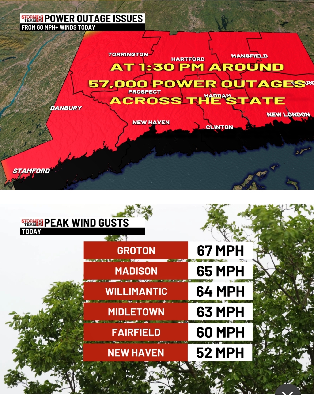
Great day of damage across CT.

-
Front yard still has snow, woods, out back were decimated though.
-
Long range finally looks more serviceable after the NY. Before that it’s more of the thread the needle and timing of the shortwave nonsense. It doesn’t mean nothing will happen, but it ain’t that pretty. Speaking of the EPS.
-
Update: winds ripped apart our pergola roof. Meh…
-
My experience with the squall line was a 5 minute heavy shower with one bolt of lightning/ clap of thunder and a wind gust to 35 mph. FWIW my station at Fire Island measured a wind gust to 51 mph this morning. A station I follow on Block Island measured 80 mph. This storm system definitely means business.
-

December 2025 Short/Medium Range Forecast Thread
Carvers Gap replied to John1122's topic in Tennessee Valley
The Euro Weeklies are full bore winter in January. They have increasingly BN temps. That LR ext ensemble and the GEPS have broken towards cold today. We were waiting for ensembles to track....some good trends. In the case of the Euro Weeklies...great trends. 95-96(lite) and some 84-85 vibes as you all noted earlier in the thread. -
WB latest EURO weeklies bring normal temps by week ending Jan. 10. Rest of month is below normal.

-
Just came through. Strong winds for a few minutes, heard some power lines arcing in the distance but didn't lose power luckily.
-
Any snow left?
-
My high was 52, winds weren't too bad, killed 90% of my pack, time to start over.
-

December 2025 Short/Medium Range Forecast Thread
Golf757075 replied to John1122's topic in Tennessee Valley
In regards to the PDO, imo, the WCS has a better depiction of it in real time. The CPC just does it on a monthly basis. https://s2s.worldclimateservice.com/climatepanel/. -

December 2025 regional war/obs/disco thread
WxWatcher007 replied to Torch Tiger's topic in New England
I think that works back this way too -
I think there may be a little more hope for February this year with a fading Nina (possibly neutral by then)
-
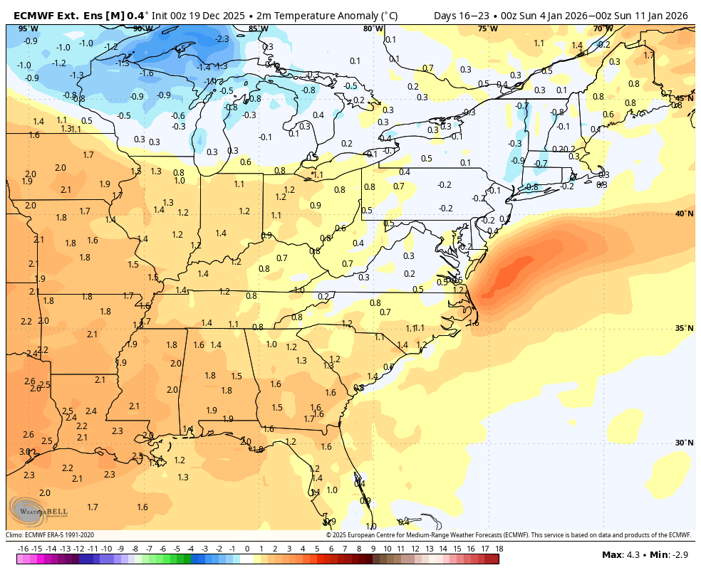
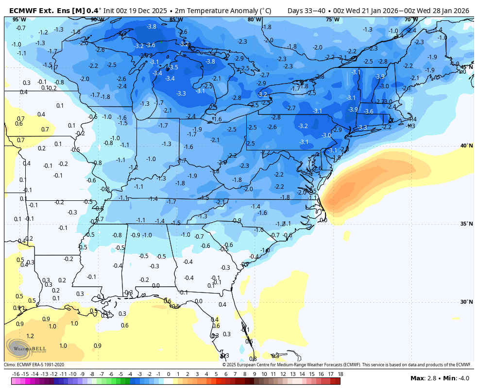
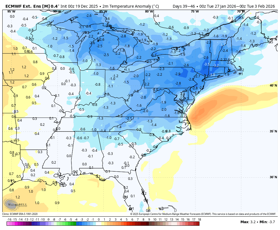
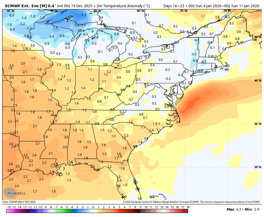
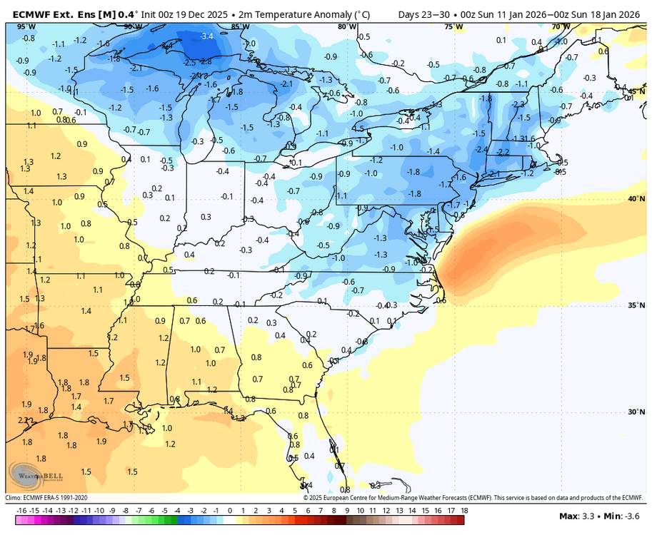
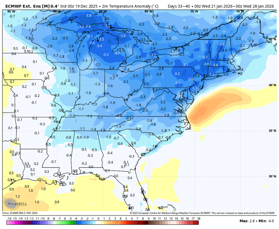
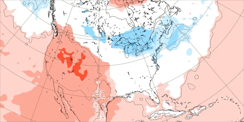
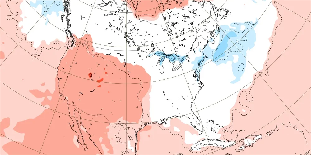
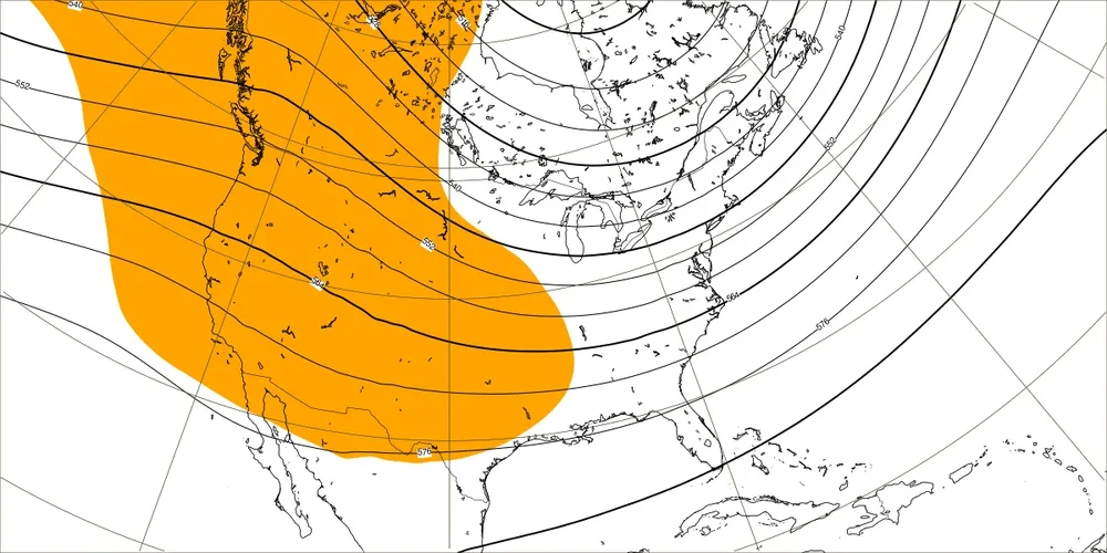
Today’s Euro Weeklies are similar to the prior ones through Jan 11th with mild for much of the country though the warmest is closer to the C US, well away from the E US. However, today’s weeks 4-5 continue yesterday’s cooling trend: 1/12-18 12/17 run: 12/19 run: 1/19-25 12/18 run: 12/19 run: And then week 6 is similar to yesterday’s in the E US: In summary, whereas the first 3 weeks (through 1/11) remain mild in much of the E US, the last 3 weeks (1/12-2/1) are mainly NN to a little BN in most of the E US. The 1/19-25 map suggests a +PNA is trying to form:

-
Rain/sleet mix falling. 43.5
-

Pittsburgh/Western PA WINTER ‘25/‘26
PghPirates27 replied to Burghblizz's topic in Upstate New York/Pennsylvania
Ripping here pretty good, got in the snow squalls. Measured about 1.25" to 1.5" here. Closer to 1.25" though. -
Yeah looks like that red dot on the radar went over your area
-
Hit 54 (53.6). Back to 38 now.
-
That we can work with.
-
Just had a lot of pea sized hail here. The ground got coated. Cool to see.
-
Rain and some very strong winds Small hail
-

December 2025 regional war/obs/disco thread
Typhoon Tip replied to Torch Tiger's topic in New England
The blocking that has been consistently depicted isn't really the type that backs warmth down into the Maritime and Maine if it helps. This is clearly favoring the eastern limb of the NAO domain. In that regime, if anything, you're likely to be in a mean WNW to at times N flow around the Maritime train-wreck low that is sourced by intermediate polar air over midriff Canadian Shield.. -
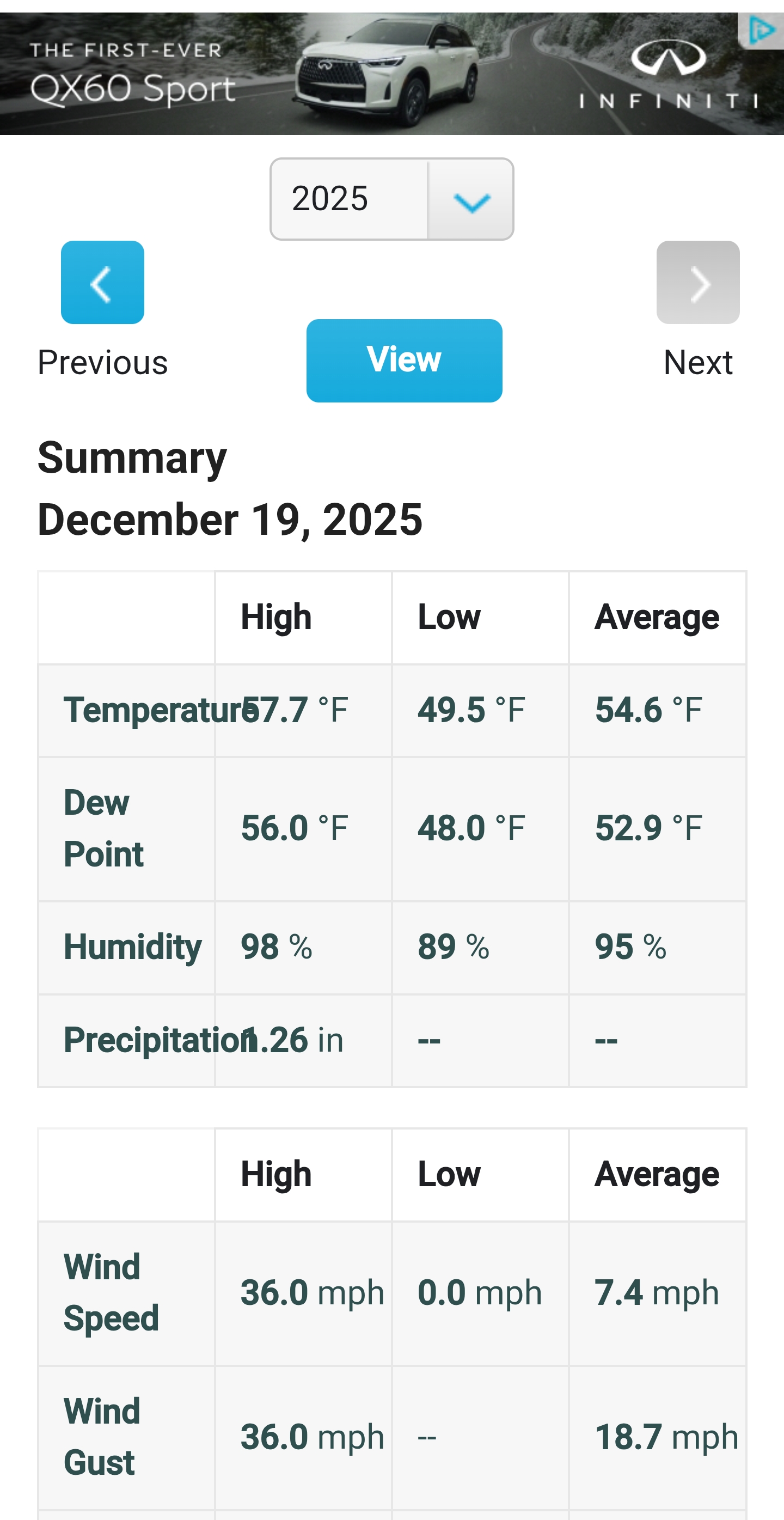
The new wx station at 395 probably 2 miles due west HD 59 it's probably close. Edit actually neighbors nearby had 57.7

-
It's really dark out here in New Providence, like what you'd see before some nasty summer storm.


.thumb.png.4150b06c63a21f61052e47a612bf1818.png)