All Activity
- Past hour
-
Can't make this stuff up 18Z Euro AI is still off the coast out to sea
-
18z EURO.meh
-
Enough mood flakes for a white Thanksgiving… .
-
Cant wait till models puke themselves and get 1-2" followed by cold rn Sent from my SM-S921U using Tapatalk
-
-
You will be shocked how much difference that 20 miles means in the winter. Congrats.
-
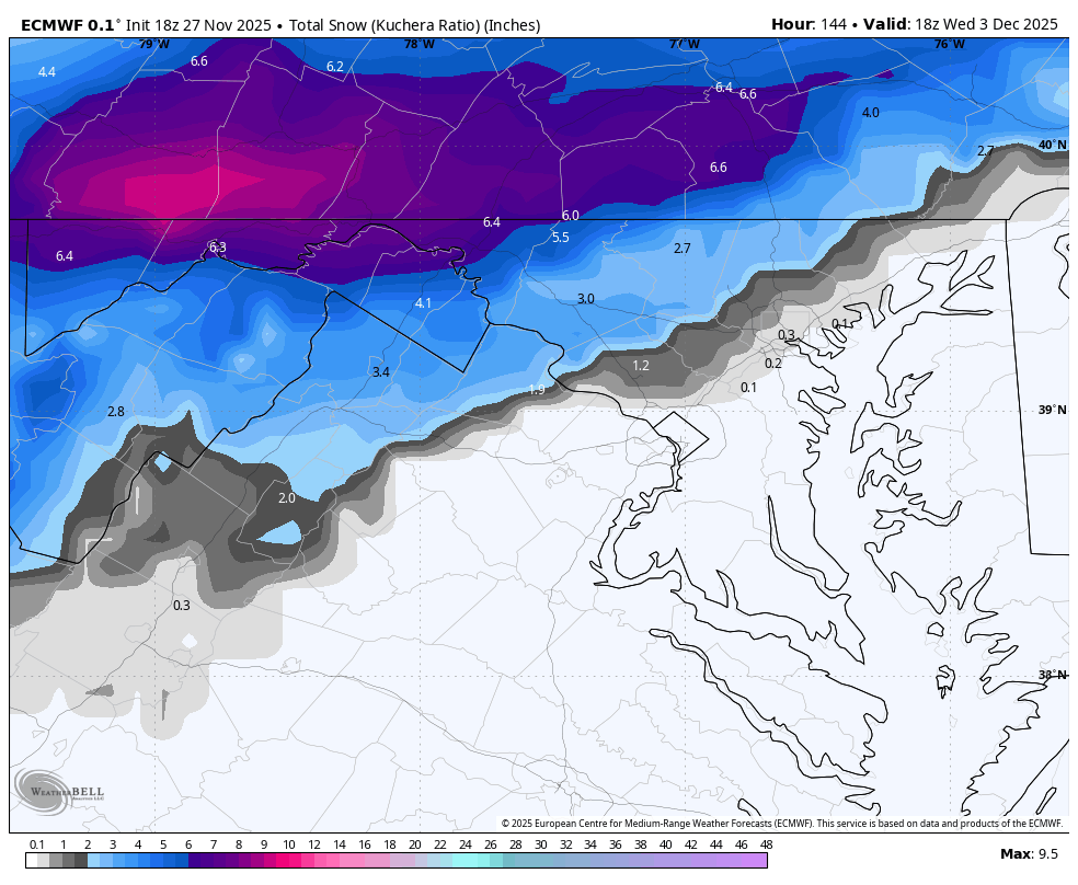
WB 18Z EURO... still in the game. Happy Thanksgiving everyone!

-
Yes just NE of Winchester up 81 to Stephenson
-
Good enough to triple lock!
-
I know what it’s about I just meant the models much don’t know. Lol
-
Moving out my way?
-
First flakes of the season nw of Winchester right now. Happy Thanksgiving!
-

December 2025 regional war/obs/disco thread
powderfreak replied to Torch Tiger's topic in New England
It must be, only does it during standard time. Unlikely to show feet of snow during daylight savings time. -
5pm happy hour
-
Getting into the more intense LES now, the bands are intensifying over much of SON with it jutting all the way to K-W and Guelph commonly. I got 3" overnight as expected, melted some on the roads and compacted which was more than I thought. The bands aren't stable enough to give anyone a huge amt. I see more down to my SW.
-

December 2025 regional war/obs/disco thread
Sey-Mour Snow replied to Torch Tiger's topic in New England
What’s the scientifical reasoning for the 18z gfs to always be more drunk than the other runs. Can always count on it for feet of snow somewhere. -
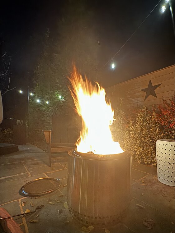
36 right now. Warming up with a fire. Weather app says some snow happens around 7:30. I ain’t buying that but it’d be nice.
-
We can always go higher
-
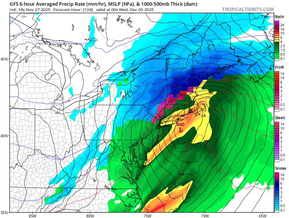
GFS looks good.
-
-

December 2025 regional war/obs/disco thread
Torch Tiger replied to Torch Tiger's topic in New England
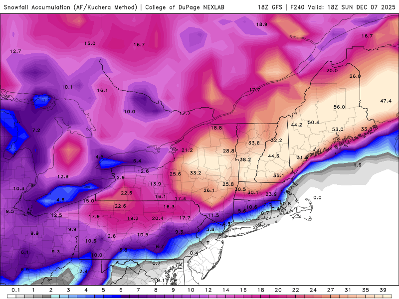
Another interior hit 12/6-7. Lfg -

Nov 28-30th Post Turkey Day Wintry Potential
KeenerWx replied to Chicago Storm's topic in Lakes/Ohio Valley
Yanked some stats for Kankakee County because they have done especially incredible compared to climo this November. While I don’t live there, I can geek out about random stats. Now, consider that this data comes from COOP reports. It’s justified to question some data especially as we reach further back. But it’s what we’ve got. Pulled 1925-2025 from reporting locations nearest to Kankakee. Top 5 Snowfall: Month of November Some locations in Eastern Kankakee County have already notched 2025 as #1 or will soon do so. The rest of the county will likely place at #2, with real possibility of taking #1 if things break right. 1951 - 12.3” 1959 - 9.8” 1932 - 7.2” 1950 - 7.0” 2017 - 6.3” Gamma distribution would suggest roughly along the following periods for each breaking point in total November snowfall: 8” - 1 in 35 years 12” - 1 in 75 years 16” - 1 in 150 years 20” - 1 in 300+ years Needless to say, the upcoming snowstorm will likely push the county into historic+ proportions for the month of November. Especially the eastern portions of the county where the highest breaking points are achievable. Top 5 Snowstorms: Month of November Here again areas in eastern parts of the county already notched a likely #1. The rest of the county can put these on watch to surpass. November 6-7, 1951 - 9.0” November 12-14, 1959 - 8.0” November 15-16, 1932 - 7.2” November 29, 1942 - 6.0” November 21-22, 2015 - 6.3” Finally, it looks nearly certain that the county will grab two 4”+ events in the month of November, which hasn’t ever happened from what I grabbed. Soliloquy over. Carry on. -
43.7 for a high which is lowest of season
-
Didn't see this thread until almost a year later, but I gave you a follow.
-
Some flurries floating around. 35°.