All Activity
- Past hour
-
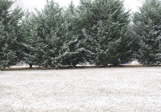
This turned out to be a nice little event IMBY. The snow fell at a decent rate for around an hour. This, along with the temperature quickly dropping below freezing, allowed for a light accumulation. Currently sitting at 31.6°/29.3°.
-

Rise of the Machines: January 18-19 Winter Storm Obs Thread
CoastalWx replied to WxWatcher007's topic in New England
You’re actually saying this to me? Just saying what it shows. Could see it coming this morning. Now I’m just hoping I can get solidly into my 2-4 call. -
Underground forecast has updated since the 12z runs for MBY. lol .
-
How’s everyone feeling this afternoon? It’s going to snow peeps! I feel pretty confident in that. I’d even put down money in Vegas on it. Except, of course, I don’t gamble. I’d rather spend $’s on pre-gaming HH 18z GooFus runs at Sapwood instead. .

-
 You must be fun at parties lol
 -
Flurries starting Magnolia Delaware. Weather system is showing chance of thunder. Winds have also picked up out of the NE.
-
Very light snow has begun to fall here. Temp is 34.
-

E PA/NJ/DE Winter 2025-26 Obs/Discussion
Ralph Wiggum replied to LVblizzard's topic in Philadelphia Region
The ens means like a more Northerly track. Under the hood it seems there are a few members NW of us, a few big dogs in our region, and a cluster of weaker systems to the South...so the means could be skewed. Regardless, should make for a fun week of tracking. Glad I took vacation this week! -
I haven't kept up in a day or so and holy moly things have changed.
-
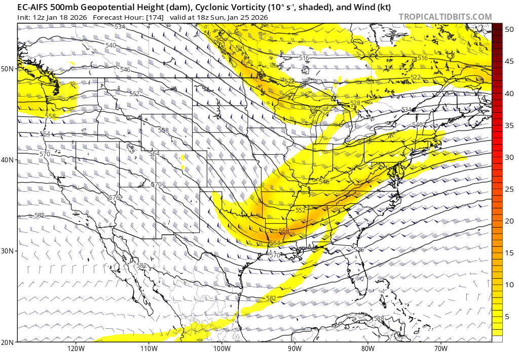
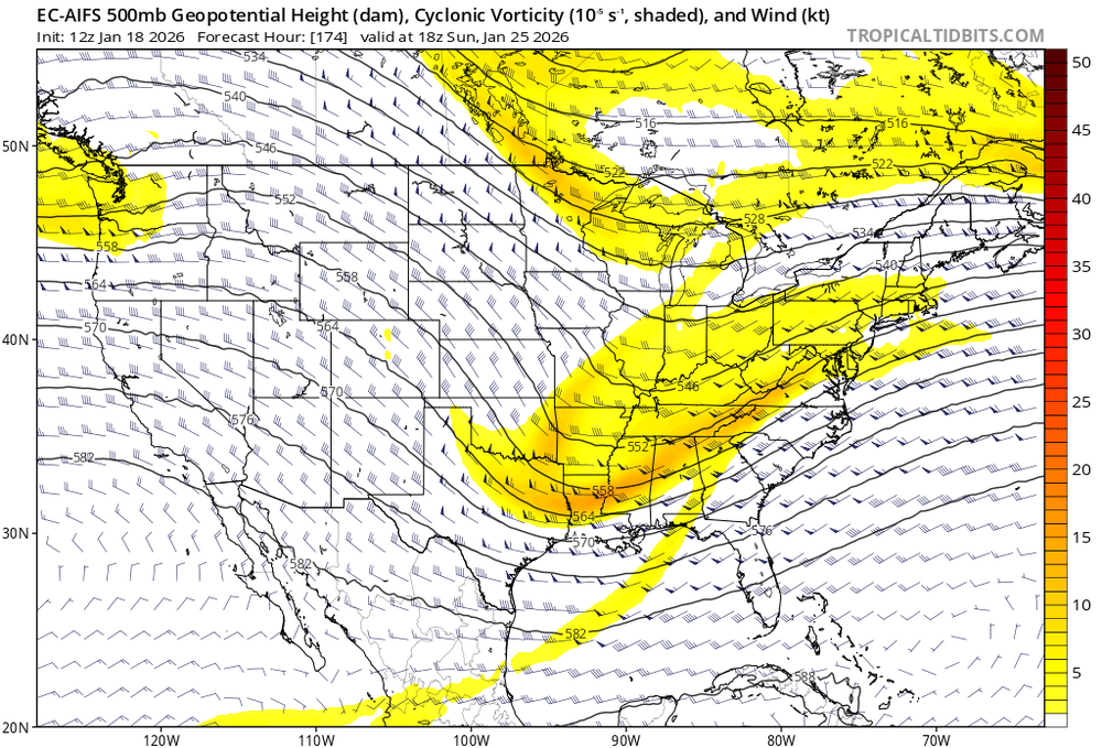
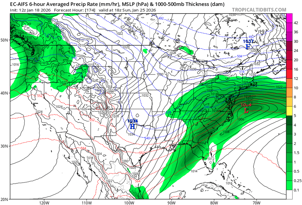
In AI we trust! (with the weather modeling)
-
Just checked - AIFS op has been beating all other op models based on 6-10 day verification scores at 500mb over the past 3 months. Let that sink in. Today’s 12z run:
-
Hope they can plow my surgical team out to reach Sovah Monday. .
-

January 16-18th: Rolling the dice
BTRWx's Thanks Giving replied to SnowenOutThere's topic in Mid Atlantic
Tiny flurries in Alexandria. -
Definitely white rain in Charlottesville, car temp dropped from 39 to 36 pretty quickly...
-
Couple flakes on Bacon Ridge. The breeze has picked up and it feels cooler.
-

2025-2026 Fall/Winter Mountain Thread
Maggie Valley Steve replied to Buckethead's topic in Southeastern States
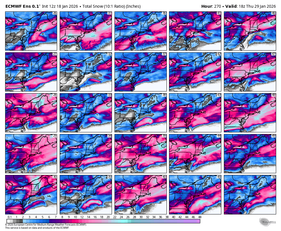
Speaking of Carvers Gap in the Tennessee Valley forum. I'm borrowing this shot of the 12Z Euro ensemble for 150 hours. That's about as good as it can get 6 days out. Remember our next event will begin unfolding around Wednesday night/Thursday for N TX and Arkansas. The short term Mesoscale Guidance will be in range Tuesday for those areas. Also, that is brutally cold air dropping down from the Dekotas and Minnesota into the mid Mississippi/Ohio Valley!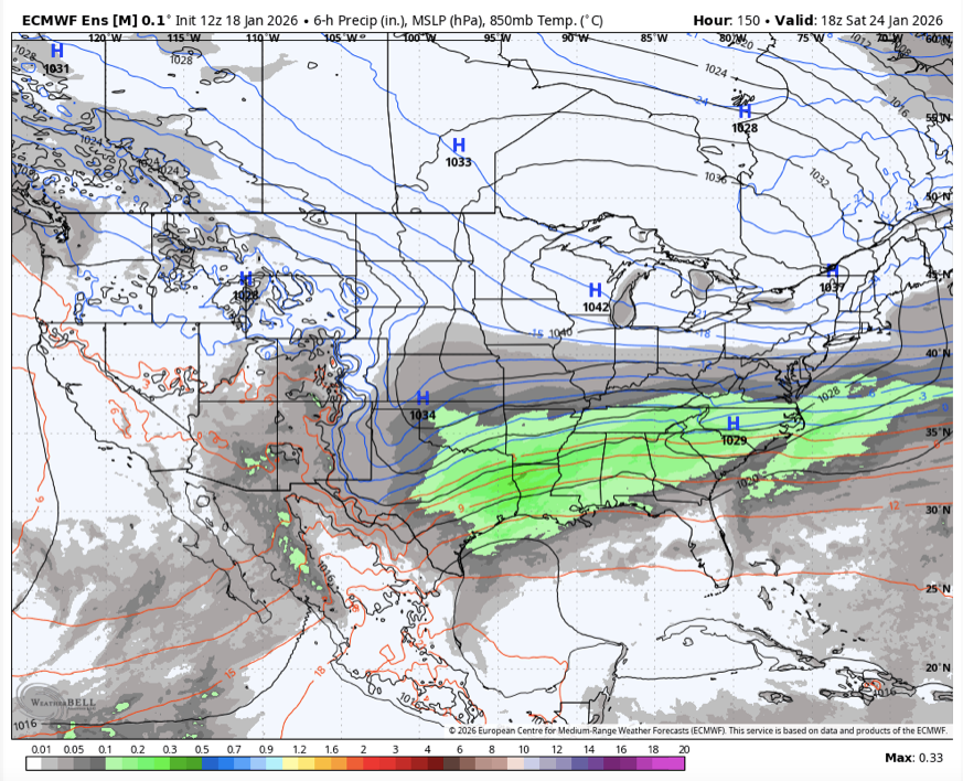
-

January 2026 regional war/obs/disco thread
VivaManchVegas replied to Baroclinic Zone's topic in New England
Thats something you would see in May. -
Thats me [emoji24] .
-
https://x.com/PettusWX/status/2012967315084611780?s=20
-
flurries in mclean
-
l love digital snow!
-

Storm potential January 17th-18th
Wxoutlooksblog replied to WeatherGeek2025's topic in New York City Metro
Those areas have been over-performing for 2 years or more. I think this time will be no exception. When I say there's a good chance this could over perform I'm not referring to all locations. There are different forces at play here. You have the signs that the coastal will indirectly enhance the snowfall rates here and colder air will also squeeze out a little more moisture. But there is also a drier punch of air which will move in from the west and the clipper moving across the northern tier will be trying to kick this system out to the east. So we just have to see what forces win out. The heaviest precipitation on the guidance was always late this afternoon and early this evening. To that extent nothing has changed. But this is NOT a big storm for us. Maybe we can squeeze out another inch or two some places another three like the north shore of eastern LI. WX/PT -
Guys I’m going to be really negative this week so I apologize in advance. Partly because im in ill believe it when I see it on the ground mode, but I’m also going to generate good mojo by telling Mother Nature she’s not capable of pulling it off.
-
Cold 850s, night time, good snow growth, blossoming precip leaf.
-
Rise of the Machines: January 18-19 Winter Storm Obs Thread
CoastalWx replied to WxWatcher007's topic in New England
Nam is about .3 to .4” from BOS to the canal. Definitely cut back.