All Activity
- Past hour
-
 bristolri_wx changed their profile photo
 -
In all seriousness let’s get something in the next 10 days because it’s mild after. Then it will be broken.
-
Back broken
-
Yea CPK is rarely the winner in any storm but for moderate to large ones, it is also very rarely the loser as it sort of "benefits" from both east and west leaning BM storms. That being said, CPK recorded 0.15 of precipitation from 1-4PM, why wasn't that counted as snow? It's things like that which frustrate me.
-
A Couple GEFS members have it also.. weird how close in we are and some have a snowstorm and some have nothing and miss by alot
-

"Don’t do it" 2026 Blizzard obs, updates and pictures.
NeonPeon replied to Ginx snewx's topic in New England
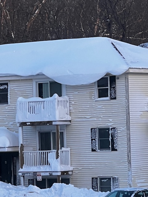
My best guess was 28 or so at the end, Newport ap says 32 but that's Middletown basically, and also tends high. It's the all time storm for me living here, 14 years. It's storms like this that make me love the winter here. The floor is low, as we've seen in the last years, but the ceiling is high, and dramatic. What did you see around Bristol for downed trees? In my tour around town yesterday I didn't see much wind damage. Downed branches, not downed trees. The trees weren't plastered as much as in 2013, and my power never went out. I also found the wind here impressive but not crazy in the context of Newport. They were also very straight line. -

Is we back? February discussion thread
Baroclinic Zone replied to mahk_webstah's topic in New England
If Wednesday's system if far enough south there won’t be enough wave spacing for Friday to amplify. -
That could be the chef’s kiss for winter ‘26
-
“Cory’s in NYC! Let’s HECS!” Feb. 22-24 Disco
Baroclinic Zone replied to TheSnowman's topic in New England
I busted too low on my 20-30” call. -
Honestly not sure where we could put any more at this rate. I have 6 ft fence nearly gone in spots with drifting.
-
31" Bristol, RI
-
Clipper Fires In Wednesday Feb 25 Disco/ Obs
Baroclinic Zone replied to Damage In Tolland's topic in New England
If this system shifts south there won’t be enough wave spacing for Friday to amplify. This one looks more promising for 1-2”. -

Central PA Winter 25/26 Discussion and Obs
pawatch replied to MAG5035's topic in Upstate New York/Pennsylvania
18 degrees this morning. Liked it better in the 30’s Looks like I might get 1-2” of snow tonight…Haven’t checked yet this morning. And you’re going to get some snow Thursday and looks like that’s staying south of me. The ground is still covered with snow this morning. That is crazy snowfall up in Rhode Island. It would be hard to imagine dealing with that much snow. -
26.8 this morning, last 20s of the month
-

Central PA Winter 25/26 Discussion and Obs
philliesmd replied to MAG5035's topic in Upstate New York/Pennsylvania
They got pretty close. RECORD EVENT REPORT NATIONAL WEATHER SERVICE BOSTON/NORTON MA 0131 AM EST TUE FEB 24 2026 ...RECORD SNOWSTORM FOR PROVIDENCE RI... THE BLIZZARD OF 2026 BROKE SEVERAL SNOWFALL RECORDS AT RHODE ISLAND T.F. GREEN INTERNATIONAL AIRPORT IN PROVIDENCE: - STORM TOTAL SNOWFALL OF 37.9 INCHES BROKE THE RECORD FOR THE GREATEST SINGLE SNOWSTORM ON RECORD, WHICH WAS 28.6 INCHES SET DURING THE BLIZZARD OF `78, ON FEBRUARY 6-7, 1978. - DAILY SNOWFALL OF 35.5 INCHES BROKE THE RECORD ONE-DAY SNOWFALL, WHICH WAS 19.0 INCHES SET DURING THE BLIZZARD OF `96, ON JANUARY 8, 1996. - FINALLY, THE DAILY SNOWFALL OF 35.5 INCHES BROKE THE RECORD SNOWFALL FOR FEBRUARY 23, WHICH WAS JUST 3.8 INCHES IN 1967. -

Pittsburgh/Western PA WINTER ‘25/‘26
Rd9108 replied to Burghblizz's topic in Upstate New York/Pennsylvania
It appears a pretty decent band went through overnight. Everything is covered and looks like maybe another inch outside. Another 1-2 tonight-wednesday and then who knows about the weekend. Its funny how just two weeks ago it looked like winter was dead. -
Bob on WVIT took out anything for Thursday night/ Friday. He said there was some agreement with the medium range models showing everything being pushed out South, but he's not writing it off. That storm next Wednesday looks like it could be another potential snowstorm
-
17" NW part of Southbury....
-
Yeah, the GFS was #1 back to last weekend with the longer range forecasts and the AIFS was #2. In the shorter range it was the SPC HREF that did the best. For consistency across the entire season the best scoring models have been the AIFS and EPS AIFS. So it’s good to see the AIFS not having the suppression bias of the OP Euro and EPS with East Coast storms. Andrew has written an excellent article below. I would be curious if the outstanding winter forecast from the Open Snow team which Andrew is a part of used AI for their winter forecast. They didn’t mention it in the write-up back in November but perhaps they have a seasonal AI model that they aren’t ready to announce yet. https://opensnow.com/news/post/november-update-2025-2026-winter-forecast-preview
-
@The 4 Seasons15.3 inches from this storm. 59.3 on the season. Highland Mills Orange County NY. between NNJ, LI, RI and SEMass I imagine you've got your hands full. Lots of 30+ out there.
-
Think it might be the only one that has it?
-

2025-2026 Fall/Winter Mountain Thread
Buckethead replied to Buckethead's topic in Southeastern States
7° with clear skies this morning. Picked up another inch overnight to bring my total to 10.75". That brings my season total to 65.25" making this my snowiest season here in Wolf going back to 2017. Sent from my Pixel 10 Pro using Tapatalk -

E PA/NJ/DE Winter 2025-26 Obs/Discussion
PhiEaglesfan712 replied to LVblizzard's topic in Philadelphia Region
The March 2-3 event now looks more like a cold shot, than a precipitation event. -

Central PA Winter 25/26 Discussion and Obs
Mount Joy Snowman replied to MAG5035's topic in Upstate New York/Pennsylvania
Edit: I was going strictly off of Blizz’s post about 0z when I said that, but after checking some other guidance and the 6z gfs/nam it appears things are now projected well south of us. Who knows ha. -
"Don’t do it" 2026 Blizzard obs, updates and pictures.
Baroclinic Zone replied to Ginx snewx's topic in New England
-
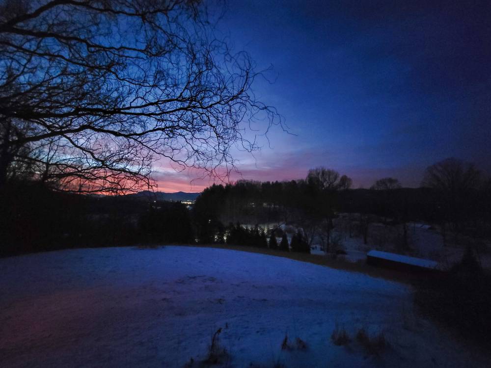
Beautiful sunrise this morning. Sent from my SM-G998U using Tapatalk