All Activity
- Past hour
-
Locally speaking, and truly locally, some of yall won big, but the Catawba River basin desperately needs to score soon. That impacts a lot of ag and water supplies from Lake James all the way down to the low country. I’ve never seen lake hickory this low (granted I wasn’t living here in 2007). Lake James —> Lake Rhodhiss —> Lake Hickory —> Lake Norman —-> Lake Wylie —> Wateree to Marion and out to sea at Charleston. This watershed supplies millions.
-
At least some of yall won! We all need it, so that’s a win in itself. I’d just settle at this point for consistent weekly thunderstorms as we warm up. As much as we loathe it, we need to get some soupy air to tap into. I can’t recall the dp being this consistently low. It feels nice, but it’s not conducive to active weather and afternoon lift. I’ve normally already put two treatments of disease X on the yard - no need so far.
-
Thank you again for the information.
-
It's pretty close to average throughout the year - slight uptick in Nov and Dec to above avg. Nov-Feb of strongest El Nino's:
-
Third day in a row with snow showers, and the fourth this month. High in the upper 30’s yesterday.
-
additional .25 last night, so .35" total
-
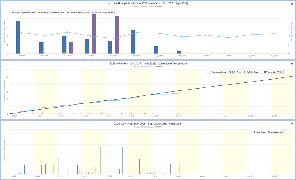
Pretty dry from the last week of March to the last week of April. Looks to have created a ~4 inch deficit compared to the 30 year average. Hopefully we'll get some decent rain on Saturday and early next week before the Steining continues.
-
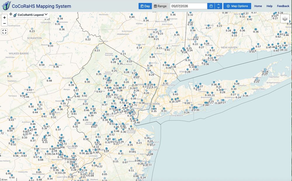
Appreciate the response and map! What month, if any, would average much above average precipitation so that we can put a real dent in this drought.
-
A quarter inch of rain never felt so wet.
-
0.15 correlation, if average is 4.00", that's 4.60"
-
What about June?
-
Same. That salvaged it being a half decent event. The initial rain barely wet the ground.
-
Yeah the overnight batch really overperformed. I ended up with 0.45" for the event. Not bad. Glad the garden got a good watering.
-

Winter 25-26 (All Snowfall Maps & Season Total)
SouthCoastMA replied to The 4 Seasons's topic in New England
Pretty close to what I had for here. ~60", but i might be a hair low -
Yeah, felt like a lucky night - that it happened overnight was good too because it allowed it to soak in better instead of the sun baking it off.
-
Got more rain from the overnight batch here than the daytime batch
-
Cedar Rapids got down to 31º this morning. The personal stations closest to my home also dropped to 31 or 32º, although then clouds moved in and the temp quickly rose. There was no ice in my bird bath at 7am.
-

Winter 25-26 (All Snowfall Maps & Season Total)
CoastalWx replied to The 4 Seasons's topic in New England
Good stuff as usual! - Today
-
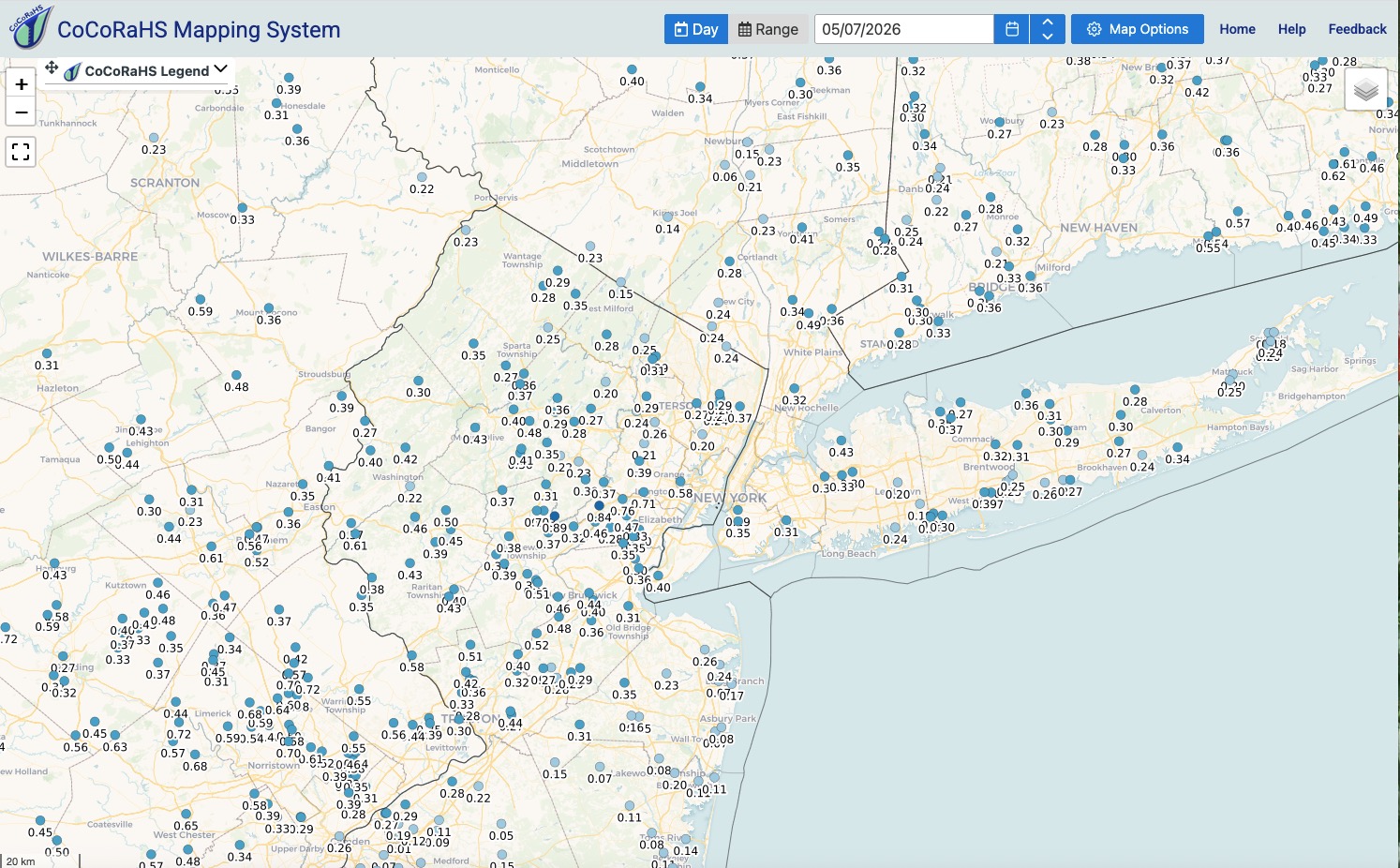
Received .40" rainfall last 24 hours. Better than I was expecting. I'll take it. Click map to enlarge.
-
About 10 so far, including one I picked up this morning in the flower garden 2 feet from the porch. 3-4 got their mandibles into me but none have gotten a drink. I'm heading out in a bit to continue the re-inventory of the woodlot, so picking up a few more hitchhikers is inevitable. 0.62" from the latest event. 10 miles WNW in the NW corner of Farmington reported 1.47" - just missed the heavy bands here.
-

E PA/NJ/DE Spring 2026 Obs/Discussion
JTA66 replied to PhiEaglesfan712's topic in Philadelphia Region
0.20" from the "main event", 0.40" from the leftover showers...go figure. -
Although not for all areas, of course, I feel that next week’s map may show notable improvement (say at least one drought category) in portions of the SE. Besides the current system, there’s more waiting in the wings for much of the SE Sat-Mon, especially S areas! The N 1/2 of AL was the only area on the SE drought map that showed notable improvement.
-
I expect only minor changes to the drought map after this event. We still need a lot of rain for meaningful changes.
-
The fronts are moving through without stalling because of the strong NW and W flow
-

2026-2027 Strong/Super El Nino
snowman19 replied to Stormchaserchuck1's topic in Weather Forecasting and Discussion
The NMME joins the EURO, BOM, CFS