All Activity
- Past hour
-
Late april into the first week of May looks like the Final Boss of spring misery in new england. See 6z euro AIFS Hosting a party on May 3rd, so we hope that doesn't pan out.
-
I thought that you got hammered a few weeks ago, while I was suffering one miss after another. In the meantime, we've had 5.66" in the past 30 days, completely wiping out our extreme drought. Amazing how different it can be in only 50 miles.
-
heh... just a general note on the NAO. Taken fwiw but my personal observation with -NAO(+NAO)s that are long lead signals is that they have very poor verification. We already know with safe assumption that in partial (at least) this has gotta be true, because the actual ridge node associated with the physical manifestation of the NAO block itself is being placed in different locations on every other run of the guidance. So off the bat, there's poor deterministic value there. But, even at a more orbital consideration, 'do they even happen?' ... I've come to find that a significant number of occurrences when -NAOs(+NAOs) show up in that D10 to 2-week window, they don't even exist when the whole of it is D4/5/6. They don't survive continuity coming into mid range. This -NAO manifested about 5 days ago... about when it was D12. Prior to that... we were going to roll right back into a warm up. But then Monday's sharp trough and attending cold shot showed up, and it seems the models "might" have been getting a bit overzealous in creating positive anomaly NE of it as it turned the corner and rose in latitude through the Maritime of Canada. But two aspects are true and they are sort of competing. The 2nd aspect is also a personal observation, particularly in late winter into springs: when we have a warm anomalous pattern, the breakdown has in the past seemed to segue the -NAO response. It's like the warm anomaly rises in latitude and gets dumped up there...then takes 3-5 days to finally disperse... a time in which we tend to get cold shits down this way. The former aspect is more of an always consideration. The latter is a spring one. I'm trying to assess which is going to be the case. It seems at this moment, while typing, we're getting a hybrid expression between in the guidance complexions.
-
75 / 57 clouds to the north. Step down to upper 70s / low 80s with enough sun, possibly a bit warmer if mostly sunny in the warm spot. Perhaps a n isolated shower later today. Saturday looks great back towards normal , Sunday front comes through with best shot at any rain. Overall cooler than normal week - contingent on extent of onshore backing in and clouds could be near normal and a few nice days away from the onshore or pure / typical marine layer cool. Still looking mainly dry but these have a habit of rain popping on a several days. 4/17 : Warm 4/18 - 4/19 : Near normal 4/20 - 4/21 : Chill down 4/22 - 4/28 : Near - below normal perhaps wetter. 4/29 - beyond : moderation towards the end of the month / early May
-
Wish I still had it in me to drive more than 50 miles to chase lol. Again, line will come through here overnight, probably just enough to scare the dog and wake me up. To be honest , there's a a good 250 mile stretch of that front that if any kind of updraft can get isolated there's a decent possibility of a long tracker. Yes more so in the N/IL S/C/WI areas, but there are more than enough shotgun/ semi automatic impressive pre-frontal hodo's on the models anyway. Guess my play was back in March with and 80mph downburst lol, may have to wait until June now. Regardless, agree with all, good chance of a long tracker here, and very well could be where one doesn't expect it with this setup. Good luck to all that dare the chase traffic jam and stay away from that one idiot that goes 100mph and runs stop signs. Thats what got Corbin Jaeger, Randy Yarnell and Kelley Williamson (I chased with him a lot many many years ago, great guy) killed. Be the fuck careful man
-
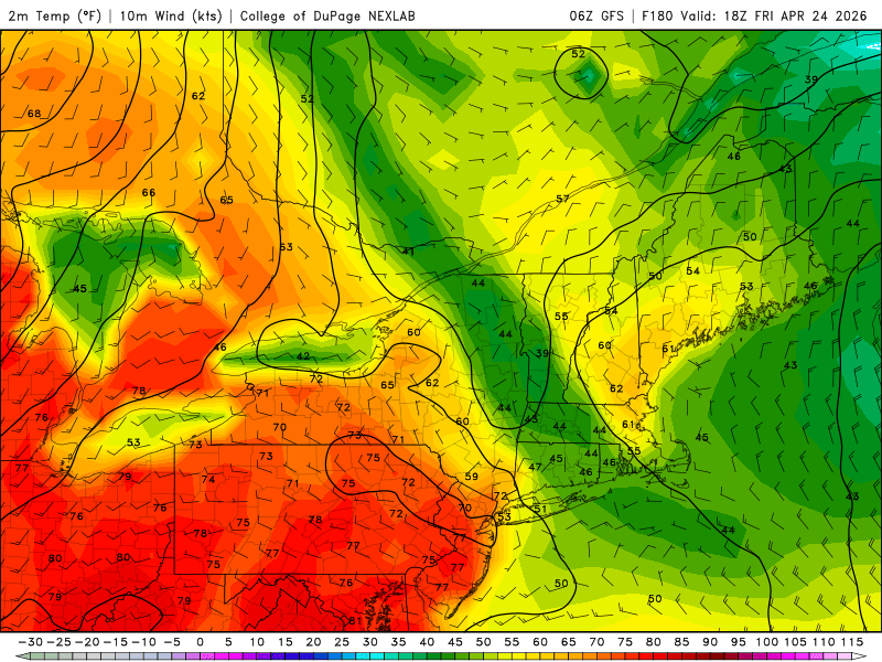
Do you have the 00z version of this at 186 ?
-
Hopefully this verifies
-
As always this time of year-better to live further south and west
-
models also showed a -NAO going into late March-never happened and now we are seeing it again. Would think models trend warmer then
-
Relative to all climate zones there's a tendency in the guidance, et al, to back off the "doom" as you say. Certainly CT ( 00z GFS ) does the best - just by virtue of where they are. Case in point, they flip glorious on Thur/Fri for example as a stuck warm/stationary boundary slices from Watertown-ish NY-like to Providenceness, Rhode Islage. Just quantificaiton of that snap shot is probably 80 at HFD and 55 with a feeble Labradorian prostate drip coming into Logan. Not the full-on cold dildo flogging of previous runs. Can and Euro leave something to be desired, but they are also less cold in total qualitative.
-
Last year’s strawberry plants overwintered in the old bathtub I planted them in; nice buds on multiple plants. I’ll have to cover them Sunday/Monday as projected lows are 26.
-
I feel like we're going to be saying a lot of "GWDLs" next week. Sucks for those who live in doom and gloom zones. Monday sucks for all but the remainder of the week doesn't seem to terrible for us
-

2026-2027 El Nino
snowman19 replied to Stormchaserchuck1's topic in Weather Forecasting and Discussion
Subsurface anomalies over +5C showing up: -

It's time to grade Winter 2025-26(now that it's actually over)
wxdude64 replied to CAPE's topic in Mid Atlantic
I'll go with a solid B here. Only about 80% of climo on the snow, but the 'snowcrete' from 1/25 stayed OTG for a long stretch, almost 3 weeks. Temps were actually nice for once, with below normal for majority of the winter. The wild and strange events in March with the 40-50 degree temp swings and snow after almost 80 was crazy. The 'no A' comes from March and April being almost snowless, had we gotten close to the averages we would have been close to annual snowfall average. -

2026-2027 El Nino
roardog replied to Stormchaserchuck1's topic in Weather Forecasting and Discussion
I see the SOI has gone strongly positive in the last couple of days. I don’t know how long that’ll last though. -
58 with very little wind under August 23rd sun ( this weekend) is going be just fine for me, anyway. Sunday sucks tho. Nasty cold front with a 36 hour -5 anomaly behind it...I guess we need something to keep it real tho.
-
Exactly. I get that primary cluster was overperforming into the mid-state but there was still time to issue a watch. SPC did issue a MD highlighting counties, though by then, the deck had been reshuffled and those established risk zones were obsolete. 99.9% of people aren’t paying attention to those discussions unless they’re promoted by a local weather authority. Bottom line: The now-casting reluctance is a tad concerning. Hopefully, SPC isn’t as gun-shy next time.
-
I know what you're getting at but 65/44 ( say ..) is still a very significant warm anomaly. (as an aside, also a handsome CC piggy. haha)
-
I noticed this too. Especially the GFS. I'm not completely sold on it, but it's been steadily backing off the -NAO's blocking. 00z constructed a 564+ dm warm sector ballooned to the southern Lakes, E to our doorstop next Thur/Fri. That's not really a cold anomaly - it is in fact still a very warm one relative to April. Even if that warm air doesn't spill in here, it's not like it's aching hands on the cool side, either. The other models are also backing off of the -NAO's, but still are colder in complexion. The Canadian being the most happy. The Euro has other days that are sneaky mild. Overall, the influence of a -NAO circulation mode is coherent. However, the depth of the negative thickness ( the blue(cold) vs warmer(red) lines) have been easing off a little per runs
-
dont do that
-
You wonder when it will be 80 again.
-
They need to remove those shower chances. Looks dry
-
I’ll sell all those 60s except maybe for NJ. Wednesday could be decent though. Otherwise meh.
-
To be fair… none of the cams had that MCS like structure move through middle Tennessee. A couple of the mods had a system like that, but they had the system track more from Northern Arkansas, Southeast through Western Tennessee into northern Mississippi, Alabama. That’s why a slight risk was put out in the area where the mods had the cluster tracking. However, I do believe that looking at the atmospheric conditions of middle Tennessee yesterday afternoon, once those storms fired and it was obvious they were headed toward middle Tennessee, I do agree I think a watch was appropriate for that area. I’m not even sure that a MD was put out just to talk about the system. .
-
 Surface temps weren’t that impressive 28/29c but OHC was high enough as warm water extended deep. It also reached MPI as the atmospheric environment was exceptional. .


