All Activity
- Past hour
-
 Quick .51 from that storm
 -
Looks like a dud Tuesday Wednesday Thursday
-

If you could re-experience ONE winter event....
Torchageddon replied to cyclone77's topic in Lakes/Ohio Valley
I'd go with Jan 6, 2014 as a single instance. It was a lake effect blizzard here (never seen an low blizz), never seen anything close to that severity it was sheer chaos in-town. Various aspects I've never seen before were playing out; no returns on radar during intense rates of snow, all plows pulled off (not sure on other events), -40C windchills by the end. There were a few times the visibility was so low that a streetlight just 50 ft across the street was completely shrouded in a blanket of dark grey like we were being swallowed. I have a hard time imagining the scene now since it was so mind blowing (typically its the opposite). For a longer event it'd be mid Nov 2000 with historic LES. Around 100cm or 40 inches+ during that. That and Dec were the snowiest months on record in Hanover; the definition of a front-loaded winter. -
Point to you, sir. Training overhead now and yeh, this is pretty solid. .
-
 Let us know why you left out the text here. You’ve long been the laughing stock of the board and this just reaffirms that.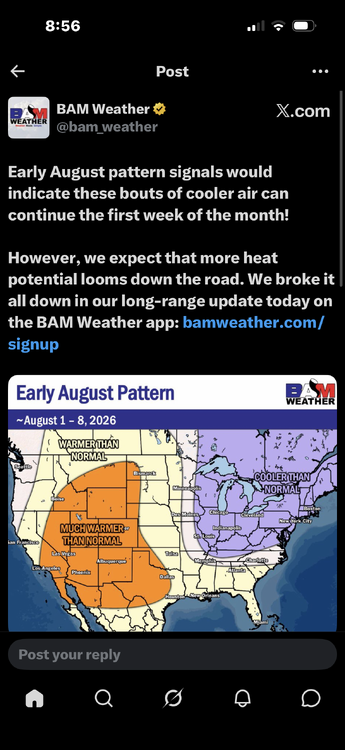
-
Over an inch of rain and counting!
-

2026 Spring/Summer Mountain Thread
Maggie Valley Steve replied to Buckethead's topic in Southeastern States
We'll need to watch overnight in the Mountains. Radar suggests the frontal boundary is sagging into our area. Storms are beginning to fill in as we get a nocturnal increase of South Westerly winds associated with increasing Gulf moisture. -
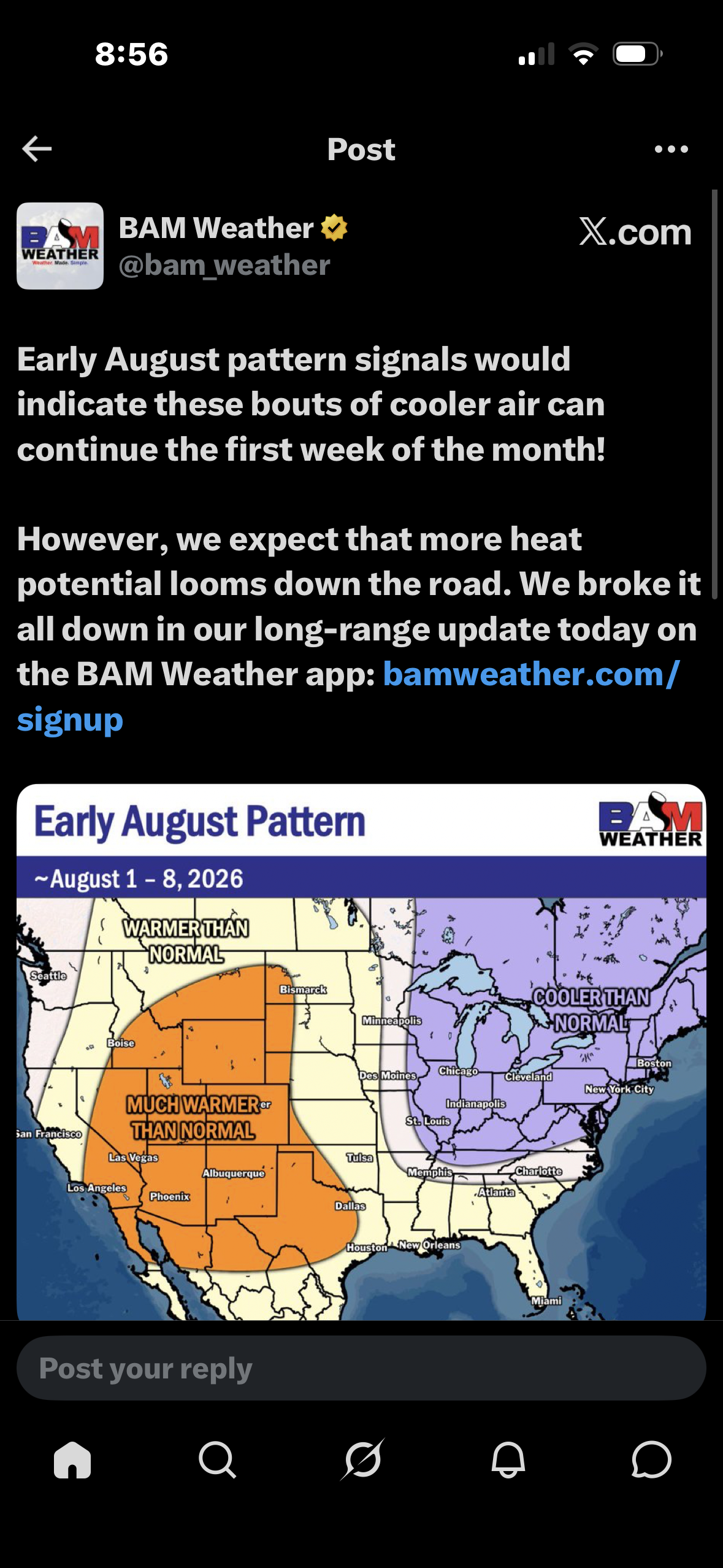
Do you think the heat dome ever rebuilds over us in August and we get upper 90s to 100s again?
-
Today's Highs sunny over performance: EWR: 90 ACY: 90 PHL: 90 New Brnswck: 89 LGA: 89 TEB: 88 JFK: 87 TTN: 87 BLM: 86 NYC: 85 ISP: 84
-
Today's Highs sunny over performance: EWR: 90 ACY: 90 PHL: 90 New Brnswck: 89 LGA: 89 TEB: 88 JFK: 87 TTN: 87 BLM: 86 NYC: 85 ISP: 84
-
If they finish with atleast 75 wins my guess is Elias is still around. I get the impression Rubinstein is going to be patient with the front office.
-
 My personal storm.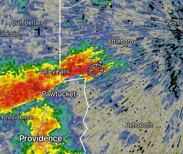
- Today
-
They sure as hell are due for a loss
-
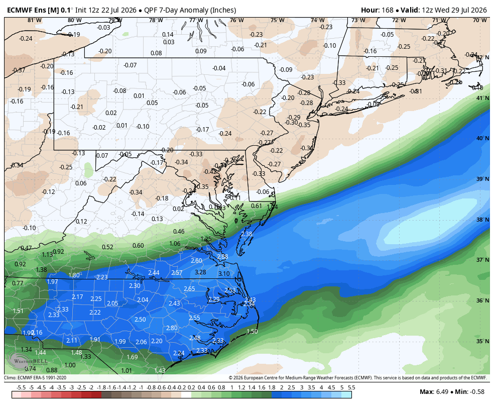
WB map inundation.
-
I actually think they'll hang on and win this one--records are often tied but rarely broken...and Bradish is on the mound!
-

Mid-Long Range Discussion 2026
WinstonSalemArlington replied to BooneWX's topic in Southeastern States
August -
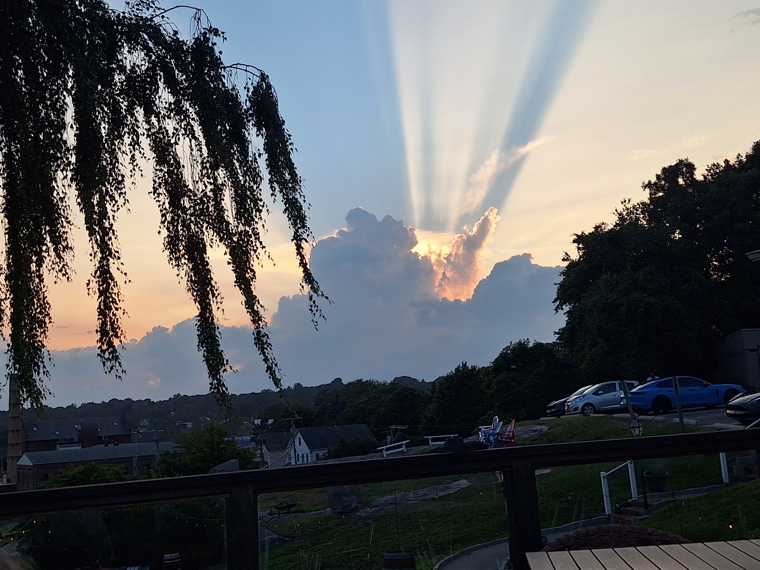
 Looking west from Mystic.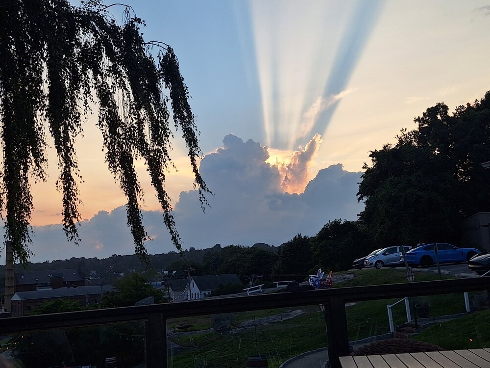
-
 Sorry for the rant, here, but Wxwiz's statement deserves more detail using recent and further back factual history. El Nino is a lazy blame here. Can one really say this very wet period on South Coast on it? What about ern MA w/ its long-tern precip deficit and svr drought conditions? What happened to that? Did emerging El Nino conditions cause that as well? Going back to BDR record wet Julys that was posted earlier as an example, #1 is 1971 which was weak La Nina, #3 is 2021 and that was mdt La Nina. #4 was in 1988 and that was strong La Nina. Oh, but #2 is 2026 and strong El Nino is imminent, so that means it was the cause, esp. b/c it is in the here and now! Vapid and linear thinking. Are we to believe the El Nino singled out the South Coast and has left BOS high and dry, relatively speaking, and even more so NNE this month? What about how wet was in NNE the previous months and SNE was ripped of? Yes, BOS finally has an above avg rainfall month, but what, just quickly dismiss the long-term dryness that local media can't leave alone? Some ppl just turn on a dime here, whichever way the winds blows, and use the fact the public has short-term memory/attention spans. Also, El Nino direct effects show most in the winter for the CONUS, and most apparent for the precip in the subtropics this part of the globe. See the problem here? Some just make simplistic 1-1 correlations w/ nothing to back it up. Content on social media, and truth/facts be damned! Anyone can speculate, opine, or conjecture, and that's fine in itself, but too often these days it gets treated as fact or "will happen."
 -
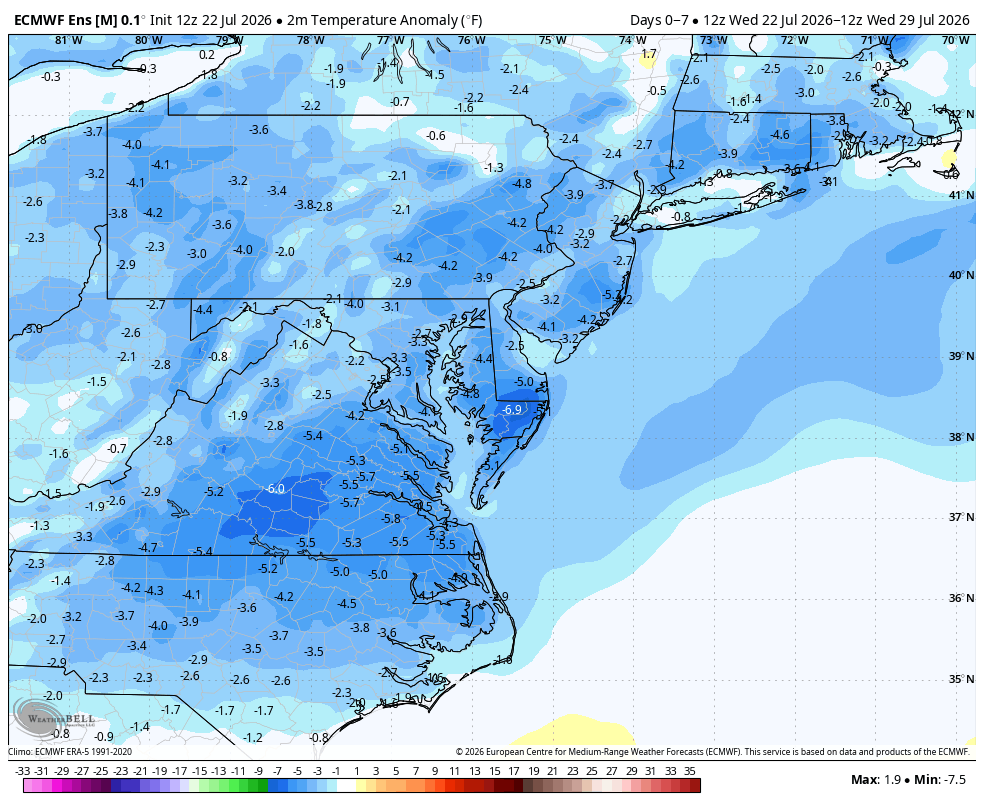
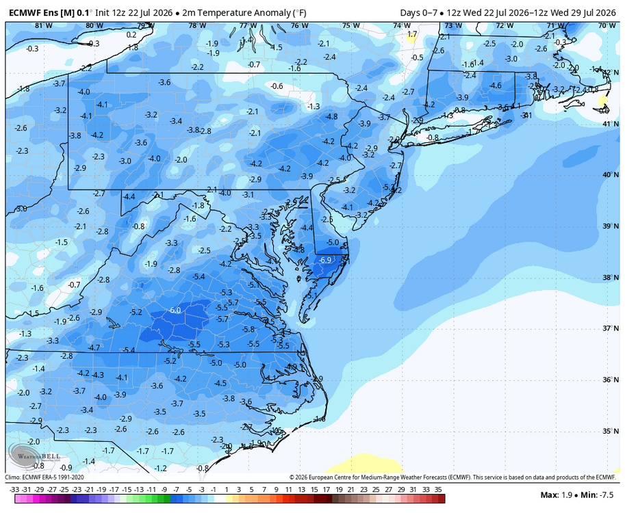
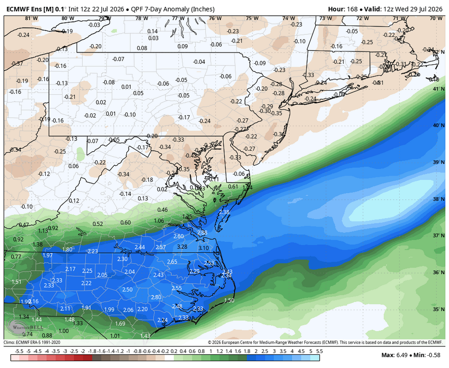
Pretty spectacular midsummer weather over the next week after rain pushes off the coast tomorrow. WB 12Z EPS
-
DP down 2 degrees in last 30 minutes. Down to 64, can feel the more comfortable air settling in.
- Yesterday
-
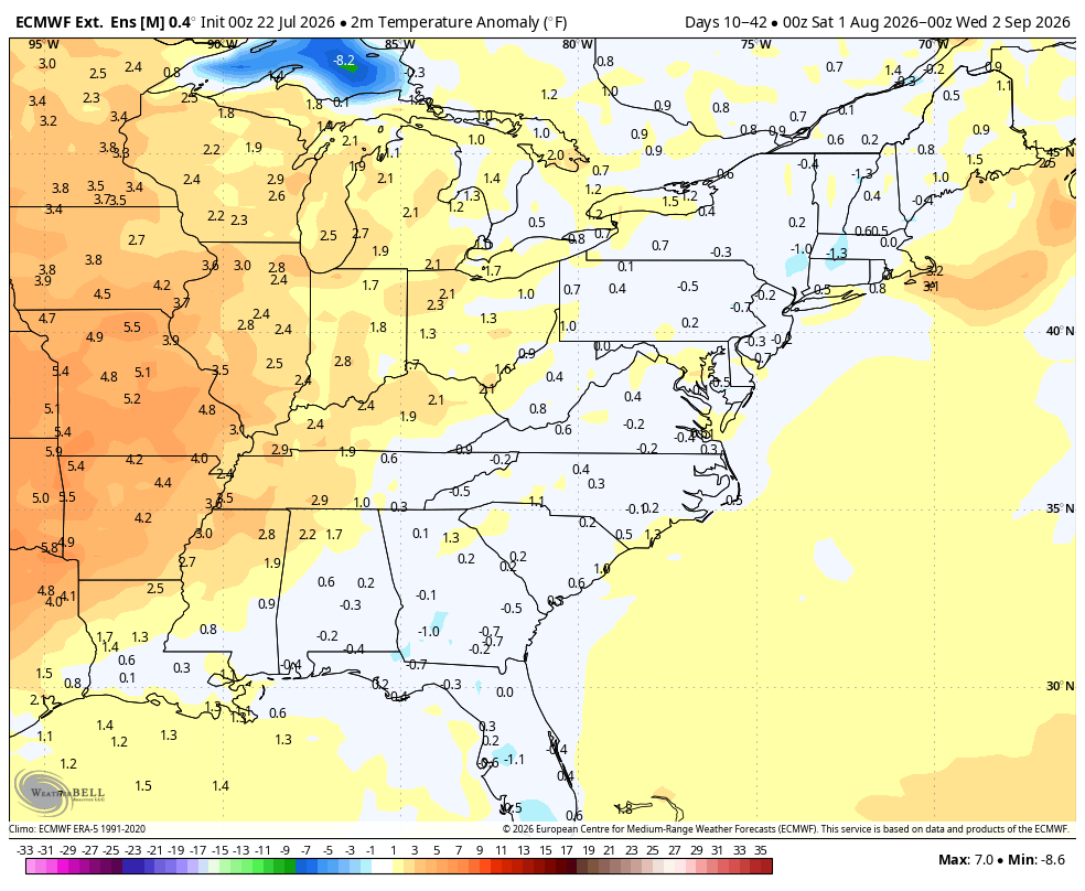
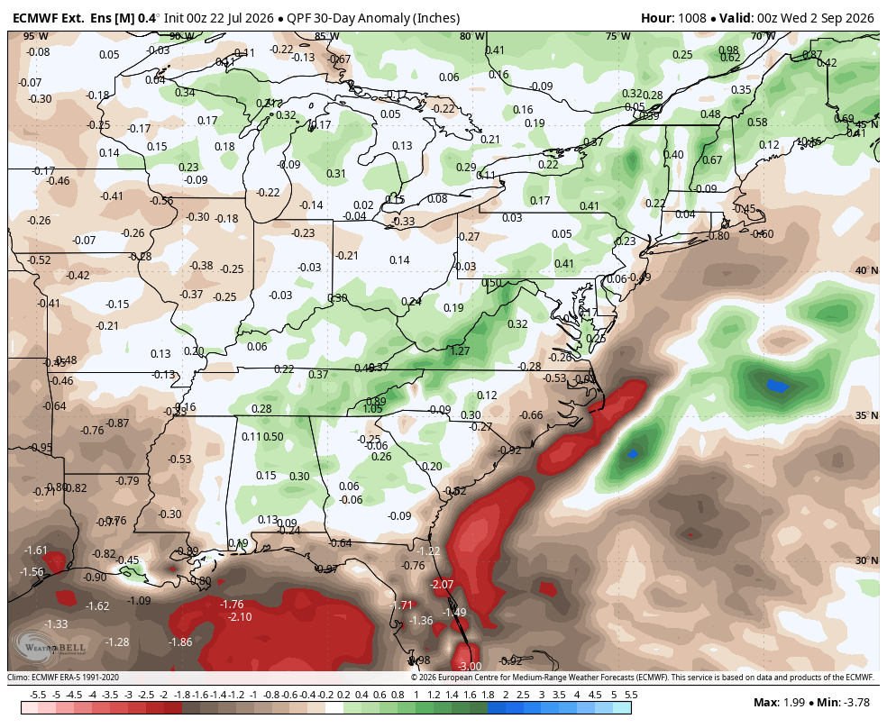
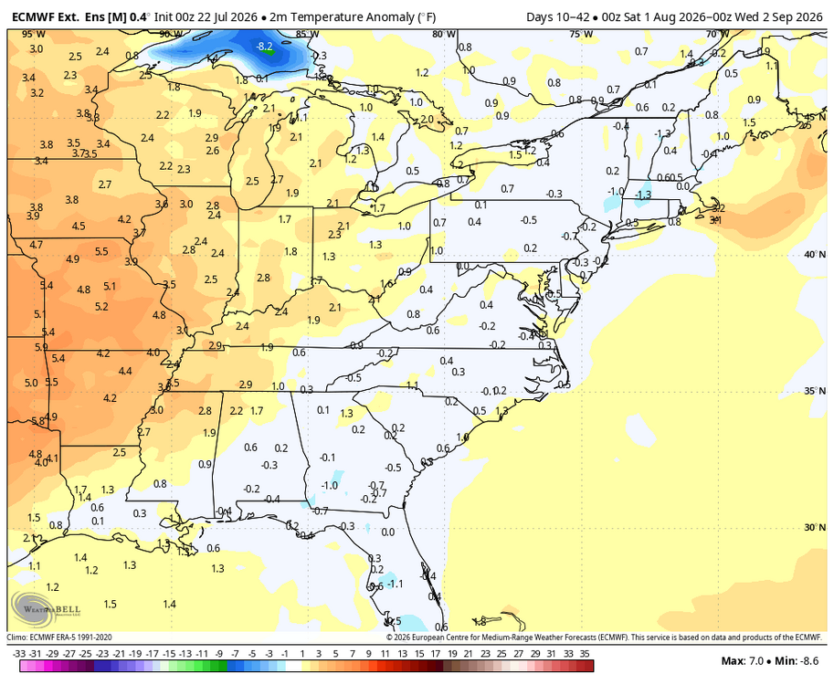
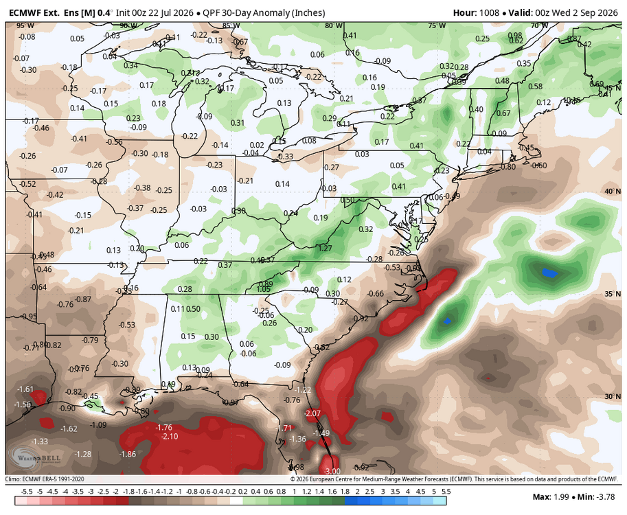
Latest WB EURO weeklies for August; no searing heat; precip. above normal in mountains/ southwest mid Atlantic.
-
.thumb.gif.f92b16c631a1d15d405ed77b33f0710d.gif) sounds like.....
sounds like..... -
15 years ago saw one of the most widespread heatwaves for this area. Newark set an all-time record of 108: https://www.wunderground.com/blog/JeffMasters/july-22-2011-a-day-of-records.html