All Activity
- Past hour
-
It's hot and sunny in my area.
-
2.50 in so far today. A flood warning was issued for Greene Co, but not sure why not for the NE part of Hamblen though. All of that in Greene Co. came through here first.
- 348 replies
-
- 1
-

-
- severe
- mountain snow
- (and 1 more)
-
 Just lock in these days. Perfect summery day.
 -
Maybe that outflow boundary moving SW from the SNJ storms can trigger something.
-
 https://mexicandoctortous.online/# mexico farmacia
 -

Central PA Summer 2026 Discussion/Obs Thread
canderson replied to Voyager's topic in Upstate New York/Pennsylvania
Due S movement on these popup storms is interesting -
Yes, esp. this time of year when large-scale dynamic forcing and strong low pressure areas are less, yet enough of a signal in the probs for SPC to outlook an area. NW flow aloft can lead to some of the best tornado events due to excellent directional shear. We have good speed shear very often, but strong directional shear is much less common. NW flow promotes lee troughing which can back the low-level winds, so you can over 90 deg turning sfc to 500 mb. And you tend to get solid EMLs for more CAPE overall.
-
A normal summer day feels really nice after five days of blowtorch and a week of stifling overcast.
-
Just picked up another .58" with a storm that just rolled through. Currently 61 here. A perfectly cool rainy birthday. Sent from my Pixel 10 Pro using Tapatalk
-

E PA/NJ/DE Summer 2026 Obs/Discussion
hosj III replied to PhiEaglesfan712's topic in Philadelphia Region
trees down blocking roads here -
A quarter inch of rain would be cool. Not asking for much. That would get me to a little over an inch and a half for the month, while continuing the pathetic monthly totals since March.
-
-
Good gosh! I was wondering if yall got hammered.
-
Rainy and cool!
-
These 15 year olds lol.
-

E PA/NJ/DE Summer 2026 Obs/Discussion
BBasile replied to PhiEaglesfan712's topic in Philadelphia Region
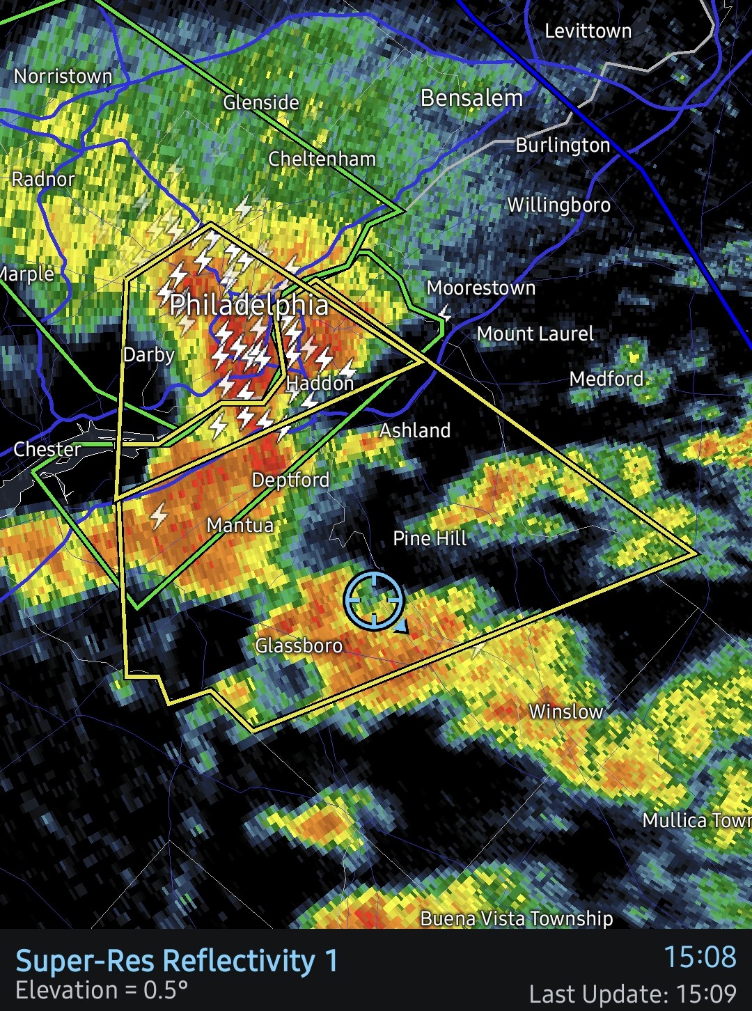
Hearing a few calls for tree removal on the Gloucester Country fire band. Heaviest rain approaching soon. Temp is down to 71.6F. Not bad! -
Your area over to Green seems to have been in the bullseyes for these, and down along the southern border areas.
- 348 replies
-
- 1
-
-
- severe
- mountain snow
- (and 1 more)
-

E PA/NJ/DE Summer 2026 Obs/Discussion
RedSky replied to PhiEaglesfan712's topic in Philadelphia Region
Yesterday and today are an unfortunate miss here but the dry region in Berks is getting some. 2.40" the last 8 days the local farmers are happy that saved the corn. Next 7 or 8 days look dry. -
E PA/NJ/DE Summer 2026 Obs/Discussion
SouthernNJ replied to PhiEaglesfan712's topic in Philadelphia Region
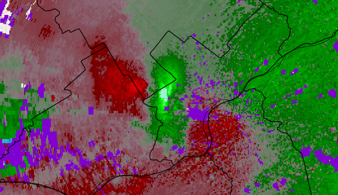
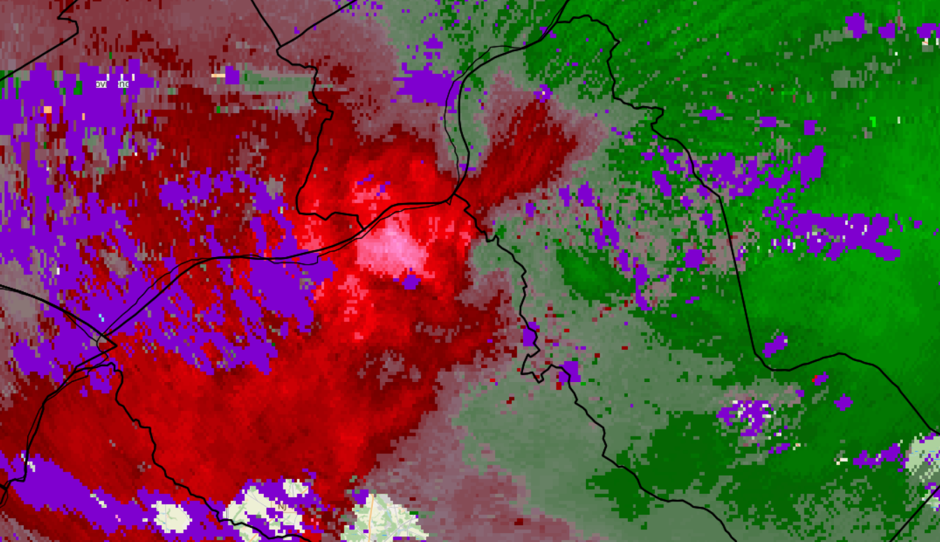
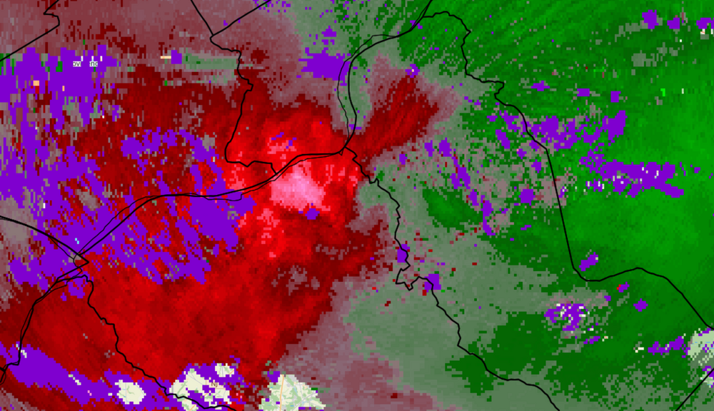
This was TPHL in West Philadelphia at 2:48 PM, then at 3:12 PM in National Park.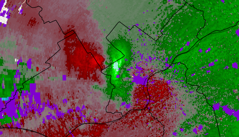
- Today
-
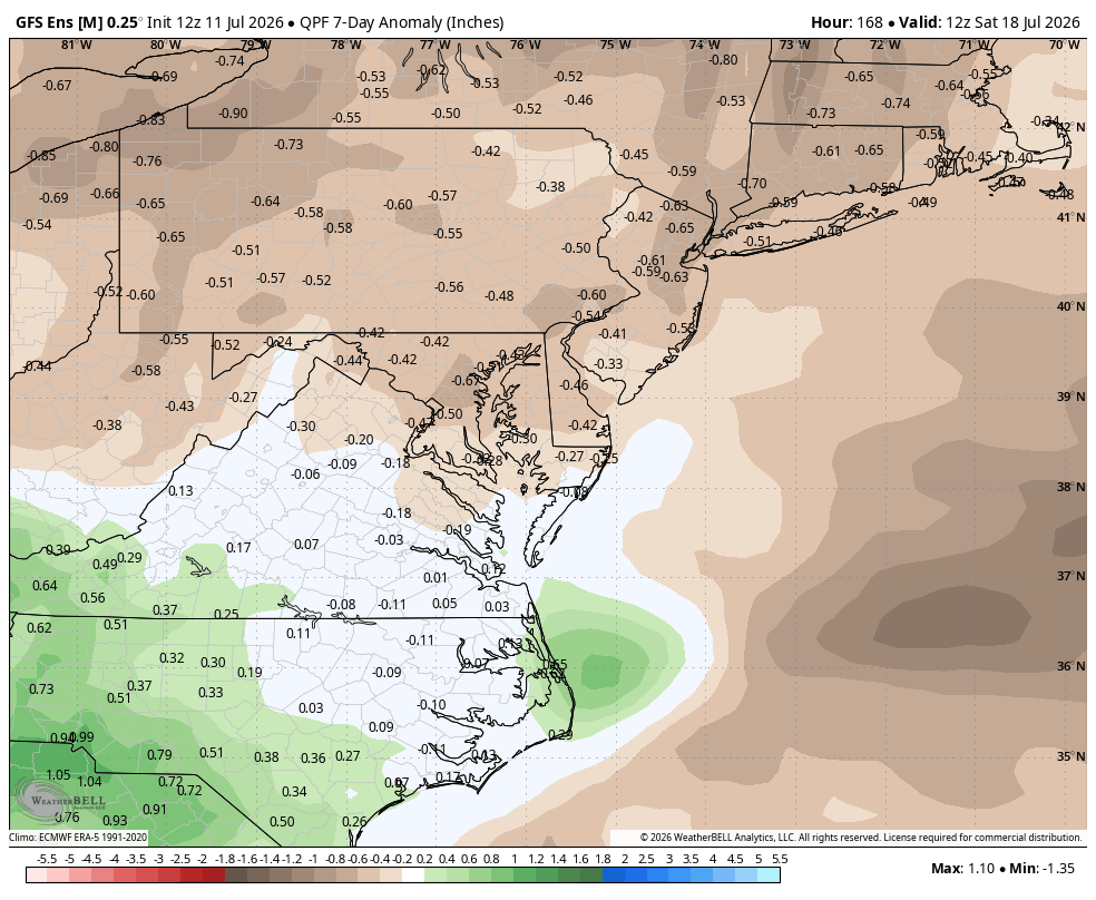
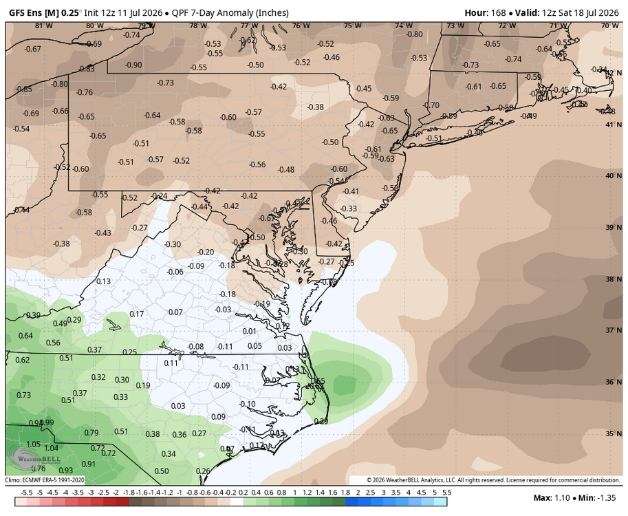
WB 12Z EPS. Looks like a dry work week ahead.
-

Central PA Summer 2026 Discussion/Obs Thread
Voyager replied to Voyager's topic in Upstate New York/Pennsylvania
Same as it ever was. Just a bit outside...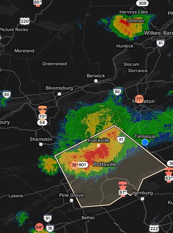
-
E PA/NJ/DE Summer 2026 Obs/Discussion
Albedoman replied to PhiEaglesfan712's topic in Philadelphia Region
LV swing and a miss strike 3 we are out of t storm chances for today. The 7 10 split lives on. Just incredible outflow boundaries preventing us from getting decent rain. 50 miles on either side of the lv gets 2+ in of rain. This is no longer funny. Another week of no rain and temps near 100 , the little lehigh will go dry in spots. I really see a drought emergency issued by Lehigh County Authority by next weekend. The lawns will be burned if people mow them this week and corn will be spiking. -
E PA/NJ/DE Summer 2026 Obs/Discussion
BBasile replied to PhiEaglesfan712's topic in Philadelphia Region
Gust front definitely helped. Rainfall up to 0.64" now. More on the way.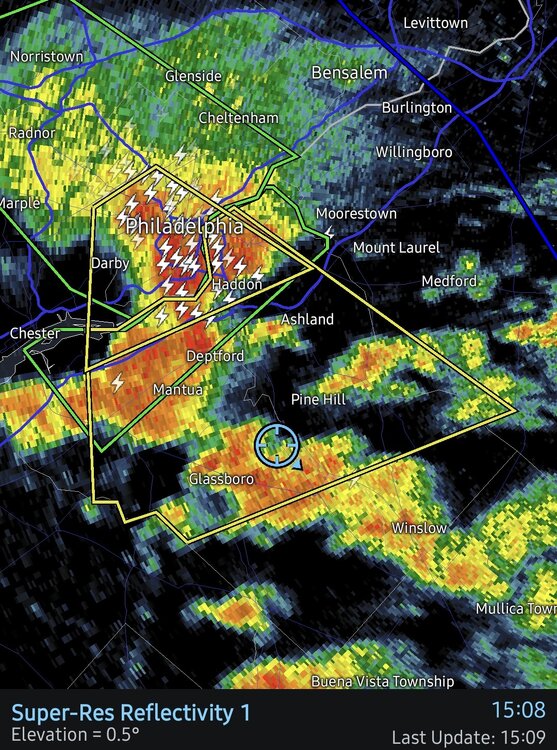
-
E PA/NJ/DE Summer 2026 Obs/Discussion
hosj III replied to PhiEaglesfan712's topic in Philadelphia Region
Intense storm here. Very strong (guessing 58+ mph wind) and hail nearly quarter sized. Best storm of the year. Pouring right now still. Everyone overdoes winds but hard to see how that wasn't severe. I got soaked standing under a covered porch. -

E PA/NJ/DE Summer 2026 Obs/Discussion
LVblizzard replied to PhiEaglesfan712's topic in Philadelphia Region
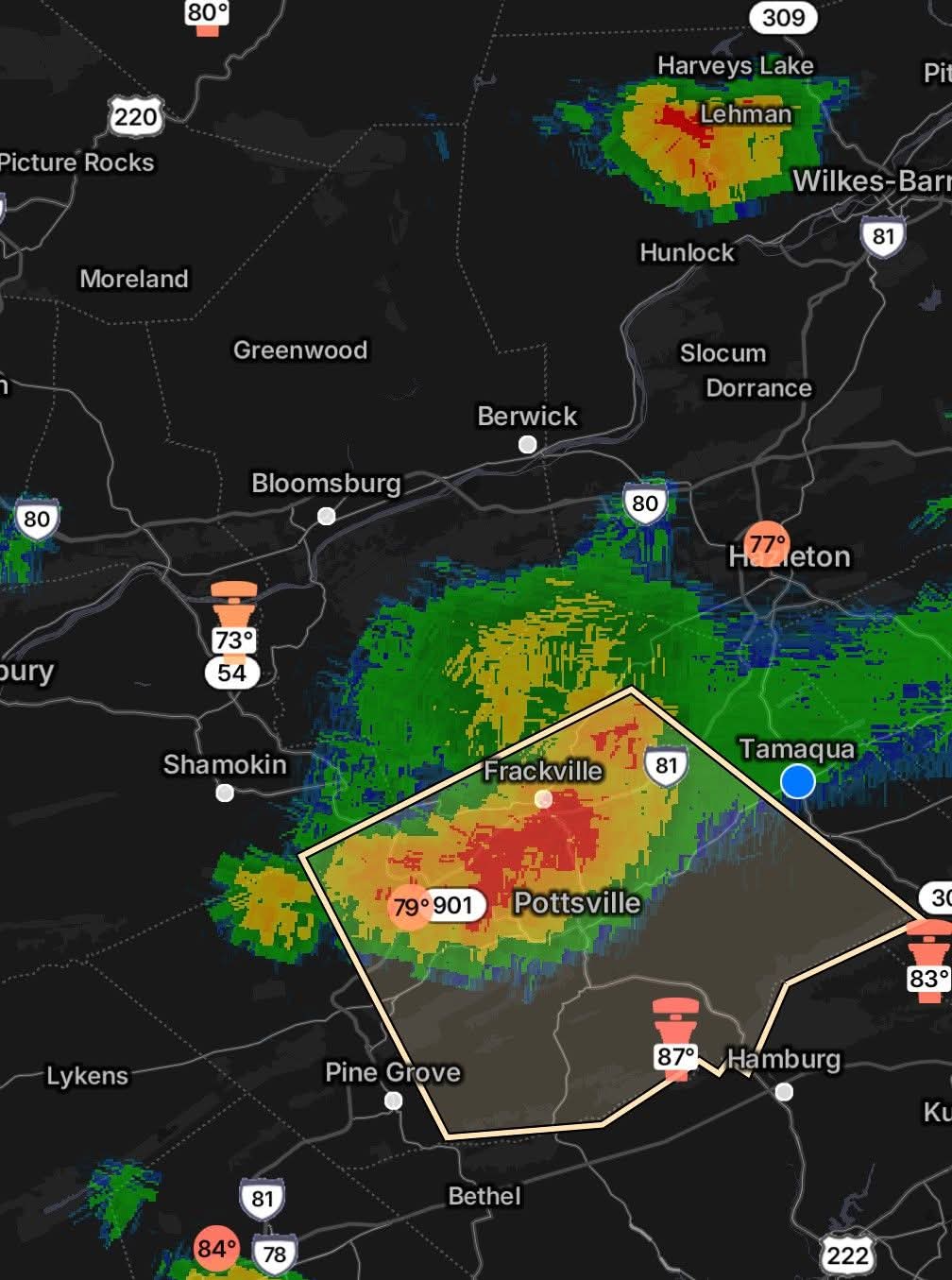
Radar says this will happen today too. The cell over Schuylkill County looks to miss to the west.