All Activity
- Past hour
-
ABBA MCS So when you're near me, Darlin can't you hear me? MCSThe love you gave me, Nothing else could save me, MCSWhen your gone, How can I even try to go on, When your gone, though I try, How can I carry on?
-
Destructive severe warning
-
Looks like around 0.9” from the afternoon storms on top of 0.4-0.5” overnight.
-
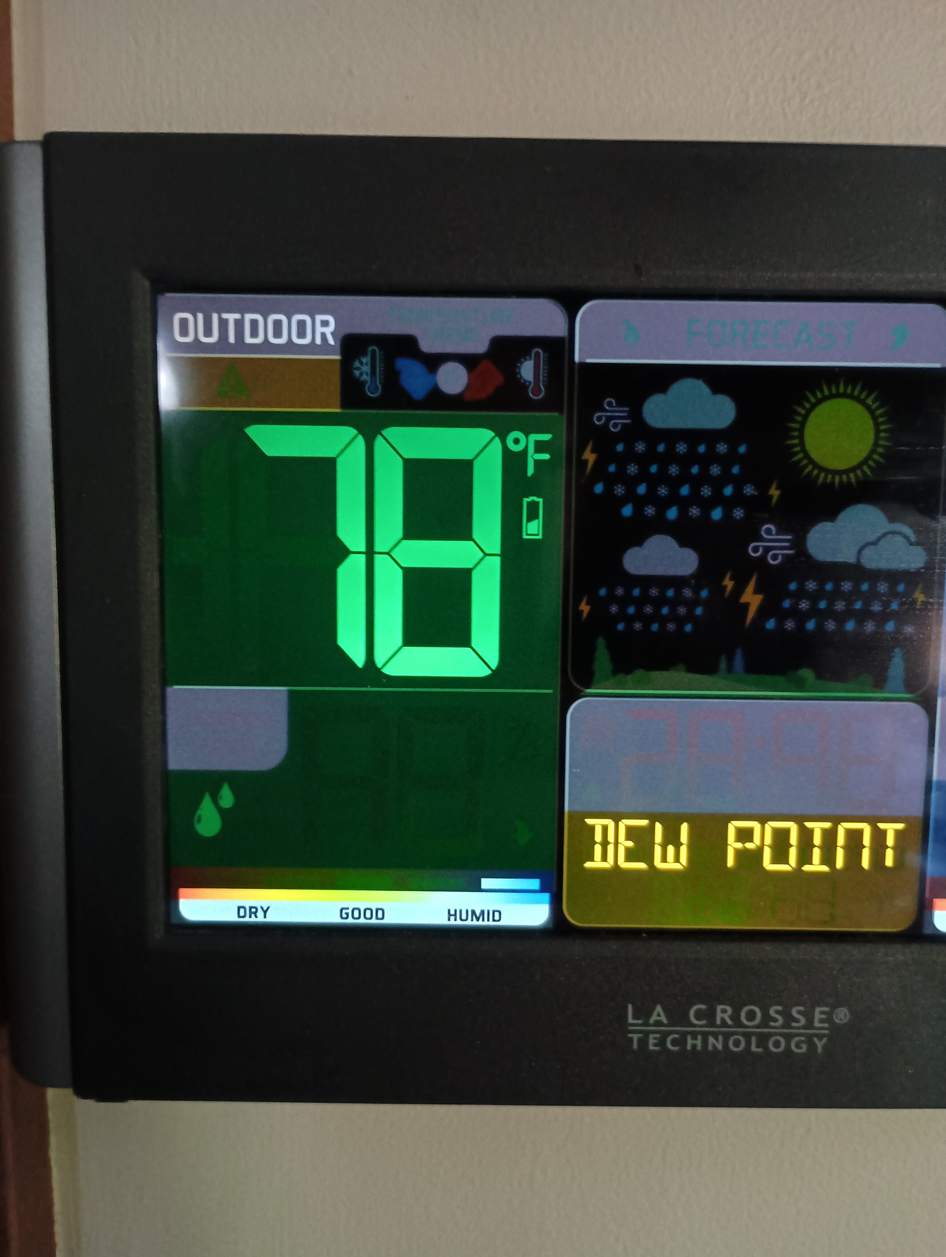
Only 75/70 (Temp/Dew point) here on the south shore with sun. Maxed at 79 around 2pm with 0.26" of rain this morning
-
Not sure why he cheers it on. He’s obsessed with hiding from it in AC.
-
Yeah, I'm sure farmers would disagree but I would sign up for 10 days of Stein if it was an option.
-
Wow, line kind of split, but mostly went poof. Ok, it weakened, and just a trace here so far. All that rushing around from lawn care and weeding the garden for nothing.
-
Yep. Sun’s out here and first summer true sauna afternoon.
-
Timing sucks for any MCS Saturday night, at least if you take a blend of the models. NNE could do well though
-
congrats to you on the high dews you have been begging for!!
-
This humidity sucks. If it’s going to be dewy at least let it be warm so it’s not sticky.
-
Next recon is en route and I fully expect at least a mid grade 3 by the time it arrives. I don’t think cat 4 before landfall is off the table. This is incredible for June
-
Hopefully we get a solid MCS...been quite some time since we had a solid legit MCS roll through
-
Mesoscale Discussion 1349 NWS Storm Prediction Center Norman OK 0238 PM CDT Wed Jun 18 2025 Areas affected...northern IN...southern Lower MI...northwest OH Concerning...Tornado Watch 434... Valid 181938Z - 182145Z The severe weather threat for Tornado Watch 434 continues. SUMMARY...Northern, fast-moving portion of a QLCS should progress across the rest of northern Indiana into southern Lower Michigan and northwest Ohio through early evening. Damaging winds should be the main threat, but a tornado or two will be possible. Downstream watch issuance expected by 21Z. DISCUSSION...The northern portion of a QLCS has been steadily progressing east around 45 kts with a history of estimated to measured gusts of 55-70 mph. This fast-moving portion of the line has likely outpaced stronger low-level shear across southwest IN, per comparison of VWX and IWX VWP data. Given largely veered surface winds downstream and recent HRRR guidance, an outflow-dominated line will likely persist as it spreads into southern Lower MI and northwest OH through early evening. Damaging winds should remain the primary hazard, with a tornado or two possible in any QLCS mesovortices across northern IN.
-
Needed this
-
lol it probably won’t even hit 90° here.
-
It’s gonna be 96/75 there tomorrow. Dude, you’re nuts
-
Sent from down below?
-
Likely to be the first major hurricane to make landfall in Mexico in the month of June for either basin. Also an unusual track for the time of year with only handful of hurricanes to ever have made landfall along that stretch of coastline this early.
-
Finished with 0.71” from 2 rounds of storms sunny 79/75
-
Not yet. I’m comfortable. But the MIL is here so it may be going in.
-
Chicken feathers stuck to legs.
-
Still no installs huh ?
-
Well ... ha, they'll miss whether the damn things 'll form. They tend to turn right of the environmental steering, because they are in fact drawn toward the better CAPE, and that's likelier S, where the cold pooling off the ongoing convection has organized into a meso or meso-beta scaled convectively induced cold front. This lifts the environment, and the static stable layer over the top is forced to ascend to where it is no longer static, and that kicks off the redevelopment cycles there ..hence the propagation. The model physics handle that in principle. The GFS is in fact turning right ... the Euro and GGEM are driving it E through Maine. At this range, either is possible. The amount of turning right probably has some other factorization.
-
nice


.thumb.png.4150b06c63a21f61052e47a612bf1818.png)