All Activity
- Past hour
-
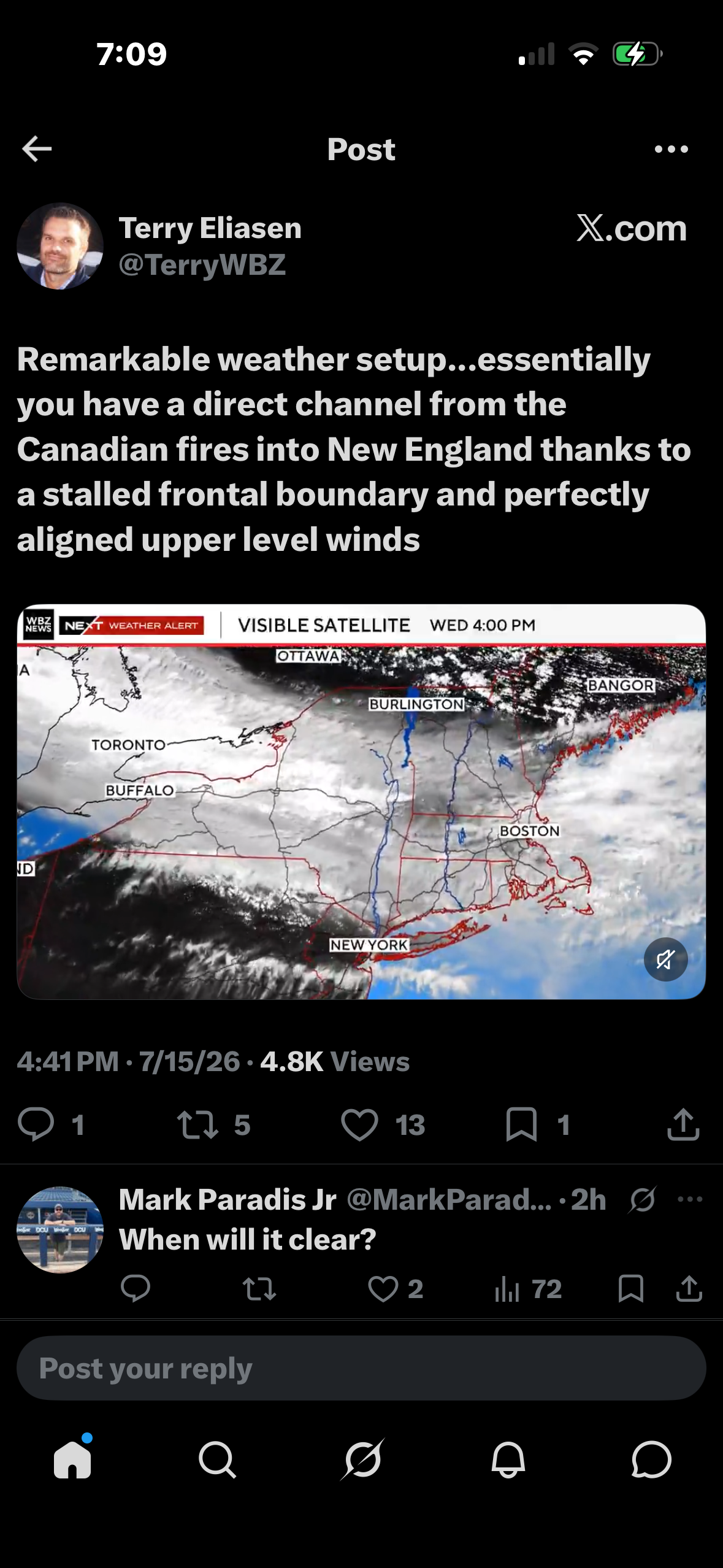
.thumb.gif.f92b16c631a1d15d405ed77b33f0710d.gif) Smoke just cleared out...smoke line near 128
Smoke just cleared out...smoke line near 128 -
 I remember people describing the sky as a sickly amber color before the '38 hurricane. I wonder if it was similar to today. Pretty wild looking out there, but nice and cool thankfully. Running was definitely off the table though. The lungs are not happy.
 -
The storms were the leading edge of the thicker smoke.
-
Thought the thunderstorms woulda cleared some of the smoke, in fact it's worse then earlier.
-
 You forgot the dirty picture.. giggity. Just opened the windows here for the night, will be shut up again tomorrow.
 -

Pittsburgh PA Summer 2026 Thread
Ahoff replied to TheClimateChanger's topic in Upstate New York/Pennsylvania
Hit 90, but fell a good bit short of forecasted highs again. -
 for example both Sunday and Monday topped out between 800-900 watts/m2
 -
 You know there’s a few posters here @dendritefor example that have opened their windows. Taking years off lives breathing it on like they do with the pollen
 -

E PA/NJ/DE Summer 2026 Obs/Discussion
JTA66 replied to PhiEaglesfan712's topic in Philadelphia Region
Topped out at 97F. Any chance at triple digits was thwarted when haze/smoke/schmutz moved in. 92F/DP 73F -
Despite wildfire smoke, temperatures topped out well in the 90s across the region. Highs included: Atlantic City: 99° Bridgeport: 92° Islip: 92° New York City-Central Park: 95° New York City-JFK Airport: 98° New York City-LaGuardia Airport: 98° Newark: 98° Philadelphia: 98° Temperatures will soar into the upper 80s to perhaps lower 90s tomorrow. Smoke could hold down the readings by several degrees across parts of the region. Friday will also be very warm before the temperatures ease for the weekend. Showers and thundershowers are possible during the weekend. The greatest risk is Saturday night and Sunday. Highs will generally reach the lower and perhaps middle 80s through the middle of next week. The ENSO Region 1+2 anomaly was +3.4°C and the Region 3.4 anomaly was +1.8°C for the week centered around July 1. For the past six weeks, the ENSO Region 1+2 anomaly has averaged +2.80°C and the ENSO Region 3.4 anomaly has averaged +1.52°C. The ongoing strong El Niño will continue to strengthen through the summer. The SOI was -36.56 yesterday. The preliminary Arctic Oscillation (AO) was +0.104 today. Based on sensitivity analysis applied to the latest guidance, there is an implied near 65% probability that New York City will have a warmer than normal July (1991-2020 normal). July will likely finish with a mean temperature near 78.5° (1.0° above normal). Supplemental Information: The projected mean would be 2.0° above the 1981-2010 normal monthly value.
-
 Just wake up, take a deep breath, and admire near zero visibility reaching your kitchen?
 -
94 and smokey. We never had smoke days like these as kids. It's insane that people think this isn't a warning sign that our planet is in distress.
-
I look forward to the day when that shows snow again.
-
5 minute light shower here.
-
Alot of outdoor related business closing tomorrow due to air quality here on the east side of mi. Also a very light fine ash sprinkled on my truck windshield when I left work at 330 here in the thumb of mi. Never would have had that on the weather of 2026 bingo card.
-
Smoke is definitely better here now. The sun set looks almost normal. We had hours today like it looked like an apocalypse movie outside the office. Its 76 right and might actually open up the widows...
-
95 today! Tied for highest this season thus far.
-
after the storms pass it is mostly smokey sky conditions you can see the smoke hanging between the trees down the street temps only in low 80's with high humidity
-
Isn't that the guy that flip flopped back and forth and was wrong all last winter?
-
disgusting outside. unnerving
-
My RH freakishly stayed around 85% most of the aft til 5:30 pm when it finally began to drop. Yesterday mid-aft it was 45%. The temp very slowly creeped up only to 24C - not surprisingly. Off by 5-6C. Any item with fabric felt damp still as if it never aired out from the morning dew. Looking at broad radar, I suspect there is a very long teleconnection happening all the way from Dauphin MB to Syracuse NY!!! Its a thick weak band that fragments at times. Never seen anything like that.
-
Go España!
-
Checking in on new England
-
90/62 here in Augusta.