All Activity
- Past hour
-
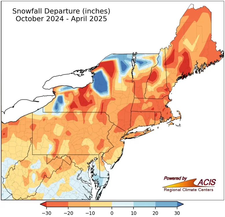
I’m pretty sure the model was forecasting all of that below average snow because it had a country wide blowtorch. So it was right for the wrong reason pretty much.
-
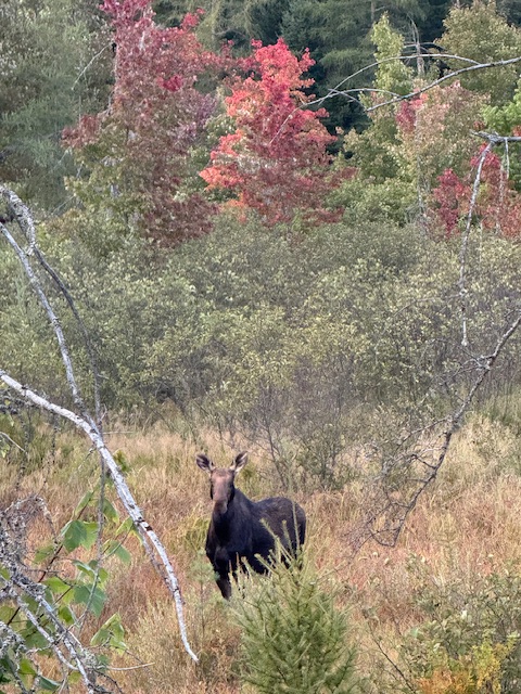
Just saw this lady…
-
Forecast totally changed . Front slowed to crawl and a wave forms on it
-

September 2025 OBS-Discussion centered NYC subforum
IrishRob17 replied to wdrag's topic in New York City Metro
You couldn't tell by looking at the sky this afternoon? -
Woof. Team euro I guess. 0.5” would be nice since it’s probably not going to rain for 10 days after at least.
-
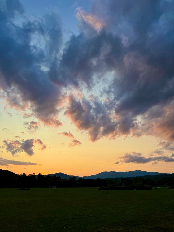
What an evening.
-
That'll suck for my yard/garage sale. Hope it's done early AM.
-
It was the warm storm tracks from Philly to Boston that resulted in the very low snowfall. Very strong Southeast ridge and Pacific Jet on the days when most of the precipitation fell. This has been the main theme since 2018-2019.
-

September 2025 OBS-Discussion centered NYC subforum
qg_omega replied to wdrag's topic in New York City Metro
Smoke? -
Crazy rebound in soil temp 0 to 10 cm layer New Castle County, DE (19709) Current Soil Temperature : 80° https://www.greencastonline.com/tools/soil-temperature
-
Had a low of 54 and a high of 78. Current temp is 70. Saw a high reading today in Asheville of 88 degrees. Crazy how elevation works around here with Temperatures. One more warmish day then back to being very October like.
-

September 2025 OBS-Discussion centered NYC subforum
doncat replied to wdrag's topic in New York City Metro
Warmest day in a while...up to 87° high, had 0.40" rain overnight. -
Looks like a decent drink incoming here for the weekend.
- Today
-
Wasn't last year more a product of it being dry over warm storm tracks?
-
https://x.com/BenNollWeather/status/1964063639037509647 Ben Noll @BenNollWeather Wildfire smoke from the Pacific Northwest and British Columbia will cause hazy skies along the East Coast into the weekend. Most of the smoke will be lofted up high, so air quality shouldn't be too bad, but eerie sunrises and sunsets may occur.
-
Getting a little worried about the Sunday stuff being too far east for me…may need the Sat afternoon/eve stuff to overperform.
-

2025 Atlantic Hurricane Season
BarryStantonGBP replied to BarryStantonGBP's topic in Tropical Headquarters
Don't bother with non-ens/ai models tbh -
Cool sunset incoming from this smoke coming through aloft. It reminds me of a 90's summer evening.
-
The much below average snowfall forecast from the seasonal models run during the fall of 2024 from Philly to Boston did work out. They even got the very low snowfall correct for Chicago. That’s what most on here follow anyway. A continuation of the warm storm tracks through the Great Lakes theme.
-

September 2025 OBS-Discussion centered NYC subforum
donsutherland1 replied to wdrag's topic in New York City Metro
The 0.48" rainfall at Bridgeport today broke the daily record for September 5. The old mark of 0.44" was set in 2012. -

September 2025 OBS-Discussion centered NYC subforum
WestBabylonWeather replied to wdrag's topic in New York City Metro
Last “warm” night of the season maybe? -
High of 89. Dew points in the mid 70's made it feel hot.
-

2025-2026 Fall/Winter Mountain Thread
Maggie Valley Steve replied to Buckethead's topic in Southeastern States
Woke up at 4:30 this morning and it was 58. No rain at the house today and I had a high of 74. Lots of Bikers in town which is a good thing for our Valley. Folks are slowly coming back after almost a year for the Helene Anniversary. -
Euro and GFS both showing nothing through September 20. Time to start bringing 2013 into conversation...
-
77/55 Another grade-A quality day.


