All Activity
- Past hour
-
@canderson this seems like our best shot in forever at some rain above 0.10" Sent from my SM-G970U1 using Tapatalk
-
Just got a trace of rain !!!!
-
92F. Picked the worst day to tackle some landscaping.
-
1. I get that, but it's not like the monsoon season in Phoenix exists in a bubble that doesn't affect other cities in the region. 2. Sure, but the warming part is clearly exaggerated in Phoenix by other factors. 3. This completely ignores the reality of increased UHI in Phoenix metro, particularly around the airport area. Why do you think PHX is such an outlier compared to other AZ cities? This is the most sensible answer.
-
-
Reporting from OCMD next couple of weeks. Beautiful day and ocean is warm. Will be watching the surf increase this week.
-
Caught it as it formed over Brooklyn, only 0.01” but will take that these days
-
Negative Nancy post here, but I have no confidence in seeing storms in Tamaqua anymore. That being said, the radar (so far) looks like I may get skunked again with a repeat of the storms north and south, but nothing here. last weeks storms slammed Hazleton north to Scranton and Allentown and southeast... Just like it's been for most of the summer. The pattern of have's and have nots continues.
-
92/72
-
8/15 or prior. I looked those up, all later
-
some enjoy the pain. I doubt anyone would merrily track a massive blizzard that barely scrapes CC, unpaid anyway.
-
29 90F.
-
 90 /74 32nd day of 90+ here in southeast Passaic County, will it be our last this year?
 -

NEW DISTURBANCE: Central Tropical Atlantic (0/20)
GaWx replied to BarryStantonGBP's topic in Tropical Headquarters
From my perspective, I hope Erin takes her sweet time and thus reduces the chance this could hit the US. Being near the coast in a highly vulnerable location, I’ll take boring over interesting with this AOI. 12Z: CMC, Euro, Euro AIFS, and UKMET are all recurving between 65 and 70W. JMA isn’t out yet. ICON doesn’t go out far enough to know where it would go in relation to especially E NC and Cape COD but the 180 suggests it’s likely about to recurve, regardless. So, other than the still unknown JMA, the GFS is the only major operational global suggesting a big threat to the Conus with Icon being undetermined. -
. 33 nice watering garden
- Today
-
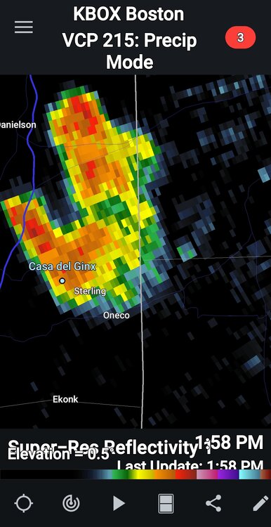
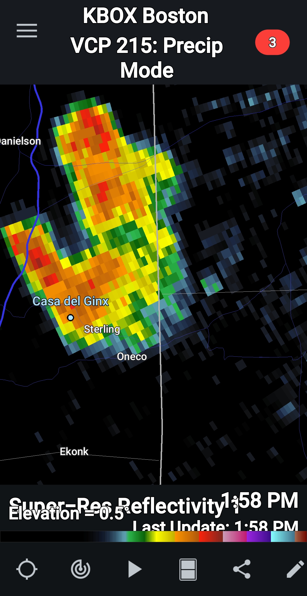
Private rain storm. Pouring
-
88.7/66 Rain would be nice
-
FROPA is through BTV… 70/57 (dew down almost 10F since 11am) It’s on our doorstep here now. 73/63
-
 Long duration heatwave 8 days 90/77/99
 -
Yesterday‘s rain shower helped ensure extra streamy today. 88/72
-
85/68 here. KFIT is 89/63
-

Hurricane Erin: 125 MPH - 946mb - WNW @ 13
Wannabehippie replied to BarryStantonGBP's topic in Tropical Headquarters
2:00 PM AST Sun Aug 17 Location: 21.3°N 68.0°W Moving: WNW at 13 mph Min pressure: 946 mb Max sustained: 125 mph -
 Down at the nautical mile for the first time in many years. Almost a perfect day just a bit cloudy
 -
yup!
-
Too many Vito’s in mine. My mom bucked the tradition 78+ years ago. The contentious fallout, sadly, lasted for decades. As always ….


.thumb.png.4150b06c63a21f61052e47a612bf1818.png)


