All Activity
- Past hour
-
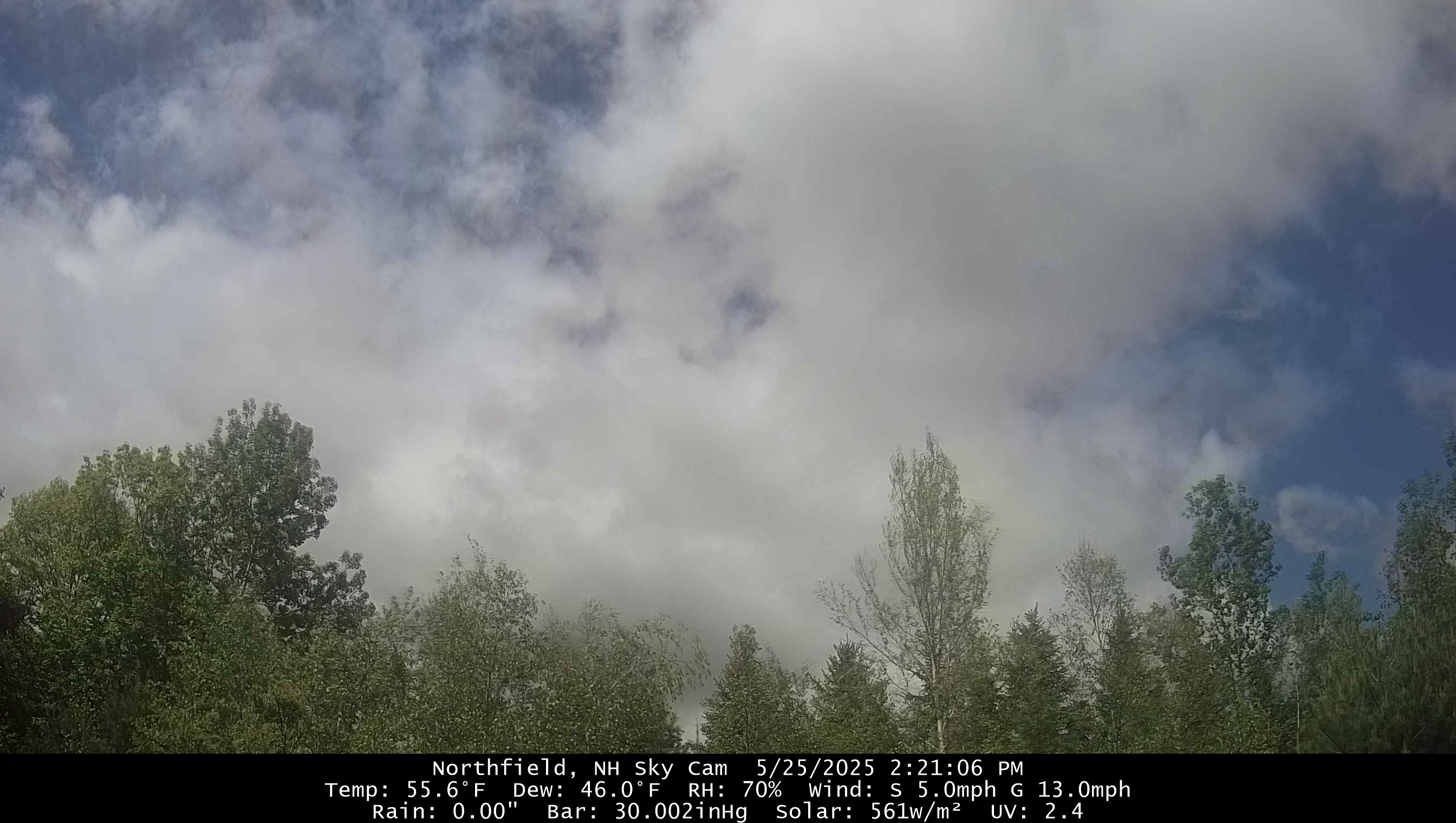
The first storm appears to have produced ~1.5” within a short period. A 2nd thunderstorm started here ~10 minutes ago producing some heavy rain and once again plentiful CTG lightning. This is on the northern end of a line moving eastward. Just to my south this line has been severe warned.
-
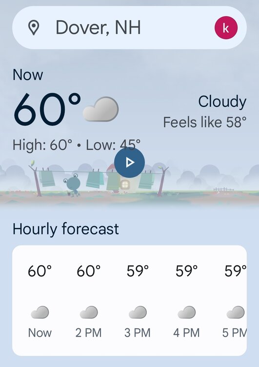
You have a few too many sips of the holy sacrament this morning? My high here was 59, and it’s been 90% cloudy since 7am. but hey, at least the wind helps keep the black flies at bay.
-
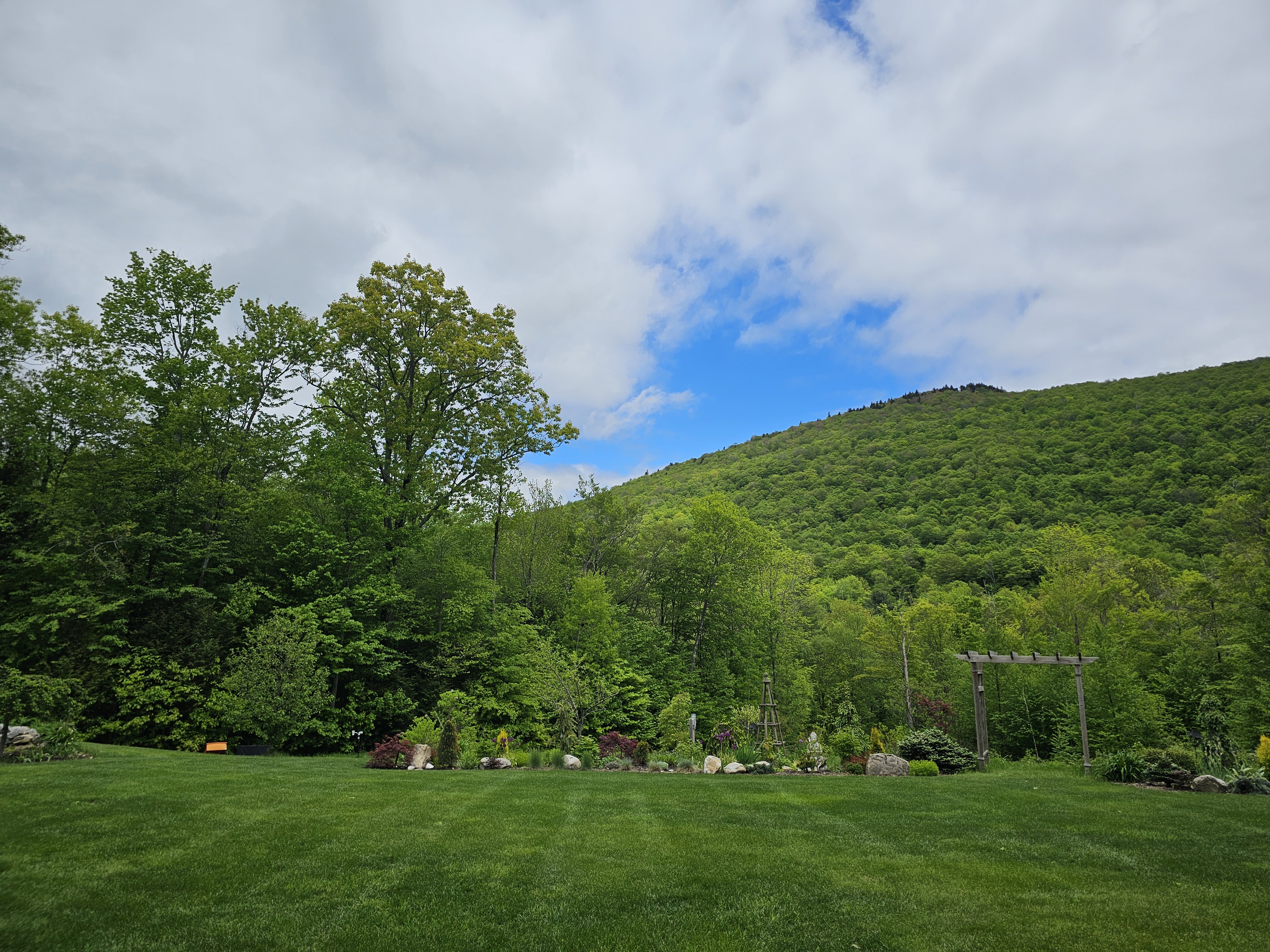
Sun finally starting to peak out
-
It’s freezing at Jones beach again. Fully clouded over, the never ending wind whipping. Three layers and I’m shivering and I’m a very large guy who doesn’t really get cold. Being up in a life gaurd stand fully exposed to the wind will do that.
-
Could be worse-you could be here in Austin with me today where it’s currently 97, heat index 105. Absolutely disgusting, broiling heat. Chance of severe tomorrow so hopefully that works out
-
Congrats. The only place in New England.
- Today
-
Thread explaining why I think chances for tropical development in the NW Caribbean and Gulf of Mexico ramp up significantly around Jun 4-10. https://x.com/yconsor/status/1926690131181731976
-
After the great success of the Chester County Facebook Weather page with now over 11k followers I am starting a new Jersey Shore focused weather and observation page for all of those interested in Jersey Shore and beach weather insights - come join us ! Thanks to all!! https://www.facebook.com/groups/jerseyshoreweather/
-

E PA/NJ/DE Spring 2025 Obs/Discussion
ChescoWx replied to PhiEaglesfan712's topic in Philadelphia Region
After the great success of the Chester County Facebook Weather page with now over 11k followers I am starting a new Jersey Shore focused weather and observation page for all of those interested in Jersey Shore and beach weather insights - come join us ! Thanks to all!! https://www.facebook.com/groups/jerseyshoreweather/ -
Finally sun. Looks like some dry air is advecting in from the N-NE.

-
It's becoming more difficult to bet on the change to warmer/hotter weather. The pattern of the cold cyclonic flow aloft keeps repeating itself to the point that I think it's going to be very hard to get out of this. Each time a curly cue upper low develops it helps the trough deepen along the coast allowing for more of them. Meanwhile the height rises/warmth and heat are well over the top and staying to our west. As I see it now this could be the story through a good part of June even. We may be waiting until the last week of June or first half of July to see our first 90+ degree day. For now it looks as though rainfall continues to be near to above average with mainly cooler than normal temps, maybe a few isolated warm days here and there but no warmer than normal pattern. WX/PT
-
We’re about to get blasted with a strong thunderstorm. The CTG lightning is bad. Edit: 2:39PM: A little late for this imho. Here it is already starting to let up. I’ll reiterate that the CTG lightning has been very frequent and nearby (worst in a long time). The rain has been torrential, leading to my street flooding and a little water coming in near both edges of the garage door, but the winds haven’t been high. I didn’t spot any hail, but I could have missed it: BULLETIN - IMMEDIATE BROADCAST REQUESTED SEVERE THUNDERSTORM WARNING NATIONAL WEATHER SERVICE CHARLESTON SC 231 PM EDT SUN MAY 25 2025 THE NATIONAL WEATHER SERVICE IN CHARLESTON HAS ISSUED A * SEVERE THUNDERSTORM WARNING FOR PORTIONS OF... CHATHAM COUNTY IN SOUTHEASTERN GEORGIA... BEAUFORT COUNTY IN SOUTHEASTERN SOUTH CAROLINA... JASPER COUNTY IN SOUTHEASTERN SOUTH CAROLINA... * UNTIL 315 PM EDT. * AT 231 PM EDT, SEVERE THUNDERSTORMS WERE LOCATED ALONG A LINE FROM OVER BLUFFTON TO OVER MONTGOMERY, MOVING EAST AT 20 MPH. HAZARD...60 MPH WIND GUSTS AND SMALL HAIL. SOURCE...RADAR INDICATED. IMPACT...EXPECT DAMAGE TO ROOFS, SIDING, AND TREES. * LOCATIONS IMPACTED INCLUDE... DOWNTOWN SAVANNAH, HUTCHINSON ISLAND, HUNTER ARMY AIRFIELD, BLUFFTON, BELLINGER HILL AREA, MIDTOWN SAVANNAH, WILMINGTON ISLAND, HILTON HEAD ISLAND, FORT PULASKI NATIONAL MONUMENT AND TYBEE ISLAND. THIS INCLUDES I-16 BETWEEN MILE MARKERS 166 AND 168. PRECAUTIONARY/PREPAREDNESS ACTIONS... SEEK SHELTER INSIDE A WELL-BUILT STRUCTURE AND STAY AWAY FROM WINDOWS. THESE STORMS ARE CAPABLE OF PRODUCING DAMAGING WINDS. CONTINUOUS CLOUD TO GROUND LIGHTNING IS OCCURRING WITH THESE STORMS
-
In Calvert we've gotten enough rain to be close to average but definitely not the excess some areas have seen to really reverse the long term drought. Hopefully it'll get whittled away though.
-
Going down to Ocean City Tues to Fri and of course the forecast is garbage.
-
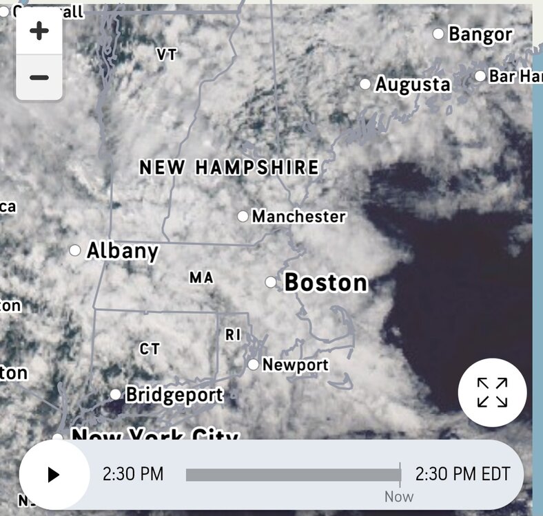
Kind of meh with all these clouds. Figured the clouds would win today but was hoping it would be more of a mix
-
Enjoyed last evening once it was clear, felt better. Then first thing this morning walked quite a bit while it was sunny with the green everywhere established. Now back to overcast as of 10:30, this is unreal. Still feels chilly too.
-
Take the nearest rooftop thermo and add 5.
-
NE
-
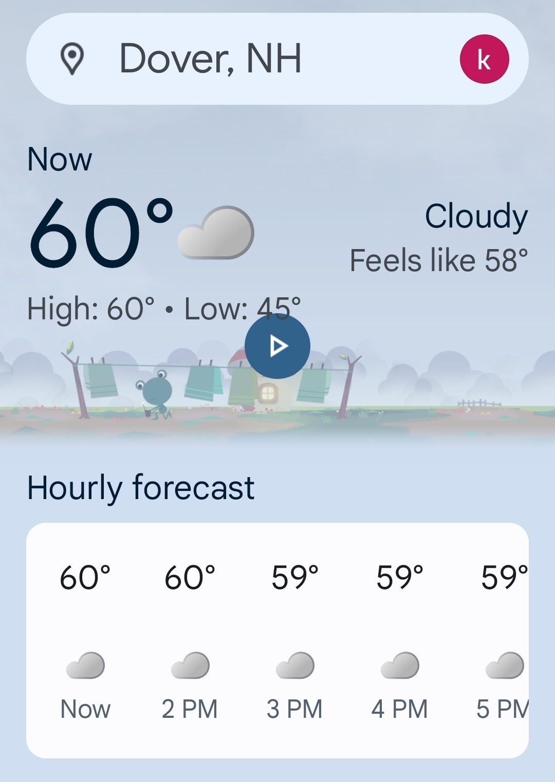
Sunny and 68.
-
it might be decades before we get another long beautiful stretch of cool pleasant temps in mid to late may..
-
Yes, the skies are getting brighter and the sun just came out here again just now!
-
What direction is that looking? I love that view.
-
This is the most blue sky I have seen in 8-9 days.. even bright overcast has been a win.

-
59 at the Vatican. Pope-A-Wheelie kind of day.
-
Not even sure it’s that humid.