All Activity
- Past hour
-
Please. The lawn is toast at Pit2.
-
let’s go
-
-
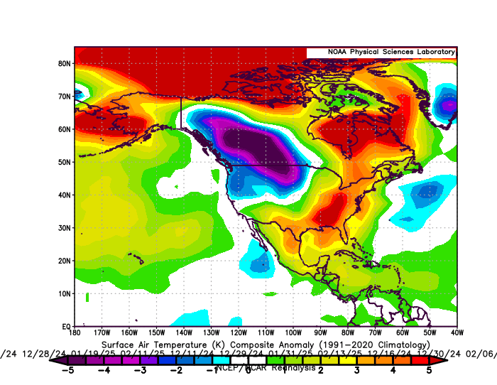
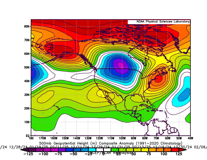
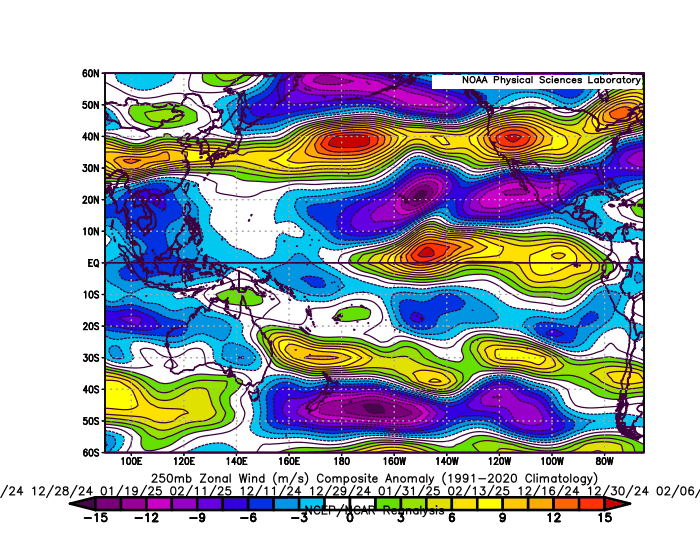
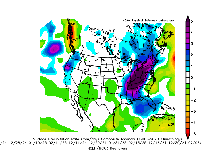
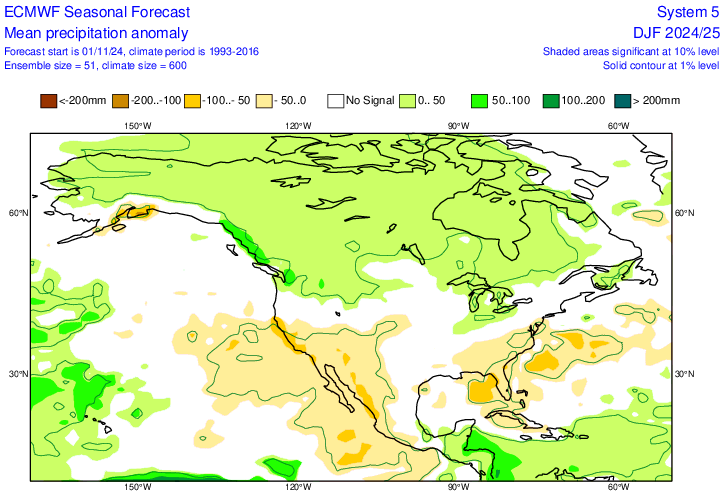
But the storm track matched the warm winter pattern it was forecasting. The composites below are for the 20 days that .20+ of precipitation fell from Philly to Boston. The average temperature at Philly to NYC on these days was in the low 40s. So it was too warm for much snow with the storm track to the west of the I-95 corridor. The Euro seasonal precipitation forecast had above average near the Eastern Great Lakes matching the warmer storm track which verified. Plus there was major flooding in areas like West Virginia along this storm track. The Southeast ridge on the days when the wettest storms occurred was even more amplified than what the general seasonal forecast from the Euro was. Plus the warm departure on the heaviest storm days was significantly warmer than the seasonal temperature forecast. So in effect a warmer version of the seasonal forecast did occur through the storm track. The Pacific Jet was too strong and warm for much snowfall from Philly to Boston relative to the means. This has been a common theme leading to the record low snowfall near I-95 since 2018-2019.
-

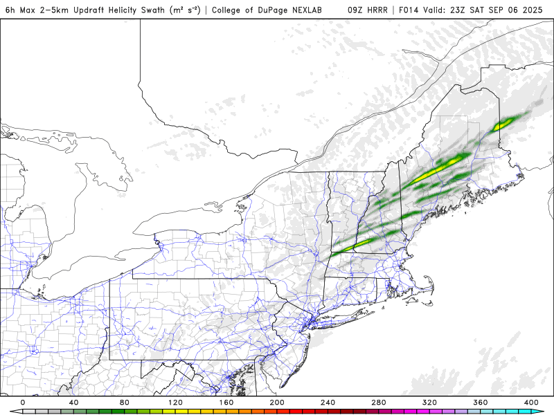
Saturday 9/6 Strong/Severe storm potential
Torch Tiger replied to Torch Tiger's topic in New England
Looks and feels like a big day -

Saturday 9/6 Strong/Severe storm potential
Damage In Tolland replied to Torch Tiger's topic in New England
Deep summer 5 miler this morning.Felt great just the way most like it -
9/7/23 was ok
-
Early September is a mini-peak for severe, often as good as it gets around here. 9/7/98 is a great example
-
Saturday 9/6 Strong/Severe storm potential
Damage In Tolland replied to Torch Tiger's topic in New England
Tors galore to be sure… but low clouds/ thick pea soup doesn’t scream stormy -

2025-2026 ENSO
Stormchaserchuck1 replied to 40/70 Benchmark's topic in Weather Forecasting and Discussion
snowman19 has been pretty accurate with his predictions. Don't underestimate him. -
There is growing evidence that we may see a big shakeup and complete pattern flip by October to much warmer than normal and possibly much drier than normal as well. @Stormchaserchuck1 warned of this weeks ago….-PDO/-ENSO October correlation. The -IOD is magnifying those effects
-
Walked out the door this morning and it just has that feel in the air.. today could be a good day..
-
1st month to end up drier than normal since January
-
Water coming up.
- Today
-
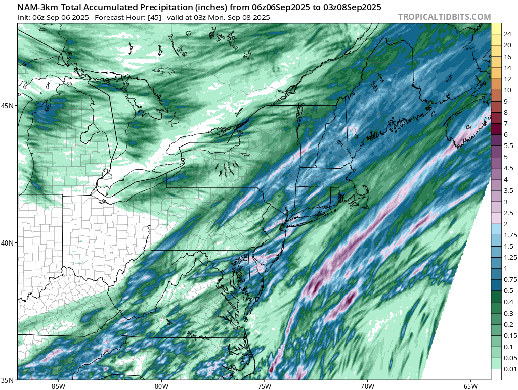
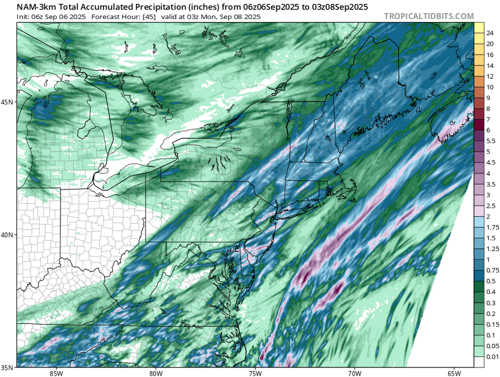
Seeing this graphic, I now have a new catch phrase to go along with the "Tamaqua Split" (which applies here). It's called the "Schuylkill Sandwich"... It is correct, though, as I recorded 0.21" from the Thursday event, and it shows Tamaqua in the 0.10" to 0.25" gradient.
-

2025 Atlantic Hurricane Season
BarryStantonGBP replied to BarryStantonGBP's topic in Tropical Headquarters
No. Conditions will become more favourable then so you are being too optimistic -
0z GFS Op goes up the GOM from WC off TB 9/14, so la la land. GEFS appear to showing that dev thru mid run.
-

September 2025 OBS-Discussion centered NYC subforum
SACRUS replied to wdrag's topic in New York City Metro
Highs (9/5) EWR: 88 New Brnswck: 88 PHL: 88 TEB: 86 TTN: 86 BLM: 85 ACY: 85 LGA: 83 NYC: 82 ISP: 81 JFK: 81 -

September 2025 OBS-Discussion centered NYC subforum
Wxoutlooksblog replied to wdrag's topic in New York City Metro
I think there are a couple more. WX/PT -

September 2025 OBS-Discussion centered NYC subforum
winterwx21 replied to wdrag's topic in New York City Metro
Made it to 87 here today. Could see 90 tomorrow if the storms don't come in too early. I see 0z HRRR hits this area hard. Looks like an interesting day for potential severe and flash flooding. -
Heck of a windy storm blowing through here now. Looks like the mid-state is also getting heavy rain too.
-
A ) We don't get real severe B ) It's September
-

E PA/NJ/DE Autumn 2025 Obs/Discussion
LVblizzard replied to PhiEaglesfan712's topic in Philadelphia Region
Makes sense. I just thought it was weird that the sky looked smoky but the air quality was good. -
Ok yeah I've been to Great River, that's decent...parts of that path are a little sketchy near the highway. I like the Riverfront Park in Glastonbury better I think. Wow, Wickham looks awesome! Definitely plan on bringing him there next week.
-
Might be DOA