All Activity
- Past hour
-

June 8 Southern Plains Severe Outbreak
Powerball replied to Powerball's topic in Central/Western States
https://x.com/NWSFortWorth/status/1931927067773358147?t=bWXphnTMAVFoFkuKJlcTlA&s=19 -
June 8 Southern Plains Severe Outbreak
Powerball replied to Powerball's topic in Central/Western States
At least in Collin / Denron Counties, there were numerous 60-70 MPH wind gusts, which any other day if not for all the hype would be a solid severe weather event. It is rapidly turning into a Flash Flood situation for DFW now. - Today
-

June 8 Southern Plains Severe Outbreak
canderson replied to Powerball's topic in Central/Western States
It does look that way - how is the wind though? -
June 8 Southern Plains Severe Outbreak
Powerball replied to Powerball's topic in Central/Western States
Scenario #2 from FWD's AFD ended up panning out. -
I really hope I'm wrong, but it almost seems we're going into one of "those" summer patterns, in which we get rainy cool weekends with a small burst of heat midweek. This past week was a great example, as is the upcoming one. Gets warm around Wednesday, lasts through Friday, then like clockwork it cools down and/or rains for the weekend.
-
As we’re only a day away from the 72nd anniversary of the great Worcester Tornado, is there a way to get a current picture of this particular area as it looks today vs what this tornado depicts here in ‘53? I’ve tried google maps but with limited success..Any help is greatly appreciated.

-
June 8 Southern Plains Severe Outbreak
Powerball replied to Powerball's topic in Central/Western States
Just got the notification for a Destructive Wind Warning (80 MPH) here. -
Picked up 0.02" from some late afternoon post-frontal light rain. Up to 1.83" for the month now.
-

2025 Lawns & Gardens Thread. Making Lawns Great Again
mreaves replied to Damage In Tolland's topic in New England
Are sure DIT don’t move in next door? -
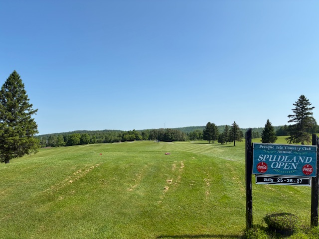
I played 9 at Presque Isle Country Club today. It’s a solid course that was fun. Beautiful day to be outdoors.
-
What has this world come to with our most fervent, Heat hating cold supporter talking like this?
-
High of 89, picked up .23" from some severe warned storms that past to the southeast of us.
-
One more moderate shower rolling through.... 1.25 since Friday.
-
I know 2 couples who have just bought places in The Villages. I can’t think of a worse spot in FL, well maybe in the deep interior panhandle.
-
But that's climatology. There are certain models that depict warm front movement very well, and none of them today had it getting nearly as far northeast as DC. The only model that had good UH tracks this far north was the 12Z HiResW ARW, but it showed DC at 80 degrees at the time the watch was issued. Guidance *and* observational trends were clear this was not the day when the front would move quickly northeast. In fairness, though, SPC's focus today was on the Southern Plains, so I can't really fault them for not working more to pinpoint the size of the Mid-Atlantic watch box.
- 985 replies
-
- 3
-

-
- severe
- thunderstorms
- (and 2 more)
-

2025 Lawns & Gardens Thread. Making Lawns Great Again
DavisStraight replied to Damage In Tolland's topic in New England
Mybe he just likes to ride his mower. I had an old guy for a neighbor, he cut his lawn frequently, not sure if it was every 3 days but it was more than I did. -
Occasional lightning over here.
-
It will be hard to clear .25 inside the beltway thus far. Maybe overnight we'll get more.
-
The French Open mens final today was one of the best tennis matches I’ve watched on TV. What a performance by both men, especially Alcaraz.
-
Right at an inch for the day.
-
Unexpected thunder.
-
Oh, the warm front WILL get as far as metropolitan DC. Only all it will bring is a few sprinkles and fierce 77 degree dewpoints along with a 13 mph south wind and highs around 99 degrees. Even on the 1/10 instance. Lucy strikes again but this time in the sweltering summer. J/K You guys will get incredible thunderstorms and lots of good rain but with minimal damage and no injuries.
-
Looks like it did last year. https://solen.info/solar/index.html
-
You're missing the point. 9/10 times the front never makes it that far northeast. Then the 1/10 time happens and there's like 20 EF0 / EF-1 tornadoes across the DC / Baltimore area. Damned if you do, damned if you don't.
-
Another batch moving through the swamps of Frederick. Might reach 0.5" for the day in my neck of the woods.