All Activity
- Past hour
-
This was mentioned extensively last fall….the research showing that +QBO/-ENSO causes a more poleward Aleutian High, while -QBO/-ENSO causes a more flattened, equatorial Aleutian Ridge. HM had a blog on this many years ago, which unfortunately I can’t find the link to anymore. IF this research is correct, then we will see it come “cold season” (Nov-Mar).
-
should ramp up a bit through Oct. 1., though obv not going out on a limb saying that. Pretty dead overall
-

September 2025 OBS-Discussion centered NYC subforum
ForestHillWx replied to wdrag's topic in New York City Metro
Would be nice to get some rain, but what a stretch of pleasant weather since August began. -
Yeah not a great game for them.
-
Cancelled
- Today
-

Occasional Thoughts on Climate Change
gallopinggertie replied to donsutherland1's topic in Climate Change
The North Pacific and Arctic are on fire. I find the giant area of 5C+ anomalies in the Kara Sea particularly unsettling. I’m not sure what marine ecosystems live up there, but I have a feeling that they’re probably in turmoil right now. The Sea of Japan is also scorching, which makes sense because Japan just had its warmest summer on record by a comfortable margin - 2.36C above average for the whole country above the 1990-2020 averages! That’s hard to fathom. https://www.aljazeera.com/amp/news/2025/9/1/japan-and-south-korea-record-hottest-summers-in-history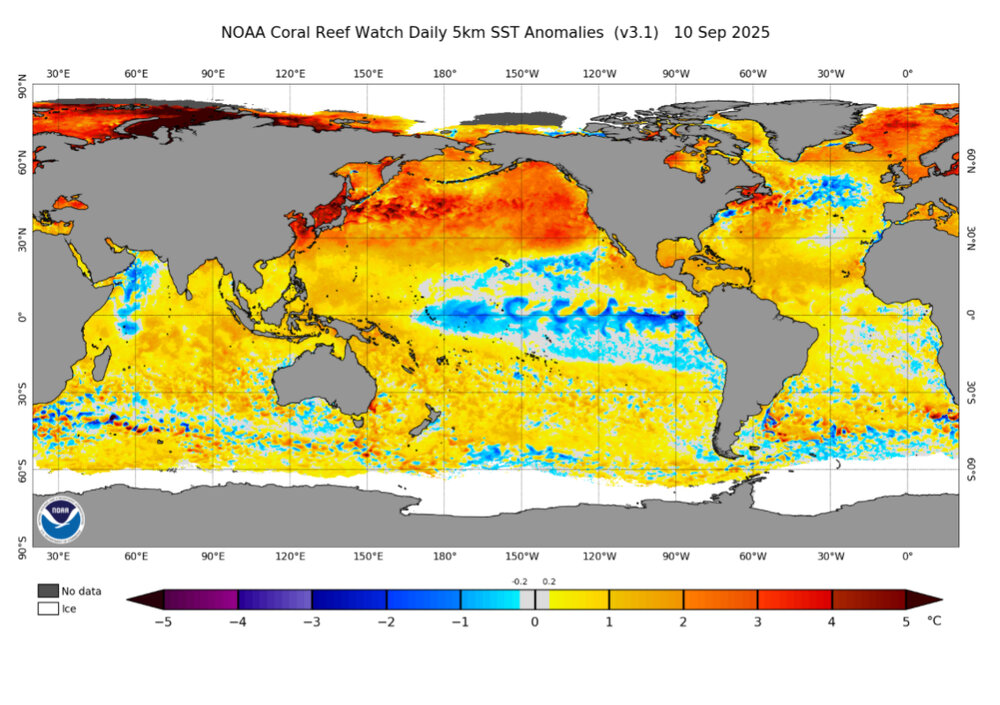
-
For the first time, the UK has a TC (actually a TS) behind the current lemon in the far E MDR moving WNW: NEW TROPICAL CYCLONE FORECAST TO DEVELOP AFTER 108 HOURS FORECAST POSITION AT T+108 : 11.9N 16.7W LEAD CENTRAL MAXIMUM WIND VERIFYING TIME TIME POSITION PRESSURE (MB) SPEED (KNOTS) -------------- ---- -------- ------------- ------------- 1200UTC 16.09.2025 108 11.9N 16.7W 1008 35 0000UTC 17.09.2025 120 13.3N 19.7W 1008 29 1200UTC 17.09.2025 132 14.7N 23.2W 1008 28 0000UTC 18.09.2025 144 15.8N 26.7W 1009 32 1200UTC 18.09.2025 156 16.6N 29.8W 1010 27 0000UTC 19.09.2025 168
-
0Z UKMET for E MDR lemon: again has a TS in the MDR moving mainly WNW though it turns W after 156:NEW TROPICAL CYCLONE FORECAST TO DEVELOP AFTER 90 HOURSFORECAST POSITION AT T+ 90 : 13.7N 36.1WLEAD CENTRAL MAXIMUM WINDVERIFYING TIME TIME POSITION PRESSURE (MB) SPEED (KNOTS)-------------- ---- -------- ------------- -------------0000UTC 16.09.2025 96 14.2N 37.0W 1008 291200UTC 16.09.2025 108 15.8N 38.9W 1006 370000UTC 17.09.2025 120 17.0N 41.9W 1006 381200UTC 17.09.2025 132 17.6N 43.1W 1006 410000UTC 18.09.2025 144 18.7N 44.9W 1006 431200UTC 18.09.2025 156 20.0N 46.7W 1006 430000UTC 19.09.2025 168 19.9N 48.8W 1007 39
-
I thought it was too early when we discussed this a couple of weeks ago and it’s still obviously far from a done deal, but the chances of your bold prediction verifying are certainly increasing as the quiet continues. Like they’ve been showing almost every day for over a week and although they don’t get to above the active avg ACE like they showed 2 weeks ago, the Euro Weeklies still end the below avg ACE starting with the week that begins Sept 22nd. It rises to near the 20 year active avg then and that lasts for the 3 weeks going through Oct 12th. It still has the most active week of the next 4 to be 9/22-28 (with ~13.5 ACE) and the 2nd most active being 9/29-10/5. It’s projecting ~40 ACE 9/15-10/12. That would bring total ACE up to ~80. That would keep season to date ACE well below the active era’s avg of ~103 as of then.
-
With the narrative the way it is, you'd never know there where plenty of hot summers in the past. It's shameful the way stuff gets portrayed sometimes, but an agenda will do that to people, instead of appreciating wx, and its cycles.
-
Like they’ve been showing almost every day for over a week and although they don’t get to above the active avg ACE like they showed 2 weeks ago, the Euro Weeklies still end the below avg ACE starting with the week that begins Sept 22nd. It rises to near the 20 year active avg then and that lasts for the 3 weeks going through Oct 12th. It still has the most active week of the next 4 to be 9/22-28 (with ~13.5 ACE) and the 2nd most active being 9/29-10/5. It’s projecting ~40 ACE 9/15-10/12. That would bring total ACE up to ~80. That would keep season to date ACE well below the active era’s avg of ~103 as of then.
-

September 2025 OBS-Discussion centered NYC subforum
nycwinter replied to wdrag's topic in New York City Metro
not really summery with dew points in the mid 40's -

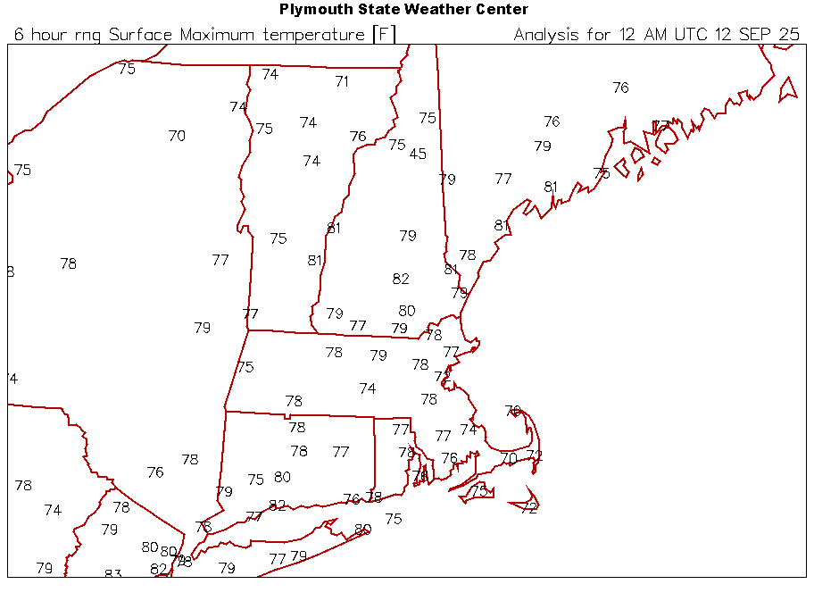
September 2025 OBS-Discussion centered NYC subforum
winterwarlock replied to wdrag's topic in New York City Metro
82/52 -
Thank, 87Storms! I remember those blizzards in Jan 1987! That's a story in itself! Why haven't they red-tagged YOU yet?!
-
LOL I was thinking exactly the same thing this morning! Arguing about climate on a weather forum reminds me of a quote from Dr Strangelove. “Gentlemen, there will be no fighting in the war room!”
-
The best by far.
-
Spotted lanternflies. https://www.washingtonpost.com/weather/2025/09/11/spotted-lantern-flies-dc-mid-atlantic-swarms/
-
Offense is missing... but they are playing a real team this week
-
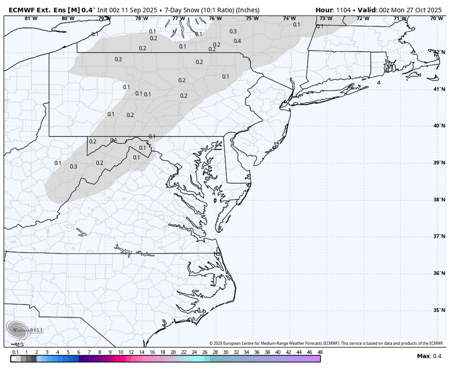
WB latest EURO weeklies. First fantasy dusting in the mountains third week of October....
-
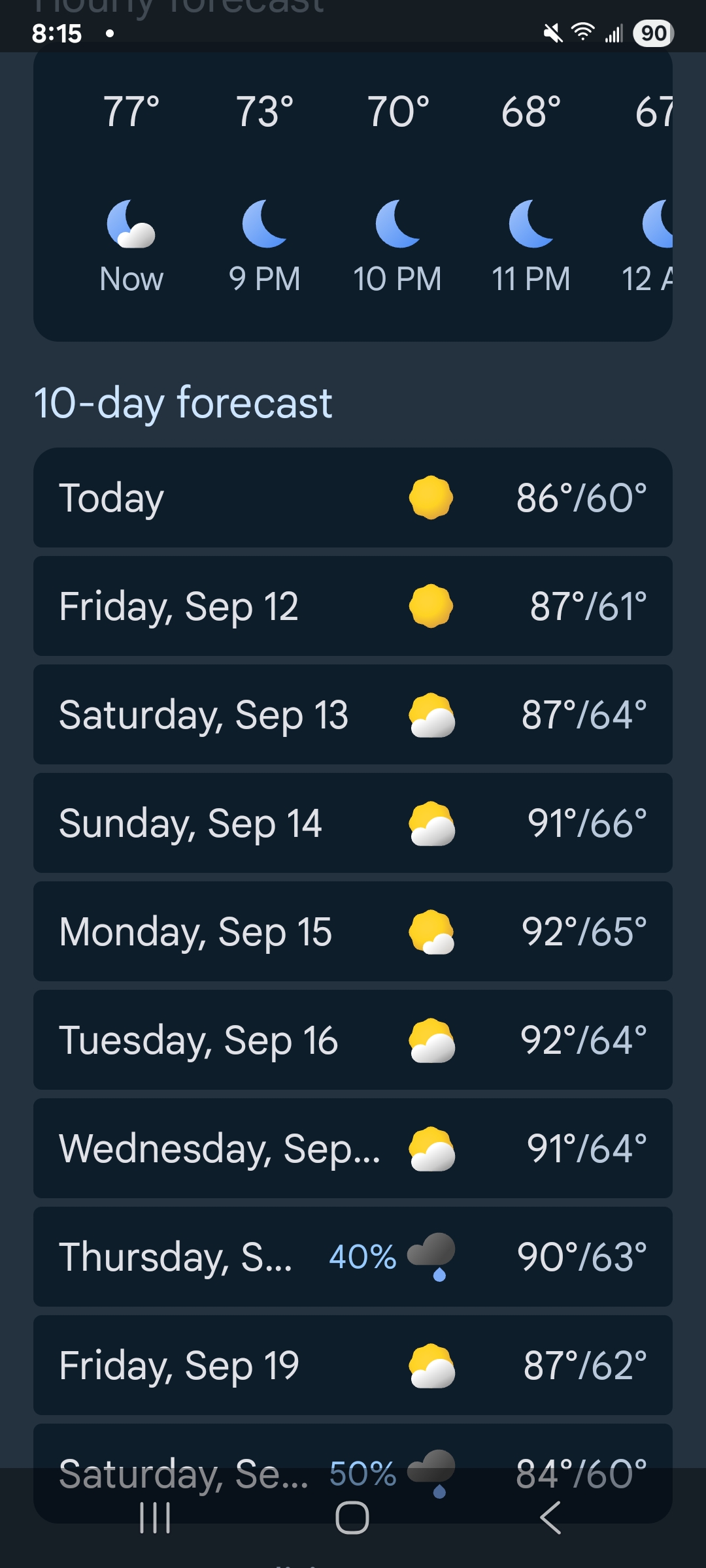
Looks likely we bag a late season 90 at MSP this weekend.
-
GWDLT.
-
Cooking in the Ohio valley.
-
More winning. Great day for Kourtney Kardashian at the lake.
-
Means you don't get your lawn mowed.
-
Hopefully , Boston is over 2° below normal for the month. It would be nice to warm up a little.