All Activity
- Past hour
-
Just looking at things now.. we track!! I think 94l gets pushed to the west a bit and Humberto also goes west.. then gets stuck under the ridge and eventually comes up.. 6z GEFS coming west! We watch!
-
Wet AM coming
-
 6z GFS slams the storm into the Carolina’s as a hurricane
 -
61F/ .48"
-

September 2025 OBS-Discussion centered NYC subforum
winterwarlock replied to wdrag's topic in New York City Metro
Only. 14 for me thus far -

E PA/NJ/DE Autumn 2025 Obs/Discussion
PhiEaglesfan712 replied to PhiEaglesfan712's topic in Philadelphia Region
Where did Sandy develop? -
0z euro would up the fun meter vs the last several months.
-
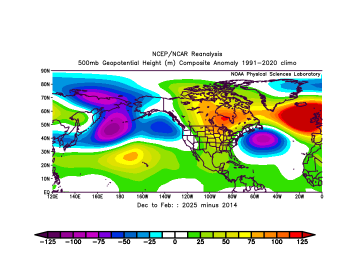
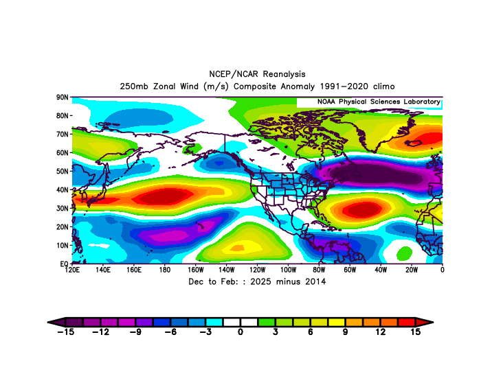
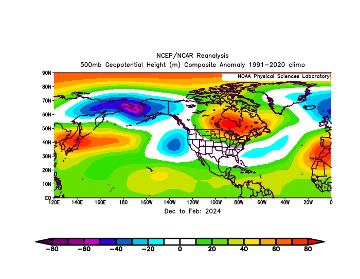
We maintained the -EPO and -WPO throughout the 13-14 and 14-15 seasons. The Pacific Jet was much weaker so frequent shortwaves weren’t constantly lowering heights in the region. Notice how much lower the -EPO and -WPO domain 500mb heights were in 2025 than 2014 with the much stronger Pacific Jet. Also look how the subtraction of 2025 from 2014 resembled 2024. Much stronger ridge last winter near Hudson Bay than 2014. This is exactly where the ridge was during 2024.
-
Looks like a predecessor rain event perhaps on the euro?
-
No posts from ineedfish.. all you need to know
-
Euro looks fun. Gfs looks boring. At least we have something interesting to track!
-
My opinion has not changed. I don’t care what the models say. I still believe we finish this season below 100 ACE. If I’m wrong so be it
-
I had foolishly allowed myself to believe that we were actually done with 70-degree dewpoints for the year, and there was even reason to hope that the Atlantic would be devoid of tropical systems except far-off fish storms. Suddenly it all comes crashing down!
-
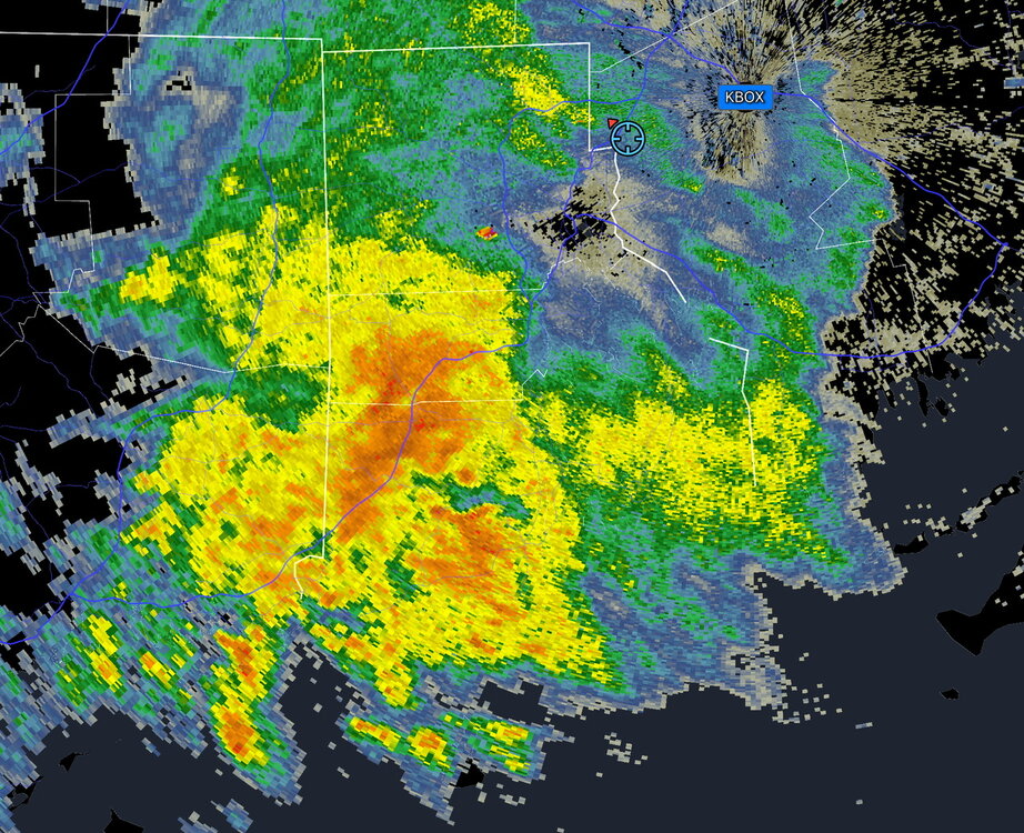
Where’s the heavy rain and storms? I just ran in no rain
-

September 2025 OBS-Discussion centered NYC subforum
Sundog replied to wdrag's topic in New York City Metro
I smell a bust -
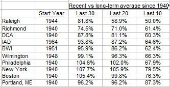
Here are some snow stats for I95 cities. Last 10 years have been below normal at all cities. Philly to Boston are above average over last 30 years. This year 95/96 will be dropped from 30-year average, so 30-year averages are likely to drop.
-
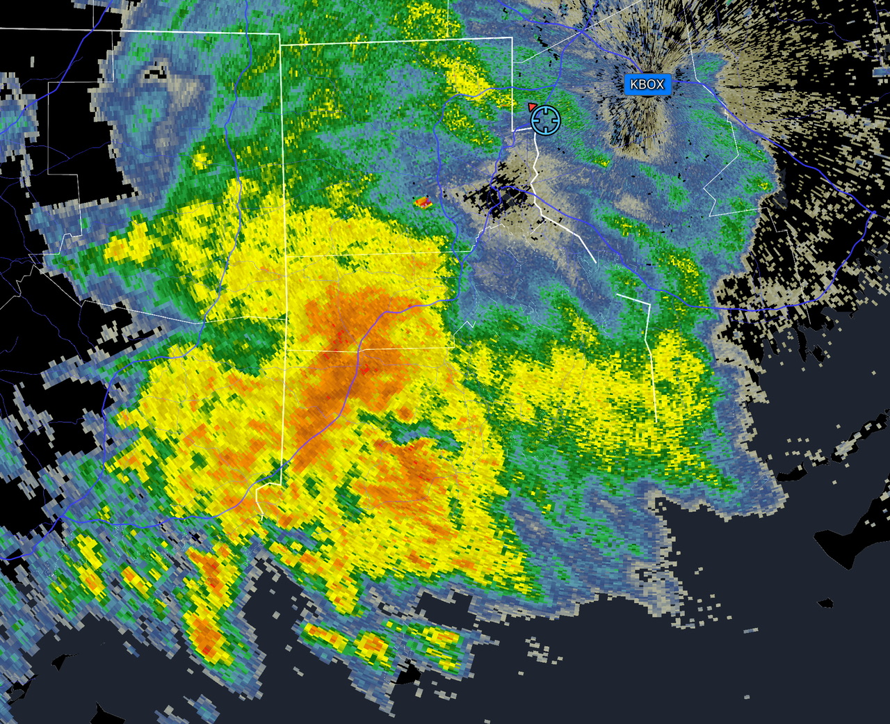
Been a while since rain like this.
- Today
-
 It doesn't, last night's run of the Euro has a stronger blocking high over Humberto slowing it down and allowing 94L to be pulled into the coast by the ULL. Without Humberto 94L would have a higher chance of landfall
-
.38"
-
NNE soaker Enroute.
-
 TriPol, Humberto doesn't kick so much as the other system escapes. Deepmind 18z suggests the position of 94L relative to Humberto, once 94L reaches about Nassau, is the key to its landfall prospects. At 26-27°N, if it's a little faster and north of due west from Humberto, some members reach SC as early as Monday night. Slower members get no farther than 28°N (about Cape Canaveral's latitude) before getting sucked toward Humberto and OTS. To my eye, it looked like a 50/50 split. Here's my take: if Humberto becomes a major east of the Bahamas, and it moderately scoots NW while growing in size, whatever 94L becomes after getting over Hispanola is gonna put on some brakes due to Fujiwhara. That's why I don't see the low making a CONUS landfall in the cards; for us in the SE U.S., the effects are then limited to coastal erosion from the two systems and maybe several inches for whoever sits along the Carolina coasts nearest the low as it gets yoinked east.
 -
I'll take the 3K and HRRR please.
-
High of 93.7 yesterday. Honestly I thought we were done with this
-

Invest 94L—40% 2 day and 80% seven day odds of development
TriPol replied to WxWatcher007's topic in Tropical Headquarters
I don;t understand the physics of how Humberto kicks the other system into the east coast. -
If you’re on the coast from Florida to NC I would be following this closely and make sure you have the ability to prepare if needed. This forecast is as uncertain as it gets relating to a tropical cyclone