All Activity
- Past hour
-
Low of 40°.
-
I'm moving to the snowiest spot east of the rocky mountains. Barn Corner NY. I'll be at about 1600' elevation on the Tug Hill starting Dec 1. I'm super pumped. I lived up in Carroll County on Parrs Ridge for a couple winters. I was all pumped for a better climo. Still sucked lol
-
32.7 for the low. Colder than I thought it would get. House is at 59F.
-
34 & frost for me.
-
30° (29.6°) for the low here.
-

2026-2027 Record-breaking El Nino
LakePaste25 replied to Stormchaserchuck1's topic in Weather Forecasting and Discussion
I’m with snowman on the MC convection idea. It’s been at near 0 since the summer, not sure why we would expect it to fire up again this winter. Will it be absolute 0? probably not due to the MJO, but it’ll be heavily suppressed just like phase 8 is during La Niña. -

Central PA Autumn 2026
Mount Joy Snowman replied to canderson's topic in Upstate New York/Pennsylvania
Low of 33 here but should be a beautiful day. Having a fire pit here all day before settling in for the Green Bay Dallas game tonight. -
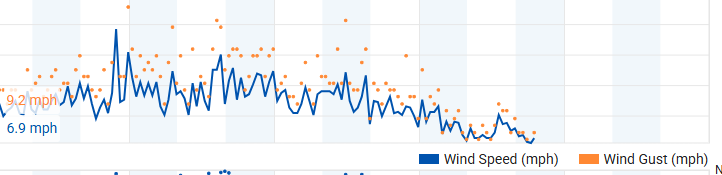
Only bottomed out to 48 this morning, guessing because of the wind. This wind has been consistent with 25MPH gusts since Friday night. Hopefully they subside today, so outdoor activities can be enjoyed. Haven't felt air this crisp since April.
-
26 at mi casa, BAF and CEF.
-
34
-
Forecast was 27 and hit 26.8. Nicely done.
-

2026-2027 Record-breaking El Nino
snowman19 replied to Stormchaserchuck1's topic in Weather Forecasting and Discussion
It would not surprise me at all to see forcing in 1+2 this winter. The SSTs are going to be more than warm enough to support convection….way warmer than 1997-98 actually. This thing is east-based as they come -
In the area I see several stations hit freezing or slightly below. I was a warm spot at 36.
-
25.9, we hard freeze. That’s a wrap on whatever stuff was left
-
Bottomed out at 28.8 at Pit2. Looks like 35.8 in Mattapoisett.
-
About as beautiful and comfortable a full late Oct week as is possible for outdoor activities is in the cards this week for a large portion of the SE away from E NC with lots of sunshine, high temps in the 60s-70s, mainly 15 mph or lower winds after today, and dewpoints down in the 30s-40s. We can thank persistent mainly N to NE winds resulting from three sprawling areas of Canadian high pressure centered to our NE, helped by persistent low pressure offshore the E coast especially the first half of this week. Enjoy it while you can, especially with the amount of rainfall expected Nov-March due to the very strong Nino.
-
Worcester couldn't even make freezing last night. 26 already 35 though. Still air leaf fall flitting through the lateral morning sun rays... always a neat effect.
-

2026-2027 Record-breaking El Nino
George001 replied to Stormchaserchuck1's topic in Weather Forecasting and Discussion
I agree that the models are probably too cool. In terms of winter prospects, what are your early thoughts? I agree with you that it will be warm, but some of the guidance is indicating that the AN precip anomalies will get pretty far north. So I am thinking it will be more of an interior winter. -
Looks like EWR with a few 4 * 79 degree readings will hold second place tied with 2024, with not much likelihood of more 80s with the ridge going up north and west of us next week. Year Rank Days ≥ 80°F 2015 1 118 2026 2 117 2024 2 117 2021 3 116 1994 4 114 2016 5 113 1993 5 113 1991 5 113 2011 6 111 2010 6 111 2023 7 110 2022 8 109 1959 9 108
-
28° for a low here
-
Driving around Columbia and Ellicott city and patchy frost on rooftops and some grassy areas. Probably also on grassy cartops @paulythegun
-
NWS indicates some bigger spots, such as Winchester, Cumberland and Martinsburg all got below freezing.
-
Same here wrt the frost.
-
What area are you moving to? I left Calvert for Germantown when I got a DC based job and it paid off in quite a few winters. One time I had 8 inches on the ground and got off the train at Union Station to bare ground and rain. Now I'm back in Calvert for family and space LOL Got to 40 here. I'm hoping to keep my flowering plants a few weeks longer
-
28° for a low here








.thumb.JPG.418e8a9a2902ae687ec35ff4bc0e038e.JPG)