All Activity
- Past hour
-

Central PA Winter 25/26 Discussion and Obs
lazywxwatcher replied to MAG5035's topic in Upstate New York/Pennsylvania
I second -
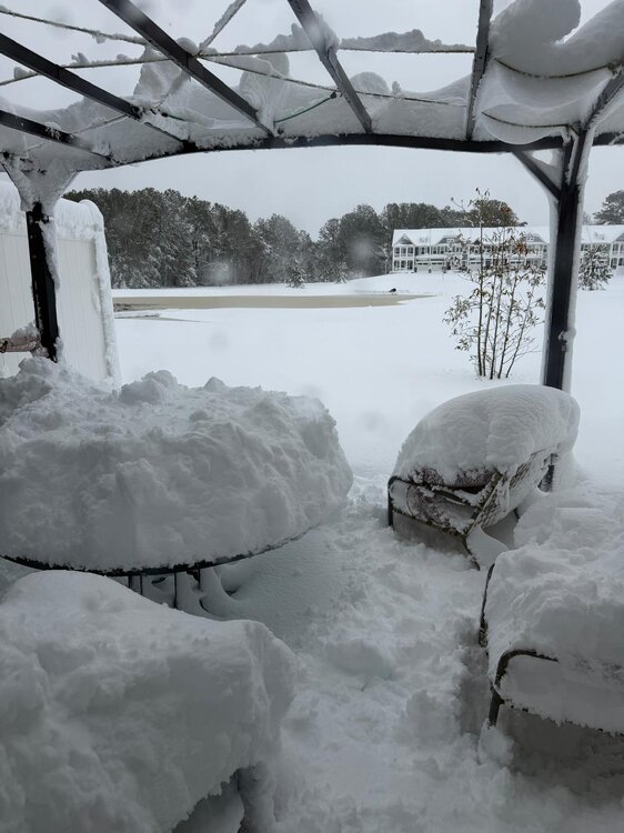
Ended up with about 1/3in in grass and wood surfaces but the roads also caved a little this morning. Several school districts are out today. It’s still snowing pretty well in town right now as I type this.
-

"Don’t do it" 2026 Blizzard obs, updates and pictures.
Mj-pvd replied to Ginx snewx's topic in New England
Holy moly thought it would slow down by now. -
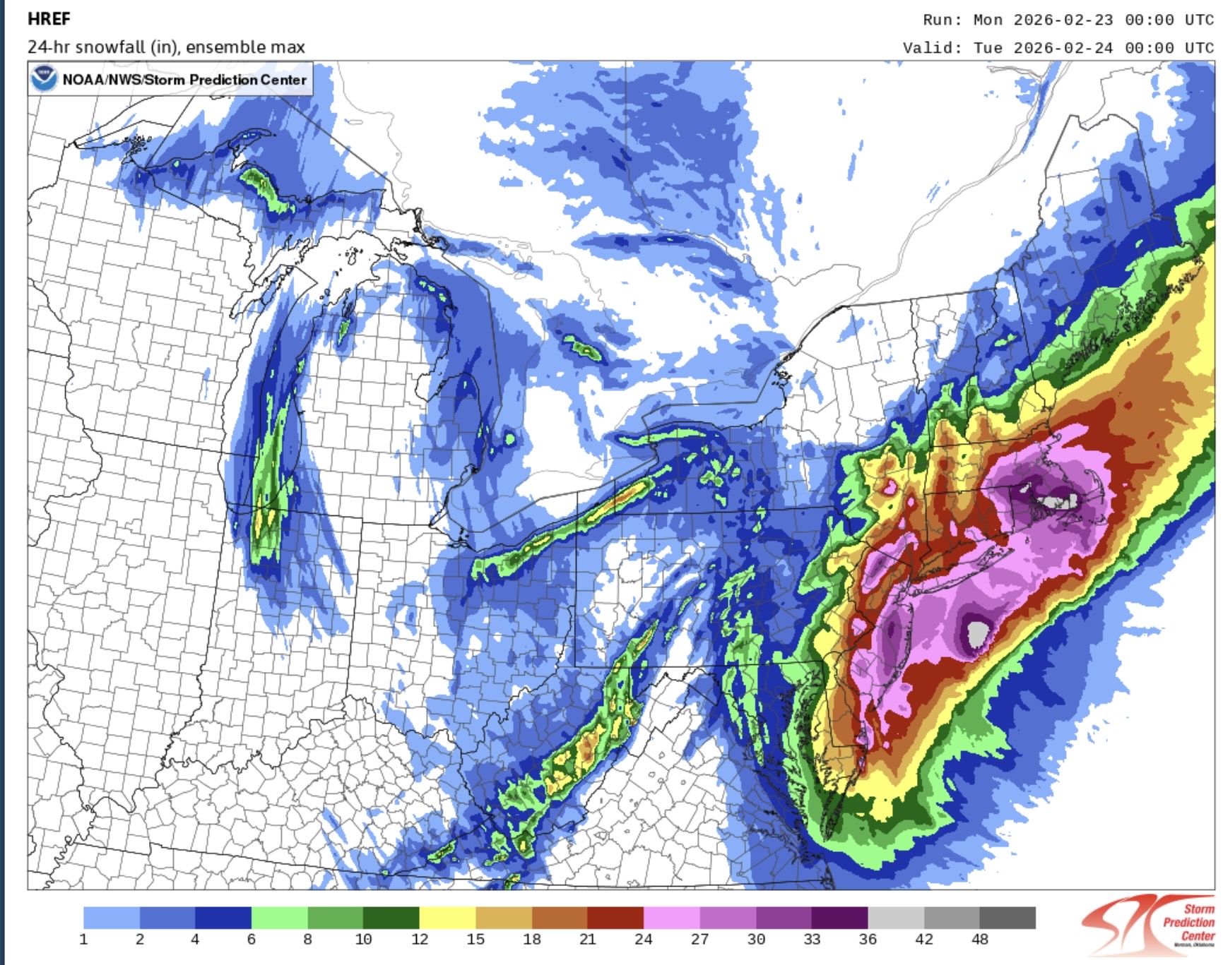
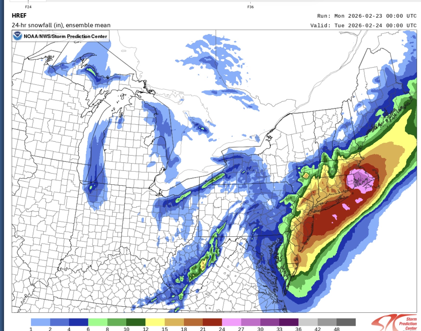
Yes this will be analyzed differently depending on location. Seems the heaviest snow axis was higher and more widespread than the non American models had it but the western cutoff was sharper and further east than some runs. Neither is super surprising knowing how these storms tend to go.
-

"Don’t do it" 2026 Blizzard obs, updates and pictures.
tavwtby replied to Ginx snewx's topic in New England
rotation?? -

"Don’t do it" 2026 Blizzard obs, updates and pictures.
DavisStraight replied to Ginx snewx's topic in New England
WOW, I bet we see 30+ somewhere. -
This was family's backard in lewes Delaware this morning. Totals must be huge as well.
-

"Don’t do it" 2026 Blizzard obs, updates and pictures.
CoastalWx replied to Ginx snewx's topic in New England
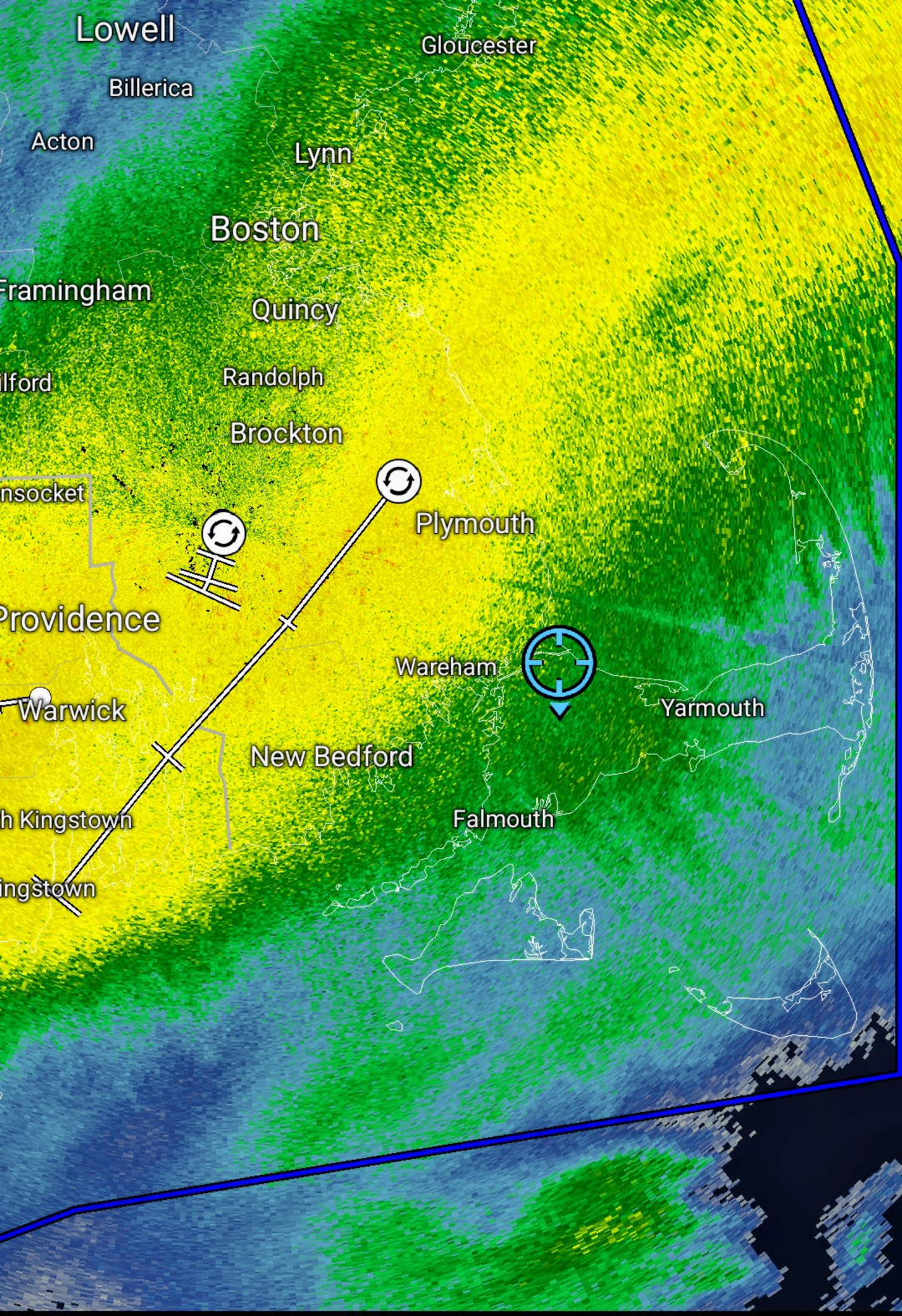
This is incredible. Looks like another surge west with this band. Seems like some OE here too. -
I would say about 15 inches here. Was not in the heavy bands as much as areas to my west and east.
-
Central PA Winter 25/26 Discussion and Obs
lazywxwatcher replied to MAG5035's topic in Upstate New York/Pennsylvania
Interesting you say that as he was pounding his chest a bit on X. Don't know the guy, and he does deserve credit for being correct, but low-end is an easy default position. If you always underforecast: 1. Big snows are rare so you will frequently be correct 2. People are generally not upset if the storm overproduces, but the snow hounds are very upset if it underproduces 3. If you say 2-4" and it winds up 5" hardly anyone notices and it is only 25% above your high-end. A pleasant surprise, essentially, if you like snow, and a little bit more to clean up if you don't. If it ends up 1" it is 50% lower than your low-end. As a percentage game, it is way easier to win. -

"Don’t do it" 2026 Blizzard obs, updates and pictures.
snjókoma replied to Ginx snewx's topic in New England
Both of them are from towns north of Providence that got 40" in '78 so they're not even interested yet lol -
snow in Chelsea, golden retriever for scale .
-
Hello!
-
I trust the NWS Mets at the office know how to take measurements over whoever the fuck Ginger Zee is.
-
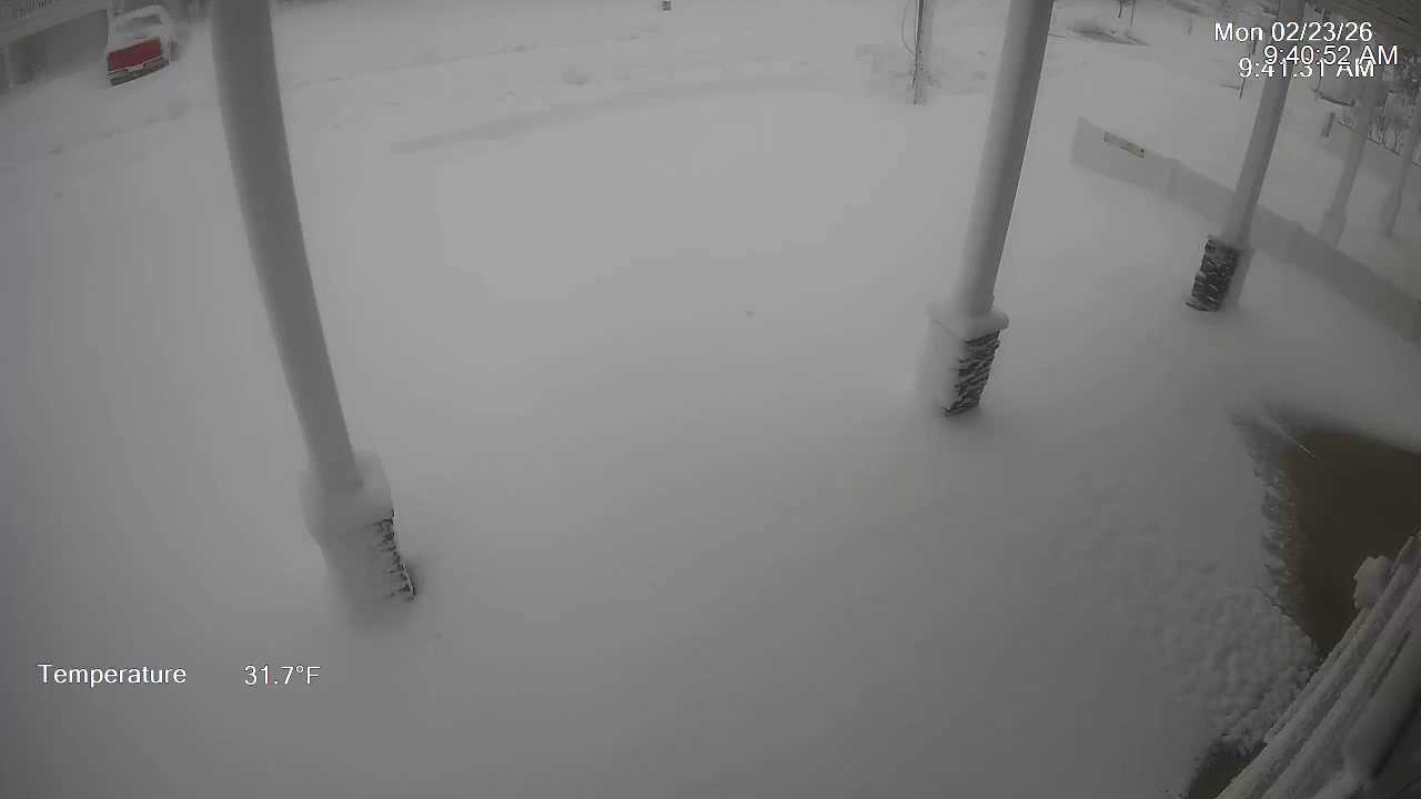
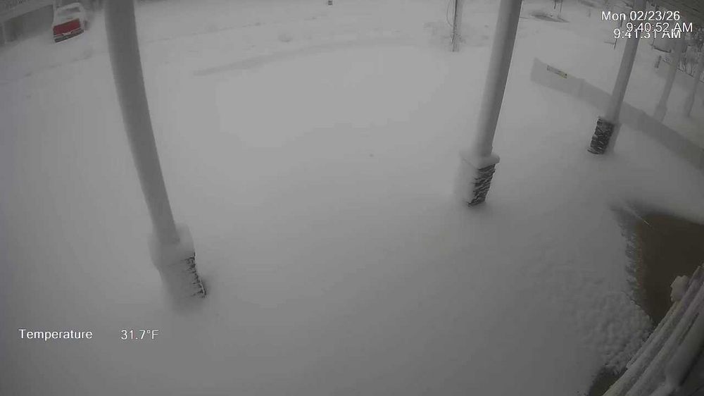
Hey Kevin. My brother has a place a couple blocks from me they briefly lost power. I can tell by the below view of my driveway down there that we did not get any flooding. It would have washed the street clean of snow. I asked him to get me a measurement this morning.
-

"Don’t do it" 2026 Blizzard obs, updates and pictures.
SouthCoastMA replied to Ginx snewx's topic in New England
wtf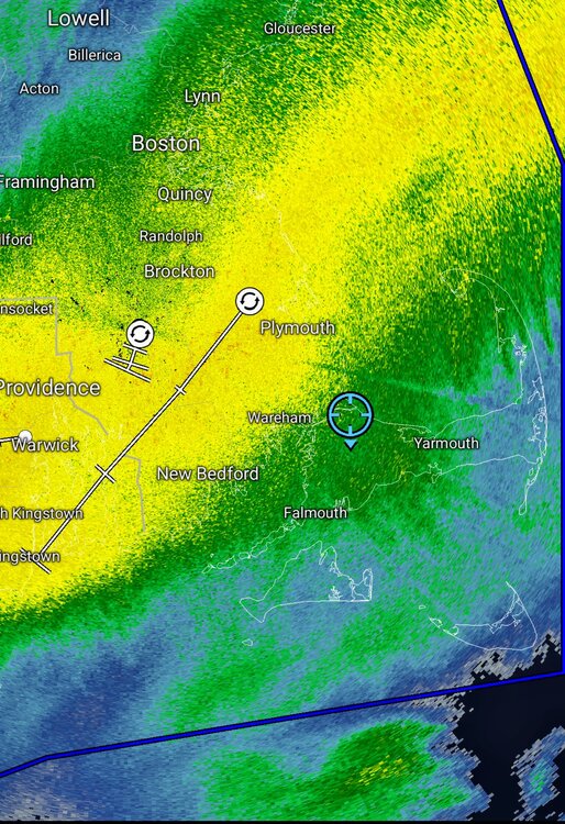
-
It was modeled well in terms of there being a major coastal storm and significant accumulations, but I think huge chunks of Mount Holly‘s territory underperformed, in some cases rather dramatically. The jersey shore, northern DE, and much of Mount Holly‘s area in PA dramatically underperformed their predictions. .
-
About to head out to attempt to confirm; but winds are kicking up finally. Easily 10”+; will circle back.
-
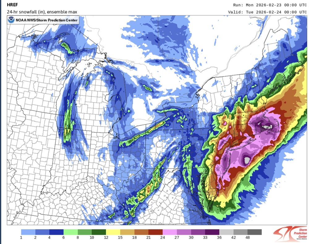
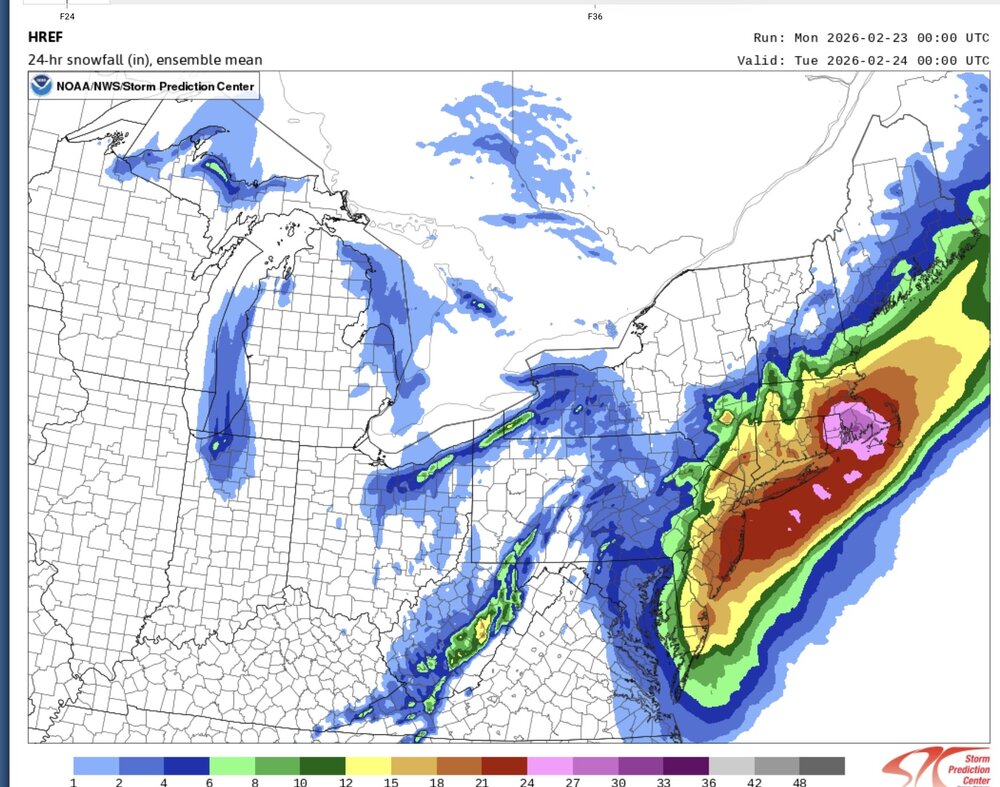
The SPC HREF had the right idea somewhere between its mean and max. The globals and even some models like the RGEM struggle with such dynamic systems. I have often noticed that the best banding usually is just NW of where the globals and even some regionals show.
-

"Don’t do it" 2026 Blizzard obs, updates and pictures.
wxeyeNH replied to Ginx snewx's topic in New England
Kearsarge to my south is now hidden from view. I can still see Ragged clearly. -

Blizzard of 2026 Storm Thread/OBS
PhiEaglesfan712 replied to Mikeymac5306's topic in Philadelphia Region
FWIW, Ginger Zee's tweet (at around the same time) had Mt. Holly at 16 inches. -
Looks like about 4" in here in Cloverly. Haven't measured.
-
I can get that, it’s the comparison to others phenomenon.
-
Yeah I got 12" here for Boxing Day. Amounts doubled once you got to the eastern side of the county. These wound up systems that move E off the Delmarva dont like us too much out this way.


(002).thumb.png.6e3d9d46bca5fe41aab7a74871dd8af8.png)