All Activity
- Past hour
-

E PA/NJ/DE Spring 2025 Obs/Discussion
JTA66 replied to PhiEaglesfan712's topic in Philadelphia Region
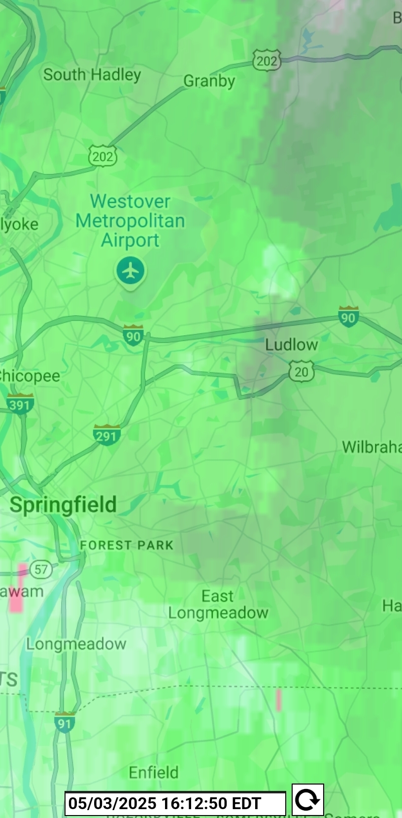
Getting the 7-10 split here. -
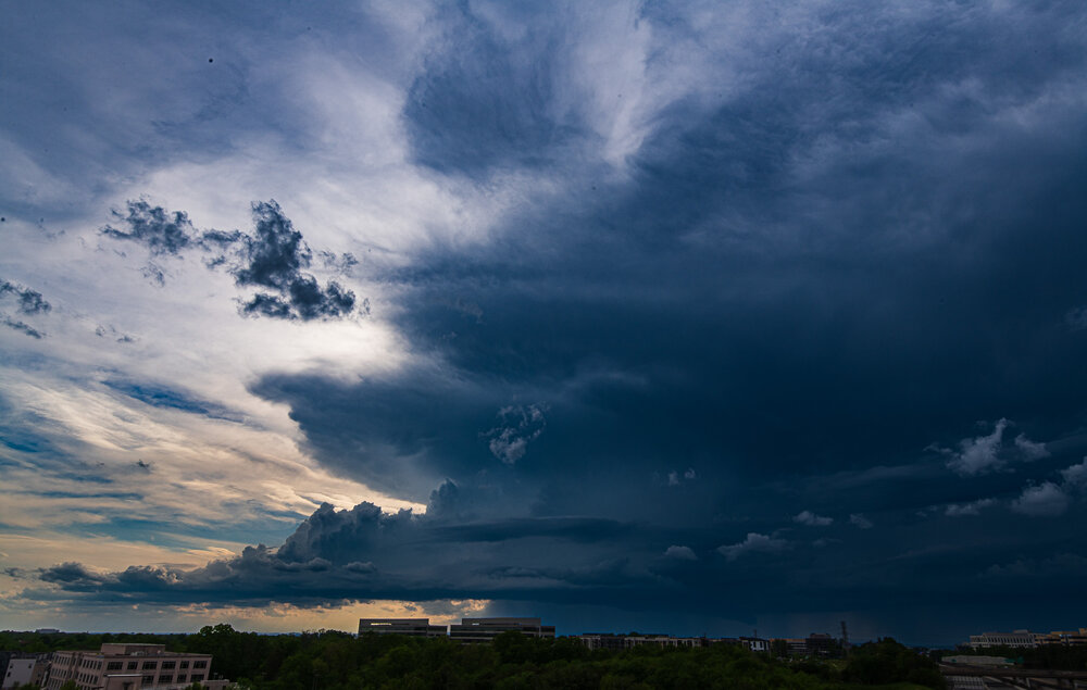
I’m just to the east of Dulles airport watching the storm pass literally under 3 miles to the west. Glad the rain will at least get into the ground water from over there.
-
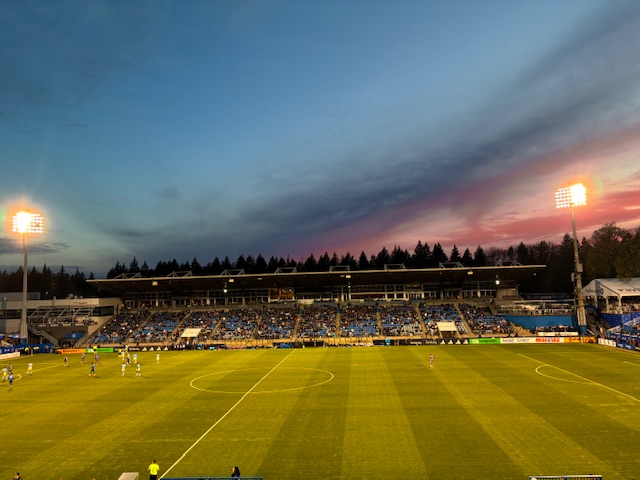
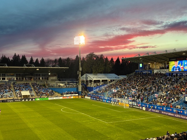
Turned out to be a nice evening a few hundred miles north in Montreal.
-
Absolutely amazing photos Don.
-
.75 with this batch that's a great start let's see what the overnight can do.
-

E PA/NJ/DE Spring 2025 Obs/Discussion
I Like Snow replied to PhiEaglesfan712's topic in Philadelphia Region
Crazy here in Abington right now. Hail sounded like it was going to break through the skylights. -
I only got to see it for seconds. I saw it coming from over the bank and then pass me. But if I was several parking spots to the right I wouldn't have had the bank obstructing that direction and I probably would have been able to see it come from up the road.
-
This is the next base scan

-
Repost here since it was severe warned with some definite shape.
- 463 replies
-
- 1
-

-
- severe
- thunderstorms
- (and 2 more)
-
It looks like it was moving really quickly in the video. How long did you get to actually see it? Very cool for you!
-
Picture of the Louden storm from around 5 this afternoon. Picture taken at the top of the Herndon Metro parking lot.
-
I’m mostly watching for the fertilizer we put down, and my drive home after the concert haha
-
Storms approaching me from the south. A good bit of lightning with this one, CC branches.
-
Getting hit pretty good 0.50 and still dumping
-
I’d like it a lot more if all that green was to my south. We’ll see if more pops up
-
I wish now I was parked several spots over to my right...I wouldn't have had the building obstructing me, I could have maybe seen it coming from farther away. I still can't believe it...the lights flickering too just before it approached...very movie like.
-
I think that activity in Northern Virginia could scrape you.
-
Today was another exceptionally warm day. Temperatures again rose into the 80s across much of the region. Behind the front, it will turn somewhat cooler tomorrow. A wet pattern is likely tomorrow through Wednesday. A significant rainfall is possible, but there remain large differences among the computer models. The European Model is most aggressive in showing 5" or more rainfall. An early estimate of a general 1"-3" total with locally higher amounts during the Sunday-Wednesday period looks reasonable. The ENSO Region 1+2 anomaly was -0.3°C and the Region 3.4 anomaly was 0.0°C for the week centered around April 23. For the past six weeks, the ENSO Region 1+2 anomaly has averaged +0.82°C and the ENSO Region 3.4 anomaly has averaged -0.05°C. Neutral ENSO conditions will likely continue through at least early summer. Early indications are that summer 2025 will be warmer than normal in the New York City and Philadelphia areas. The potential exists for a much warmer than normal summer (more than 1° above normal). The SOI was -6.88 today. The preliminary Arctic Oscillation (AO) was +0.650 today.
-

E PA/NJ/DE Spring 2025 Obs/Discussion
Birds~69 replied to PhiEaglesfan712's topic in Philadelphia Region
Some serious lightning. Hope it's coming my way and not leaving... -
First storms today mostly a miss. Round 2 moving in now....
-

E PA/NJ/DE Spring 2025 Obs/Discussion
Hurricane Agnes replied to PhiEaglesfan712's topic in Philadelphia Region
Gully washer. Getting almost 1.75"/hr rates. Have 0.30" in the bucket at post time. Temp down to 69 with dp 68. -
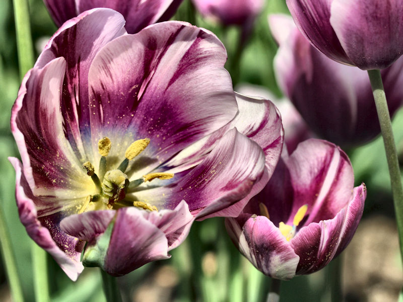
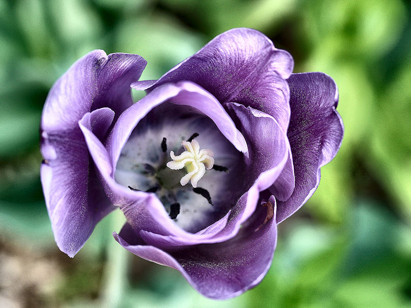
The temperature rose to 85° in New York City. At the New York Botanical Garden, tulips are in peak bloom.


-

E PA/NJ/DE Spring 2025 Obs/Discussion
Kevin Reilly replied to PhiEaglesfan712's topic in Philadelphia Region
64f got nailed pretty good at peak SW winds gusted to 40-45 mph picked up 1.07” in 30 minutes long duration lightning and thunder all elevated no strikes. -
I guess the next question is how much of it holds after sunset. Just started raining here again while I’m waiting for takeout.