All Activity
- Past hour
-
How long have these apps been out? Smh
-

The “I bring the mojo” Jan 30-Feb 1 potential winter storm
BooneWX replied to lilj4425's topic in Southeastern States
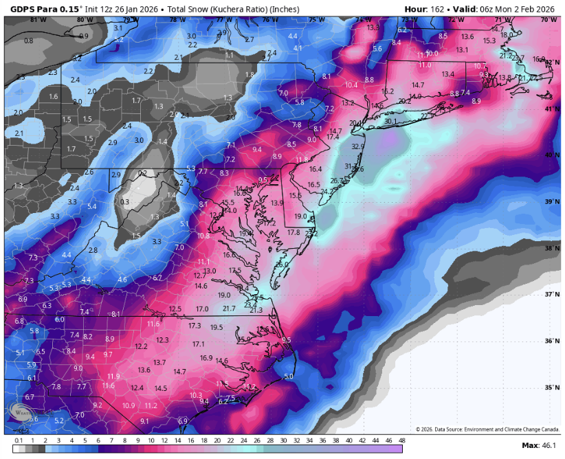
Mind you, those aren’t Kuchera ratios. It spit out .75” of QPF under the ULL in the western Carolinas. Would likely be 8-10” with the projected temps. -
I waited till today to shovel and it's not unmanageable, just a bit slow. Just dug out the car and some of the driveway, which thankfully is flat and not super long. Going back out in a bit. Sun was a help with the car once the snow pack on it was loosened up. I've been going at it kind of primitively...cleaned around the car by stomping on the pack with a foot and either kicking the chunks away or lifting and tossing away by hand (thick waterproof gloves ftw). No shovel involved lol. When not stomping the glacier I'm using a hammer to break the crust. Once underneath it's soft and not difficult to shovel. Feels pretty good out there my god I love snow!!! Bring me more!
-
Apparently Google’s weather app is similar to Apple’s. A friend of mine just told me it says 30” for his town (Phoenixville). Awful
-
Weather Next QPF map. 10:1 THAT would be 2.5-4 from the Plateau eastward, but we may be looking at 15:1 or 18:1 ratios.
-

January 2026 Medium/Long Range Discussion
overcautionisbad replied to snowfan's topic in Mid Atlantic
I would like to order this please -

Pittsburgh/Western PA WINTER ‘25/‘26
colonel717 replied to Burghblizz's topic in Upstate New York/Pennsylvania
The organic forecasting method has been pretty good at sniffing out timeframes for storms this year. The next best chance would appear to be Feb 5th -7th or 11th-12th. -
Btw a super non scientific thing to keep an eye on. I’m way more ok with guidance being a miss to the southeast than if it’s to the east or worst northeast. If the axis of snow is to our south or southeast we have the best chance of a positive trend. East is more iffy. Northeast and don’t waste your time. It’s next. There are scientific reasons behind this regarding which model errors we need to correct each of those and which are more likely but I’m not in the mood to write 5 pages so for now I’m ok with the fact the major ensembles are all showing the snow max to our south. That’s not a typical miller b representation and one that’s more likely to adjust in a positive way.
-
From MA forum shifted east from 0z
-
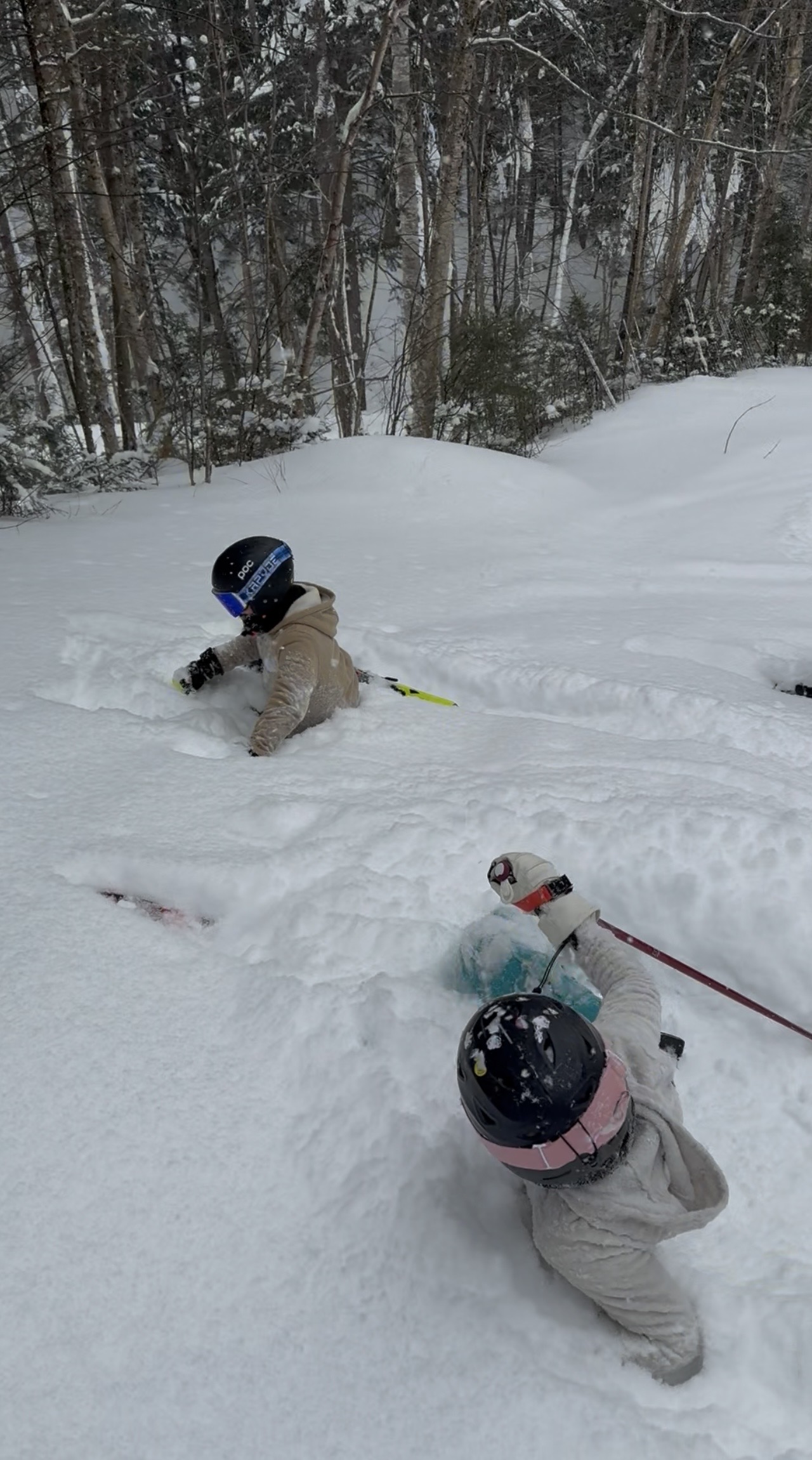
What a day on the slopes with the kids

-
From the MA forum definitely shifted east from 0z.
-
 Not sure about there but the stuff we got here will not pack well if at all. It's about as dry a snow as I've seen. We've gotten about another 3" since I finished snowblowing around 9:30 and it is almost like every single flake is adding the most it possibly can to the accumulation total.
 -
good, felt bad for them they didn't make it to double digits.
-
I think its an intriguing setup but not really one to get invested in at all. PSU's post about the western ridge axis pretty much sums up my thinking as of now. We also shouldn't be living or dying by the OP models quite yet, as even the GFS ENS have a decent signal. Instead I think its unlikely, though not quite a long shot, to get an appreciable storm into our area. Comparing this setup to last week at this time is a completely different ballgame as well. By this point last week we could say confidently that someone on the east coast would get a foot of snow, since this setup is more NS based I wouldn't feel comfortable saying that till Wednesday. Also want to watch the tilt of the western ridge. The 12 Euro has it more W-E which seems to hurt us.
-
Totally agree! No offense to the NWS, but we’ve had some of our best snow storms when there was already WSW criteria on the ground before they issued anything!
-
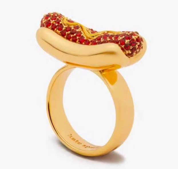
I award you the weenie ring for today.
-
Also as important is whether the EPS is trending one way or the other.
-
 12” yesterday/overnight, 2” so far today and still snowing at a pretty good clip.
 -
 Unofficial report but the southern end of Newport had upwards of 12 inches. I'm in Boston right now and although Boston had 5 more inches the amount of snow looks the same probably because sleet makes snow banks more impressive.
 -
It was the best from what I could tell and basically similar to what happened from 5+ days out. It seems to lock on and hold steady while others bounce around. It may have just gotten lucky. But it's 500mb verification scores are the best of all models this winter.
-
Yea people don’t realize that the difference between 6” and 12” in your yard doesn’t impact the verification scores of a global model. Missing a mid level warm layer by a few hours and 30 miles might effect our ground truth but it’s an insignificant error in the global scheme.
-
Pittsburgh/Western PA WINTER ‘25/‘26
colonel717 replied to Burghblizz's topic in Upstate New York/Pennsylvania
I noticed it starting to darken up, and looks like more snow showers moving into the area. -
Upgraded CMC is good
-
 I wonder will see another burst right around sunset this evening like seems typical in the plateau areas with these systems.
 -
Super helpful here and we all are now on the same page with what we are looking for. I know people are saying we have time...but not as much as people think regarding meaningful changes. Important features develop 72-78 hours. Im still optimistic