All Activity
- Past hour
-
Fair point. The IOD and Nina are going to favor phases 5-6.
-

2025-2026 ENSO
donsutherland1 replied to 40/70 Benchmark's topic in Weather Forecasting and Discussion
OT: My flashdrive that contained the ENSO data became unreadable today. Fortunately, I have a backup that is reasonably up-to-date. Pre-device failure might have led to a corruption of the data e.g., the wrong ENSO values for some of the cases referenced previously in this discussion. In the meantime, it looks like Savannah could see its earliest first freeze since 2010. -
I'm not confident on the MJO getting thru phases 7-8-1-2 as he mentions at the end of his post. Failure to get thu them would be a negative for us. https://www.stormsurf.com/page2/links/mjo_phase.html
-

November 2025 general discussions and probable topic derailings ...
wxeyeNH replied to Typhoon Tip's topic in New England
33.6F Light rain mixed with mangled flakes. No sleet just rain and a few parachutes. -

November 2025 general discussions and probable topic derailings ...
BrianW replied to Typhoon Tip's topic in New England
57 and full sun here. Some 60's out on Long Island and around NYC. -

November 2025 general discussions and probable topic derailings ...
CoastalWx replied to Typhoon Tip's topic in New England
Friday was -3.5. Tough week for the Pope. Yesterday was well AN which everyone knew. -
 35.4° here in Bradford, and suddenly there's a bunch of sleet rolling off the roof.
 -
I’ve already got more than I expected. Snowing and blowing out my window.
-
That I don’t remember. I seem to recall one person was in control of everything. That alone was likely enough to be a big problem, just waiting for a time to present itself.
-
The models were real bad in the long range with the MJO last December. They kept showing an amplified MJO wave going 8-1-2 which obviously didn’t happen
-
November 2025 general discussions and probable topic derailings ...
CoastalWx replied to Typhoon Tip's topic in New England
Dim sun here. Another mild morning. -

November 2025 general discussions and probable topic derailings ...
dendrite replied to Typhoon Tip's topic in New England
Next batch is here, but it’s all rain despite some brightbanding aloft. No pings yet. 36.2° -
Great thread from @griteater on the weakening early season Strat vortex and connections to a -NAO in December-ish. His two closest analogs are December 1981 and early January 1982 and December 2000. December-January 81/82 was a very cold and snowy period for our area, especially January. December 2000 was quite cold, but fairly dry without much snow.
-
It's better than Manhattan obviously. But, no where close to ideal. Western Brooklyn/Western Queens and Manhattan is the peak UHI zone. Since you're close to the park you at least have a good option to see better stickage. Overall though with a big well placed storm you will be fine. Problem is getting one lol
-

11/8-11/10 First Snow and Lake Effect Event
mimillman replied to Geoboy645's topic in Lakes/Ohio Valley
Think this is a little extreme in Cook. I could see the LOT AFD playing out over Lake and Porter counties in Indiana but overnight guidance seems to have swung the band further east. -
 But you’ll go to NYC
 -
Spent another 4 hours clearing the yard yesterday, trees are about 20% still holding leaves. Maybe one or two more 'yard days' and I'll be done for the season.
-
Looks like a version of last January when the coldest departures went to our south also. But this time we have more warmth in the West. Plus the surface high will crest over the south while we get the flow off the still very warm Great Lakes.
-
Currently 38.8 degrees here after a 38.4 low.
-

November 2025 general discussions and probable topic derailings ...
Brewbeer replied to Typhoon Tip's topic in New England
i'm not clicking any links posted in this forum, that's for sure -
I’ll believe it when I see it. Life time early season lake snow/snow event if it were to verify.
-

November 2025 general discussions and probable topic derailings ...
mreaves replied to Typhoon Tip's topic in New England
First accumulation of the season. Maybe a half inch? 30.5°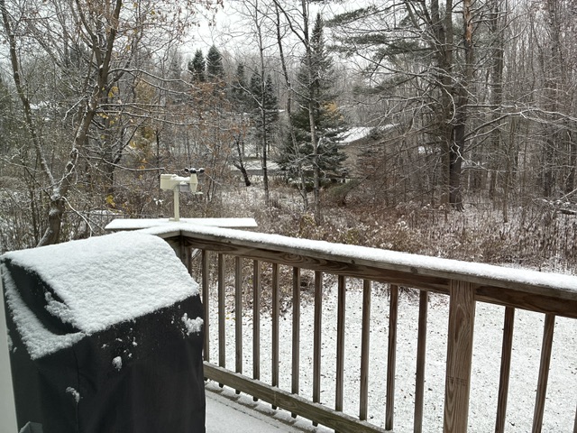
-

11/8-11/10 First Snow and Lake Effect Event
A-L-E-K replied to Geoboy645's topic in Lakes/Ohio Valley
Fwiw, tons of leaves on trees still here -
Models are shifting the vort north at the last minute (sound familar?) Not like we were going to get more than flurries anyways.
-
We’ll see if this can trigger a strong enough wave reflection to lead to more of a -WPO -EPO from late November into early December. Then the main question is will it be able to weaken the Pacific Jet enough. Last December we saw how the stronger -EPO didn’t really weaken the jet enough so we got a mid to late December +EPO reversal. Remember none of the models got this +EPO reversal later in December from early in December. So we’ll just have to monitor the Pacific Jet once we actually get into December. Plus we have seen warm ups every December since 2011 from the 17th to 25th that most of the long range models missed. Even during colder starts to the month.


