All Activity
- Past hour
-

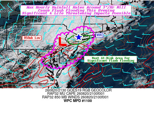
Another Flooder for the South Coast. 8/20/26
Sey-Mour Snow replied to Sey-Mour Snow's topic in New England
-

Augdewst 2026: Summer's Last Stand
Baroclinic Zone replied to Prismshine Productions's topic in New England
Deluge going on here right now. -

Augdewst 2026: Summer's Last Stand
vortex95 replied to Prismshine Productions's topic in New England
W/ the RRFS going operational in Oct, I asked about how it handles TCs. Got this reply: RRFS isn't specifically designed to handle hurricanes well, but the hourly data assimilation and the model dynamics (which handles rotational modes well) mean it should at least handle them okay. But I would certainly defer to HAFS forecasts for hurricanes. Important info given it is a new model. Just have to be careful here and see how it does overall and what its biases are. And this prevents @CoastalWxfrom the "GARBAGE MODEL" label he likes so much when a TC is present! -
TOG heading towards Dover
-
You live in Boston now?! Christ, you move almost daily!!
-

2026 Mid-Atlantic Severe Storm General Discussion
WEATHER53 replied to Kmlwx's topic in Mid Atlantic
Still wont Heavy rain too challenging? -
Run of the mill storm. Decent rains tho
-

2026-2027 Record-breaking El Nino
qg_omega replied to Stormchaserchuck1's topic in Weather Forecasting and Discussion
Conus torch -
2026 Atlantic Hurricane Season
vortex95 replied to Stormchaserchuck1's topic in Tropical Headquarters
W/ the RRFS going operational in Oct, I asked about how it handles TCs. Got this reply: RRFS isn't specifically designed to handle hurricanes well, but the hourly data assimilation and the model dynamics (which handles rotational modes well) mean it should at least handle them okay. But I would certainly defer to HAFS forecasts for hurricanes. Important info given it is a new model. Just have to be careful here and see how it does overall and what its biases are. -

E PA/NJ/DE Summer 2026 Obs/Discussion
Birds~69 replied to PhiEaglesfan712's topic in Philadelphia Region
-
I’m behind the camera, genius.
-
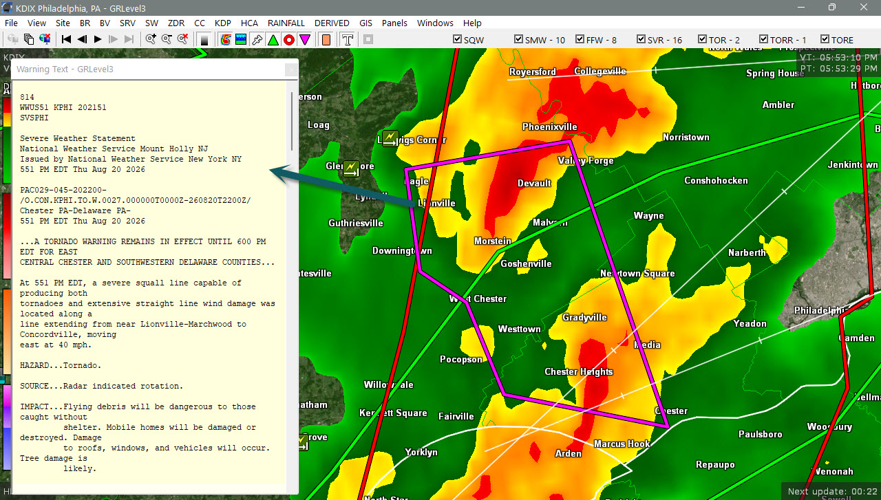
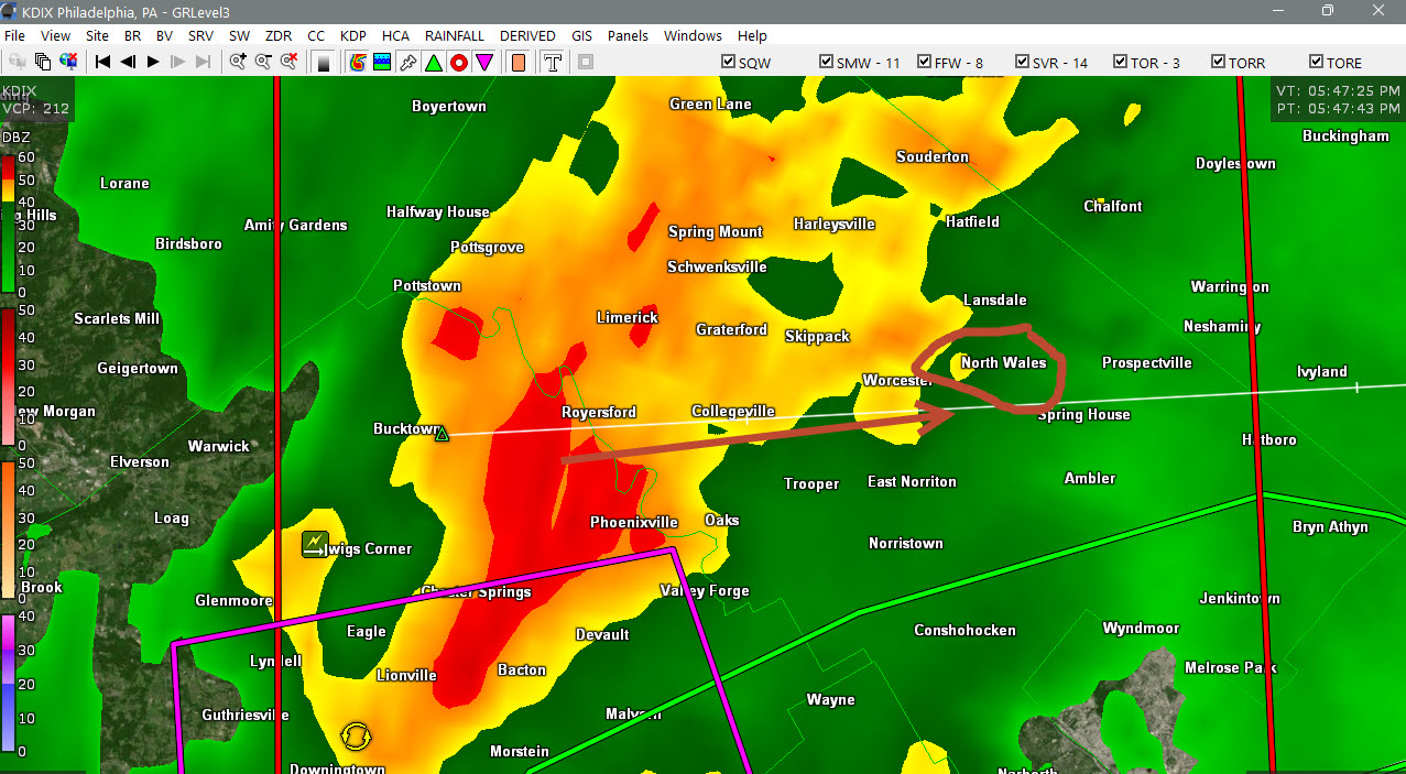
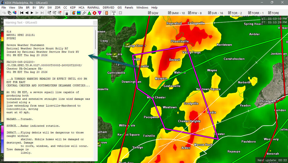
Headed straight for us this time east of the city. HRRR gone crazy last run. I think this time we (most) of us really get it.
-
Bad timing. I can't load the radar or anything really.
-

E PA/NJ/DE Summer 2026 Obs/Discussion
Psychguy replied to PhiEaglesfan712's topic in Philadelphia Region
I think the national weather service is down again because I cannot access it either. -
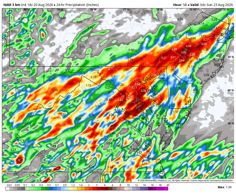
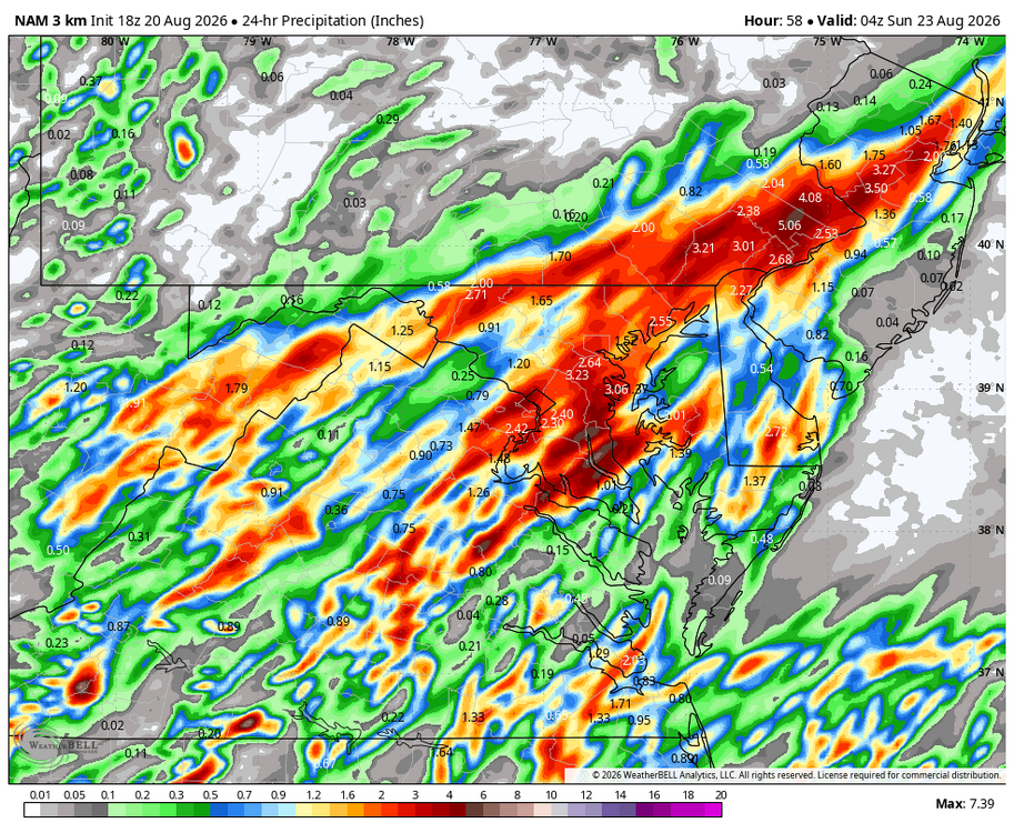
WB 18Z 3K NAM. Saturday is looking wet...
-
Flash Flood Warning for... Southern Bergen County in northeastern New Jersey... Essex County in northeastern New Jersey... Hudson County in northeastern New Jersey... Eastern Passaic County in northeastern New Jersey... Northeastern Union County in northeastern New Jersey... Bronx County in southeastern New York... Kings (Brooklyn) County in southeastern New York... New York (Manhattan) County in southeastern New York... Queens County in southeastern New York... Richmond (Staten Island) County in southeastern New York... Until 745 PM EDT. At 539 PM EDT, Doppler radar indicated thunderstorms producing heavy rain across the warned area. Between 1 and 1.5 inches of rain have fallen. The expected rainfall rate is 0.5 to 1.5 inches in 1 hour. Additional rainfall amounts of 1 to 2 inches are possible in the warned area. Flash flooding is ongoing or expected to begin shortly.
-

Augdewst 2026: Summer's Last Stand
Damage In Tolland replied to Prismshine Productions's topic in New England
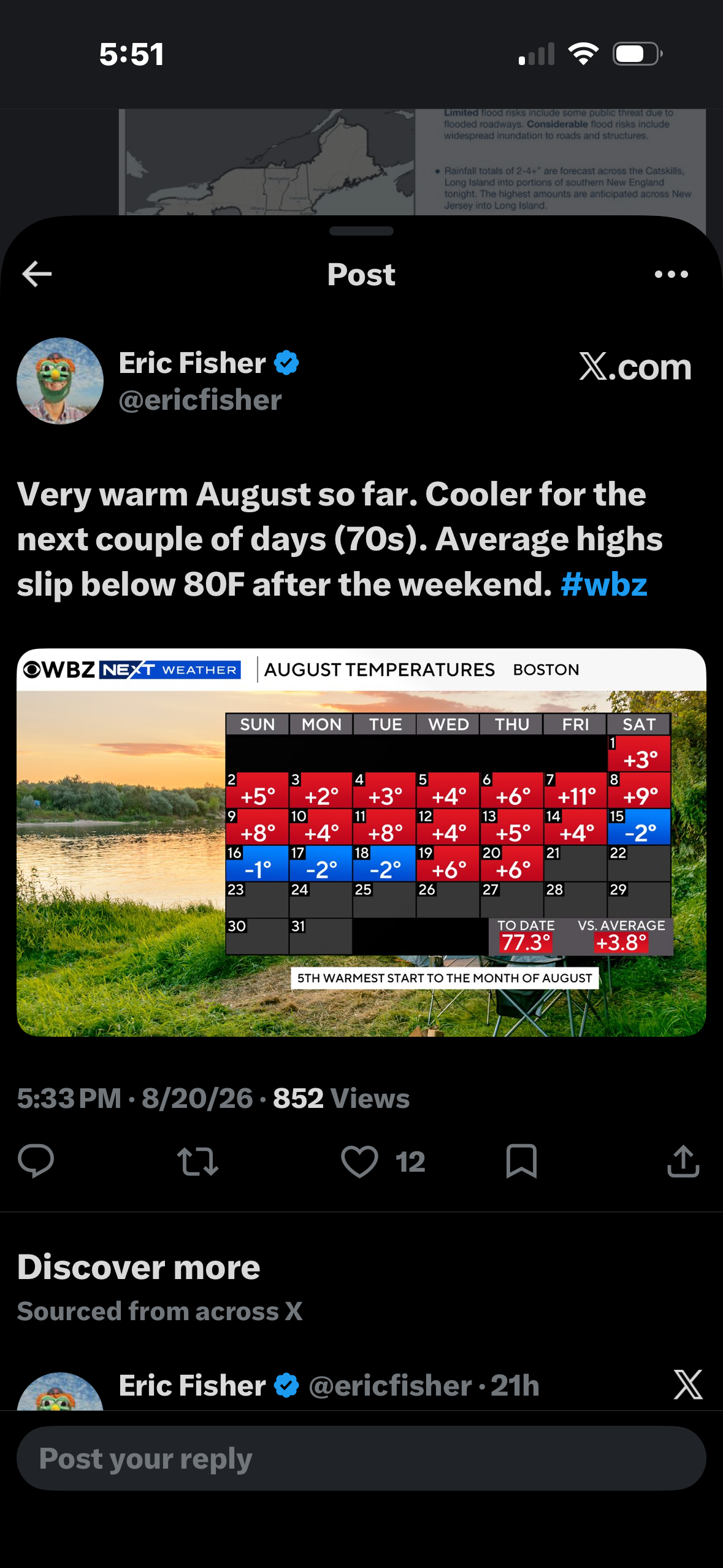
What a torch !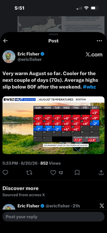
-
E PA/NJ/DE Summer 2026 Obs/Discussion
Birds~69 replied to PhiEaglesfan712's topic in Philadelphia Region
Liking my odds, at least some heavy downpours. Dark as hell outside....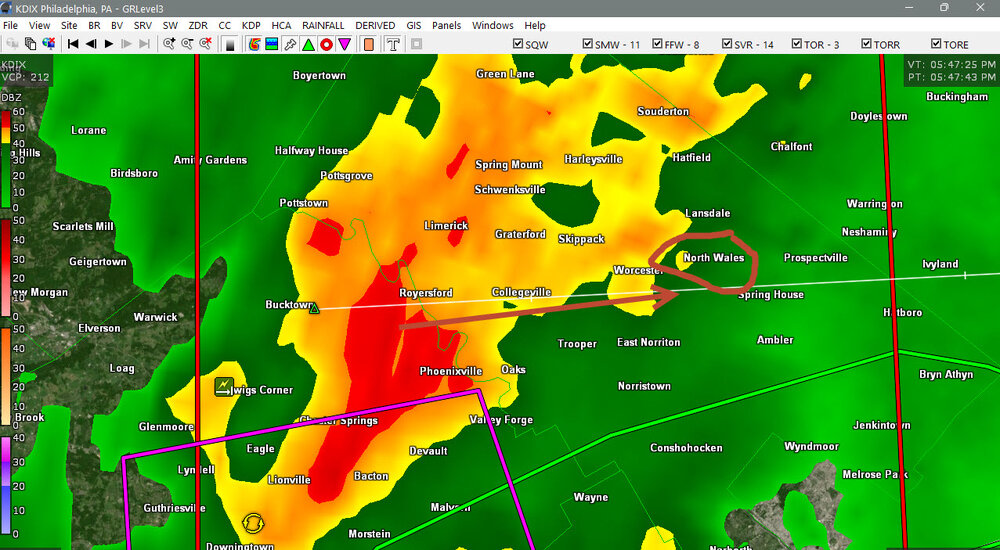
-
Tornado warning at Sudlersville MD, close to Delaware state line
- 2,126 replies
-
- 2
-

-
- severe
- thunderstorms
- (and 7 more)
-
 New CPC temp outlook for JFM, kind of surprising it's based with mean ridge over NE more than NW Matches Nino 1+2 JFM composite
 -

-

Augdewst 2026: Summer's Last Stand
dendrite replied to Prismshine Productions's topic in New England
Is he Jim Duggan?
-
E PA/NJ/DE Summer 2026 Obs/Discussion
KamuSnow replied to PhiEaglesfan712's topic in Philadelphia Region
There was tornado warning here, but I can't access NWS for some reason. Heavy rain here now, but not much wind. -
Weather.gov has some issues currently I read in a notice.
- 2,126 replies
-
- 1
-

-
- severe
- thunderstorms
- (and 7 more)