All Activity
- Past hour
-
Had a gust to 50mph at ISP
-

Friday February 6 FROPA / WINDEX small event
The 4 Seasons replied to HoarfrostHubb's topic in New England
well that was certainly another positive bust/over performer for the season. yet another one. deep winter out there if anyone has any snowfall totals from this event, that are FINAL, let me know. doing a map for this should certainly be interesting and fun. Going to be the 10th 3"+ event of the season. -

February 2026 Medium/ Long Range Discussion: 150K Salary Needed to Post
Ji replied to Weather Will's topic in Mid Atlantic
what is this @mappy The recent visitors block is disabled and is not being shown to other users. -
February 2026 Medium/ Long Range Discussion: 150K Salary Needed to Post
Ji replied to Weather Will's topic in Mid Atlantic
my block thing isnt working. I blocked him and now im seeing all his posts again smh -

Friday February 6 FROPA / WINDEX small event
ORH_wxman replied to HoarfrostHubb's topic in New England
4.5” but this is without clearing. Might have maybe squeaked 4.8-5” if I cleared after the midnight-6am batch.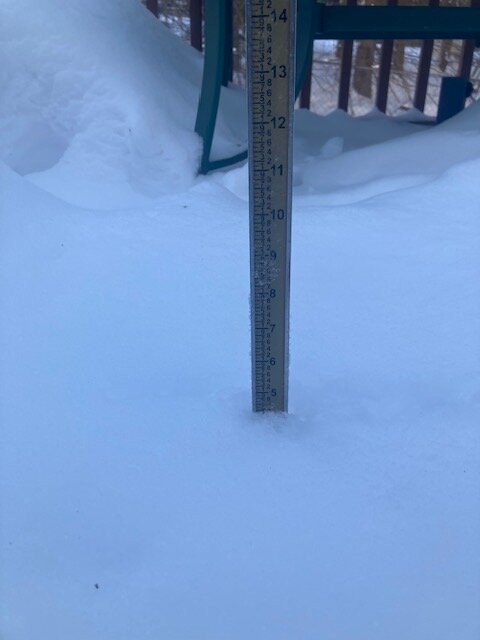
-
Temp has been around 17 since early this morning. Was 20 at 6am. The high temp is probably 30 which occurred just after midnight prior to the Arctic front.
-
 Down to 1f. 2. " new overnight and during the day.
 -
 Thank you for answering the question “what if there was another Chuck, but who didn’t know anything and was even more annoyingly repetitive”. Im not sure who was asking that question but thanks for answering anyways.
 -

Feb 10-11 Mid Week Minor Event - Ride the hot hand?
HoarfrostHubb replied to HoarfrostHubb's topic in New England
yeah. I could see nothing coming of it. maybe it comes back -
Northern tier of CONUS appears to hold on to the general ridge W. trough E. Favorite time of the year for phasing with the greatest chance for blockbusters.
-
 This one and 18th system seems to go up through the MW into ND, MN.
 -
Currently 1.5 here with winds still gusting 25-35 mph. Just too bad that s/w didn't rotate off the coast about 100 or so miles further south and start to go negative. That surface low would have delivered the goods to this entire sub forum. Another near miss of something really good! So close.
-
Peaks gusts at the airports DCA: 58 BWI: 57 IAD: 52
-
 high today was 22.7° at midnight, and 17.1° at 12, it's now 0, with 23 sustained and gusts 45+, only got an inch new but seems like more with the wind blowing it over everything old, nice little refresher hopefully more by the end of next weekend.
 -
February 2026 Medium/ Long Range Discussion: 150K Salary Needed to Post
Ji replied to Weather Will's topic in Mid Atlantic
one of the lamest 18z runs i can remember -
I like it, got porked on this one today.
-

Friday February 6 FROPA / WINDEX small event
amarshall replied to HoarfrostHubb's topic in New England
Radar filled back in 8” and climbing Duxbury . -

Friday February 6 FROPA / WINDEX small event
CCHurricane replied to HoarfrostHubb's topic in New England
So just a tad more than 1 inch. Gotta stay positive! Results to the north boded well for you. -
9 degrees here
-
.thumb.png.4150b06c63a21f61052e47a612bf1818.png)
Feb 10-11 Mid Week Minor Event - Ride the hot hand?
HIPPYVALLEY replied to HoarfrostHubb's topic in New England
Moisture starved, we need to start seeing changes in that aspect by tomorrow night.. -
 You're right. The GFS is the superior model after all. Euro only showing about 1-2". Dry ass model. Good post.
 -

Winter Storm Threat *Technical* Discussion. No Op Run PBP or Snow maps
CAPE replied to CAPE's topic in Mid Atlantic
18z GFS crushes the initial wave as the NS vortex digs too far south and exits, then the unfavorable Pacific takes over. The HP from the initial NS confluence exits stage right with no NA blocking, and the result its a cutter with mostly rain. Just one of many possible outcomes. Only a week to go! -
European sort of on an island with 2nd system. Gonna take a well timed HP. First system has a chance for a lighter event the way it looks. .
-
HRRR was pretty good, at least for most of NJ, sadly. Just 0.1" of snow here vs. ~1" forecast, which is still a pretty minor bust, since the 1" assumed 15-20:1 ratios meaning only about 0.05" QPF and to be off by only that much shouldn't come as a surprise.
-
I haven't seen 4", just warm rain again. I know it's not showing your snow anymore, so now you'll say it's the GFS.


