All Activity
- Past hour
-
The pax river forcefield seems to be in effect from what I can see.
-
The clouds look wild right now and flying in from the east
-
Outside watching a storm pop almost right over me the last 10 minutes or so..
-
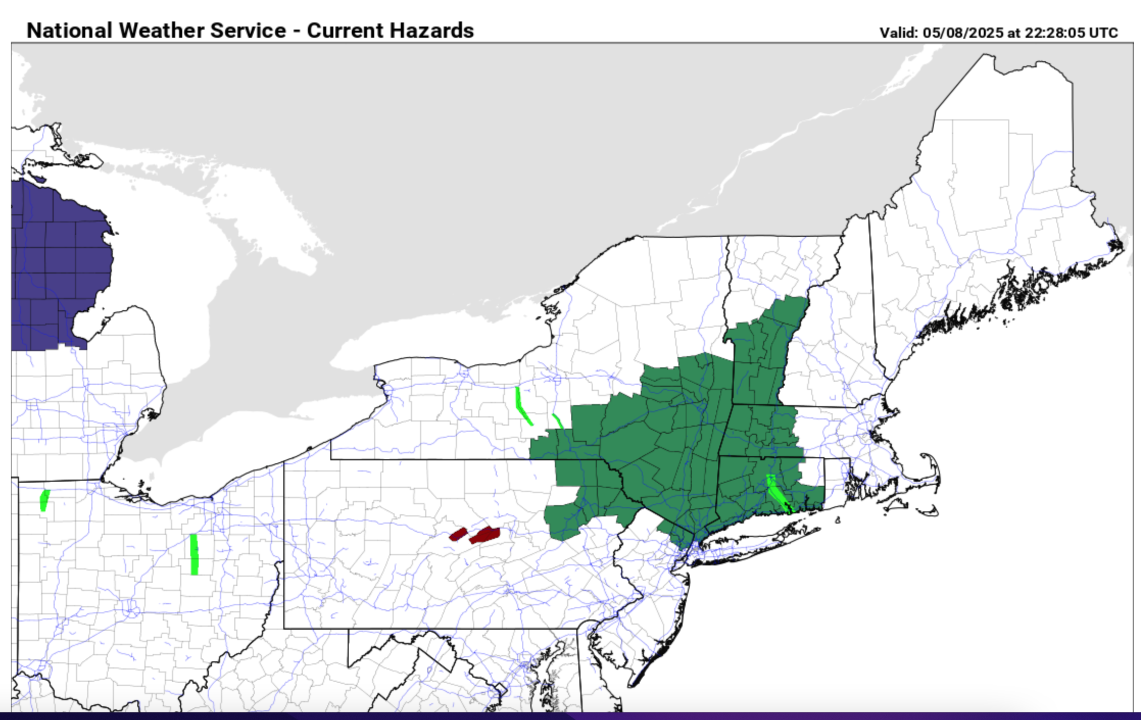
Added an OBS thread for the OKX Flood Watch. Am not enthused as I'd like to be, mainly due to antecedent conditions but potential does exist for spot 4" amounts se NYS, W CT... basically within the axis of most modeling heaviest rain northwest of I-95. Seems like the FFG is on the higher side but training - repeat episodes could result in spot flooding within the OKX Flood Watch. CT RVR Flood warning is minor at this time and may not crest til the weekend. Have a good night.
-

OBS for OKX Flood Watch (attached) into early Saturday 5/10/25
wdrag replied to wdrag's topic in New York City Metro
Wantage NJ 0.62 125P-7P. -
Cloudy and cool now with a brief shower
-
It's gonna be dependent on where some of the cells start popping. Had a tremendous, and I mean tremendous, 15 minute downpour here around 5pm or so.
-

2025 Lawns & Gardens Thread. Making Lawns Great Again
Damage In Tolland replied to Damage In Tolland's topic in New England
Had this whole area of lawn totally redone last year. Brought in loads of topsoil and then they hydro seeded in Napril . Had them back in late Augdewst for an aeration and overseed . And it finally looks like what I have been searching for in that area. Tons of Oaks so a lot of shade and debris disaster. Not a weed. No dandies , no clover .. just deep green grass . It will erode as it’s prone to do in that sloped area and not enough sun. But for this season it is 100% full frontal nudity . T & V -
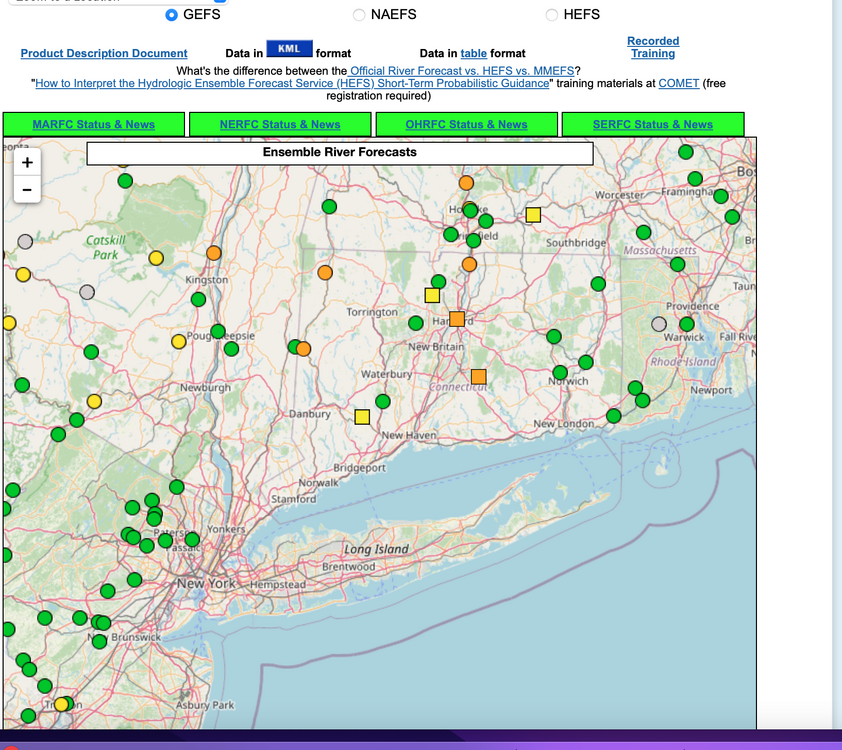
Isolated 4" rainfall possible by daybreak Saturday for w CT, se NYS where OKX has issued a flood watch this Friday afternoon 5/8/25. Most modeling has a needed 1-3" spread out over a 36-42 hour period ending Saturday morning. Flood guidance suggests we'll need 2.5" in a 6 hour period for flooding. Lesser rainfall LI NJ and ne PA under 1.5". A snapshot of ensemble forecasts showing minor flooding anticipated at several gages in the north part of the NYC subforum. Long ways to go. We'll add some CoCoRaHs amounts at 9A Friday and see where we stand.

-
Wild stuff is just NW of me, may get a shower
-
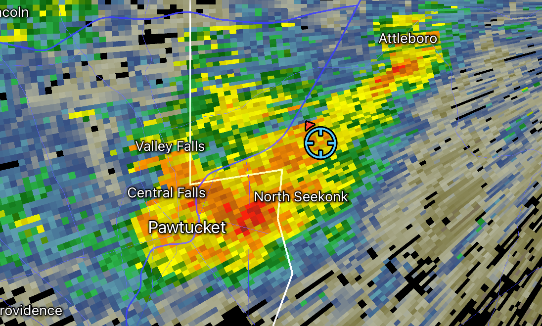
This afternoon was the rainiest and most thunderstormy in quite a long time in this area! Lots of street flooding. The rush hour traffic was a big mess!
-
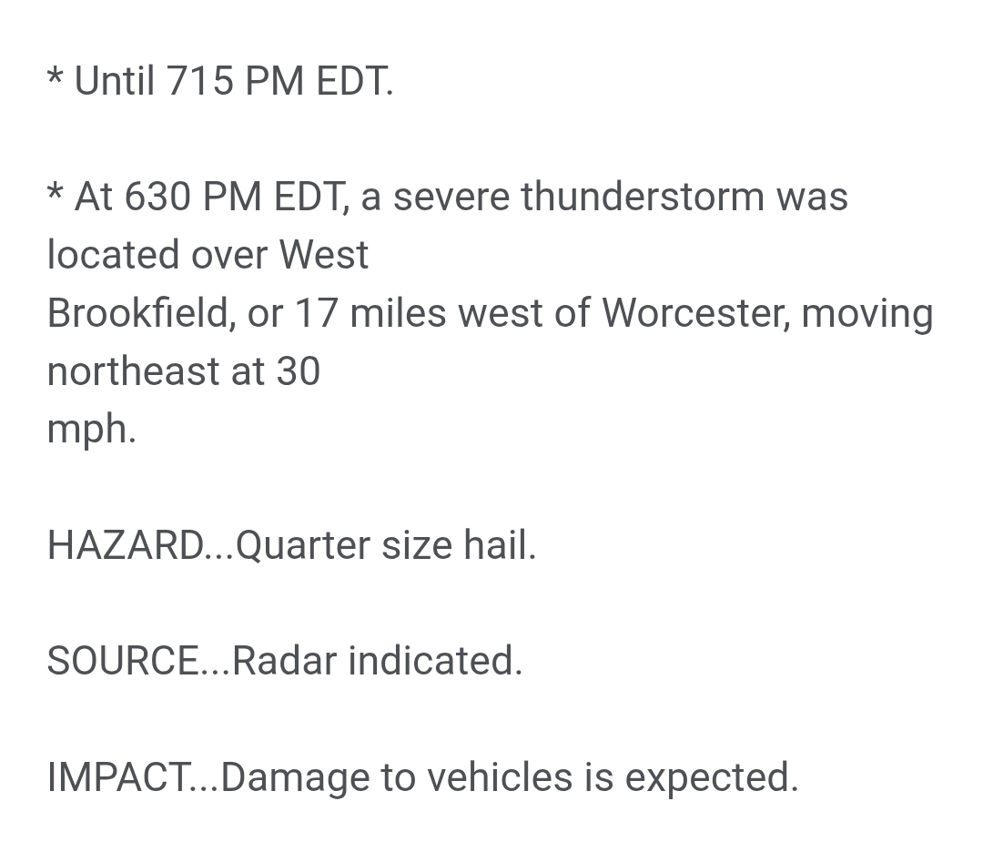
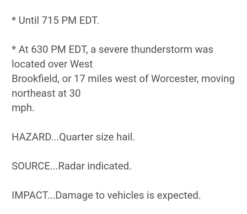
Some storm scale rotation on that SVR. I'll be surprised if anyone gets quarters but even here I was wondering if a few peas might fall (they didn't) and it did pulse up after, but weakening now.
-
-
NAM 3K likes the lowlands for 1-1.5". HRRR says we continue to drought while the same places that got rain a couple days ago get more rain.
-
Damn it does.
-
Cell near North Brookfield looks spicy
-
A bit of thunder here in Hubbardston
-

-
Just got absolutely soaked walking the dog, cell popped up right over me, looks more to come
-
Deluge
- Today
-
No frost advisory but will probably get frost here in the Rock River lowlands.
-
More cutoffs than I can stand. 2" of rain up here this week with more coming. I absolutely loathe mowing the lawn in the spring as the grass is so thick.
-
Will the lowlanders actually get rain this time?
-
Radar looks a bit paltry.
-
70/23 couldn’t script it any better.