All Activity
- Past hour
-
Most are 50 ft or less. My entire road has soooo many, just loaded with Beech. Very dense sections. I dont see alot of dead ones from beech leaf disease. Im sure its just a matter of time unfortunately. I have only been here 8 years, so maybe some larger ones succumbed befors that. The majority are in the 15-30ft range.
-
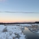
 Exactly, not having snow cover in Churchill/mooseonee this time of year is far far from normal. They have polar bears there .
-
@grok is this real?
-

2026-2027 Record-breaking El Nino
mitchnick replied to Stormchaserchuck1's topic in Weather Forecasting and Discussion
I'm impressed and excited. Look at that potential record breaking heat in the west. -

2026-2027 Record-breaking El Nino
snowman19 replied to Stormchaserchuck1's topic in Weather Forecasting and Discussion
@LakePaste25 Speaking of 1997-98, which I firmly believe is the best analog for this winter despite this El Niño being much stronger (and more east-based) -
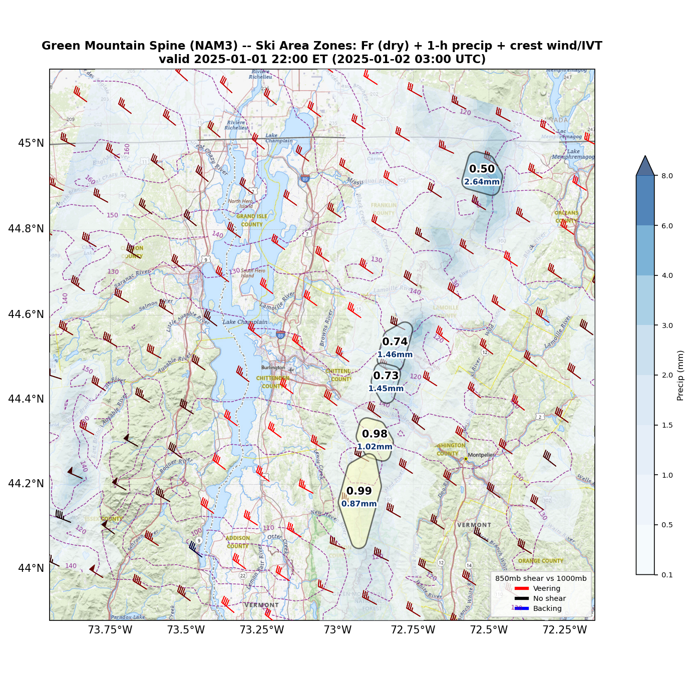
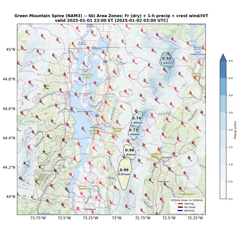
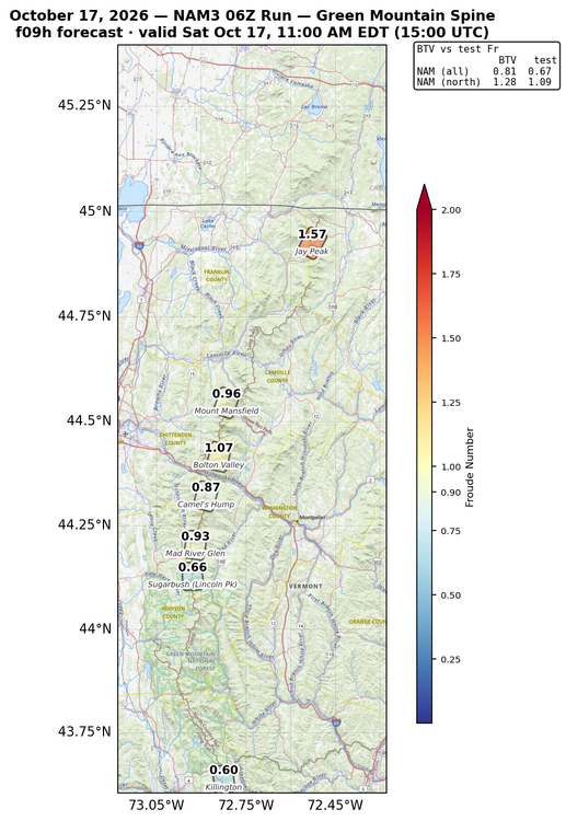
As promised, here is a bit of a look into the new insights I am attempting to generate for orographic forecasting this winter. First, here is an initial look at my froude number visualizations for a random hour of a NAM forecast during the light upslope event a few weekends ago. Note the comparison to the BTV calculations, currently there is a bit of a low bias that needs to be sorted out: The full product will look something more like this, where other factors like IVT, wind speed and direction, forecasted precip etc.. are all included: The image shown is late in the evening during the January 1-2 2025 upslope event, just as the flow was beginning to become critical rather than blocked. I tested with this event as by the AM on 1/2, the flow became fully unblocked and I wanted to see if the product captured that correctly. As we all know, upslope can be a fickle forecasting problem, I hope these products can help simplify it! There aren't many places where all of these essential factors in the forecast are all visualized together. Ultimately, I may scale this up into an "upslope index" if all goes well.
-
IAD had an hour of blowing dust obs this afternoon. I'm just going to blame data centers.
-
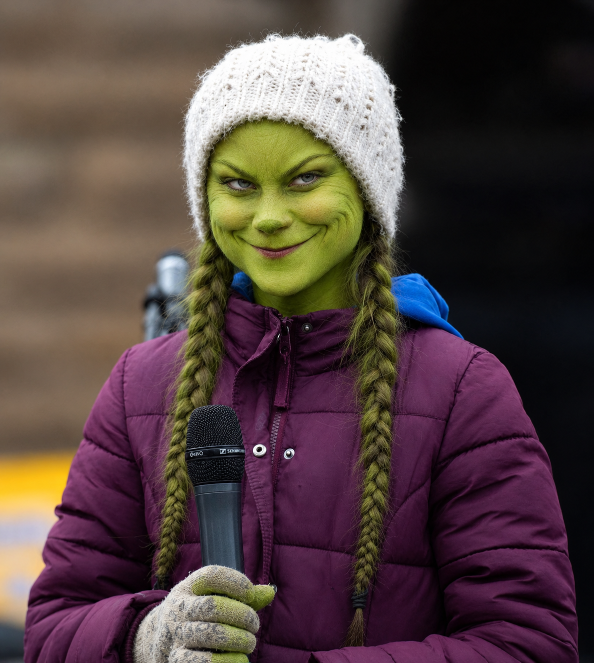
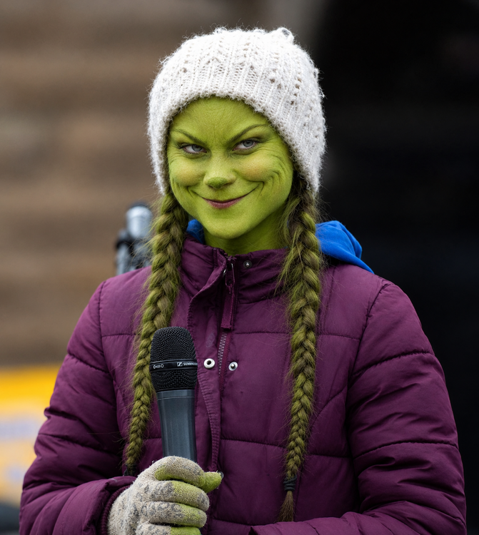
Please AI that Grinch smile on Greta.
-

2026-2027 Record-breaking El Nino
GaWx replied to Stormchaserchuck1's topic in Weather Forecasting and Discussion
After a mild DJ, Cosgrove has a frigid Feb: With the rapid decline of the El Nino and evidence for high-latitude ridging and cross-polar flow, I went in a colder direction for February to the right of the Continental Divide. The southern branch jet stream looks depressed into the Deep South and up off of the Eastern Seaboard, which would seem to favor more cold air and frozen precipitation. While I do not think that we will have a 2009 or 2015 type outcome, I lean toward a colder look than what official and major vendor sources are showing for February.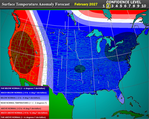
-
How Greta stole Christmas?
-
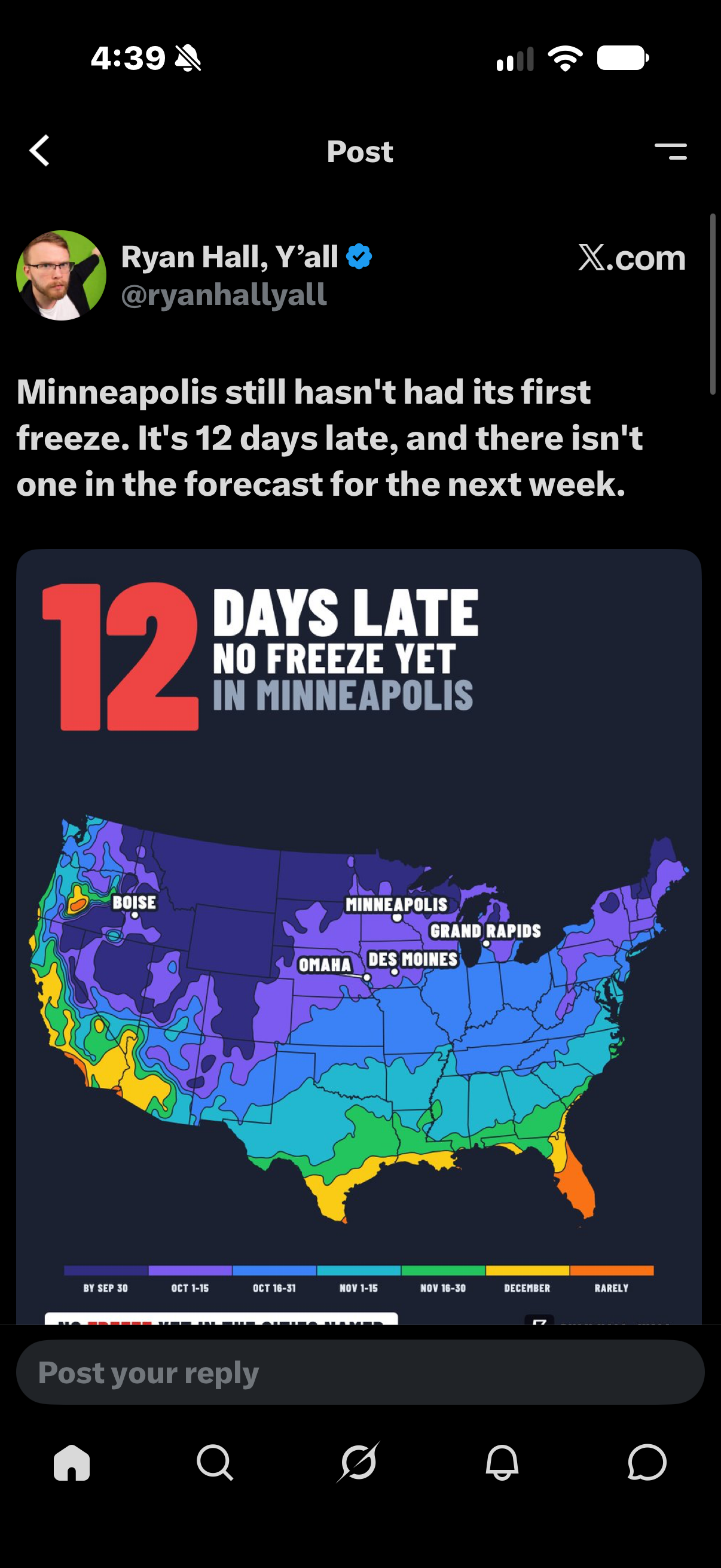
Growvember and perhaps heading into Dewcember.
-
2026-2027 Record-breaking El Nino
mitchnick replied to Stormchaserchuck1's topic in Weather Forecasting and Discussion
We disagree on geographic labels. -
We torch
-
Wonder if anybody stopped and wondered what will happen when the PV strengthens December and January?
-
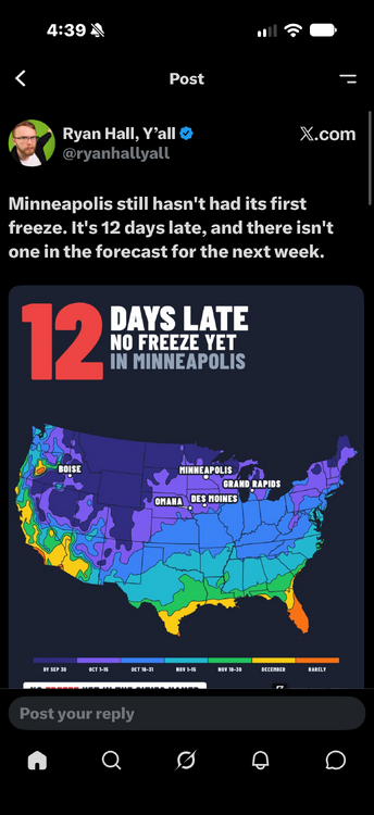
Guess we not alone in ORH and TOL
-
Cold front passing through
-
We are flirting with 1965 when a severe drought continued thru 1966. The + 1.8 DJF 65-66 El Nino did NOT break the 4 year drought. I simply report historical reality.
-
aren't the new models replacing some of the older models in November ?
-

2026-2027 Record-breaking El Nino
qg_omega replied to Stormchaserchuck1's topic in Weather Forecasting and Discussion
Literally shows nothing across almost all of southern Canada -
2026-2027 Record-breaking El Nino
LakePaste25 replied to Stormchaserchuck1's topic in Weather Forecasting and Discussion
The trade off here is that we probably avoid a December 2015-like outcome and instead see something closer to December 1997. -
2026-2027 Record-breaking El Nino
snowman19 replied to Stormchaserchuck1's topic in Weather Forecasting and Discussion
Massive WWB coming for early-mid next month. This will cause even more warming in regions 1+2, 3 and 3.4, setting the stage for the December peak. This super El Niño has secured and guaranteed its rightful place as the strongest and most east-based in history…. -

2026-2027 Record-breaking El Nino
bluewave replied to Stormchaserchuck1's topic in Weather Forecasting and Discussion
You are a funny guy. The reason that I point out how much warmer things have become is due to the fact that I grew up in a much colder 1970s and 1980s. This is literally a new climate paradigm. Not because I like such a warmer planet. But most people off this forum like a warmer climate since a large portion of the population has been moving to the Sunbelt from the colder regions. But there has been some small shift to this long term trend in the last few years. Since we live here near the surface and not up in the stratosphere. Numerous posts on how the stratosphere might change the eventual outcome vs the super El Niño. Not meant to single you out since I understand that you were only posting the data. But the super El Niño is a much greater climate driver in comparison. We pretty much knew where this was headed with the record WWBs last spring and the early model shift to a stronger and stronger east based El Niño. So no hopes are going to get dashed since expectations were lowered in accordance to how extreme an east based event this has become. The national and global climate system is much bigger than our local backyards. Last winter was our first both cold and snowy winter in 11 years. The limited area of the cold against the background of the 2nd warmest CONUS winter on record explains what has happened. The cold since the 2015-2016 super El Niño baseline shift has become extremely limited. So the chances of any one winter being both colder and snowier than average is becoming less likely. The geographic footprint of the cold when it does occur is more limited. So this new pattern made it possible for us to go this long before experiencing a colder winter. In the old days it was possible to get coast to coast widespread cold. So our chances for a colder winter in any given location were greater. These days we can’t get a colder winter winter in a portion of the CONUS without a much more impressive warm winter somewhere else. We were discussing snowfall before last winter and during previous winters. I was very happy to get the benchmark storm track back for the first time since 21-22. But it highlights how important the benchmark track is for our snow especially since the mid-90s. In the colder climate prior to the mid-90s, we could nickel and dime our way to normal snowfall especially around NYC Metro. It was possible during the colder era to have an average snowfall season with just small or moderate events. But for the last 30 years getting a KU benchmark storm has become a prerequisite. This has lead to the snowfall for places around NYC to become an all or nothing proposition with hardly any more seasons near the mid-20s average. I also said in earlier years that it would be a struggle to get another 50” snowfall season in NYC with how warm the winters have become. Since NYC proper needs a winter close to 32° in order to pull this off. The colder temperatures are necessary but not always sufficient like we found out last winter. Areas like Islip to the east and Newark to the west don’t fall into this category which I also pointed out years ago. So it’s more of a NYC and surrounding stations like LGA and JFK requirement. - Today
-
71 today at my stations. Trees are really popping with color now as well.
-
Windy
-
torchvember incoming