All Activity
- Past hour
-

“Cory’s in LA! Let’s MECS!” Jan. 24-26 Disco
bristolri_wx replied to TheSnowman's topic in New England
Our AI overlords are not good at weathermaps but very good at weenies. -

January 24-26: Miracle or Mirage JV/Banter Thread!
Maestrobjwa replied to SnowenOutThere's topic in Mid Atlantic
The one most here forget about: Baltimore! -
50/50 NAM/Euro blend probably makes sense right now.
-
 So we are waiting on what's back out west before we get anything measurable in loudon
 -

January 25-26 Winter Storm Potential
Kevin Reilly replied to Ralph Wiggum's topic in Philadelphia Region
I can hear Elliott Abrams in my ears, “should the delay in the changeover occur we can easily pick up a foot of snow.” -

Extreme Cold, Snow & Sleet: SECS 1/25 - 1/26
nycsnow replied to TriPol's topic in New York City Metro
Highly doubt there’s any freezing rain, he likes the NAM I guess -

January 24-26: Miracle or Mirage JV/Banter Thread!
JenkinsJinkies replied to SnowenOutThere's topic in Mid Atlantic
Towson. -

1/24-1/25 Major Winter Storm - S. IL, IN, and OH
Radtechwxman replied to A-L-E-K's topic in Lakes/Ohio Valley
You're riding razor's edge?! Try Peoria. Lol. You are sitting pretty. Brutal cutoff will be very close to me. -

1/24-1/25 Major Winter Storm - S. IL, IN, and OH
largetornado replied to A-L-E-K's topic in Lakes/Ohio Valley
I’m not crying. I’m pointing out a blatant lie. You NPC wouldn’t understand that. -
January 24-26: Miracle or Mirage JV/Banter Thread!
Maestrobjwa replied to SnowenOutThere's topic in Mid Atlantic
I'd imagine it's close to the same (5-9"). I am skeptical of the high end though but would love to break through! -

Extreme Cold, Snow & Sleet: SECS 1/25 - 1/26
Prue11 replied to TriPol's topic in New York City Metro
Jim Cantore concerned with possible ZR moving into nyc and LI evening hours -
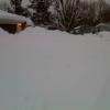
Rhode Connectichusetts bottom left
-
Skiing in this weather takes dedication.
-
Jan 24-26 Weekend Snow and Sleetfest Model Thread Part Tres
JenkinsJinkies replied to H2O's topic in Mid Atlantic
I mean we’re rapidly running out of time for a Euro cave. -

Central PA Winter 25/26 Discussion and Obs
GrandmasterB replied to MAG5035's topic in Upstate New York/Pennsylvania
This is what we need with the rates. If they are this nuclear we should all be fine! -

January 24-26: Miracle or Mirage JV/Banter Thread!
WxUSAF replied to SnowenOutThere's topic in Mid Atlantic
Monday and Tuesday are basically locks I think. What area? -
No
-
Jan 24-26 Weekend Snow and Sleetfest Model Thread Part Tres
Grothar of Herndon replied to H2O's topic in Mid Atlantic
Tri-City airport on the east TN southwest VA boarder current temperature is 35F. Showing high tomorrow of 50F. -
Baro 30.44 here
-

Jan 24-26 Weekend Snow and Sleetfest Model Thread Part Tres
wasnow215 replied to H2O's topic in Mid Atlantic
Love being a part of this weather community! Can somebody please do me a favor and post the freezing rain totals from the 12 z euro?0 -
January 25-26 Winter Storm Potential
Kevin Reilly replied to Ralph Wiggum's topic in Philadelphia Region
Their app algorithm must calculate 1-2” of sleet as 10” -
Extreme Cold, Snow & Sleet: SECS 1/25 - 1/26
Prue11 replied to TriPol's topic in New York City Metro
Didn’t SWSuffolk and SE Nassau jackpot during that storm? -
 Temp is still dropping and flake size is growing. I peaked at 27 and am down to 23 now.
- 140 replies
-
- 3
-

-
- observations
- obs thread
- (and 1 more)
-

January 24-26: Miracle or Mirage OBS Thread!
IUsedToHateCold replied to Jebman's topic in Mid Atlantic
A strangely sunny day for a storm coming. 18.5/-7.1 -
Looks like you snuck a government map in there on the left side, middle row. We also lost most of eastern MA on the middle map. ORH hills gonna get crushed with onshore flow.


