All Activity
- Past hour
-

2025 Atlantic Hurricane Season
WxWatcher007 replied to BarryStantonGBP's topic in Tropical Headquarters
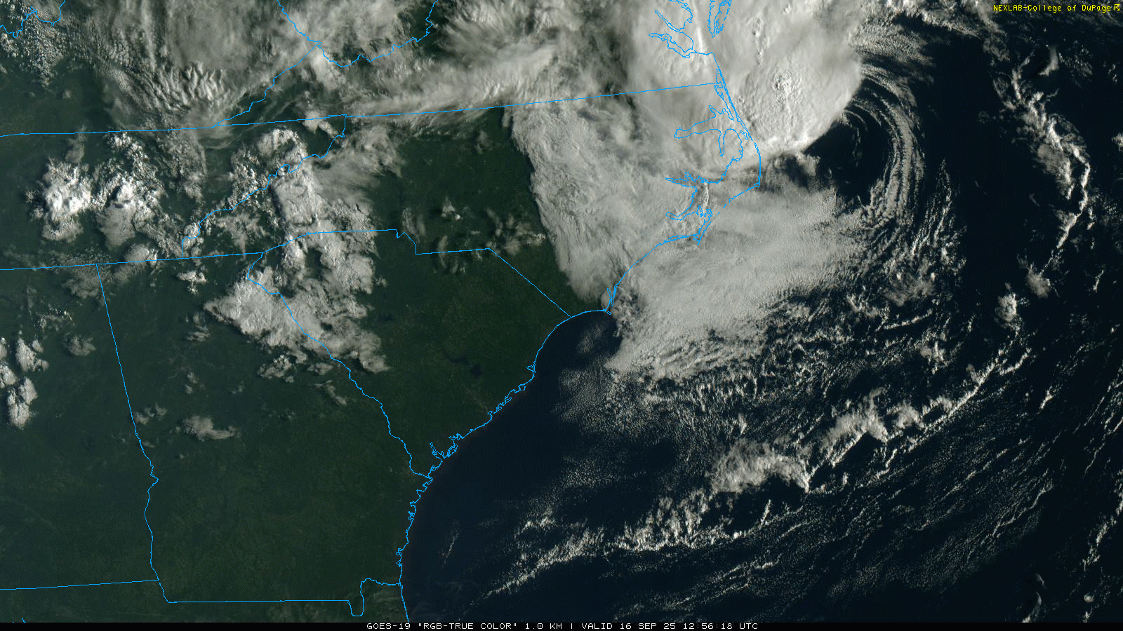
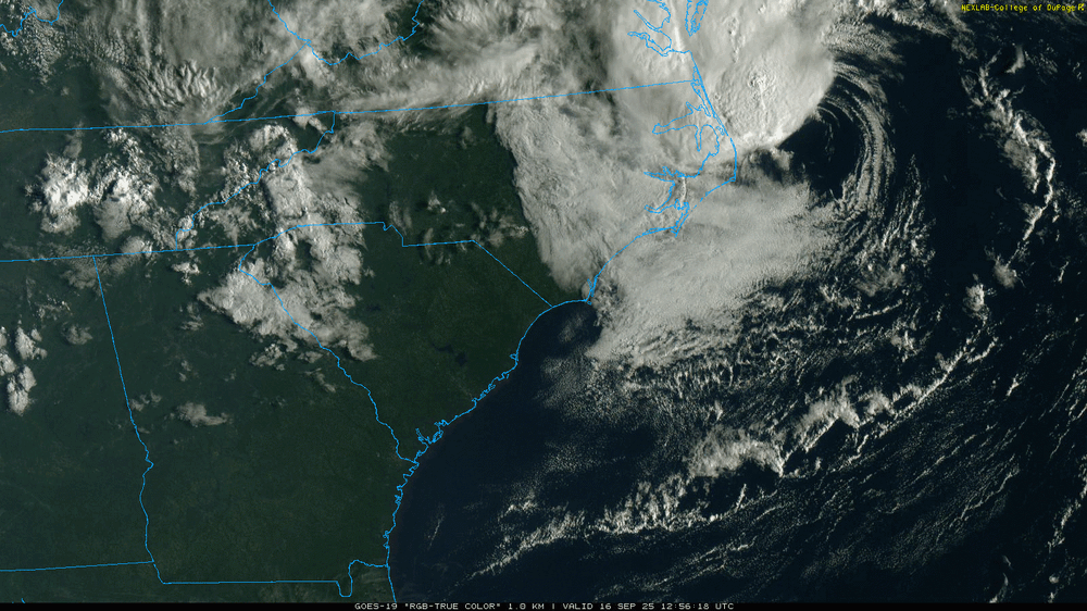
It’s still clearly baroclinic—attached to a frontal boundary. You can see it clearly in the visible satellite. Same impacts as a TS, but just not tropical. -
Jennettes pier is gusting to 65, sustained at 42!!! (MPH)
-
Euro has rain at 300 hours so I guess we can look forward to that
-
Just give me until 12:00 pm in Poolesville.
-

September 2025 OBS-Discussion centered NYC subforum
donsutherland1 replied to wdrag's topic in New York City Metro
I believe Wdrag's analysis is on the mark with rainfall potential for parts of the area. The system responsible is an impressive and strengthening coastal low (non-tropical). The guidance can sometimes be too sharp with the cutoff of precipitation. It wouldn't surprise me to see Atlantic City wind up with 0.50"-1.00" to perhaps 1.50" of rain and NYC wind up with around 0.25". I do think we'll see amounts fall off sharply north and west of New York City. In terms of outcomes, Atlantic City and Georgetown have already received more rainfall than had been expected on the guidance for the 6-hour period that will end at 18z. -
True. In this case though, keep in mind that this wasn’t even given a 10% chance in any TWO to become just a subtropical depression. The TWOs cover both tropical and subtropical depression+ development potential.
-
Keep in mind that this wasn’t even given a 10% chance in any TWO to become just a subtropical depression. The TWOs cover both tropical and subtropical depression+ development potential.
-
There's a pill for that.
-

Central PA Summer 2025
Mount Joy Snowman replied to Voyager's topic in Upstate New York/Pennsylvania
Low of 57. Any rain we can squeeze out tonight or tomorrow would be much obliged. -
go on....
-
By rafting, do you mean walking 10 miles down a river towing a raft behind you?
-
Can you raft?
-
They are hyping for likes, follows, clout, retweets and views, as per usual. If just the NE PAC was warm and it was cold in the western North PAC around Japan (2013/2014) then yes that would be a +PDO alignment and would have that correlation. We don’t have that
-
I noticed that after the bridge, but went away towards HYA. I was told that is due to the cicadas. They peal away the bark of new growth to lay eggs or nest or whatever and that kills the new growth. So that's why you see the edges with the brown leaves.
-
Is Saharan dust/dry air not included in this factor list because of its difficulty to forecast long term? It seems like that's been a significant limiting factor for many storms in the past few years, especially in the early season
-
Looks like healthy radar for south of DC - hoping for some scraps Baltimore north
-

2025 Atlantic Hurricane Season
NorthArlington101 replied to BarryStantonGBP's topic in Tropical Headquarters
People get mad when the NWS names slop for “inflating the numbers.” Now it’s the opposite? Tough job -
Another 1947 for Maine? PWM had only 2.00" total rain for August/September that year, then had no measurable for October 1-28. Bad things happened.
-
The cfs is dog sh
-

2025 Atlantic Hurricane Season
TheClimateChanger replied to BarryStantonGBP's topic in Tropical Headquarters
-
maybe the pac jet will relax this winter
-
Fingers crossed for the stuff on the eastern shore holding together and crossing the bay.
-
That could only happen with a parade of anomalous SWFE's. If you are snowing, Dave and Ineedtorelax are most likely snowing.
-
https://www.wcvb.com/article/west-nile-virus-middlesex-county-3rd-human-case/65994951
-
Bright sunshine across the Piedmont. Wasn't expecting that!


.thumb.png.4150b06c63a21f61052e47a612bf1818.png)


.thumb.jpeg.406ecda2eec9e267302c22b9f128fe3c.jpeg)