All Activity
- Past hour
-

E PA/NJ/DE Summer 2025 Obs/Discussion
Hurricane Agnes replied to Hurricane Agnes's topic in Philadelphia Region
A 2nd round gave me an additional 0.1" for a total so far of 0.94". Thanks to the rain, my "low" ended up happening around 7:30 pm this evening. About 7:45 pm, there was still some light rain but then the sun popped out in the west and that generated a rainbow! It's currently overcast but with a bright sky in the west as the sun hasn't set yet, and 70, with dp 70. As another note, my sis texted to say as they were racing to get out of the pool and inside, they saw a pine tree get uprooted and fall over (this was in Bala Cynwyd). I saw a Philly Inquirer breaking news alert too that PECO was reporting about 250,000 outages in the area due to that storm. -
Highs EWR: 93 BLM: 93 PHL: 93 ACY: 93 TTN: 91 New Brnswck: 91 TEB: 91 LGA: 90 NYC: 88 ISP: 86 JFK: 85
-
Winds here gusted to 56 MPH and dropped 0.49 of rain , still raining lightly now. High 91
-
Highs EWR: 93 BLM: 93 PHL: 93 ACY: 93 TTN: 91 New Brnswck: 91 TEB: 91 LGA: 90 NYC: 88 ISP: 86 JFK: 85
-
It seems to me that whenever there is a SW flow up here it would bring in air off the water and sock the place in with most and fog. That's how it's been this week. And based on the extensive moss and lichen everywhere I'm figuring it's like this quite often at least when the water is still cool. I prefer cold and breezy when camping but this damp mist that never stops is the pits.
-
Ended with .52 inches and a little wind and thunder.
-
hang on branches and take them down, yea wow pushing for content there........wild damage
-
The odds of having no hits through 8 innings is probably 1/450 by itself. Those other variables included, it's probably a 1/2000 type occurrence or something.
-
Topped out at 88 today. 3 days of muggy 90s ahead of us and then hopefully a ring of fire. Sure seems like a lot of areas in this sub have seen more precipitation the past week then Minneapolis has seen for all of 2025. MSP is sitting at 11.03” of precipitation since January 1st.
-

E PA/NJ/DE Summer 2025 Obs/Discussion
mcwx replied to Hurricane Agnes's topic in Philadelphia Region
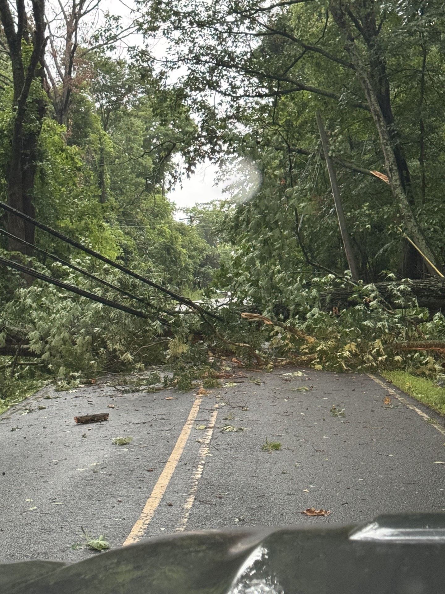
couple of more

-
Let’s raise a cold one to this
-
Islip just gusted to 51
-
E PA/NJ/DE Summer 2025 Obs/Discussion
mcwx replied to Hurricane Agnes's topic in Philadelphia Region
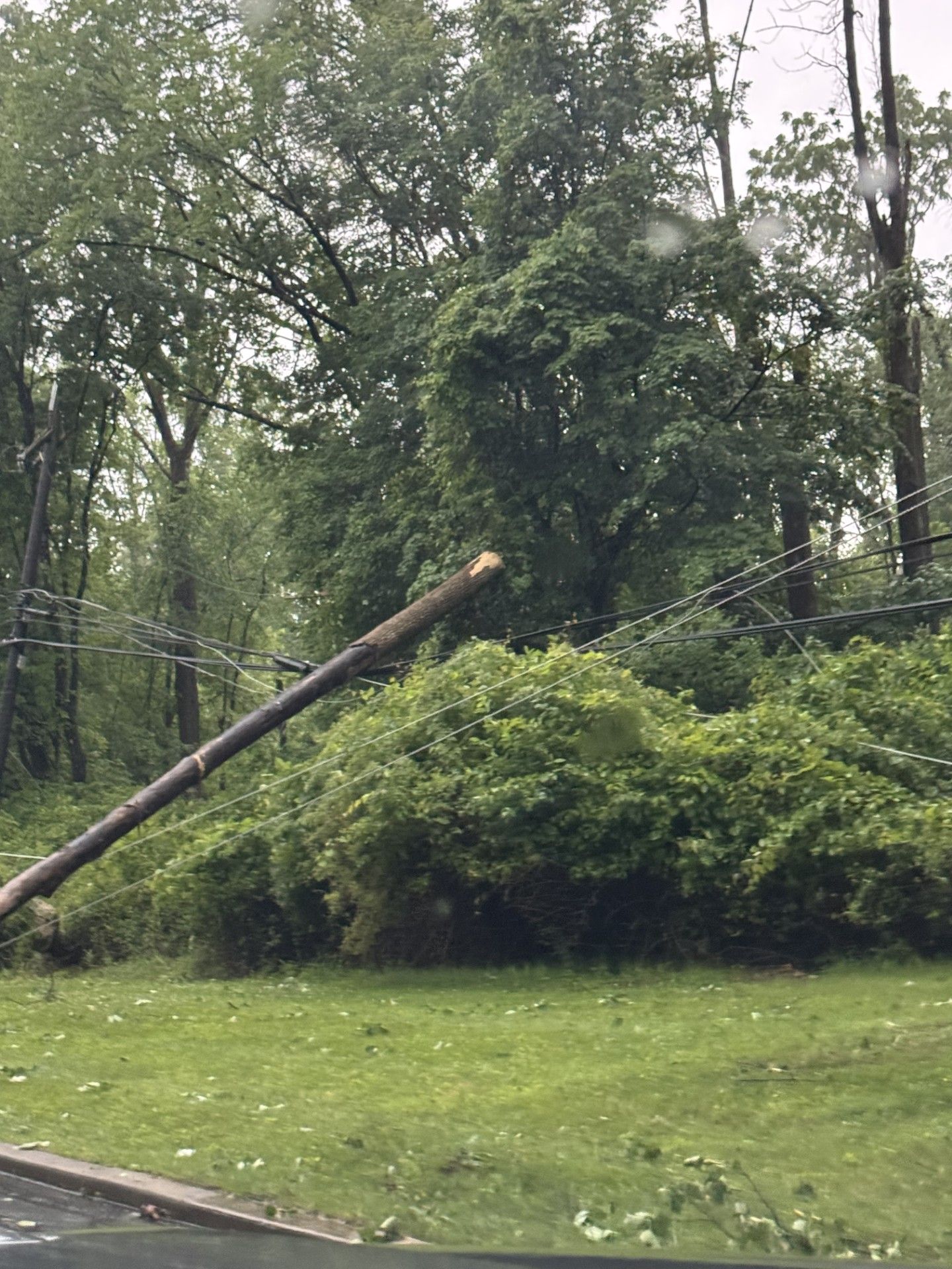
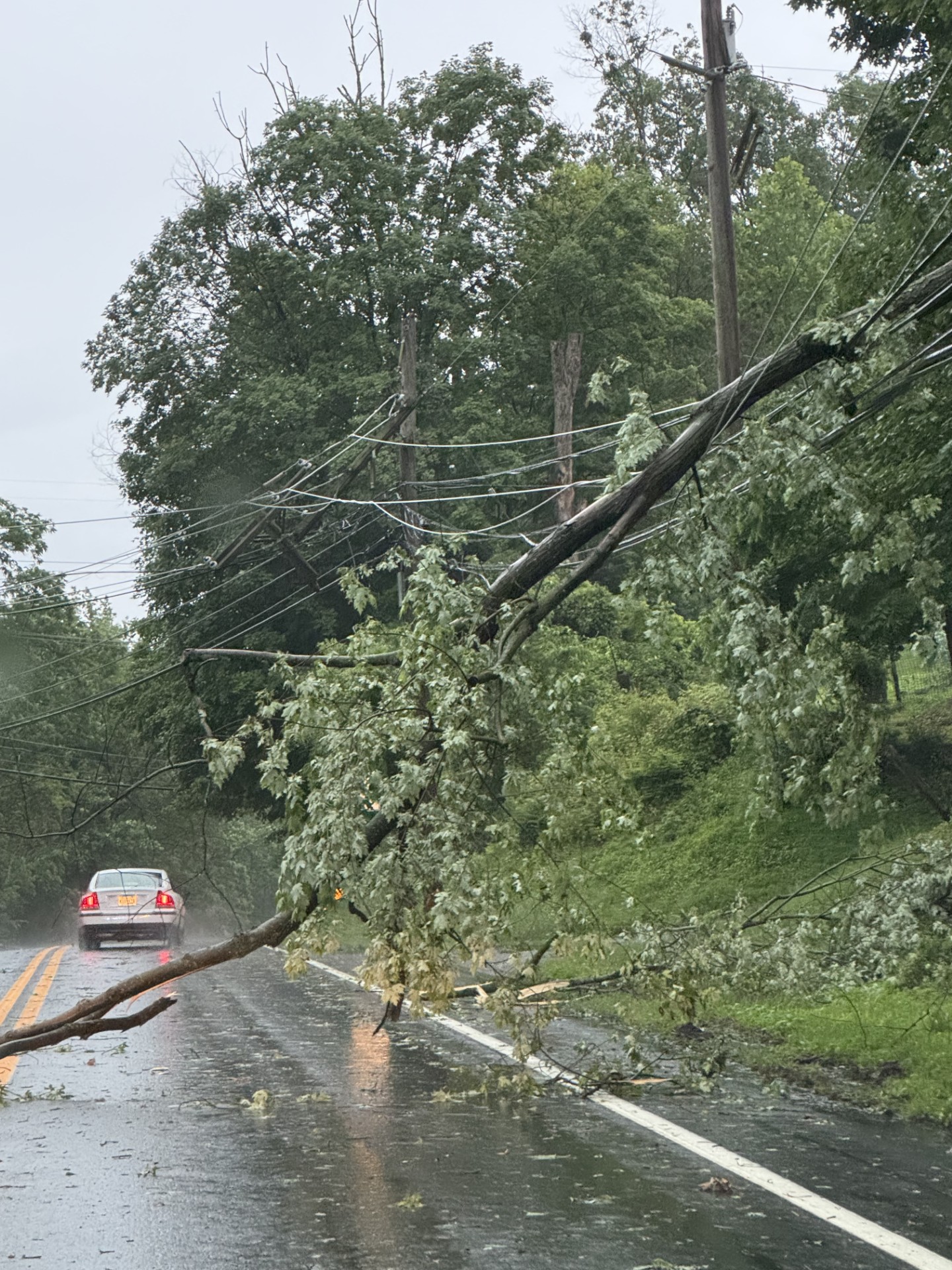
Some of the damage around the Lambertville area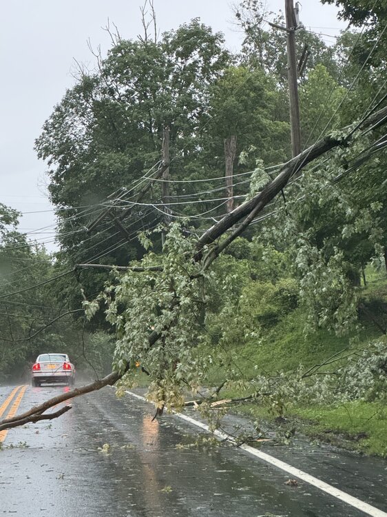

-
About 0.35” per local PWSs. Slightly above normal month to date at this point. But if it doesn’t rain again until next weekend-ish, probably will still dry up quick with that heat.
-
It’s possible the higher wind gusts missed the Mesonet but hit my house. I’m a little northeast of the meso station location. Either way, power came on around 730. But did go out for dinner and a lot of tree damage in my little area of Parkton.
- Yesterday
-
Thunderstorm season finally up and running. Plenty more chances coming up
-

2025 Lawns & Gardens Thread. Making Lawns Great Again
CoastalWx replied to Damage In Tolland's topic in New England
Haven’t noticed red thread but peak green is about gone now with these conditions. -
I’m hoping it never happens, one of the biggest things I worry about on this island. Cat 3 or worse would be catastrophic for us.
-
Another line of storms firing just to the west. Can hear the thunder. Still looks like it will mostly slide to the NW. At some point a direct hit has to happen, right? Lol its been uncanny this month.
-
Miss those days
-
I used to love fishing Lake Garda when I was a kid. Big bluegills and lots of them. Used to go with my buddy Jimmy Johnson and then we'd clean em up and cook em on the grill.
-
Light rain and some thunder now. Some gustier wind from the outflow boundary a few minutes ago. Lots of twigs and smaller branches down from the storm before but thankfully nothing bigger.
-
Outflow from the storms approaching here from the southwest just blew through here. Probably higher wind than during the storm we had a hour and a half or two hours ago. That one fizzled a little as it approached and was pretty brief but dropped .40" of rain with some thunder in an intense squall.
-

Central & Eastern Pacific Thread
LongBeachSurfFreak replied to Windspeed's topic in Tropical Headquarters
Would have really gone to town if it had more time after the EWRC. -
You could see that it gusted out in MD while it didn’t in VA. We had no outflow boundary.