All Activity
- Past hour
-
Today's Highs: rain doing its part to keep the park overgrowth and cooler ACY: 84 PHL: 84 New Brnswck: 83 LGA: 83 EWR: 82 BLM: 82 JFK: 82 TEB: 81 TTN: 80 ISP: 80 NYC: 79
-
Finally getting some decent rain' Flash Flood Warning TNC037-149-187-200230- /O.NEW.KOHX.FF.W.0031.260720T0030Z-260720T0230Z/ /00000.0.ER.000000T0000Z.000000T0000Z.000000T0000Z.OO/ BULLETIN - EAS ACTIVATION REQUESTED Flash Flood Warning National Weather Service Nashville TN 730 PM CDT Sun Jul 19 2026 The National Weather Service in Nashville has issued a * Flash Flood Warning for... Southeastern Davidson County in middle Tennessee... Northwestern Rutherford County in middle Tennessee... Northeastern Williamson County in middle Tennessee... * Until 930 PM CDT. * At 730 PM CDT, Doppler radar indicated thunderstorms producing heavy rain across the warned area. Between 1.5 and 2 inches of rain have fallen. Additional rainfall amounts up to 1 inch are possible in the warned area. Flash flooding is ongoing or expected to begin shortly.
-
Best storm in weeks is coming though,even knocked our power off brieftly
-
 While the rest of his team decided to start a brawl with Spain.
 -
 Makes me wonder if people even go outside anymore. It’s almost like they look out the window and are disappointed a catastrophe isn’t happening.
 -

2026 Mid-Atlantic Severe Storm General Discussion
ThePhotoGuy replied to Kmlwx's topic in Mid Atlantic
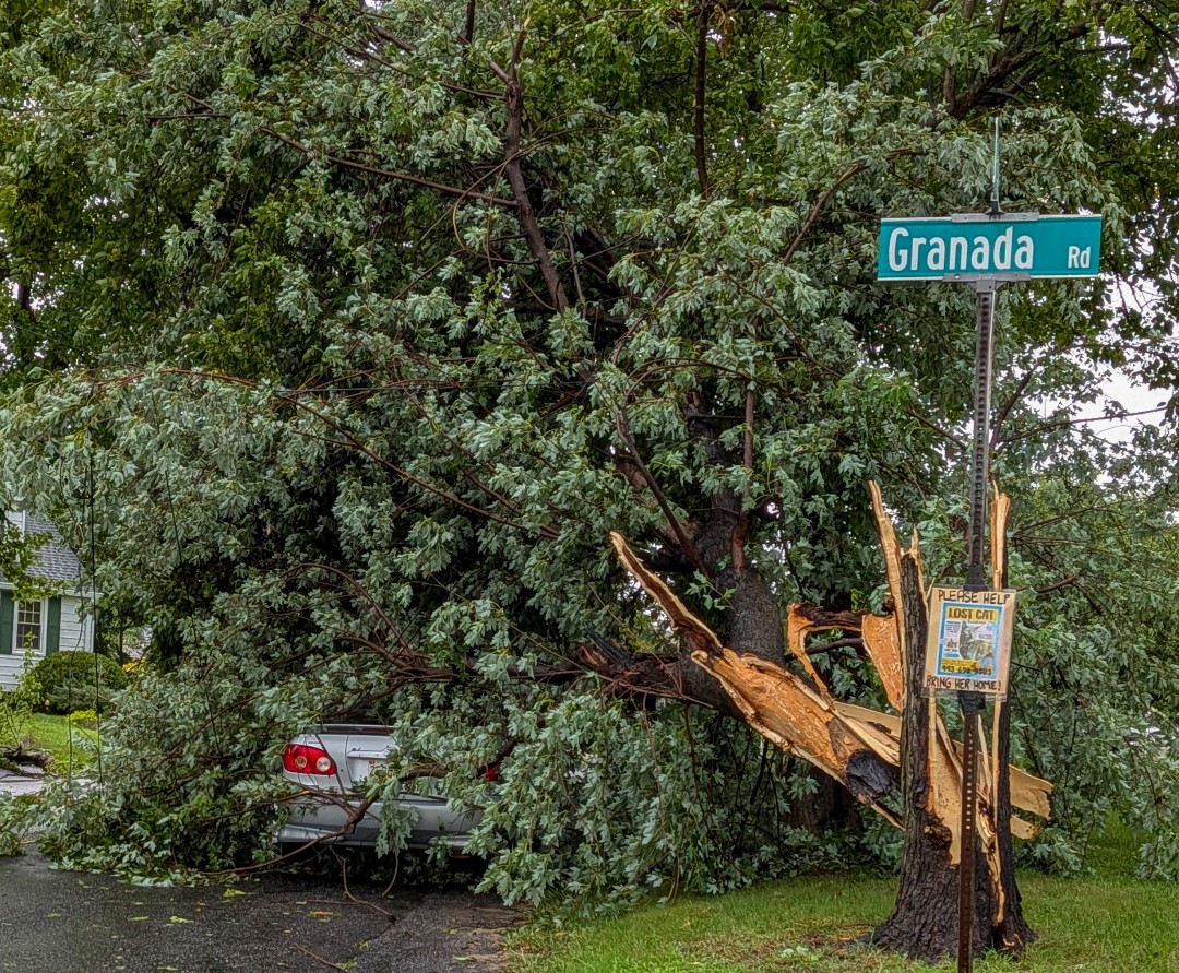
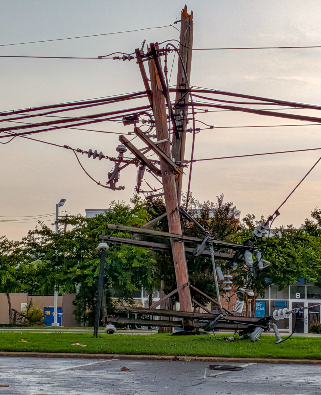
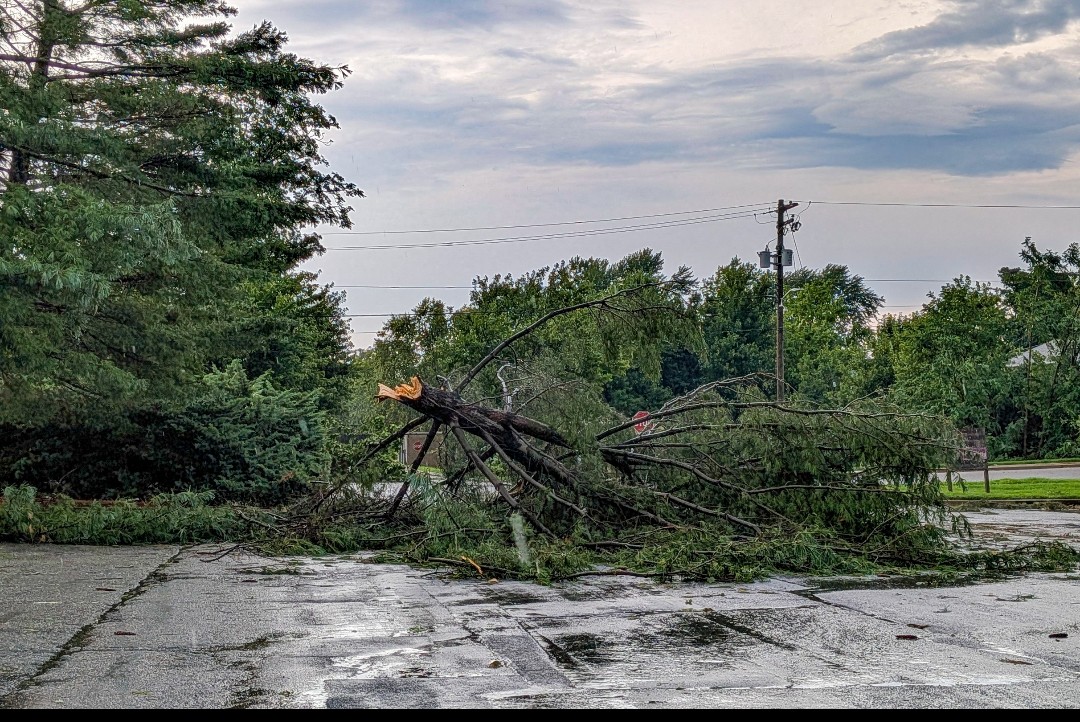
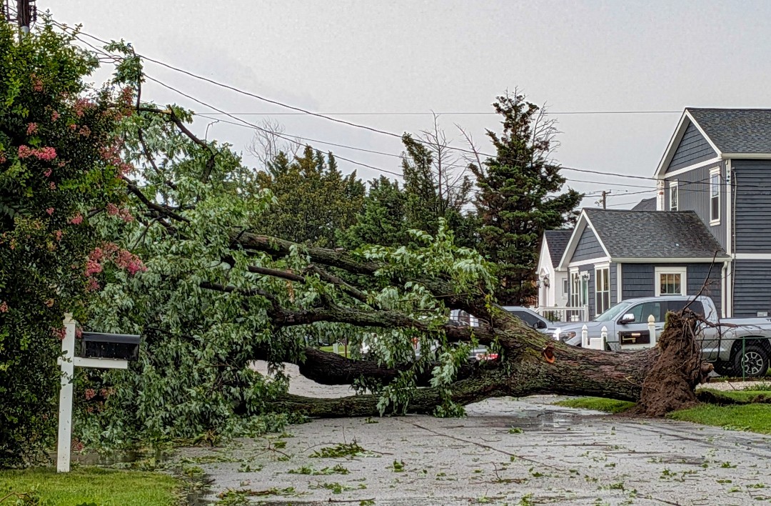
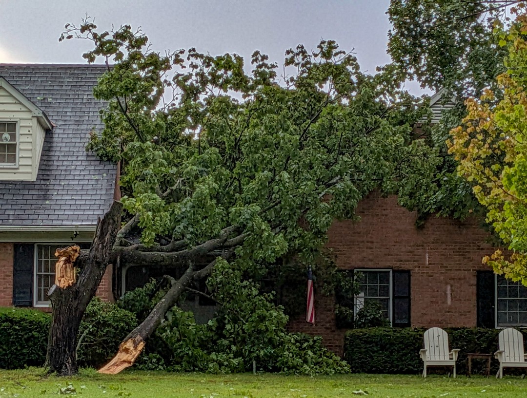
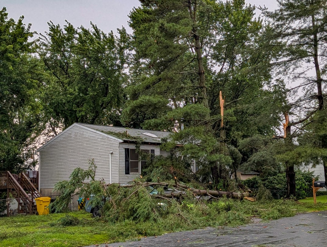
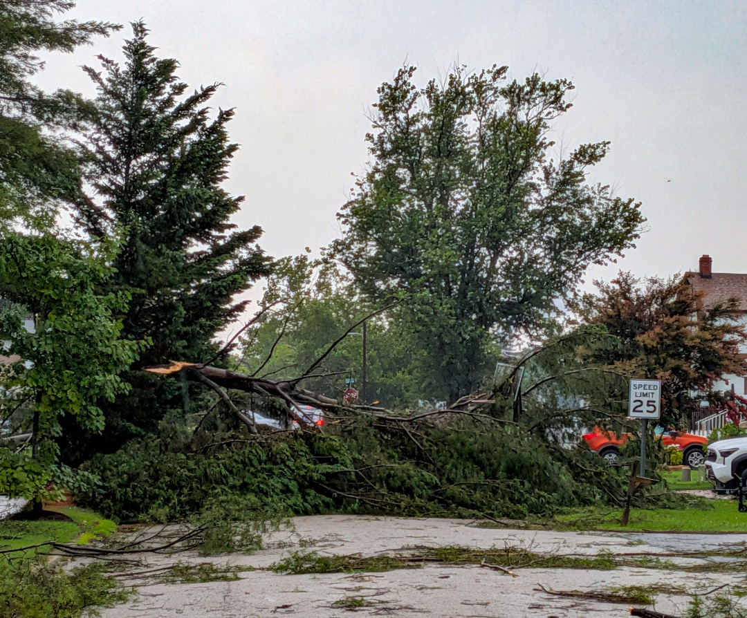
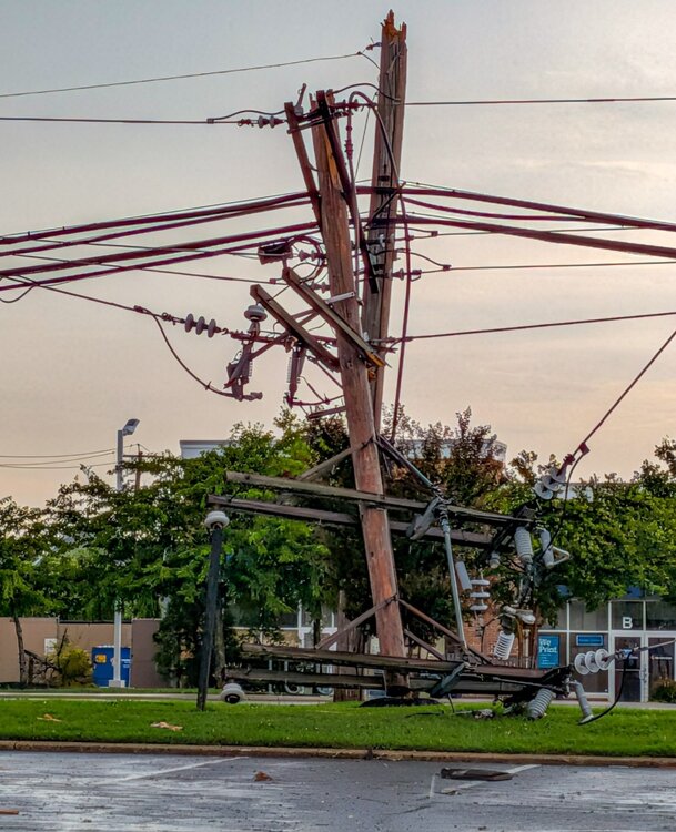
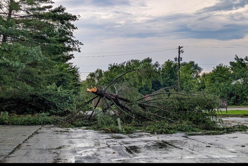
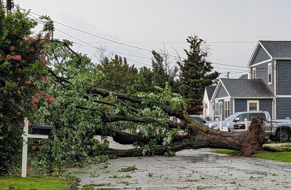
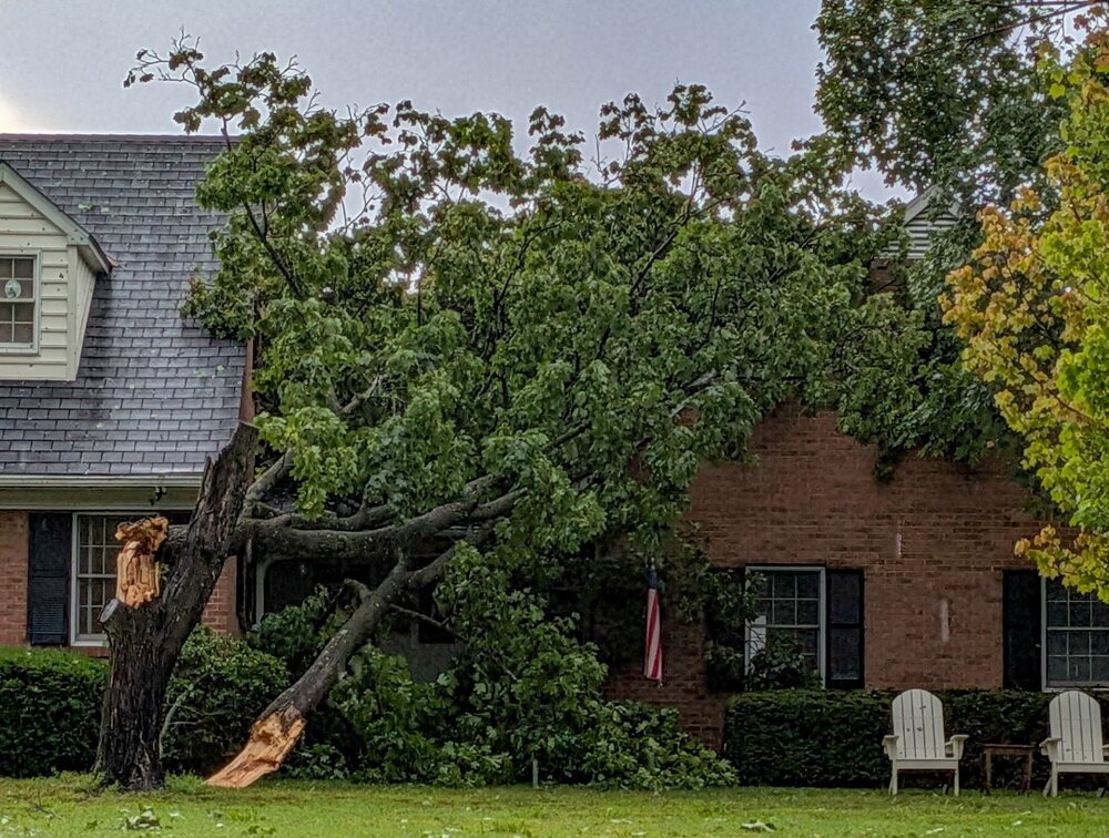
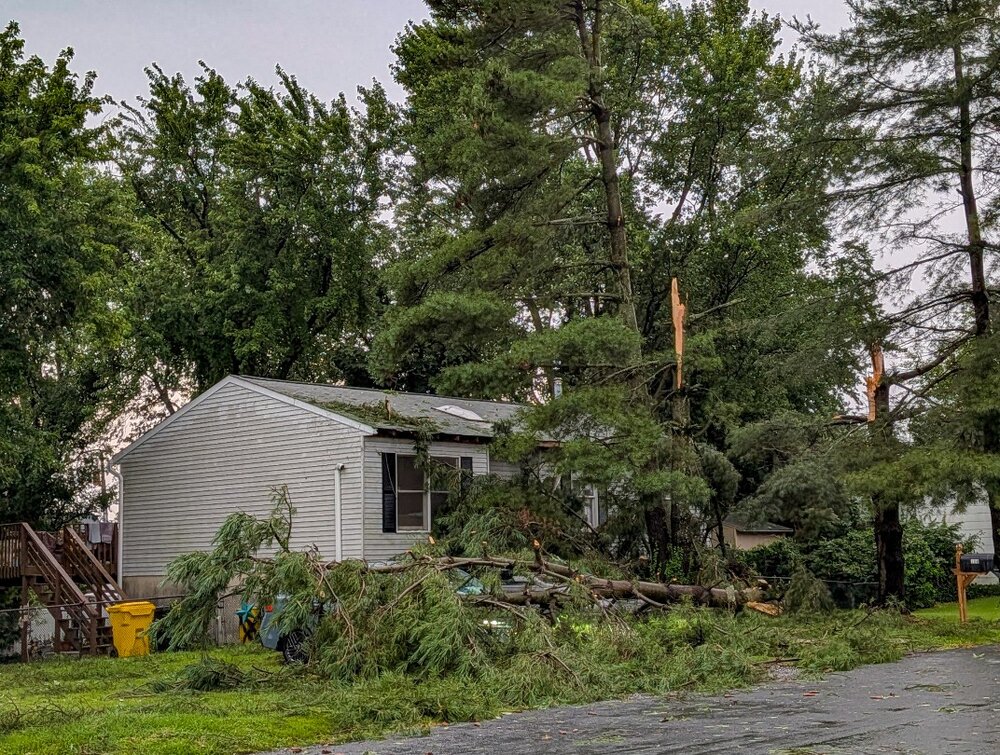
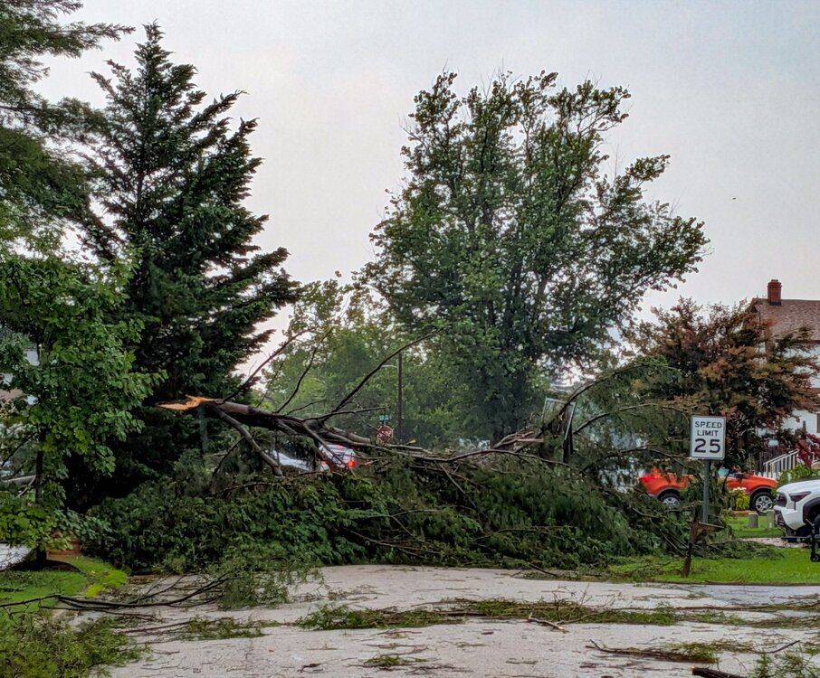
This was the strongest and most damaging storm that I have ever witnessed in my area in Pasadena. At least 10 times worse than the derecho. Over 2 dozen trees knocked down on homes and cars in my neighborhood and another community. I saw at least 5 homes marked unsafe for entry by county inspections. I haven't ventured further down Fort Smallwood where there is even more destruction.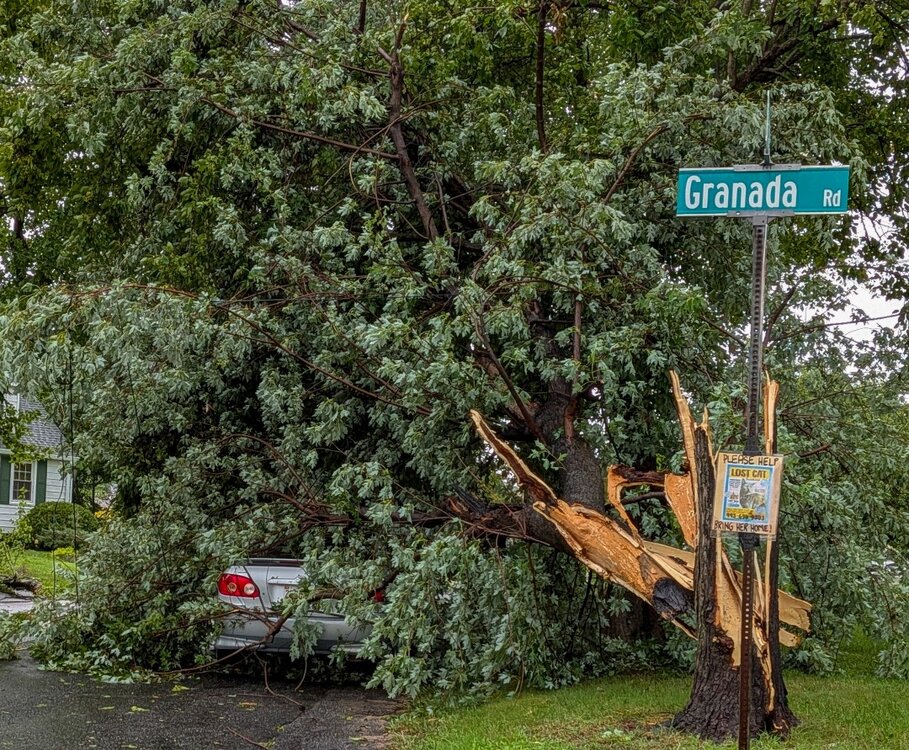
-
Same shit, year in and year out. Sad.
-
 Are you new here?
 -
For those hoping for damage; May a tree in your yard get uprooted into your house, rain pour in the busted roof, and black mold make it unlivable. There, ya all happy now? LOL
-
Ah, no! We may get rain on Tuesday/Wednesday, but unless the fire department needs to pump out basements, it will “meh” and the focus will return to “drought”.
-
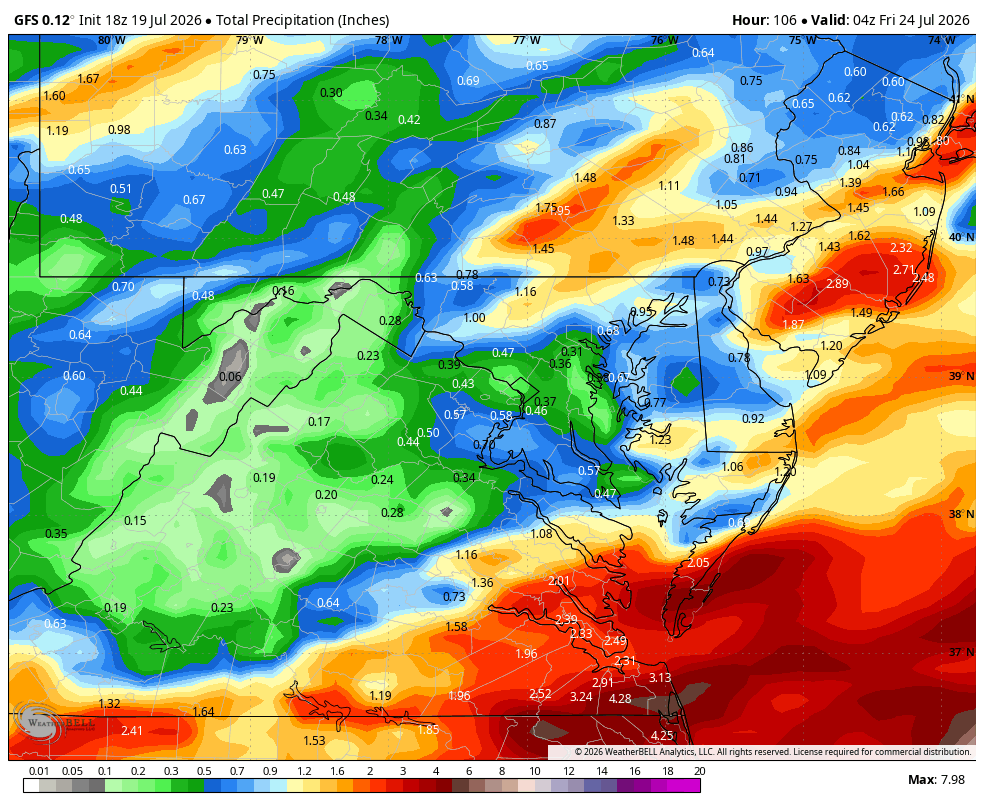
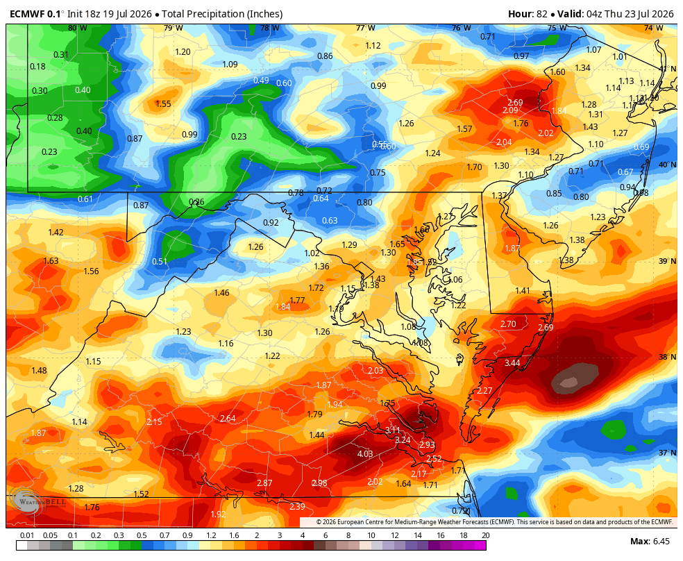
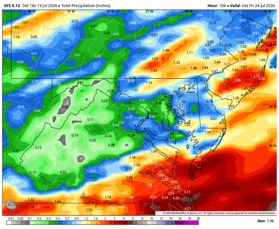
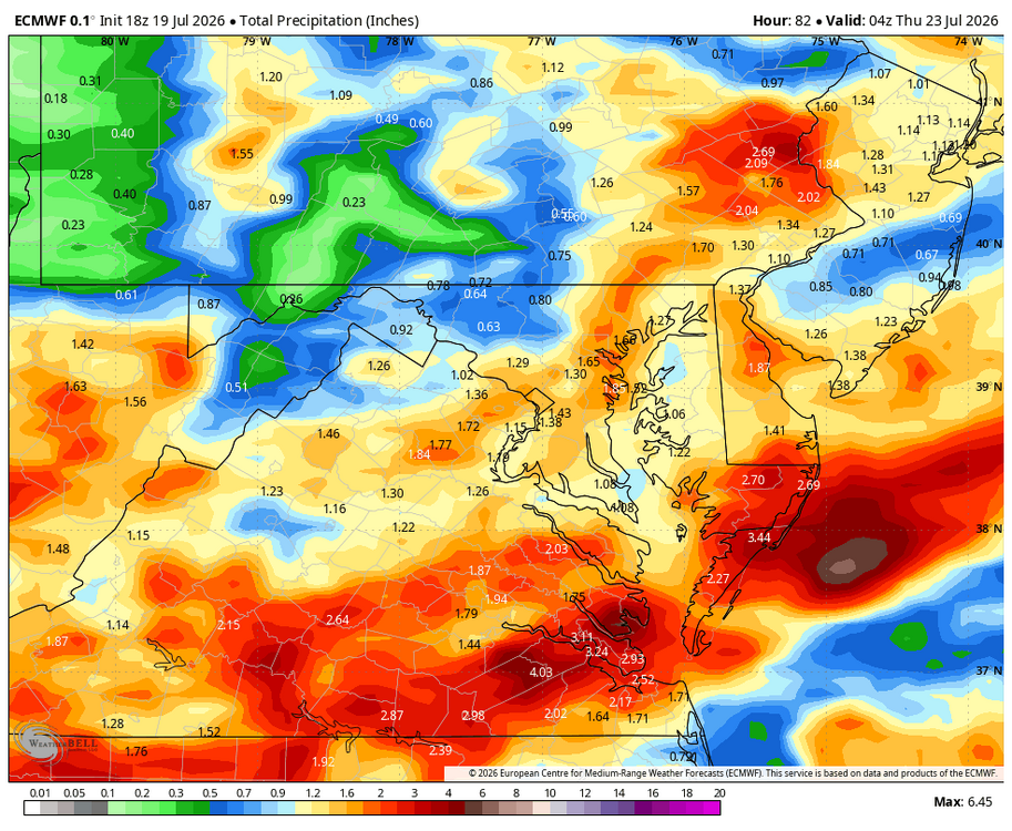
WB 18Z GFS and EURO for midweek rain.
-
 Im going to enjoy the next week of weather.. pretty much perfect for Summer
 -
at least average temps start going back down in a couple days..
-
This place is something. It’s either wish casting for unbearable cold and snow in the winter or unbearable heat and humidity in the summer. Everything in between is something to bitch about. SMFH!
-
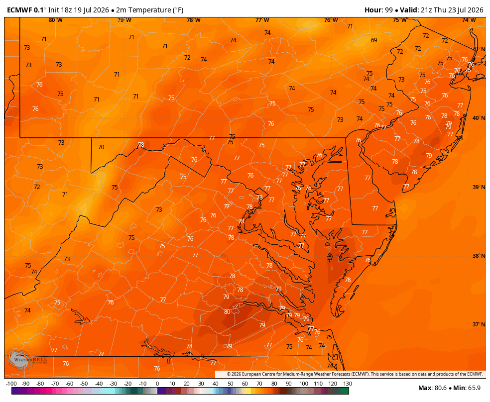
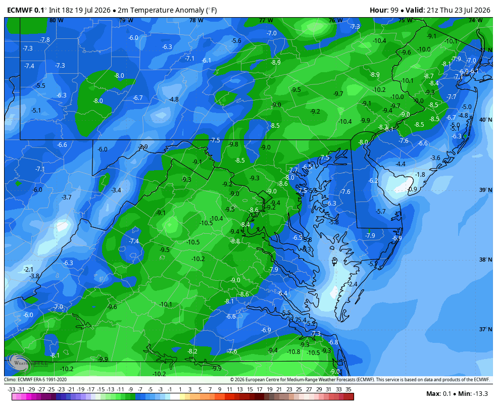
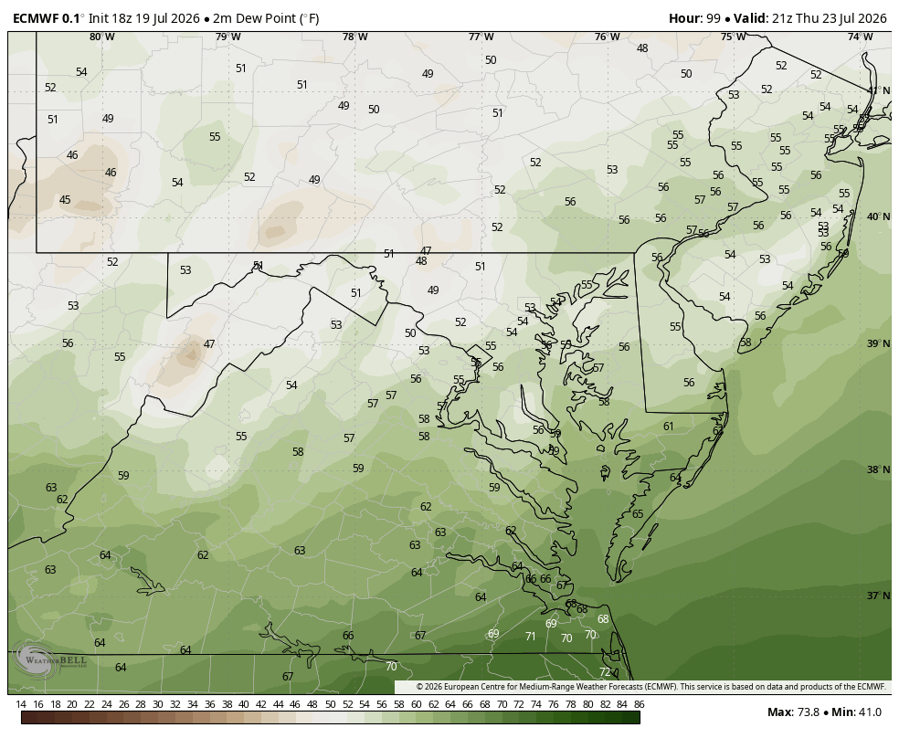
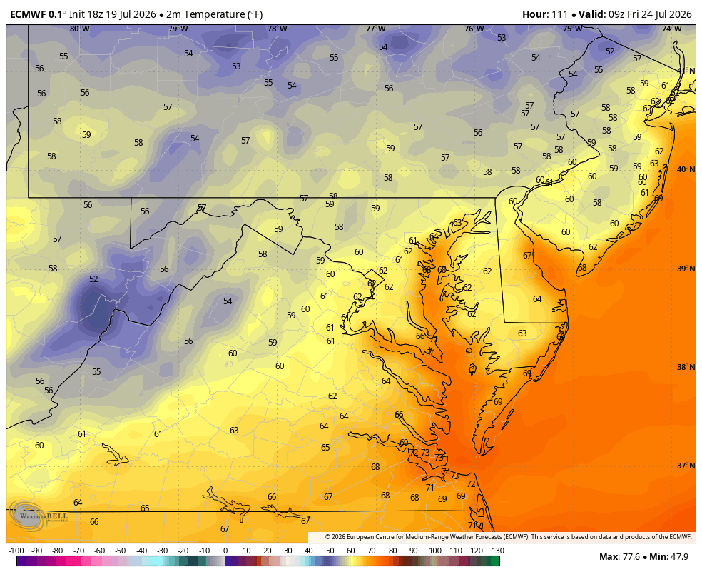
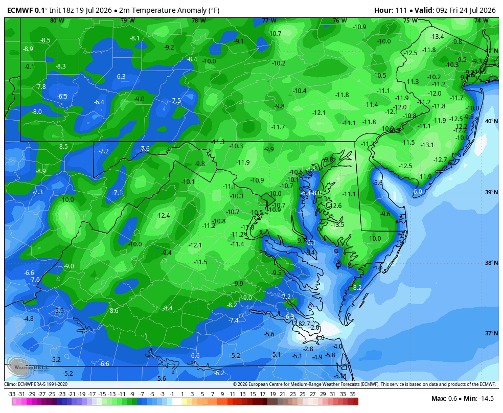
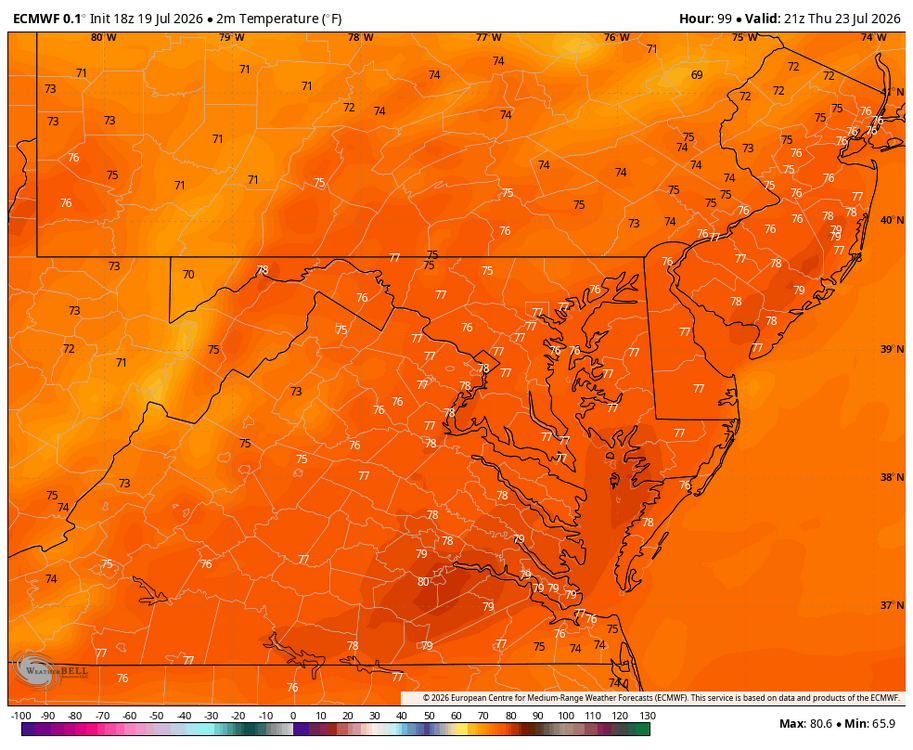
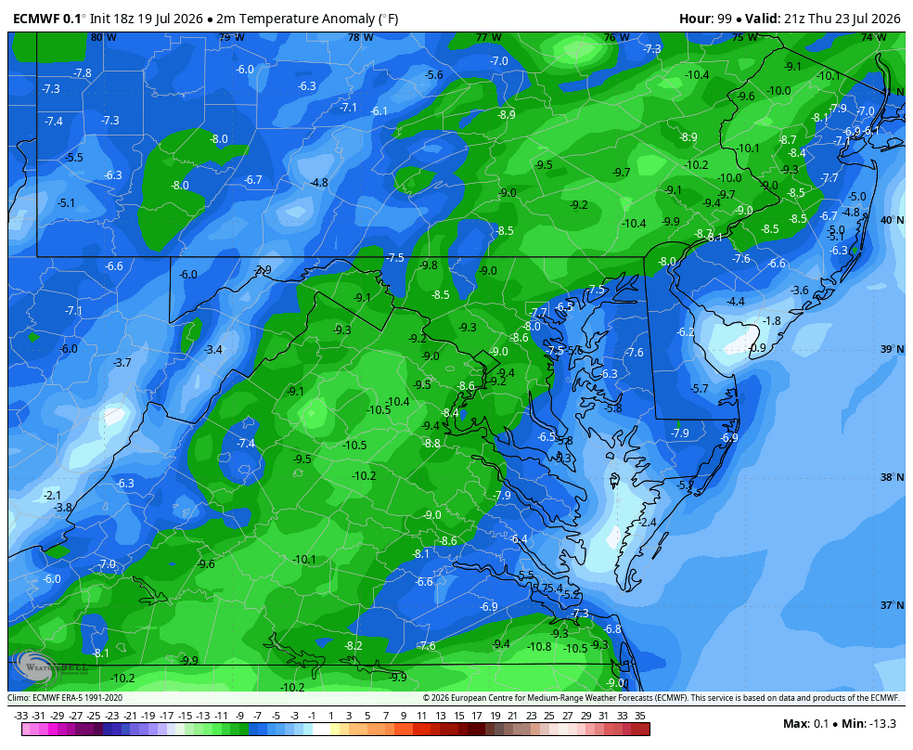
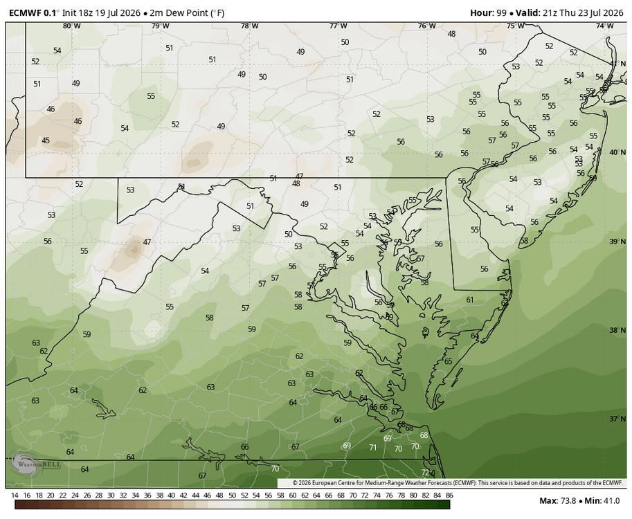
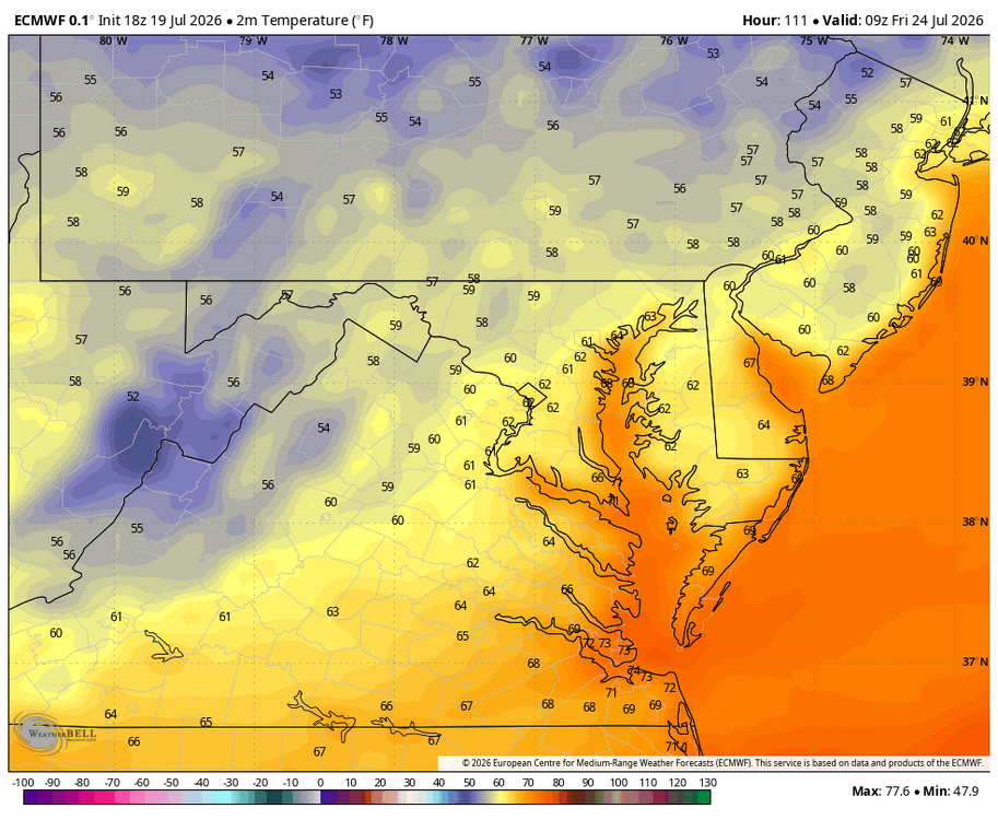
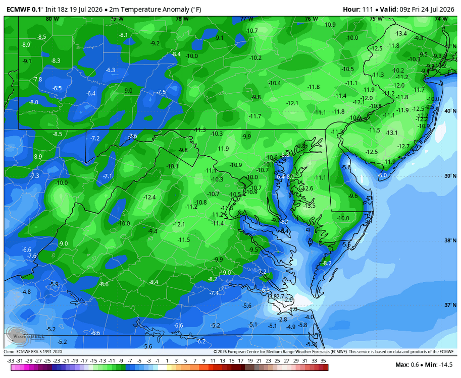
Looks like some spectacular, can I say late summer and early fall like weather for Th. And Friday... low dewpoints; and comfortable temps! Lows in the upper 50s in NW areas Friday am! WB 18Z EURO.
- Yesterday
-
Considering those 100 degree days, it is a little surprising the month may end up near normal.
-

Pittsburgh PA Summer 2026 Thread
Mailman replied to TheClimateChanger's topic in Upstate New York/Pennsylvania
Severe threat going to materialize on Tuesday? -
 63.4°/51.5° here at WXW2 Hoping I can get some clear skies tonight for some nighttime photography.
 -
So, you’re hiding in the climate controlled house. Got ya.
-
 Shorts are on from late Morch (ish) - Tgiving (ish)
 -
Mark McGuire, Sammy Sosa, and Barry Bonds were crushing homeruns when the league average was .270
-
A focus on the "three true outcomes" - walk, strikeout or home run. It's led to guys swinging for the fences or getting on base with walks or striking out a ton.
-
You bundled up like Wiz on days like this?
-

2026-2027 Super El Nino
Stormchaserchuck1 replied to Stormchaserchuck1's topic in Weather Forecasting and Discussion
2.0 ONI in mid-July is pretty impressive. JJA ONI has never been higher than +1.6c [1997, 2015] since 1950. -

2026-2027 Super El Nino
GaWx replied to Stormchaserchuck1's topic in Weather Forecasting and Discussion
Don’t forget that CDAS is slightly cold biased. But this chart isn’t relative. Relative OISST is in the +1.6-+1.7 range. I’m guessing that tomorrow’s weekly relative Nino 3.4 release will have it at +1.5 with +1.6 on the high end.