All Activity
- Past hour
-

Hurricane Erin: 160 MPH - 915mb - W @ 16
Floydbuster replied to BarryStantonGBP's topic in Tropical Headquarters
I believe that we all have a right to post threads, make comments, and show our enthusiasm and love for hurricanes. We all share a common passion for weather, and all aspects of meteorology. The guy is excited and loves to post.... ...then again if he aggravatives me too much I'm gonna have to silence him on ignore. -

2025 Short Range Severe Weather Discussion
sbnwx85 replied to Chicago Storm's topic in Lakes/Ohio Valley
Des Plaines getting rocked too. Inch plus hail. -

Hurricane Erin: 160 MPH - 915mb - W @ 16
DDweatherman replied to BarryStantonGBP's topic in Tropical Headquarters
When tracking season gets heavy we’re gonna need a muzzle for Barry -
Typhoon League?
-

Hurricane Erin: 160 MPH - 915mb - W @ 16
Wannabehippie replied to BarryStantonGBP's topic in Tropical Headquarters
Is Erin under going a ERC? blob:https://www.tropicaltidbits.com/7eca5388-017a-47ce-ba1f-5432dbb94754 -
2025 Short Range Severe Weather Discussion
sbnwx85 replied to Chicago Storm's topic in Lakes/Ohio Valley
Hearing from the gf’s dad that Crystal Lake got a good hit. 50+ mph winds. -
Hurricane Erin: 160 MPH - 915mb - W @ 16
Wannabehippie replied to BarryStantonGBP's topic in Tropical Headquarters
Latest from NHC. 5:00 PM AST Sat Aug 16 Location: 20.0°N 64.0°W Moving: W at 15 mph Min pressure: 915 mb Max sustained: 160 mph -

Hurricane Erin: 160 MPH - 915mb - W @ 16
NavarreDon replied to BarryStantonGBP's topic in Tropical Headquarters
https://x.com/maxvelocitywx/status/1956828865252172028?s=46&t=0ZvB_AF2VfA6c0SDxf53yA . -
 Just missed us
-

Hurricane Erin: 160 MPH - 915mb - W @ 16
bugalou replied to BarryStantonGBP's topic in Tropical Headquarters
I am not sure how many younger people are on here, but as an older head watching the tropics since the late 80s, I cannot stress how rare this is. The fact this is the third year in a row this happened and Erin arguably did it even faster and more efficiently than previous years is concerning. There have been a couple RI bombs in the Pacific too. I hope someone is working on a study as to what is driving this. Obviously CC is involved, but other processes/factors have to be involved and I think shoving it all in a CC column maybe leaving some good science on the table. In any case my jaw hit the floor waking up today and seeing What Erin did. Thank God its a fish. -
That was before the epic region wide fail streak.
-
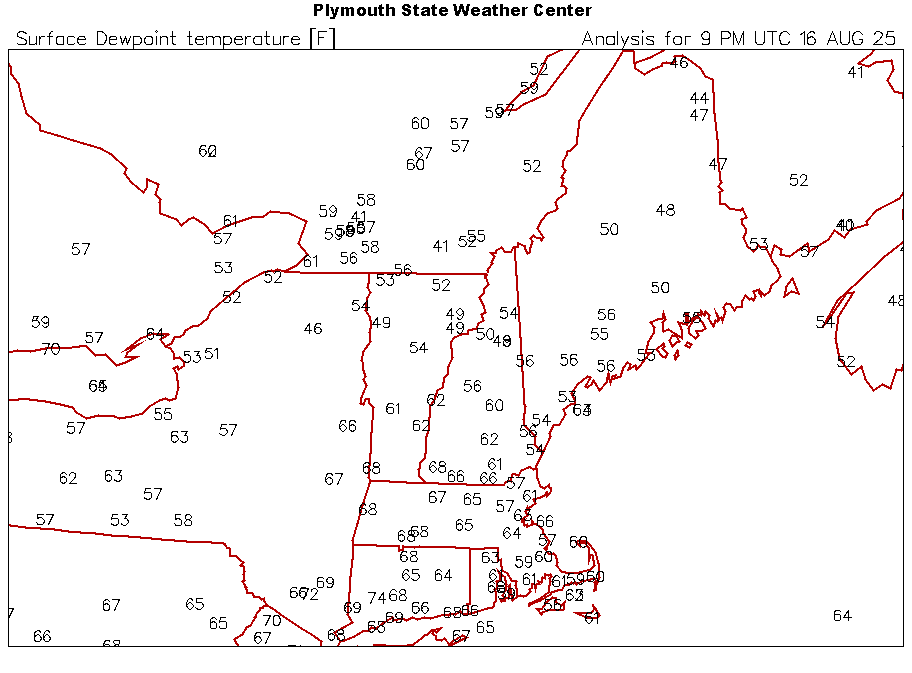
Dry heater. 90/47 at BTV for 23% RH. It’s beautiful out. 86/51 here. Deep blue. No humidity at all but warm. Didn’t realize there was such a dew boundary. Temperatures actually seem hotter north under drier air.
-

2025 Short Range Severe Weather Discussion
Malacka11 replied to Chicago Storm's topic in Lakes/Ohio Valley
Looks like a decent hit incoming -
Gotta wonder with Erin coming farther NW .. what will that do to the mild down next week? Delay it, maybe increase dews for a day .. ??maybe even a Pre somewhere that’s not modeled quite yet . She is definitely going to affect and change the look to some degree next week . We just don’t know
-
90/80 here in Cedar Rapids. This is as hot as it has been all summer.
-
It’s Dewey here all day thankfully . Never dried out Was out enjoying it in various ways in yard
-
I should be banned for this statement. 18z NAM. Anyone wanna look? BULLETIN Hurricane Erin Advisory Number 22 NWS National Hurricane Center Miami FL AL052025 500 PM AST Sat Aug 16 2025 ...CATEGORY 5 ERIN CONTINUING TO PASS NORTH OF THE NORTHERN LEEWARD ISLANDS... ...NEW TROPICAL STORM WATCH FOR THE TURKS AND CAICOS ISLANDS... SUMMARY OF 500 PM AST...2100 UTC...INFORMATION ---------------------------------------------- LOCATION...20.0N 64.0W ABOUT 135 MI...220 KM NNW OF ANGUILLA ABOUT 175 MI...285 KM NE OF SAN JUAN PUERTO RICO MAXIMUM SUSTAINED WINDS...160 MPH...260 KM/H PRESENT MOVEMENT...W OR 280 DEGREES AT 15 MPH...24 KM/H MINIMUM CENTRAL PRESSURE...915 MB...27.02 INCHES Shouldn't ERIN be written off by NOW?
-
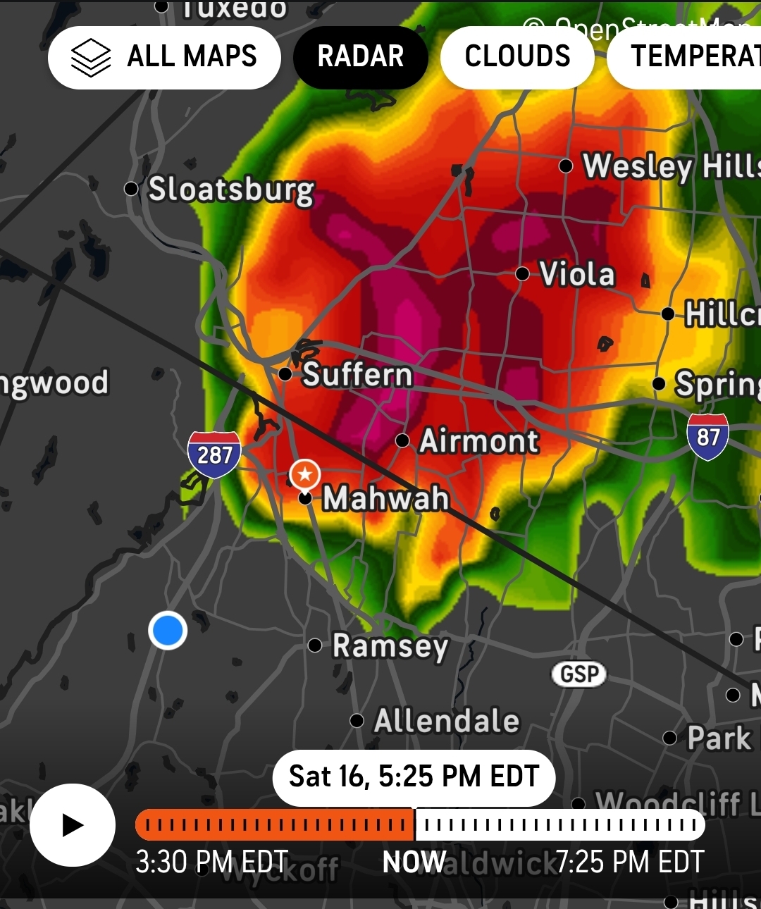
Skies are very very dark to my north above the NY/NJ state line by Mahwah, NJ
- Today
-
What a beautiful display of raw natural power this evening out there in the tropical Atlantic. The water vapor imagery is very impressive. It looks like it wants to tighten up that outflow and become a supercane overnight tonight.
-
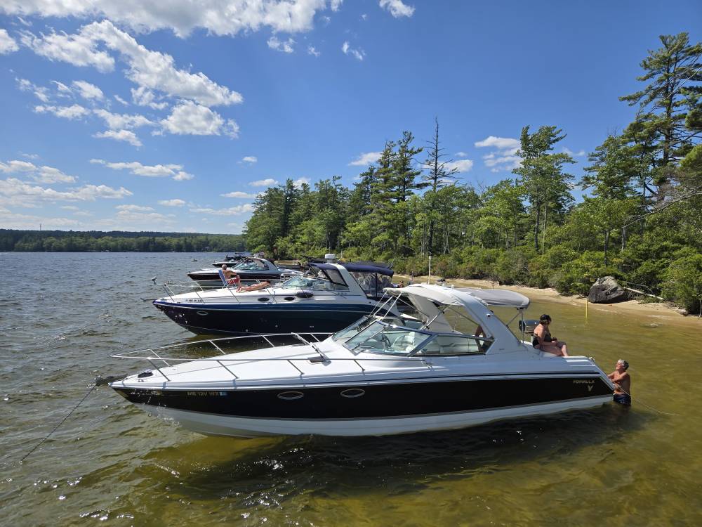
What a shitty lake day Sent from my SM-S921U using Tapatalk
-
 Tomorrow will turn briefly warmer with highs reaching the upper 80s and lower 90s acros the region. Afterward, a shift toward cooler weather lies ahead. Noticeably cooler air will overspread the region tomorrow night and Monday. High temperatures will likely reach the upper 70s Monday through Wednesday and then the lower 80s on Thursday. The extended range guidance continues to suggest that the closing week of August could feature below normal temperatures. Precipitation could be near normal. The synoptic pattern should limit direct tropical cyclone threats for the foreseeable future. Impacts from elevated tides, surf, and rip currents would be the most likely effects produced by Erin as it tracks well offshore between the U.S. East Coast and Bermuda. The ENSO Region 1+2 anomaly was +0.8°C and the Region 3.4 anomaly was -0.3°C for the week centered around August 6. For the past six weeks, the ENSO Region 1+2 anomaly has averaged +0.50°C and the ENSO Region 3.4 anomaly has averaged -0.15°C. Neutral ENSO conditions will likely continue into early autumn. The SOI was -4.37 today. The preliminary Arctic Oscillation (AO) was +0.333 today. Based on sensitivity analysis applied to the latest guidance, there is an implied 57% probability that New York City will have a cooler than normal August (1991-2020 normal). August will likely finish with a mean temperature near 75.6° (0.5° below normal). Supplemental Information: The projected mean would be 0.4° above the 1981-2010 normal monthly value.
 -
 High of 86 here. 6-day “heat wave” finished.
 -
Humidity def tickling up. Stuffy
-
Congrats on 1-3”