All Activity
- Past hour
-

2026-2027 Fall/Winter Mountain Thread
Tyler Penland replied to BlueRidgeFolklore's topic in Southeastern States
9. 95", looks like there was a little zone from Linville up this way that got the highest totals. Widespread 7-8 though, at least on the south/east side. Couple of my employees are stuck with small land/mudslides and flooded roads. Overall main roads in the county are fine. The low water levels prior definitely saved some big problems. Sent from my Pixel 10 Pro using Tapatalk -
1.47 so far, rain seemed to slow down now.
-
-
2.15
-
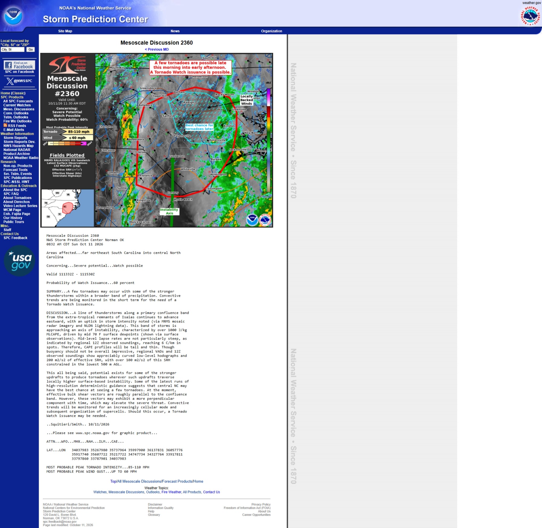
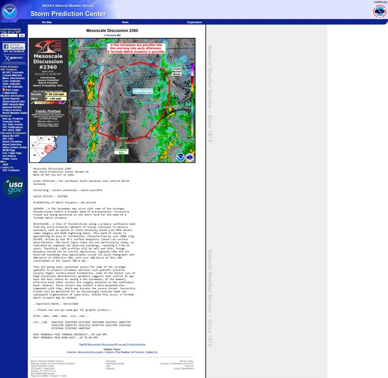
Had some thunder and torrential rain for several hours just after sunrise. Flash flood warnings went up. Some more boomers moving in now. Sitting around 1.5" in my yard but 20 miles to my west had a 4-5" bullseye. Should have no problem crossing 2" with the convective stuff moving thru
-
First lake effect next Saturday?
-
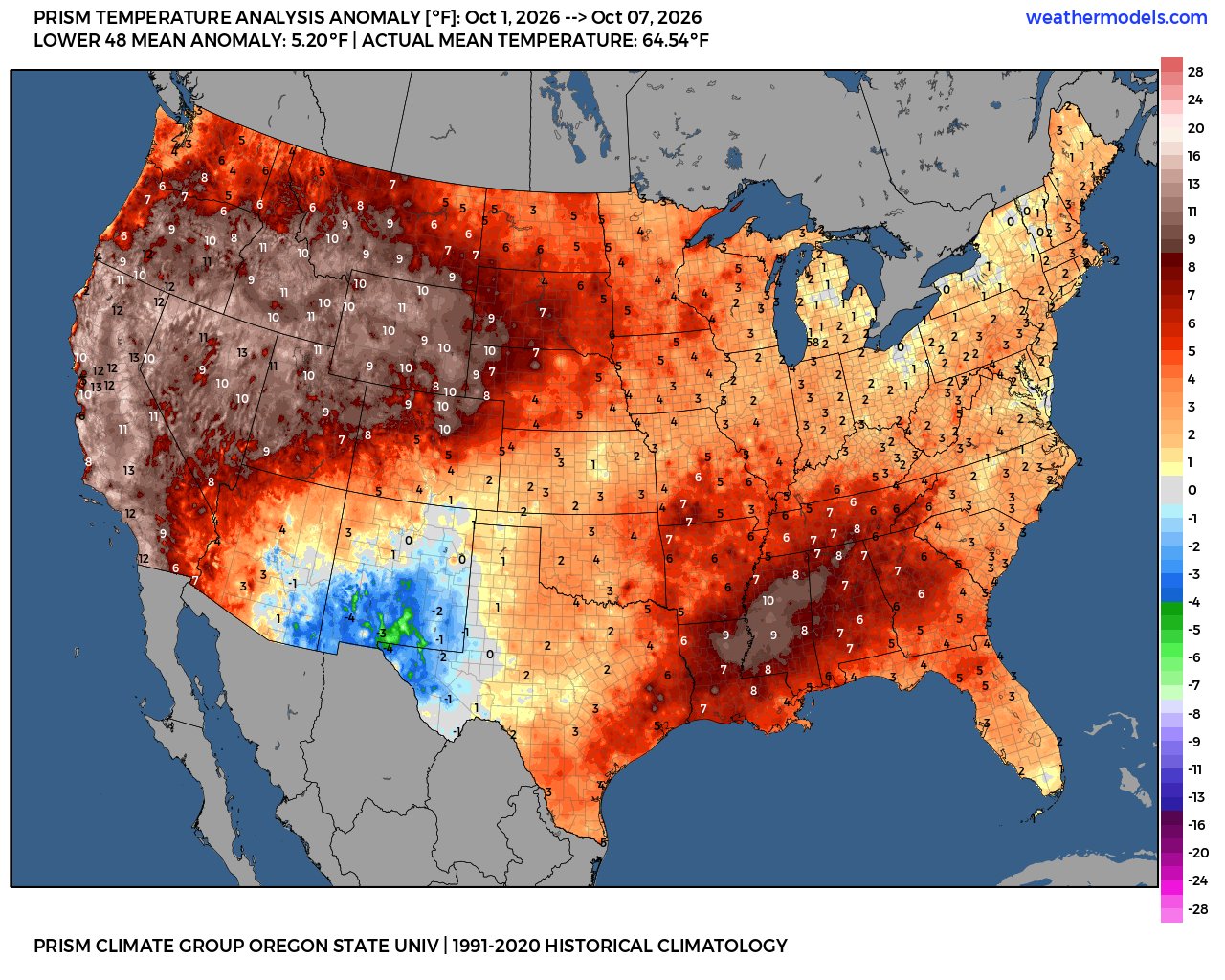
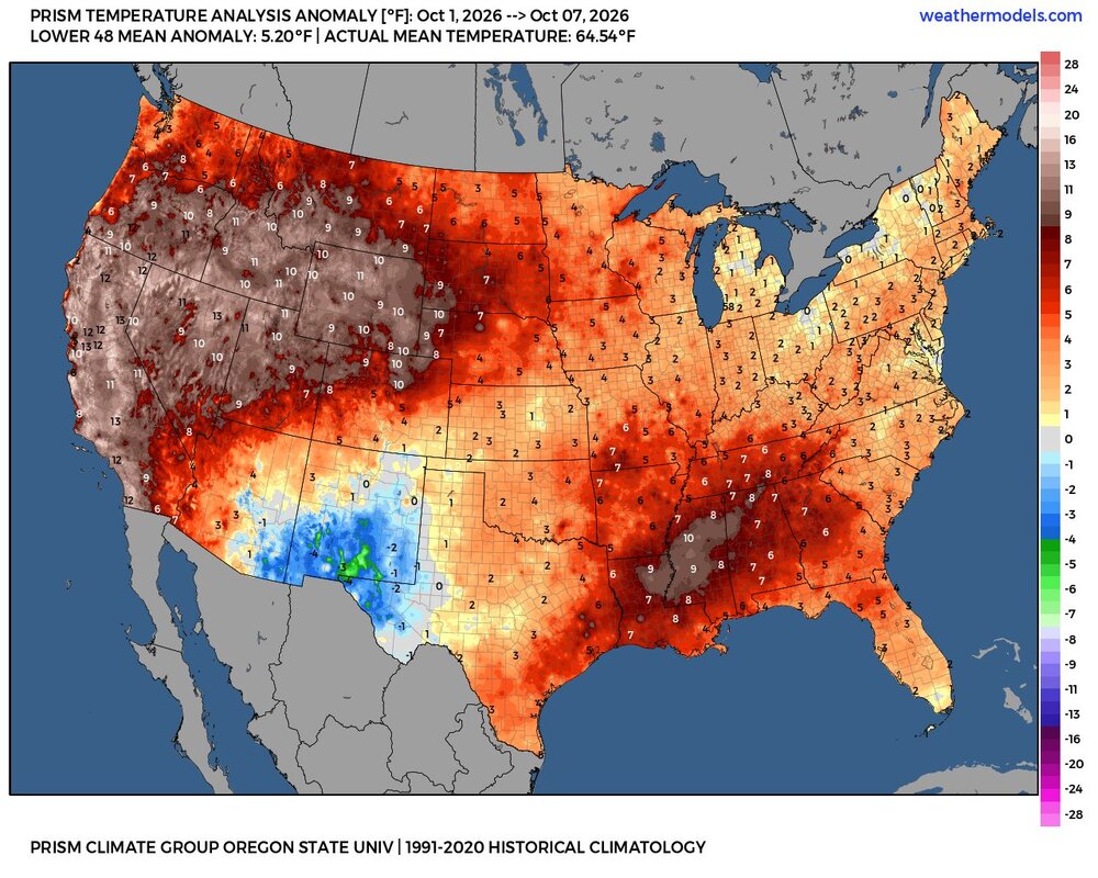
Wow. It's amazing how month after month we ge these massive +10F areas encompassing huge swaths of the conus. And little to no cool anomalies at all! In the past if the west torched then the east was cool and vice versa, but for the past 7 months its just been conus wide torch.
-
Just passed an inch with a nice downpour. And I now know which gutter is clogged.
-
Pouring rain. Already at .70”
-
Congrats Frederick and along the Blue Ridge. Those areas looked socked in with really heavy rain. Just scrapes here east of 95. It looks like it ends here shortly with only a few showers for today. Good day for a hike. Looks like a flood potential in the Catoctins.
-
2026-2027 Fall/Winter Mountain Thread
Buckethead replied to BlueRidgeFolklore's topic in Southeastern States
3.96" here and 4" of leaves. Definitely more than I expected. Sent from my SM-S948U using Tapatalk -
Rain piling up now: 0.70” .
-
Yea the radar is pretty meh.
-
Keep wishing
-
Yesterday I had to go down to Acushnet for a soccer game and the foliage looked great in those remote areas of Southeast mass. Those areas from Middleborough to Acushnet may as well be eastern Tennessee as far as I’m concerned. No wonder why contentweather guy is like southeast mass’ shallow grave zone.
-
It’s a terrible place
-
 lopressor 50 mg side effects: MetoCardioRx - Lopressor safe dose range
 -
Just passed 2".
-
Grand total of 0.01” overnight. It just cannot rain here anymore
-
“Long holiday weekend”…?
-
The first week of October finished near the warmest on record for the CONUS. The average for the CONUS from October 1-7 on Prism was 64.54° or +5.2°. So we’ll have to wait a while longer to get the final number. October 2026 through the 7th….64.54° +5.2° Top 7 Warmest October for CONUS 1963…59.34° 2024…58.93° 1947….58.50° 2016….57.45° 1950…..57.45° 2015…..57.24° 2021…..56.95°
-
.54” and radar has nothing significant for a few hours at least if ever. Kinda disappointing but expected with recent CAMs down here. Every storm recently has had a precipitation hole here.
-
Lets hope that happens with the snow this winter.
-
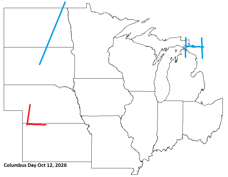
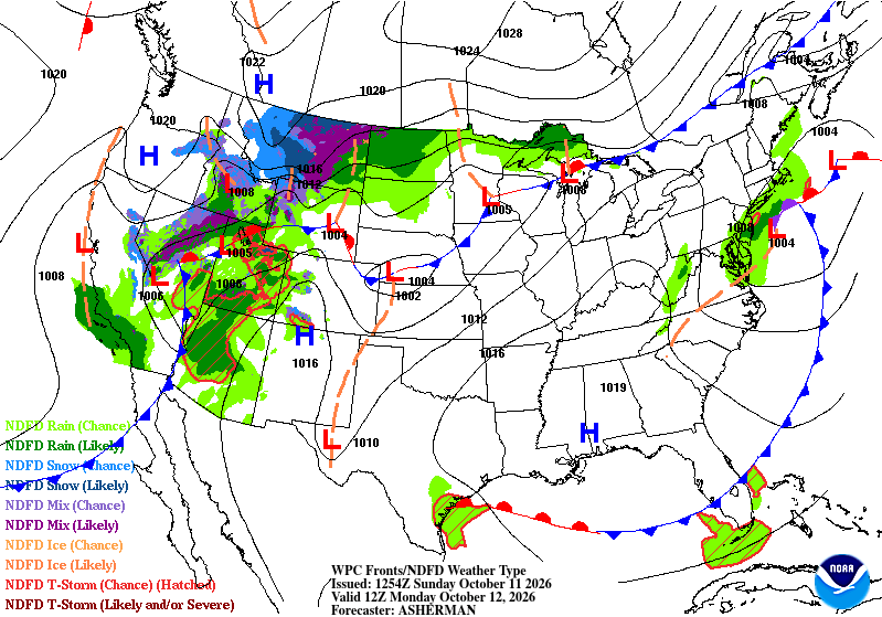
So-so cast for this day. Front lays up across the Lakes bringing wet wx across the N Lakes.
-
Ended up with 6.62 storm total. Thankfully the Catawba never reached flood stage.