All Activity
- Past hour
-

January 24-26: Miracle or Mirage JV/Banter Thread!
Eskimo Joe replied to SnowenOutThere's topic in Mid Atlantic
I'm coping hard too. -
I tell you what I particularly like about this one at the moment. It looks like the snow starts in the morning. Feels like it’s been forever since we’ve had a big one do that. I remember the ‘96 blizzard was like that and it just made it all the more special.
-
See his note about Thursday nights 00z runs being key....
-

“Cory’s in LA! Let’s MECS!” Jan. 24-26 Disco
SouthCoastMA replied to TheSnowman's topic in New England
Euro is 12"+ here with 10:1. Likes the secondary for round 2 -
ya those squalls to the west looks fun! hoping they hold.. ya hopefully we increase as we get closer
-

January 25-26 Winter Storm Potential
zenmsav6810 replied to Ralph Wiggum's topic in Philadelphia Region
Expecting a NAM'ing at 18z. -
Haha I’m at the age now where I don’t even care to go back and fix typos. My brain will spew information that I can’t type fast enough so I definitely understand. We got a few for other models to roll in, I recommend going over to Google and playing with the AI to see what it spits out for you LOL .
-
Wow.
-
This has been one heckuva a north "trend" from just a few days ago. If AI can conquer longer range weather forecasting one day that will be a truly impressive feat.
-
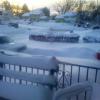
That was an epic storm. 24" of snow in Damascus, 5" in Takoma Park. We had nearly dry roads in southern Montgomery County, while upcounty it was snowing hard.
-

Southern MD / Lower Eastern Shore weather discussion
PrinceFrederickWx replied to PrinceFrederickWx's topic in Mid Atlantic
I don’t think I’m beating my snow total from Jan. 6 last year (11.6”). We’re on the wrong side of this like Feb. 2014 I think. -

Possible Record Breaking Cold + Snow Sunday 1/25 - Tuesday 1/27
SnoSki14 replied to TriPol's topic in New York City Metro
Agree 100% Rare possibility of more upside than downside I think. Also if precip falls hard enough near the transition zone that we could hold onto snow longer boosting amounts by 2-4" -

Pittsburgh/Western PA WINTER ‘25/‘26
MikeB_01 replied to Burghblizz's topic in Upstate New York/Pennsylvania
12z EPS looks like the 00z. Same idea -
Yeah the early charts were a little light on snow and ice. Euro is in line with the national charts from WPC. MRX will update accordingly. I still feel safe in Chattanooga. I see trouble from Knoxville northeast. Separately, lol I was just kidding about the AI. Guess it's so.
-
I was just telling Andy and Randy in our group chat that as long as I can stay snow until noon, I’m good. Hopefully a foot on the ground before the inevitable flip to sleet
-
I feel like we just automatically use the euro as the sole gospel and discount every other model. Again, I know the euro is King, but with this logic, we should just use the euro and not look at anything else. People are cliff diving prematurely. It could trend more NW, but we aren't looking at pure rain. It's major ice when we do flip. And then cold AF. Whats to hate about that?
-
I have to think modeling is FINALLY feeling the effects of those big highs. Cold air is just pouring down the west flank of the Apps. I looked at the wind on this morning's runs(after reading MRX's write up about mountain waves being possible), and you can see the cold just running parallel to the Apps and making a beeline southward.
-
Some was, but Mt Airy actually got close to close to 20” from the front end thump. There was a band that setup over there area down to Clarksburg that absolutely crushed them. Never forecast until the last minute. That can happen with these setups. Never know!!
-

January 24-26: Miracle or Mirage JV/Banter Thread!
EHoffman replied to SnowenOutThere's topic in Mid Atlantic
Nope just coping -

Possible Record Breaking Cold + Snow Sunday 1/25 - Tuesday 1/27
jm1220 replied to TriPol's topic in New York City Metro
This reminds me of the 12/17/20 storm overall-SWFE type system that transfers to a coastal system. 8” here from that one. -
The time stamp has yesterday's date
-

“Cory’s in LA! Let’s MECS!” Jan. 24-26 Disco
WxWatcher007 replied to TheSnowman's topic in New England
I know this is a little OT, but oh my GOD, I just had an epic squall roll through here. Pure whiteout conditions. I ran outside barely clothed. Let’s bring hours of this for all Sunday-Monday Absolute weenie dream in some of the numbers being spit out. -
And make him shovel.
-
 Monday morning with maybe some snow showers into the afternoon. There are differences on the guidance and those details will become clearer in subsequent model cycles.
 -
This is Ai, not a forecast. As of the afternoon of Thursday, January 22, 2026, there are several indications that the Arctic high-pressure system is trending stronger and faster than models originally predicted earlier in the week. This shift is a key driver for a potential "snow surprise" in Sweetwater, TN. Here is the current data: 1. Near-Record Central Pressure The high-pressure system currently over the Northern Plains is exceptionally dense. Newest model data shows a central pressure of 1050 to 1052 mb. The Trend: Meteorologists have noted that this is near record-high pressure for the region at this time of year. Significance: A higher central pressure means the cold air mass is heavier and more difficult for a southern storm to "push" north. 2. The European Model "Correction" One of the most telling signs is the behavior of the European (ECMWF) model, which is often considered the most reliable. In the last 24 hours, the ECMWF has significantly "corrected" its forecast, shifting its surface high further south and making it stronger to align with the colder GFS (American) model. This correction suggests that the model was previously underestimating the strength of the cold air "brick wall". 3. Faster Southward Plunge The Weather Prediction Center (WPC) and local NWS offices have noted that the Arctic air is plunging south faster than previously predicted. For Sweetwater, this means the cold air may already be "locked in" at the surface before the heaviest moisture arrives on Saturday. A faster-moving high helps set up Cold Air Damming (CAD), where cold air gets "wedged" against the mountains, potentially preventing the "warm nose" from ever reaching the ground. What This Means for Sweetwater's "Snow Surprise" Because the high is proving to be so robust, it is creating a southward suppression of the storm track. If the high stays this strong, it could shunt the low-pressure system far enough south (into Central Alabama/Georgia) to keep the "warm nose" completely away from the Tennessee Valley. Result: This would flip the forecast from a "messy mix" back to all snow, potentially leading to much higher accumulations than currently forecast. Current Verdict: The high is indeed verifying as stronger than earlier model runs suggested. While this doesn't guarantee all snow, it significantly increases the odds of a colder, snowier outcome for East Tennessee compared to the "rainy mix" forecasts from yesterday. .