All Activity
- Past hour
-
TundraT8 started following 1/23/26-1/25/26 Winter Storm Thread
-
Just as long as it isn’t squash city
-

Central PA Winter 25/26 Discussion and Obs
mahantango#1 replied to MAG5035's topic in Upstate New York/Pennsylvania
I'm wondering the same thing, and will there be wind ? -
Sorry I corrected the post too many models/ pictures.
-

January 2026 regional war/obs/disco thread
40/70 Benchmark replied to Baroclinic Zone's topic in New England
It's like the pre Xmas 2024 event, but stronger storm and better airmass. -
Northern Maryland still in the uprights for now.
-
Possible Record Breaking Cold + Snow Sunday 1/25 - Tuesday 1/27
NJwx85 replied to TriPol's topic in New York City Metro
The primary hanging on too long can sometimes be problematic. If I recall that was the issue with March 2001. -

Central PA Winter 25/26 Discussion and Obs
mahantango#1 replied to MAG5035's topic in Upstate New York/Pennsylvania
Looks like you have me beat on that low temp. Mine is -2.2 Congratulations on your low! -

January 2026 regional war/obs/disco thread
WinterWolf replied to Baroclinic Zone's topic in New England
My meaning to Paul was, at first this was just a huge overrunning event., then all of a sudden a phase was introduced, and a potential coastal was starting to emerge. Now that seems to be the idea for areas further east. -
Richmond Metro/Hampton Roads Area Discussion
RVASnowLover replied to RIC Airport's topic in Mid Atlantic
Hopefully we see some positive trends today. -
Ah, yes. The classic panic swings. We've been here before and we will again. It's what makes if fun no matter what!
-
-5° for the low here, back up to -4° now.
-
I get it. But yall wanted it further north hahaha
-

January 2026 regional war/obs/disco thread
40/70 Benchmark replied to Baroclinic Zone's topic in New England
Yes, good call. -
We only get a chance like every 10 years at a clean storm. We don't want to waste it on sleet. We can do that any winter lol.
-
I BRING THE MOJO.
-
January 2026 regional war/obs/disco thread
tavwtby replied to Baroclinic Zone's topic in New England
-4.2 this morning looking forward to this weekend -
Low of 7 this morning. Still just 7.3 degrees. Brrr
-

January 2026 regional war/obs/disco thread
40/70 Benchmark replied to Baroclinic Zone's topic in New England
I added this after: . (Phase 8) it's become a unicorn since the west Pacific warmed. This is why. -
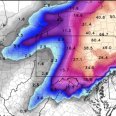
Central PA Winter 25/26 Discussion and Obs
pawatch replied to MAG5035's topic in Upstate New York/Pennsylvania
Anyone worried about power outages with the weekend storm? -
You're right. There are more overamped EPS scenarios, but the goal posts are still pretty wide.
-
2025-2026 Fall/Winter Mountain Thread
ncjoaquin replied to Buckethead's topic in Southeastern States
I have read that it is ingested, but that it would take a couple cycles to show up in the model result. Down to 11.8 this morning! -
.thumb.png.4150b06c63a21f61052e47a612bf1818.png)
January 2026 regional war/obs/disco thread
HIPPYVALLEY replied to Baroclinic Zone's topic in New England
Jeezum crow, low of -6F wasn’t expecting that. -
lol yall are gluttons for punishment
-

January 25/26 Jimbo Back Surgery Storm
Thrasher Fan replied to Jimbo!'s topic in Southeastern States
FFC discussion. .LONG TERM... (Thursday night through Tuesday) Issued at 204 AM EST Wed Jan 21 2026 Thursday into Friday will have our first push of rainfall as a quick shortwave pushes through the main trough over the eastern CONUS. QPF amounts are expected between 0.5-1" over northern Georgia. the precipitations should remain in liquid form but some higher elevations of the North GA mountains may see some mixed precip Fri morning. No accumulations expected. Fri night into Sat morning will be the beginning of the main wintery precipitation. Saturday into Sunday we will begin to see the overall troughing pattern begin to dive south into the southeastern U.S. while the low pressure system currently off the Pacific begins to push inland. This setup creates an atmospheric river from the Mexican Pacific coast, across the entire southern U.S., and out across to the Carolinas beginning Fri afternoon. The timing of how this Pacific low pressure system moves is going to in turn factor into how long we are expecting potential impacts. Current timing has this system moving rapidly across the south states through the weekend and up the eastern seaboard and pulling out of GA Monday morning/early afternoon. Some things to talk about with this event. This is shaping up to be a potentially high impact event with moderate to major impacts. With this amount of model consistency in the overall setup we are gaining confidence that this could be a long duration event as well. With initiation as early as Saturday afternoon and wintry precip looking to extend into Sunday night/Mon morning. At this point we are confident that wintry precip will affect north Georgia for areas along and north of I-20. The area south of I-20 down to Macon and Columbus are a little more uncertain but models are consistently forecasting wintry precip for this area as well. A few factors into how much/what type of wintry precip we receive are the influence of the wedge expected to take shape and then how far north the front pushes. When it comes to the wedge, current thinking is that snow will be the main precip type for far north Georgia and wintry mix/freezing rain will become the main concern for the remainder of the north Georgia including the ATL/AHN areas. There is still a decent shot that we see this freezing rain transition to more of a snow event as we get into late Sunday and Monday but that is still uncertainty. Focusing on the probabilistic information for now. --> 40-50% chance for 0.5" or greater of ice accumulation through the weekend for the areas north of I-20. --> 25-30% chance for 0.75" or greater of ice accumulation through the weekend for the areas north of I-20. --> 15-20% chance for 1" or greater of ice accumulation through the weekend for the areas north of I-20. --> 30-45% chance for 2" or greater of snow accumulation through the weekend for the areas north of I-20. For now the main thing to focus on is being prepared for a potentially high impact event this weekend. We will likely see more changes over the coming days but please make sure you have a plan to endure this event which could include power outages. Once this system exits the area Monday, a good portion of north GA will continue to see impacts as Temps Mon are not expected to get to much above freezing. Any accumulations that linger will most likely continue through Tue when temps are expected to get up into the upper 30s to near 40.


