All Activity
- Past hour
-
Yeah just a bad overall setup for our areas. Several days of action in the Missouri Valley, and then it skips over and impacts areas east for Tuesday.
-
Models are really crapping this line out as it moves into eastern Iowa later tonight. Models are also driving tonight's line well south through Missouri, which then leads to everything on Monday developing and staying down there. This might end up being a big dud of a weekend for areas around here.
-
sunset tonight
-
Or a CBell scenario…. Either way… ill be there. .
- Today
-
Not worth a conversation once you get these compressors installed… Microclimate your house with mini splits to switch between as needed and be done with it. No conversation required. not getting dragged into, but I will say it’s odd. You guys spend so much time worried about whether other people manage their thermal aversions.
-
38F at 6am when I woke up and left the tent to relieve myself at Split Rock Lighthouse State Park. 42F around 2pm in Duluth letting the kids run around the Lake Superior Maritime Museum in Canal Park. 70F around 5pm when we rolled into the driveway in Minneapolis.
-
Really rooting for severe weather around 4 PM on Tuesday. Golf league in 40 mph winds is less than ideal
-
Or not lol.
-

2026-2027 Strong/Super El Nino
michsnowfreak replied to Stormchaserchuck1's topic in Weather Forecasting and Discussion
2015-16 had multiple wintry bouts outside the torch December. I feel like for here, a strong (or super) nino is going to have 1 horrendous month and the rest of the time will have multiple chances that make or break how bad (or good) the winter is. Its different in the east coast where it seems going on getting (or not getting) one massive storm will be the story of a strong nino winter. -

2026-2027 Strong/Super El Nino
Stormchaserchuck1 replied to Stormchaserchuck1's topic in Weather Forecasting and Discussion
Jan 2024 had a pretty good -NAO with some cold coming underneath of northern latitude ridging. It was a pattern break from the -NAO bouts always hooking up with SE ridge 2018-2023. -
2026-2027 Strong/Super El Nino
michsnowfreak replied to Stormchaserchuck1's topic in Weather Forecasting and Discussion
As terrible as '23-24 was, January was a good month here. Just the rest of that winter absolutely sucked. And the March thing is wild lately....November has been more wintry than March of late. -
2026-2027 Strong/Super El Nino
Stormchaserchuck1 replied to Stormchaserchuck1's topic in Weather Forecasting and Discussion
Even that was a -PNA Winter We haven't had classic Strong Nino since 2016 -

2026-2027 Strong/Super El Nino
MarcmmKU replied to Stormchaserchuck1's topic in Weather Forecasting and Discussion
Too much niña. We haven’t had a traditional classic niño since 2018-2019. -
Pattern is turning possibly VERY WET next week in south central Texas. Some models are printing out about 5 inches but I am hoping for a half inch. I know this place all too well. We are DRY CITY. Only hope we got is for a billion-year Brobdingnagian Super El Nino this fall. We need rain BAD but you know how that goes. We better learn to use all this technology to make water fast because everyone in the entire world is going to move to Austin because of this coming Uber Tech Boom. We ain't gonna have no water. Ground reserves will be dry. Colorado River will be desert. No water anywhere. Our only hope is a crazy Brobdingnagian El Nino this fall/winter with the southern Jet smashing every storm off the Pacific right into South Texas. We need 7900 Harveys. We need this upcoming week to dump so much rain. We can NEVER have too much rain.
-
Had a high temp of 91 degrees. It will definitely be a 4 day heat wave here.
-
93.2 here
-
2026-2027 Strong/Super El Nino
Stormchaserchuck1 replied to Stormchaserchuck1's topic in Weather Forecasting and Discussion
March-Apr 2026 had a combined NAO of +4.08 -
2026-2027 Strong/Super El Nino
Stormchaserchuck1 replied to Stormchaserchuck1's topic in Weather Forecasting and Discussion
Yeah, this last March was 2nd most positive NAO in all of records. We know that decadal phase is peaking around now as the last Winter month (DJFM) under -1.11 NAO was Dec 2010. 22 winter months >+1.11 during that time. -
hot hot hot hot hot
-
9 hour race incoming. Finish at 2am again. But damn we need the rain.
-

Central PA Spring 2026 Discussion/Obs Thread
mahantango#1 replied to Voyager's topic in Upstate New York/Pennsylvania
High today was 88 had a 68 dp today. yesterday hight was 83. A few more glorious days before we drop temperature wise. -
you don't say ...
-
95* for a high here after a low of 65 today. Im ready for fall
-
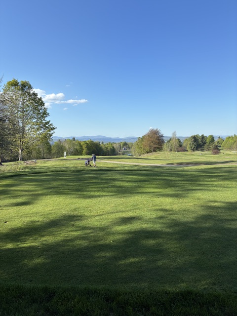
What a beautiful day. From the 14th at my home golf course.
-
The temperature surged into the upper 80s to around 90° in the region. Boston also reached 90° today. Tomorrow will be a bit cooler than today. However, temperatures will then rocket into the 90s for Tuesday and Wednesday. Tuesday and Wednesday coincide with 1962 and 1996 outbreaks of extreme heat in the Northeast during which May monthly records were set in many locations. Nevertheless, parts of the region could still approach or reach record values on Tuesday and Wednesday. Records for May 19th: Albany: 91°, 1903, 1962, 1986, 1989 Allentown: 97°, 1962 Atlantic City: 91°, 2017 Baltimore: 98°, 1962 Boston: 90°, 1949, 1986, 2017 Bridgeport: 89°, 2017 Hartford: 94°, 1962 Islip: 89°, 2017 New York City-Central Park: 99°, 1962 New York City-JFK Airport: 92°, 2017 New York City-LaGuardia Airport: 96°, 2017 Newark: 98°, 1962 Norfolk: 96°, 1880 Philadelphia: 96°, 1962 Poughkeepsie: 96°, 1962 Providence: 91°, 2017 Richmond: 97°, 1962 Sterling: 92°, 1996, 1997 Trenton: 96°, 1962 Washington, DC: 96°, 1911, 1997 Westfield: 90°, 2017 White Plains: 95°, 1962 Worcester: 92°, 1962 Records for May 20th: Albany: 91°, 1962 Allentown: 92°, 1962, 1996 Atlantic City: 96°, 1996 Baltimore: 95°, 1962 Boston: 91°, 1996 Bridgeport: 97°, 1996 Hartford: 99°, 1996 Islip: 98°, 1996 New York City-Central Park: 96°, 1996 New York City-JFK Airport: 95°, 1996 New York City-LaGuardia Airport: 97°, 1996 Newark: 99°, 1996 Norfolk: 98°, 1996 Philadelphia: 94°, 1962, 1996 Poughkeepsie: 91°, 1962, 1975 Providence: 95°, 1996 Richmond: 97°, 2022 Sterling: 93°, 1996 Trenton: 94°, 1996 Washington, DC: 96°, 1996 Westfield: 86°, 2012 White Plains: 95°, 1996 Worcester: 91°, 1903 In addition, 2026 will become Central Park's second year on record that saw a monthly maximum temperature of 80° or above in March, and 90° or above in both April and May. Currently, 1977 with a March high of 81°, April high of 90°, and May high of 92° is the only such year. 2026 has seen a March high of 81° and April high of 90°. Thursday will see temperatures top out in the lower 70s. Afterward, it will turn much cooler with highs only in the 60s on Friday and Saturday. The ENSO Region 1+2 anomaly was +1.6°C and the Region 3.4 anomaly was +0.9°C for the week centered around May 6. For the past six weeks, the ENSO Region 1+2 anomaly has averaged +1.50°C and the ENSO Region 3.4 anomaly has averaged +0.55°C. El Niño conditions are rapidly developing and will likely be in place in the next few weeks. The SOI was -27.48 today. The preliminary Arctic Oscillation (AO) was +1.368 today. Based on sensitivity analysis applied to the latest guidance, there is an implied near 60% probability that New York City will have a warmer than normal May (1991-2020 normal). May will likely finish with a mean temperature near 63.7° (0.5° above normal). Supplemental Information: The projected mean would be 1.2° above the 1981-2010 normal monthly value.


