All Activity
- Past hour
-
Yeah just surpassed 1991 with the largest discrepency between EWR / PHL with PHL having 14 more. EWR does have the 6 89 degree days PHL only 2.
-
69 / 67 clouds NE flow. Ugly day sun about an hour to 90 min drive in PA and SNJ otherwise socked in the marine layer and some drizzle at times. Flow comes around Thu/Fri and could see some overperforming high Thursday warm / hot spots touch 90 inland otheriwse mid-upper 80s. Clouds and showers Friday keep it into the 80s for most. Onshore flow keeps the long labor day weekend neaer normal and hopefully dry - a california-ish feel. Beyond there warms up a bit and back and forth progressing towards and overall warm / above normal by the mid month period where trough into the WC could push ec ridge.
-
We were in Ocean City mid August-it was great outside of the lack of waves due to no storms in the Atlantic.
-
Got multiple tornado warnings and severe warnings but no watch up there.
-

Septorcher 2026 Discussion - Endless Summer
Ginx snewx replied to Damage In Tolland's topic in New England
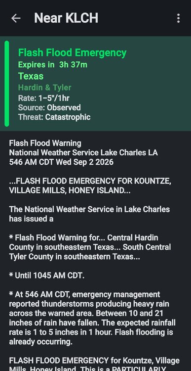
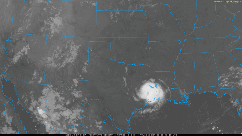
Landphoon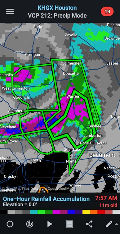
-
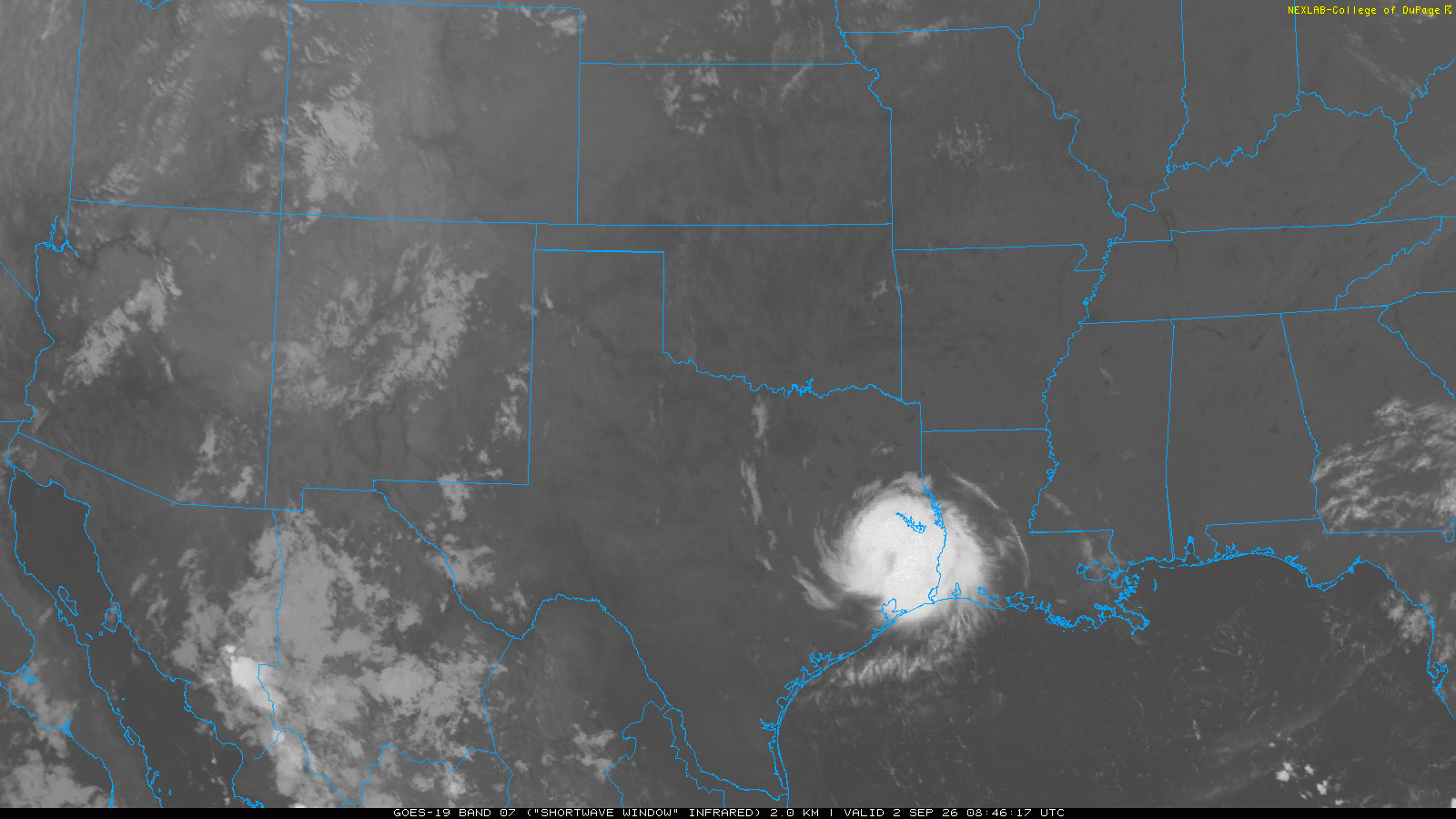
It's affecting the pattern a great deal in the tropics, probably more so than any ENSO event in history at this time of year, but it's impact in the mid latitudes of the N HEM remains rather meager at this time.
-

Central PA Summer 2026 Discussion/Obs Thread
canderson replied to Voyager's topic in Upstate New York/Pennsylvania
.65” overnight. -
The record finished very close to the ECMWF SEAS5 forecast at the top of the range near +1.64°.
-
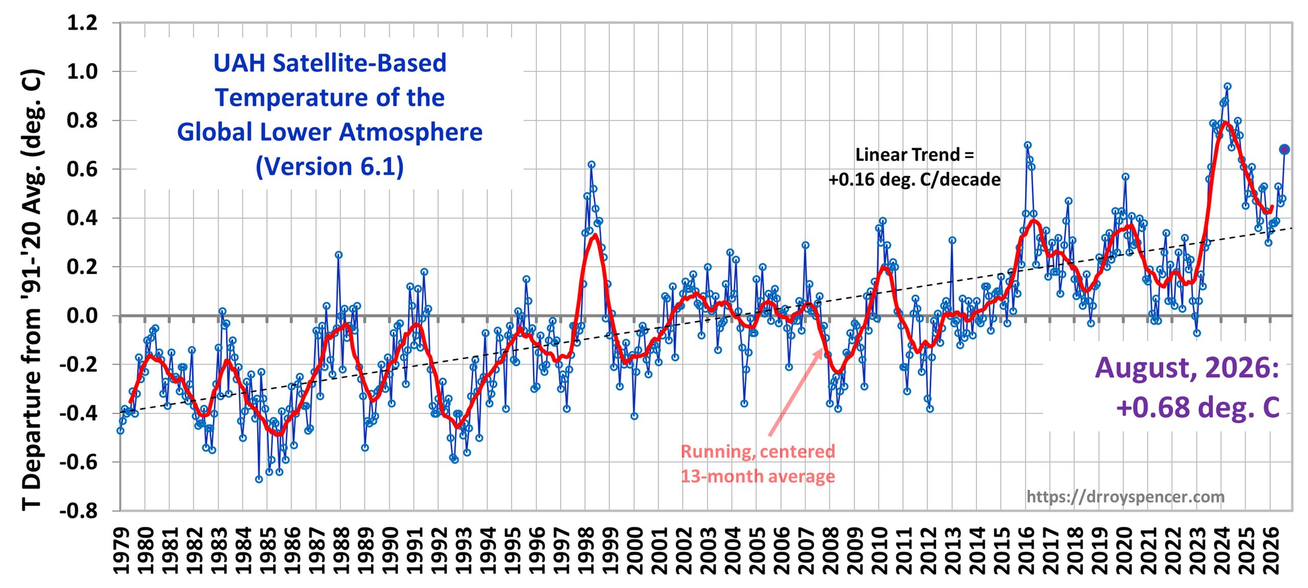
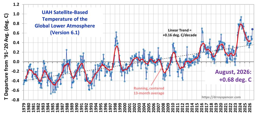
UAH warmed in August. Expect similar jumps in other August metrics.
-

E PA/NJ/DE Summer 2026 Obs/Discussion
Lady Di replied to PhiEaglesfan712's topic in Philadelphia Region
Last night was pretty intense but not as bad as NJ. Lost internet and power restored after an hour or so. Glad I could run the AC until lost power again early this morning and no info on when it will be back on. Pretty sure an outlet blew. Heard it pop. Thought at first TV got fired but plugged it into another outlet and it's fine. I'm done with this stuff. -

2026 Mid-Atlantic Severe Storm General Discussion
SolidIcewx replied to Kmlwx's topic in Mid Atlantic
Optimally, id like to see it develop more west as the morning goes on. That way it increases the chances of a wider hit for us all this evening.- 2,294 replies
-
- 1
-

-
- severe
- thunderstorms
- (and 7 more)
-
Output looks okay on satelitewx.
-

2026 Mid-Atlantic Severe Storm General Discussion
batmanbrad replied to Kmlwx's topic in Mid Atlantic
the 2AM SPC outlook pulled the 2% TOR risk down into much of our area, and the 30% wind prob into much of the northern parts of our area. CSU-MLP charts keep most of the TOR north of us but does agree with the 30+% wind area in our northern areas for today and keeps that going with even more of our area covered into tomorrow. Let's see if this holds when the 9AM SPC outlook for today comes out. Still many variables to sort out but should be an interesting next 36 hours or so to track!- 2,294 replies
-
- 1
-
-
- severe
- thunderstorms
- (and 7 more)
-

Central PA Summer 2026 Discussion/Obs Thread
Voyager replied to Voyager's topic in Upstate New York/Pennsylvania
Disgusting... Can't beg, borrow, or steal a good storm, but we sure can get an ugly, foggy, dreary, misty morning. -
@stadiumwaveCan you link where you generated this image?
-
 http://mexiph.shop/# online mexican pharmacies
 -

2026 Mid-Atlantic Severe Storm General Discussion
dailylurker replied to Kmlwx's topic in Mid Atlantic
This post caused an eagle to gain it's wings. It should be a fin day of radar watching. I could really go for some severe. I might cut out of work around 2 and do a lightning chase this afternoon.- 2,294 replies
-
- 1
-
-
- severe
- thunderstorms
- (and 7 more)
-
That doesn't change the fact that it's initialization of the Pacific is off, so I would still adjust warmer....but that does make a little more sense. Yea, H5 for August at one month lead was good, but that doesn't mean that is always the case every month.
-

Central PA Summer 2026 Discussion/Obs Thread
Blizzard of 93 replied to Voyager's topic in Upstate New York/Pennsylvania
I ended up with .67 of rain last night. -
The models haven’t done well showing the storms. Yesterday those storms that ripped ne and eastern Pa weren’t super well shown either. If that area holds together as the atmosphere gets unstable it could be an interesting afternoon.
- 2,294 replies
-
- 1
-
-
- severe
- thunderstorms
- (and 7 more)
-
10z hrrr made a big flip to carrying that Erie (I call it Lake Freedom now) cluster into central MD
- 2,294 replies
-
- 2
-

-
- severe
- thunderstorms
- (and 7 more)
-

2026-2027 Record-breaking El Nino
40/70 Benchmark replied to Stormchaserchuck1's topic in Weather Forecasting and Discussion
Sure, but we have good reasons to believe that it isn't. I could still doubt that you're one of NYC's finest after you show me your badge and a pic of you sleeping in the cruiser, but that doesn't change the facts. No runs are key if the model incessantly suffers from an erroneous initialization. Again, this doesn't necessarily mean an awful winter is en route, it just means that CANSIPS output is highly flawed. Maybe we will make out okay and score a HECS...both can be true, and in fact, I suspect that they are. -
2026-2027 Record-breaking El Nino
40/70 Benchmark replied to Stormchaserchuck1's topic in Weather Forecasting and Discussion
Yes, and I'm not being facetious....quite literally. -
2026-2027 Record-breaking El Nino
40/70 Benchmark replied to Stormchaserchuck1's topic in Weather Forecasting and Discussion
-AO/+PNA winter en route.....confirms what I had already figured. -
The Franklin Institute in Philly is the 90° day leader across the region this year. Data for January 1, 2026 through September 1, 2026 Click column heading to sort ascending, click again to sort descending. PA PHILADELPHIA FRANKLIN INSTITUTE COOP 43 MD STEVENSVILLE 2SW COOP 41 DE DOVER COOP 41 PA PHILADELPHIA INTL AP WBAN 40 Data for January 1, 2026 through September 1, 2026 Click column heading to sort ascending, click again to sort descending. NJ HARRISON COOP 35 NJ TETERBORO AIRPORT WBAN 29 NJ TETERBORO AIRPORT COOP 28 NJ NEWARK LIBERTY INTL AP WBAN 26