All Activity
- Past hour
-

Central PA Spring 2026 Discussion/Obs Thread
pasnownut replied to Voyager's topic in Upstate New York/Pennsylvania
Well...they either implied or wished by some....my post had nothing to do with you saying as such, but yes i did include your ex. into the convo. Point to be made, any and all can be wrong once in a while....NO exceptions. -
I think the lake breeze might have helped it turn right. As soon as it did it was back in action. The low level jet ramped up by 5-10mph or so also at the time. I’m sure there will be studies.
-
HRRR is cool. But I feel like every HRRR run with snow ALWAYS favors my backyard. I'm sitting in a 2.5" Kuchie jack
-
There it is, the 138th anniversary of The Blizzard of 1888. Family history has it that my great-grandfather, an immigrant grocer in Bridgeport, CT, had the 6th sense to stock up on provisions as the storm was brewing. Thus, he was able to help out his local community through the aftermath of the storm.
-
It’s not coming back. It’s a cutter.
-
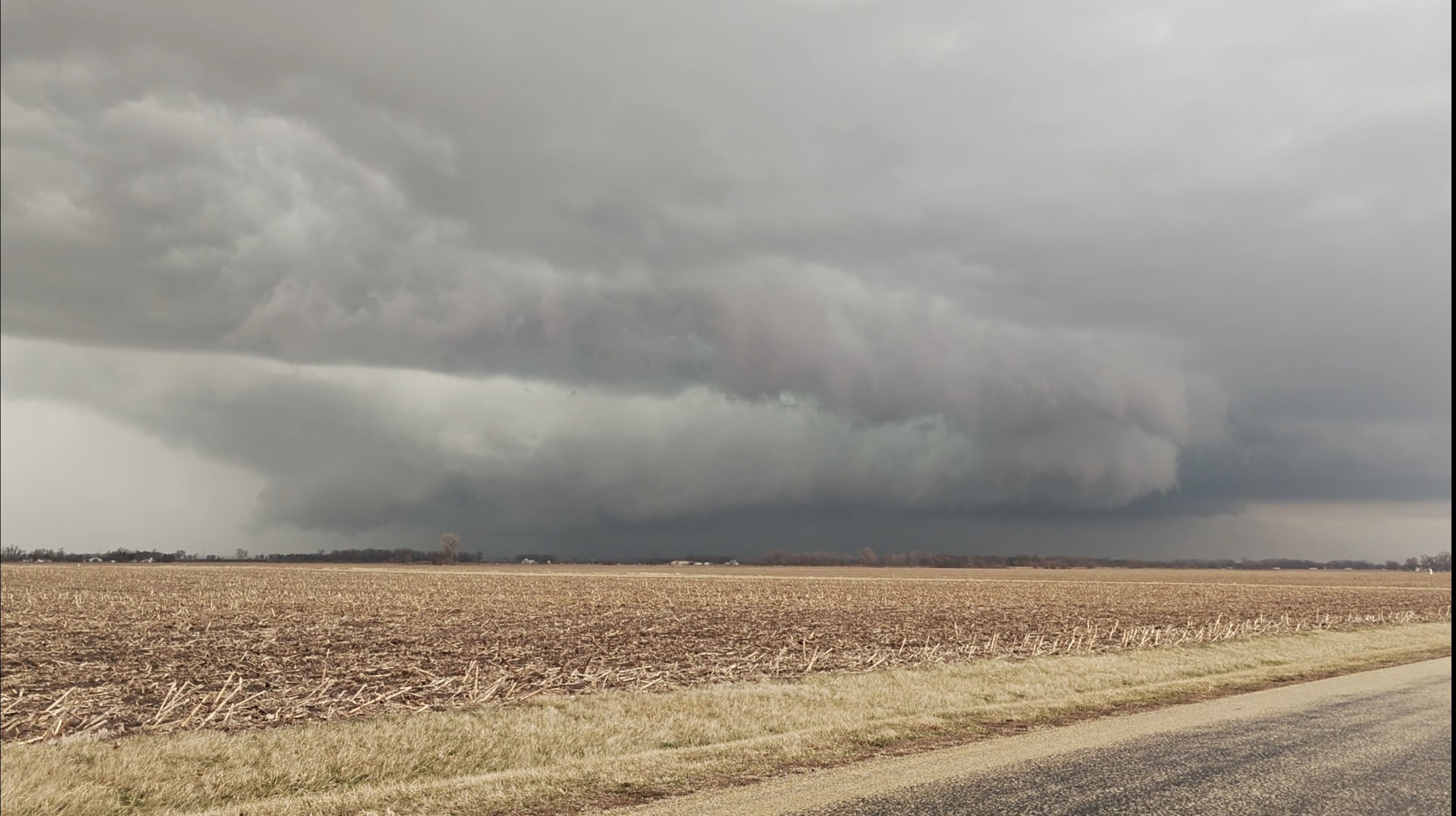
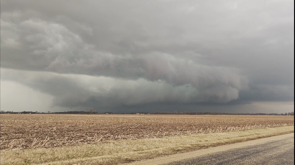
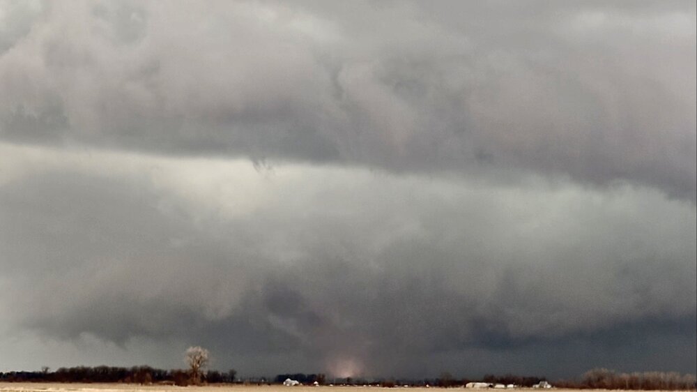
Yesterday was a very interesting chase. It was my first real chasing trip since getting hit by a satellite back on 4/4/23, so I was eager to have another shot at making safety my number one priority™. I was on the big boy sup for a little while as it cycled and then got to enjoy watching the entire storm tighten up from a very safe vantage point the whole time. It was really cool to observe broader and then tighter rotation show up again on velocity while looking at things in front of us, but then after a while it became fairly clear that there was most certainly a big ass tornado somewhere right in front of us that we couldn't see. Check this shit out. Despite a plethora of other notable things we came across, it was a bit lame to not actually really "see" the nader of course, especially since we were on it for over an hour with that sig ass signature on it. But just this morning, at the very end of the ~30 seconds of shit phone footage I managed to take, I came across this frame: I surmise it hit a transformer or something literally a second before I ended the video. Other observations include: - Shortly before this point, we came across a crap load of massive hail still on the ground. At least good golf ball+ still sitting around in this sunny field in this particular cell's wake. - Shortly before dark, right around the Indiana border, the car (presumably another chaser) in front of us slowed way down and was just weird, then kept going. When we got to that point moments later, we registered that they'd been looking at one of those tree trunk remnants that's still a few meters tall standing right next to the road which was literally glowing orange and spitting embers. Kind of cool to come across a fresh lightning strike like that right in plain view, especially because the chase was essentially over at this point. - On a more fucked note, on the way home on 65 or whatever, both "lanes" of the highway were shut down at a certain point. I'm actually proud of how quickly it dawned on me that it's a bad sign that both sides of the road were shut down because my attention span was... spant at this point. A semi and an SUV laid overturned in the ditch-style median between lanes. We rolled down the windows and saw that all of the trees on either side of the highway were significantly damaged for a very defined ~100 yard swath centered around where the crashed vehicles were. Pulling out radarscope, this appeared to be almost exactly where the couplet had tracked just a little bit ago so I'm almost positive it was indeed the actual damage path of the tornado and not just wind damage. It was a very sobering way to end what was otherwise probably my safest, most incident-free chase so far.
-

Spring 2026 Pattern Discussion Thread
Carvers Gap replied to Carvers Gap's topic in Tennessee Valley
Look at this gradient for real feels early next week....what a cold front. -
Ravens restructure Lamar's contract and free up 40M in cap space. As bad as it looked yesterday everything breaking in their favor today lol
-
Spring 2026 Pattern Discussion Thread
Carvers Gap replied to Carvers Gap's topic in Tennessee Valley
Temps are predicted to approach 80 here at TRI today. Next Monday, rain/snow showers are predicted. Tuesday's high is forecast to be 42 with lows in the low 20s. Wind chills are likely to be in the teens. Wind chills in that time frame may well even approach single digits for NE TN in the valleys w/ wind chills in the low teens likely. For those hiking the AT, wind chills in the mountains could be below zero - plan accordingly. Some through hikers have started the trek. -

80 Degrees to Ripping Snow: March 12th
paulythegun replied to SnowenOutThere's topic in Mid Atlantic
FV has a snow sandwich where the bread is the warm ground on one side and the sun angle on the other -
What. Snow? really?
-
Mid 60s yesterday, mid 30s today. At least the IP/ZR didn't materialize. Thursday's quick warm-up appears to be off the table as we're heading into a string of messy events, apparently none strong.
-
I’m either too old or not hip enough to know what this means. But thank you.
-
Thru February it's B for temps and C+ for snow. We're slightly BN for snowfall season-to-date but the Jan fluff bomb rates the plus. A slight ding for the Feb blizzard when 2-4" forecast verified at 0.2". We were never in the game for the real event.
-

80 Degrees to Ripping Snow: March 12th
MillvilleWx replied to SnowenOutThere's topic in Mid Atlantic
Westminster for that storm was beyond insane. 50's preceding, then 36/27 with 30" of snow, then 50 the next day. Absolute freak event -
Interesting how the parent NAM has hardly any QPF tomorrow while essentially every other model does
-

80 Degrees to Ripping Snow: March 12th
AmericanWxFreak replied to SnowenOutThere's topic in Mid Atlantic
Let me see it when you are done. -
No and Maybe. The high temperatures in the Baltimore area on the week preceding the event were 55, 47, 55, 60, 56, 56, & 47. The high on the day of the storm was 36. The high temperatures during the following days were 54,49,54,65,73,70,83,87,86,73,54,43
-
Meh weenies cant
-
Need to hit 70”
-
You said winter was over yesterday... stick to your guns one way or the other.
-
55 in Simsbury, with minor dews
-
Snowy one tomorrow pm to be sure
-
Maybe it comes back. I will pray like i did with the blizzard . But yes that had good potential with the cold air around.
-
Ya..me too.