All Activity
- Past hour
-
Winds coming around SSE now Still only 47
-
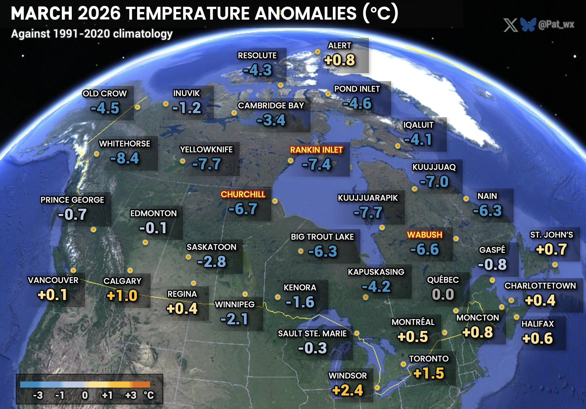
This was due to a combo of the extremeness of the pattern and GW with the extreme pattern superimposed on a warmer globe. In other words, had there been no GW the US still could have had their warmest March but not by nearly as large a margin. The extremeness of the pattern is seen well by considering how cold much of Canada and Alaska was with some of those areas having their coldest March on record:

-
Lol you work inside
-
Cold RA with 0.1" IP mixed in, currently (10 AM) very light RA and low 30s.
-
Yea, I mean.....I do think some of this is a byproduct of CC, but clearly many are embellishing the degree to which it factors in. We are also still in the declining phase of the solar cycle, which is not where you want to be for abundant NAO blocking, and it's going to be a long climb out of this Pac cold phase, so there are some additional lean times ahead. I'm not not convinced winter 2026-2027 will be one of them as of yet. Part of my rationale for looking at 1957 and 2002 is because they were in the descending phase of the solar cycle following an extended Pacific cold phase, during a +QBO/healthy El Nino.
-
All these early 70°+ and 80°+ days makes the average days for this time of year feel much colder than they really are especially with onshore flow and clouds.
-
Happy Good Friday. Enjoy the dank, damp and cool it’s the only April ya got.
-
Probably due to the lower local resolution when trying to show regional snowfall. It would be nice if they were able to develop a map with local zooming capability. These types of maps are nice for broad overviews but not necessarily great locally.
-
I'll go with B as well; did eke out one decent snow which is a win in these parts.
-
Had a little SHSN here before sunset too yesterday. Then just 32.1° and -RADZ the rest of the night.
-

Occasional Thoughts on Climate Change
TheClimateChanger replied to donsutherland1's topic in Climate Change
-
Yes the wedge is holding strong in the satellite. You can see it is starting to erode though.
-
Yeah if it makes it into the 70s here today its probably going to be towards the end of the day and brief.
-
We didn't have anything stick at my house. Rates weren't good. I didn't see much snow after dark, but I wasn't looking much.
-
1000% you could, without question. In terms of winters moving forward, I absolutely think we're in for some better times and we will see majority of winters produce versus not producing. I think too the (decreasing) AMO is going to help big time in this regard as well and may even bring back those good ole fashion NAO blocks...like true blocks in which we benefit from. I would not be surprised though if we still had some dud winters mixed in through the remainder of the decade because who knows how long it will take the atmosphere to truly respond to the large-scale oceanic changes but we should be heading in the right direction.
-
Occasional Thoughts on Climate Change
TheClimateChanger replied to donsutherland1's topic in Climate Change
-
Good luck.
-
Occasional Thoughts on Climate Change
TheClimateChanger replied to donsutherland1's topic in Climate Change
-
Wetbulbs verified a lot cooler than that in the H7-85 layer. Add in some extra cooling with convective lift and I guess it was enough to overcome.
-
I'll bet I could teach a class on that at this point even without ever having earned a met degree...theoretically speaking of course. Wholeheartedly agree on having commenced a Pacific phase shift....better times are ahead.
-
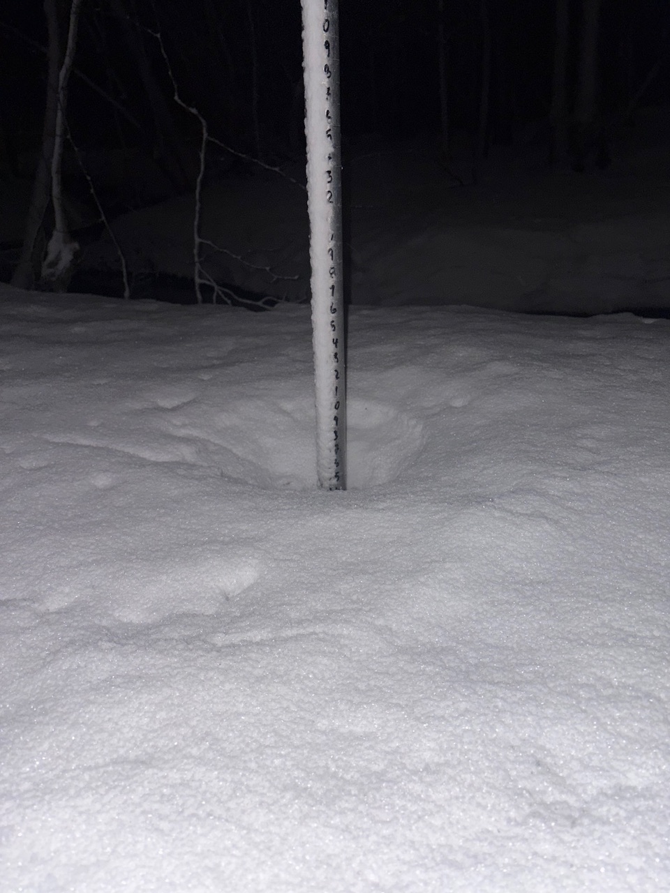
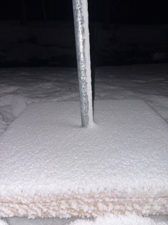
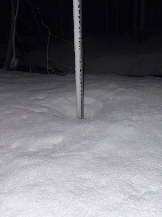
11.6" here which is 2.6" AN
-
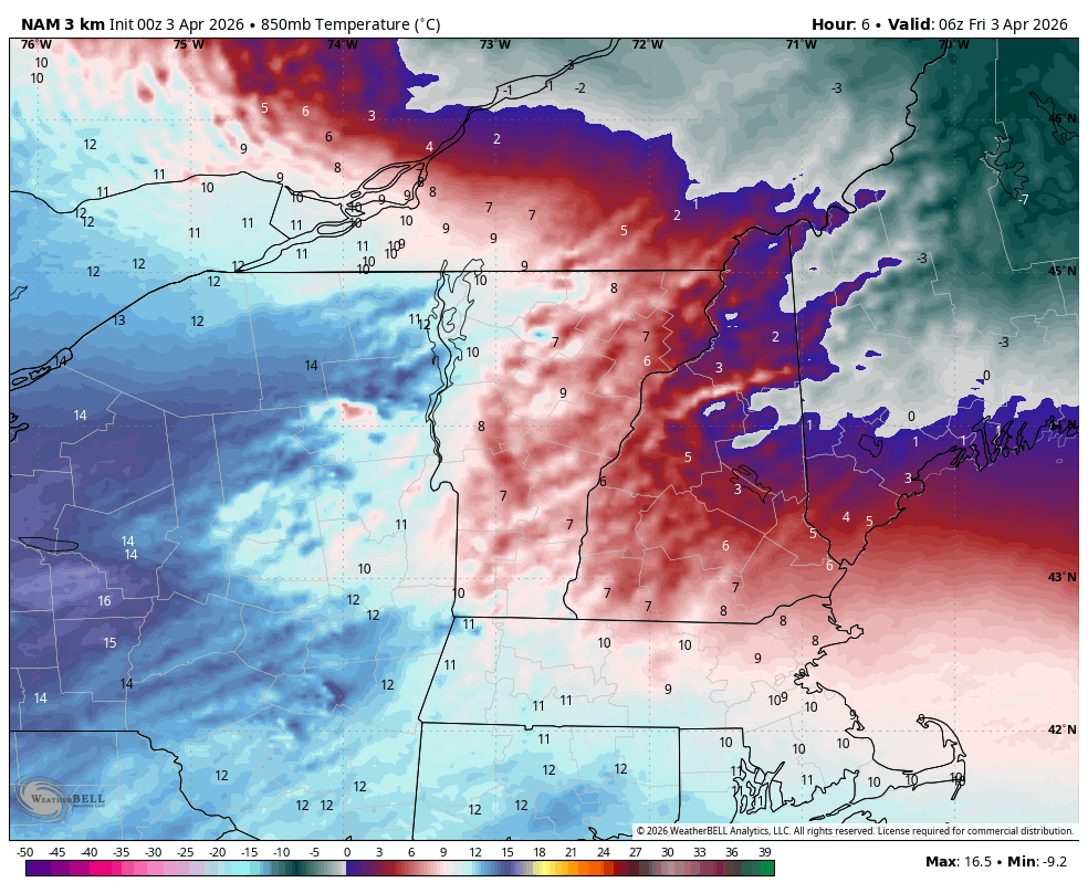
After that discussion last night… despite 850s well above 0C, we got some convection that caused rain to change to pasty snow. I’ve never seen snow fall with soundings like last night. 2am and +7C at 850mb and pounding paste in convection?

- Today
-
I have to think that we are in the beginning stages of seeing an improved PAC. But as you stated, with how warm the west PAC is there needs to be some caution in this. I'm having a ton of fun. I can't speak for other programs are, it's totally possible other programs are much more extensive with the math (but it probably depends on what you're seeking). TBH though its been a bit too easy so far, I was hoping for a bit more of a challenge. This isn't to say I am not getting anything out of it, I have learned some techniques with respect to winter forecasting, especially within the medium-range and evaluating models to help with trying to identify potential trends and model weaknesses. The section we're doing in this class though on seasonal forecasting though is really just basic stuff...going over things like PDO/AMO/ENSO/QBO but not in any great depth. But the professor is quite experienced so the real value comes from him sharing his experiences and knowledge. This is what I love most. I actually have the same professor for both classes I'm taking now and he is awesome.
-
Mixing is key... The models try to warm sector everywhere S of Brian and including his latitude, which agreed ... at the moment challenges the imagination as how in the hell that can actually happen when looking at larger regional synoptic observations. Take this hi res vis loop, https://weather.cod.edu/satrad/?parms=local-Virginia-02-24-0-100-1&checked=map&colorbar=undefined Notice that wedge of very low level cloud arrow heading into interior VA. That's like a latex paint spill on a highway, imagine cloud-cars are gliding over the top of it. We are underneath that paint spill in this metaphor. In order to scour that out, the sun will help... but mixing is really needed for that to happen. Pure speculation, but I suspect that is why the meso models have been insistently cool as they have been, despite the frontal look of the models ( 18 to 00z later on...). They are telling us that there won't be enough mixing. It's like the warm sector pivots across the top never kissing the surface. Need the cold front to clean house. Tomorrow may actually be better than guidance, particularly if it clears. Ample late summer sun quality rising over a scoured out d-slope flow that isn't CAA crazy might actually make conditions anomalously good relative to having an overtop high pressure again building in from Ontario. Which by they ... - I'm just diatribing in general - odds lean away from observing a real and true wholesale warming over the eastern mid lat continent, if/while that PV continues to its relentless re-establishing presence N-E of Hudson Bay. So long as that is apparently never ever ever going to change ... eh hm, we are doomed to those over top high pressures ... almost like back building they are, bullying in and afflicting with NE-E "coldrums"
-
I would love to take a class like that, which focuses on seasonal forecasting and doesn't try to stuff Calculus 8 down your throat.