All Activity
- Past hour
-
The currently depicted h5 pattern on the majority of guidance would have to be way off in order for that to happen. Ofc if you wanna ride with the UKie and Experimental Canadian model then maybe. It would likely take a phase of the shortwave energy dropping southward from the Pac NW with the Baja vortex and ejecting it all together.
-
Nice. Was riding this past wknd with Dryslot up in Eustis. Trails were good there, especially by the NH border. Heading to Jackman for fri/sat riding, but not liking the cold predicted for sat. Definitely will need the gauntlets, but the Doo ones don't fit well on my Polaris.
-
Remarkable consistency.
-
I haven’t read much about the AI mods… what calibrations did they make to the euro AI for it to show a different scenario from the original euro? Do we know? .
-

First Legit Storm Potential of the Season Upon Us
weatherwiz replied to 40/70 Benchmark's topic in New England
I sure did...I was reading it while eating breakfast and making coffee lol. -
Not saying anything will happen this weekend. Perhaps the suppressed look is correct and we end up high & dry. But looking back, the 2016 storm, PDII, the ‘96 blizzard and many other MESC were all initially modeled to miss us to the south.
-

January 2026 regional war/obs/disco thread
Cyclone-68 replied to Baroclinic Zone's topic in New England
If this new storm next weekend evolves, does that mean the deep south will see a severe weather outbreak as well? -

Rise of the Machines: January 18-19 Winter Storm Obs Thread
Baroclinic Zone replied to WxWatcher007's topic in New England
Just over 6” -
Just absolutely absurd. They gotta fix this. Bills fans must be so pissed
-

January 2026 Medium/Long Range Discussion
Scarlet Pimpernel replied to snowfan's topic in Mid Atlantic
Kinda hard to say that it's a definitive shift south per se. I mean, yeah, the axis of max amount shifts a bit that way but a couple of things. First (and as you say) this is out to 144h, there's still surely at least some more beyond that time. Next, notice how the max area actually expands or widens (looking at the dark blue and higher area). Probably nothing, but still interesting perhaps. And really at this point it's more or less noise. Catching up on the last several pages here (and...ahem!...ignoring certain posts!), I agree with the overall idea that we're in a pretty good spot, taking into account the AI models, GFS, Euro, GEFS, EPS, and even the CMC. Others probably already said this, but while a more suppressed solution is clearly on the table here (seems like a "cutter" is much less likely right now), even if we're on the northern edge of the best stuff we still would get a really solid amount of cold smoke. Would we all like to end up in the max zone? Yeah of course (duh!)!! But a warning-level event through this region even on the "edge" isn't something I'd sneeze at. -

January 2026 Short/Medium Range Thread
Holston_River_Rambler replied to John1122's topic in Tennessee Valley
Supposedly the Euro AI has been trained on 80 years of ERA 5 data -
January 2026 regional war/obs/disco thread
mahk_webstah replied to Baroclinic Zone's topic in New England
I was in Philly for that storm and it was tremendous. A lot of small flakes and Arctic sand though but still 18 inches with a lot of sleet at the end on top of that. But I think there was some hugely anomalously jet that was like five standard deviations above normal or something. -
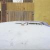
Not sure where you all live, but it’s been a cold winter with decent snow pack in spurts out this way, but for the week long mild-up. There’s easily 6” on the ground and it was 9 this morning when I went out to start shoveling again.
-
Question… obviously the GFS/Euro use past events to help with modeling. Does the AI mods get samples from the GFS/Euro or is its algorithm separate from its originals. The reason I’m asking this is because we have had a lot of cutters since the AI mods have been out which would make sense why those are showing cutters now assuming they do not get past event samples from the original mods. .
-
Your self awareness is on point
-

First Legit Storm Potential of the Season Upon Us
The 4 Seasons replied to 40/70 Benchmark's topic in New England
lol thanks i was like huh, he must have read that wrong -

Rise of the Machines: January 18-19 Winter Storm Obs Thread
Lava Rock replied to WxWatcher007's topic in New England
Only 1.6", but wasn't expecting much anyway. Add this to the 2.25" over the wknd and the pack is back to where it was before the last meltdown. -
I think the biggest positive is that we have most models on board with a winter storm for our general area. Details still need to be ironed out but the continuity is there amongst models for the most part. Nice to have something inside 7 days to track.
-
Well then, FWIW, the Google WeatherNEXT showed a very Euro-AI like solution
-

January 2026 regional war/obs/disco thread
mahk_webstah replied to Baroclinic Zone's topic in New England
What do you mean by lighting up like a Christmas tree? -
we need like a 20 inch dumping followed by another 6-12 so we can have some type of snow cover for longer than 4 weeks
-

January 2026 regional war/obs/disco thread
WinterWolf replied to Baroclinic Zone's topic in New England
Bingo. Nothing is ever a given…but this isn’t even close to a slam dunk done deal miss for SNE, especially at more than 5 days away. -
Still new and untested model like AI-GFS and its ensembles. But it has potential
-
Storm potential January 17th-18th
EastonSN+ replied to WeatherGeek2025's topic in New York City Metro
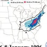
Lol they are determined to keep it under 10. -
Models hinting at another winter storm possibility the following weekend, 30/31st. Interesting period upcoming in the SE. Will have the LP tank refilled this week and test the generator for sure.


