All Activity
- Past hour
-
LWX AFD from this afternoon on the "threat" Meanwhile, stalled front to the south will try to lift back to the north Friday evening into Saturday. A wave of low pressure looks to traverse this boundary Saturday morning with a secondary wave of low pressure lifting north and east of the Deep South toward the VA/NC coast Saturday night into Sunday. With residual high pressure to the north and east, cold air will be available for some wintry precipitation to occur across portions of the forecast area Saturday afternoon into Saturday night. Main question is if phasing can occur, which remains highly uncertain. Right now, the highest confidence for wintry wx would be along and south of I-66/US-50 and east of the Blue Ridge mountains. We`ll continue to monitor this threat to see if the northward trend amongst the guidance continues. If so, some travel disruptions are possible late Saturday afternoon into Saturday night, especially on elevated and untreated surfaces. More at weather.gov/lwx/winter.
-
Any data for that criteria, no days 50+ in January, in Orange County airport in Montgomery NY?
-
Absolutely. I made a post about this yesterday. I love that you incorporated the word pedantic though lol.
-
Because there is no chance of any snow after this for the next 10 days or so?
-
Very longtime reader of threads like this here (but hardly ever post). It has been an absolutely brutal start to winter in the Intermountain West. I live in Colorado in a small mountain town west of the Divide and it is no exaggeration to say we have the worst snowpack (or lack thereof) as of today in recorded history. Snow is vital for the health of ecosystem and economy around here. It once was the case that both the East and West could have good winters at the same time but it seems nearly impossible now.
-
 DCA _ NYC _ BOS _ ORD _ ATL _ IAH _ DEN _ PHX _ SEA -2.0 -2.5 -1.5 +0.5 +1.7 +2.5 +3.0 +2.0 +1.5 havent done this in like 6 years but im back!
 -
Personally I don't pay much attention to surface temps in the long range as long as h5 looks favorable. Distilling the LR takes a bit of skill.
-

January 2026 regional war/obs/disco thread
HoarfrostHubb replied to Baroclinic Zone's topic in New England
Just walked the dog for a bit. It is most definitely cold but the sun was pretty low. -
I don't care. They're not my maps. I would use different colors.
-
 I will update that history of the contest post which is currently in Dec 2024 contest thread, and post it here around Jan 4th.
 -
It’s a shame because he’s obviously an intelligent poster but because he’s equally as much a troll, he really ruins his credibility with a lot of people on the board. And when he’s wrong he will never admit it - just moves onto his next troll. Sad for him
-
Hopefully my TIDE are going to make this close. I still feel UGA is going to win it all easily. ROLL TIDE!
-
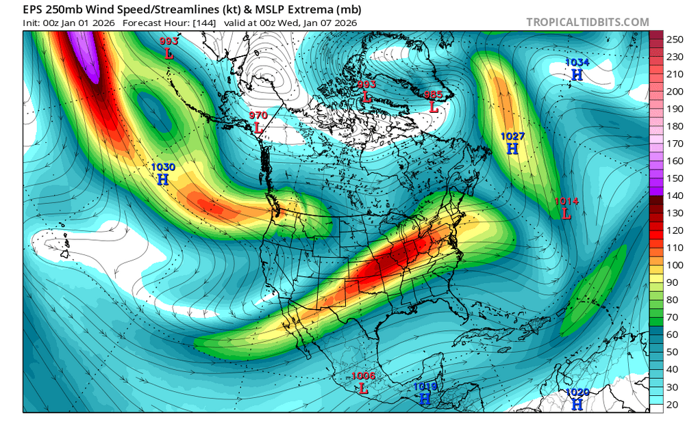
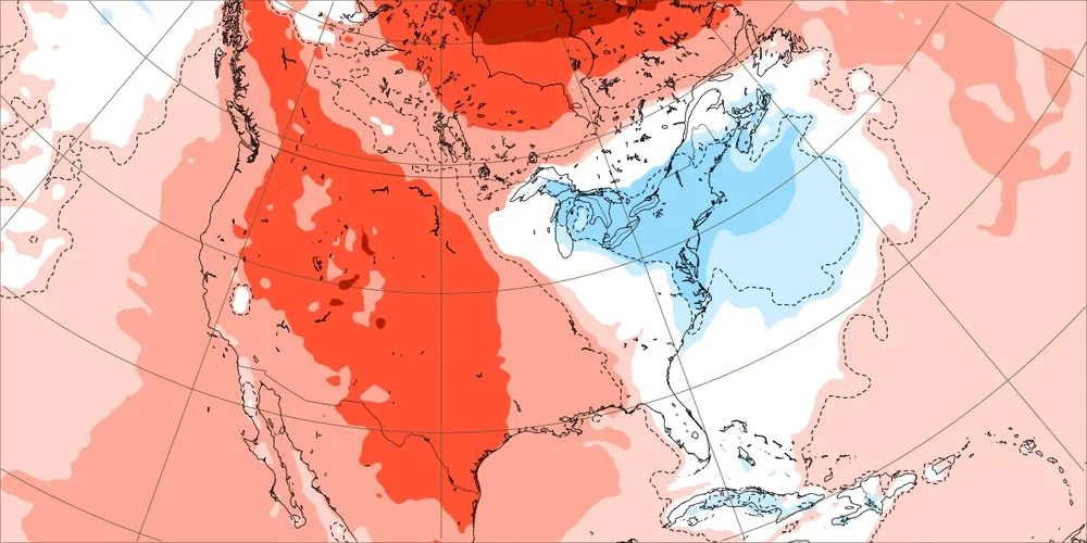
Kind of a theme I am seeing in modeling during the past 24 hours...modeling is struggling w/ the NAO. Duration, strength, and placement are all an issue. I think we score the EPO. We need at least some weak positives over Greenland which would tele connect to cold in the SE and to a block over Yukon and/or Alaska. If you look at wild swings in a model, go look at Greenland...it probably changed at 500. For now, I am riding w/ ensembles and using deterministic models for trends. Once we get Jan 12-13 in range, we "should" (famous last words) see models produce colder solutions. Ok...on to Indiana vs Alabama. I have been looking forward to this one. SEC vs BIG.
-
A forum built for tracking weather and mostly snow is making a thread for an event in the short range even if the odds are long? Heartbreaking. How will we ever recover our credibility
-
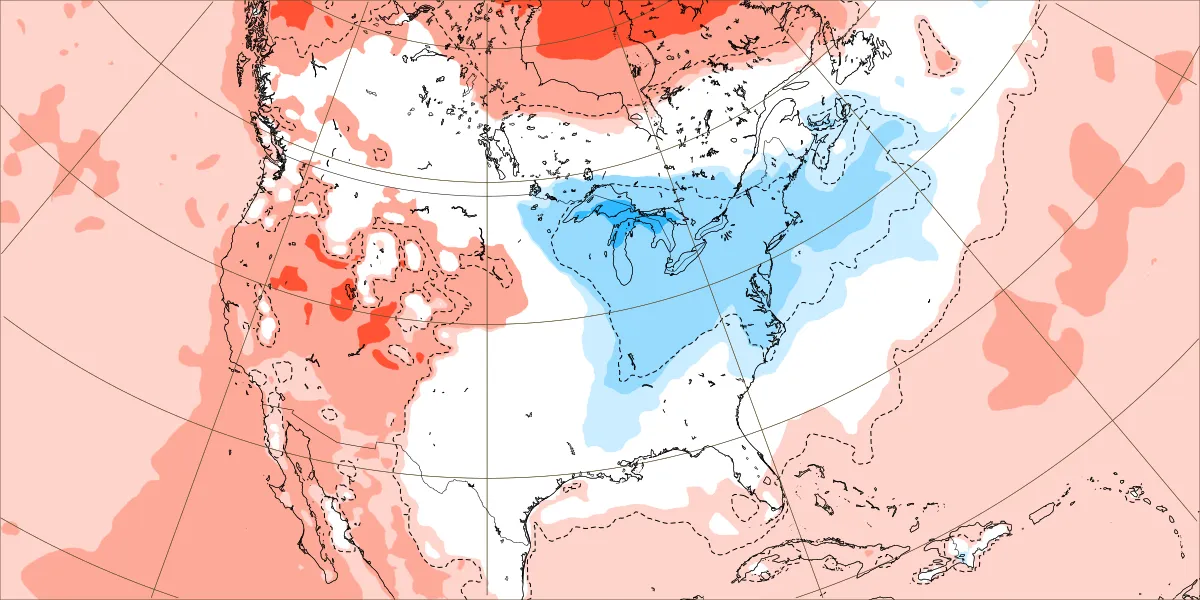
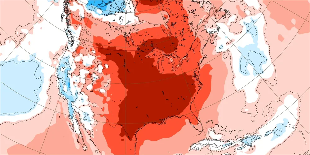
@NorthHillsWxHow about this bleak that covers, next week (Jan 5-11)? Four days ago: encouraging Today: worse than the commode, this is in the hot-tub: this is Torch #2
-

January 2026 regional war/obs/disco thread
WxWatcher007 replied to Baroclinic Zone's topic in New England
4° here with a -11 WC. Snow guns on full blast. -
I don’t trust your maps
-
Why ask why? Bud Dry
-
Why?
-

New Years Day 2026 - 1st snows of the new year possible
ORH_wxman replied to Baroclinic Zone's topic in New England
Wintry first sunset of the year.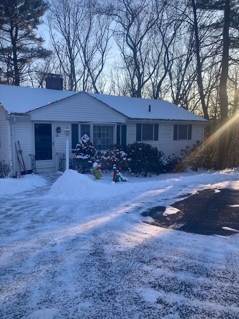
-
EPS would still set up a nice 2nd half after the thaw and honestly given the cold, snowy December it tracks. But of course we can't underestimate the northern stream either.
-
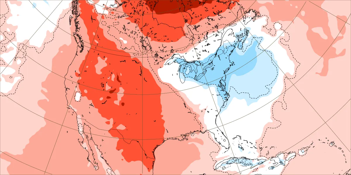
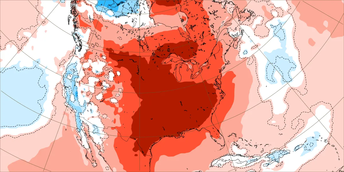
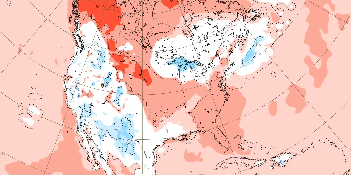
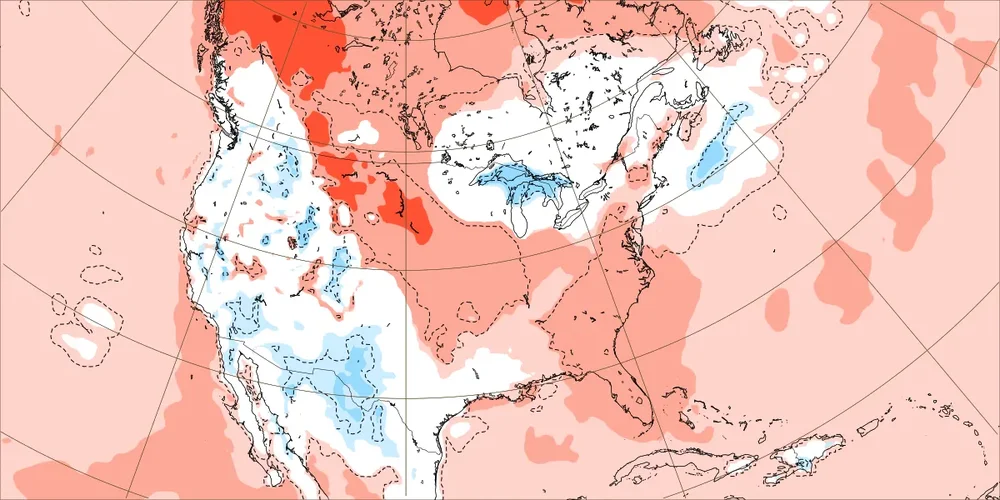
This is likely over-done, maybe by a lot. Here is a 30 day Euro Weeklies control map. The Weeklies mean pulls the trough back at the end of January, and I think it relies too much on climatology with that look. Still the mean wasn't overly warm. Even on the mean, the cold punches back during the second week of Feb after a good 10-14 day stretch in January(mean). The control, however, keeps putting the EPO back in the eastern PAC. Again, this is probably too much...but it lets us see something that a washed out mean won't.
-
how would that help misery? florida is a miserable place. folks had a home there for many years. never could stand it.
-
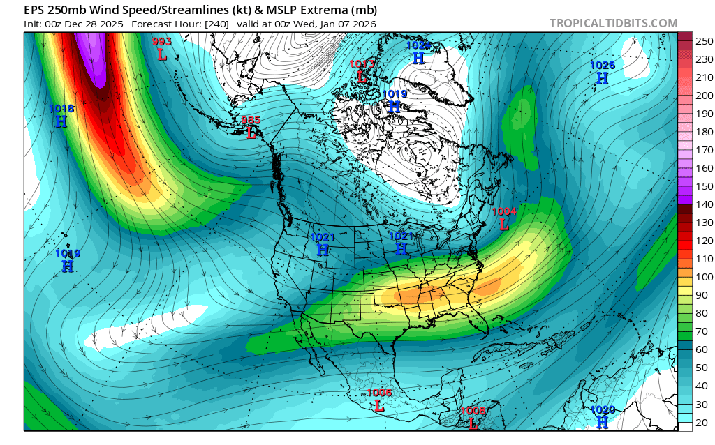
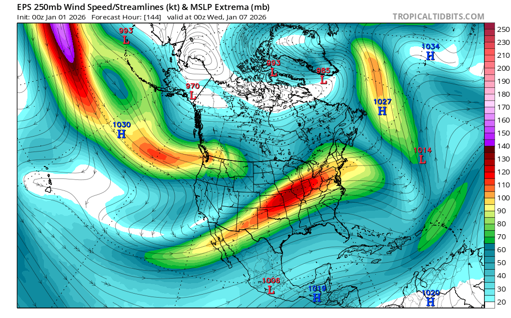
The “Bleaklies” (thanks, ColdRain, for coming up with that hilarious nickname) are almost the polar opposite of last year for the SE at this time. Related to your mention of the Euro, one “bleak” (Jan 12-18) has gone from this encouraging run just two days ago: To the commode today:

-
It was too strong with the -NAO and too weak with the Northern Stream of the Pacific Jet into the Pacific NW. So this lowered heights more out West which allowed the ridge axis to get pushed further to the east. The big question for mid to late January is exactly where the ridge and trough axis sets up? New run Old run