All Activity
- Past hour
-
I’m at the sea coast, in the Pope’s hood, and there is still quite a bit of green.
-
People are sleeping on what could be the first snowfall event of the season for parts of our subforum next weekend! Both the CMC, GFS, GFS AI, and GFS/CMC model ens are on board for accumulating snow for the ridges in WV, though the Euro hasn't bought on yet. The setup makes sense, a strong early season trough will spur upslope snow showers after the front passage with some aid from the Great Lakes. Currently, this is forecasted to take place during the night too which helps with thermals, though the GFS has them bottom out in the mid 20s so there's some room for front timing. Of course, this is still far out in the future and a weaker frontal passage, more progressive trough, or any number of factors could ruin the setup, but it's worth paying attention to for an early snow chase to see both fall foliage in the valleys and snow at the peaks.
-
Yeah, I hit 59° the other day and turned the heat on to 64°
-
It was still a top 10 warmest September for Chicago in spite of that, though obviously aided by the first four days of the month, which were a complete blowtorch.
-
Eastern area posters would retire from this hobby if that verified
-
It’s the same every year. The holiday weekend is always too late. Dont get me wrong, there’s still color in the valleys but even the mountain valleys look like 50% sticks mixed with the left over oranges. Mountains have that past peak burnt orange look, still something but no where near the fire reds, yellows mixed with green from two weeks ago.
- Yesterday
-
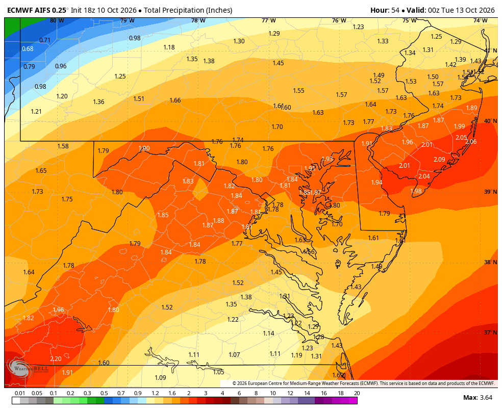
Closing in on 3 inches
-
WB 18Z EURO and AI
-
2-3” of rain would be a nice event. Fill up these reservoirs.
-

2026-2027 Fall/Winter Mountain Thread
Tyler Penland replied to BlueRidgeFolklore's topic in Southeastern States
Just got home from work and 3.53" in the gauge and coming down at a good clip. Sent from my Pixel 10 Pro using Tapatalk -
People jet skiing and swimming, bonus August Saturday
-

October 2026 General Discussion
Chicago Storm replied to SchaumburgStormer's topic in Lakes/Ohio Valley
First 80°+ day at ORD since mid-September. -
 best rx pharmacy online: Seroquel - pharmacy online
 -

2026-2027 Fall/Winter Mountain Thread
Met1985 replied to BlueRidgeFolklore's topic in Southeastern States
Getting moderate rainfall again with a cold temp of 54 degrees. -
His best year over the last 6 was with the Ravens in 2023. Decent numbers for a third WR, but that season was an anomaly since 2020.
-

October 2026 General Discussion
michsnowfreak replied to SchaumburgStormer's topic in Lakes/Ohio Valley
Thats what id say. A week early. I usually think of peak as Oct 24-30, this year thinking Oct 18-25 -
at least its peak something lol. I tell people every year - come late September to early October at the latest. Nobody listens lol. We were at 50% occupancy the last weekend of September when it was stunning, and sold out these past 2.
-
I assume he's completely washed, but who knows.
-
It’s finally over regarding this supercell! 642 PM EDT SAT OCT 10 2026 ...THE TORNADO WARNING FOR WEST CENTRAL LEXINGTON AND SOUTHEASTERN SALUDA COUNTIES WILL EXPIRE AT 645 PM EDT... THE STORM WHICH PROMPTED THE WARNING HAS WEAKENED BELOW SEVERE LIMITS, AND NO LONGER APPEARS CAPABLE OF PRODUCING A TORNADO. THEREFORE, THE WARNING WILL BE ALLOWED TO EXPIRE. A TORNADO WATCH REMAINS IN EFFECT UNTIL 800 PM EDT FOR CENTRAL SOUTH CAROLINA.
-
It’s finally over regarding this supercell! 642 PM EDT SAT OCT 10 2026 ...THE TORNADO WARNING FOR WEST CENTRAL LEXINGTON AND SOUTHEASTERN SALUDA COUNTIES WILL EXPIRE AT 645 PM EDT... THE STORM WHICH PROMPTED THE WARNING HAS WEAKENED BELOW SEVERE LIMITS, AND NO LONGER APPEARS CAPABLE OF PRODUCING A TORNADO. THEREFORE, THE WARNING WILL BE ALLOWED TO EXPIRE. A TORNADO WATCH REMAINS IN EFFECT UNTIL 800 PM EDT FOR CENTRAL SOUTH CAROLINA.
-
It definitely seems ahead of recent years by about a week unless my memory of recent years is just way off. lol
-

2026 Atlantic Hurricane Season
WxWatcher007 replied to Stormchaserchuck1's topic in Tropical Headquarters
GDM with a signal in the subtropics and NW Caribbean/BoC next week. -

2026-2027 Fall/Winter Mountain Thread
Maggie Valley Steve replied to BlueRidgeFolklore's topic in Southeastern States
Flood threat increasing for some.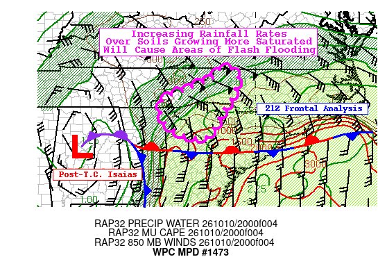
-
2026-2027 Fall/Winter Mountain Thread
Maggie Valley Steve replied to BlueRidgeFolklore's topic in Southeastern States
GSP just posted on X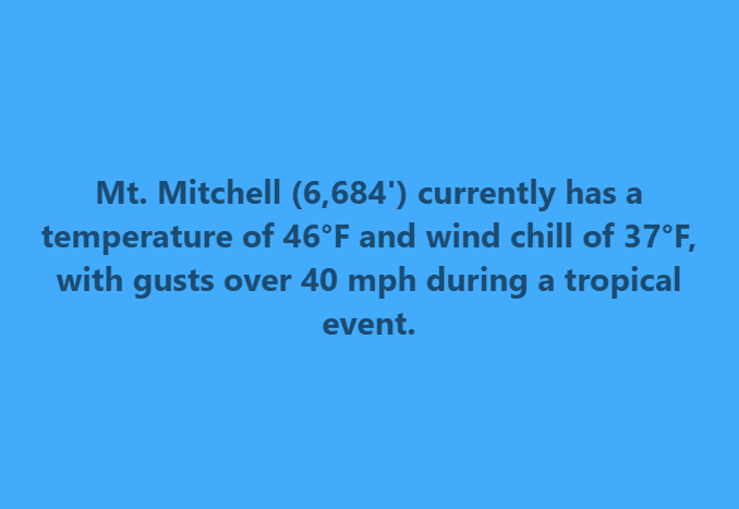
-

2026-2027 Fall/Winter Mountain Thread
ncjoaquin replied to BlueRidgeFolklore's topic in Southeastern States
I am at 3.03 inches. Downtown .67 inches. The airport at 4:30 was at .96. For a change, the rain lined up in my favor. Maybe I can make it to 4?