All Activity
- Past hour
-
and you can take a stroll down memory lane if you go back to the beginning of this forum here - all documented
-
i think that this is arguably even more impressive. this is 15 years later and the only model that really showed this being a legit hit inside of 5 days was the GFS and every model bowed down to it. literally like Tony wrote a script
-
Most dramatic favorable late shift since then?
-
This is one of those cases that will keep us up in the future when the GFS is on an island giving false hope. This time it seems to be real, and it’s been awesome watching everything trend towards it instead of the other way around. Being a Philly sports fan and knowing weather will do what it wants, Im still weary and keeping an eye out for signs of a rug pull, but that’s more reflex than conscious thought.
-

“Cory’s in NYC! Let’s HECS!” Feb. 22-24 Disco
Ginx snewx replied to TheSnowman's topic in New England
You guys need to slow down these gifs can't read init -

2/22-23 "There's no way..." Storm Part 2
stormtracker replied to Maestrobjwa's topic in Mid Atlantic
Man I tried to get out of it. I tried. I'm miserable. I'm on my 3rd Tequila shot while they are outside smoking up. Still, I'm not a sore loser. I hope yall get mauled. -
Up to 5.5" now and just dumping out
-
I had already done a pass on the driveway after the first burst that left a little over an inch but I doubt I’ll bother with this current crud unless we redevelop some more and grab a couple inches. I think if it stays below that, we’ll melt it on the pavement tomorrow.
-
Yup, while the upper atmosphere is plenty cold for snow we have a shit surface temp to deal with. Heavy precipitation will cool us down and then we'd basically be pinned to around 32 degrees. We'll lose some accumulations to white rain and ratios will suffer early even after accumulations begin until that happens, and then the ratios will be "fine", nothing insane. So the instantaneous ceiling is probably 10:1 but the event ceiling depending on where you are could be 5-8:1
-

2/22-23 "There's no way..." Storm Part 2
SomeguyfromTakomaPark replied to Maestrobjwa's topic in Mid Atlantic
Man we are so close…. -
As we await the 0z model runs, here is a detention assignment for some of you.

-
Yeah for any big totals you really need to be in Eastern Massachusetts.
-
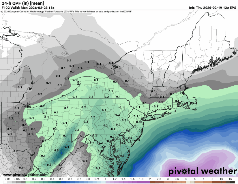
100% of 4”+ at DCA on it. Caveat 10:1 ratios. But that should still mean a solid 2-4”+ for DC.
-
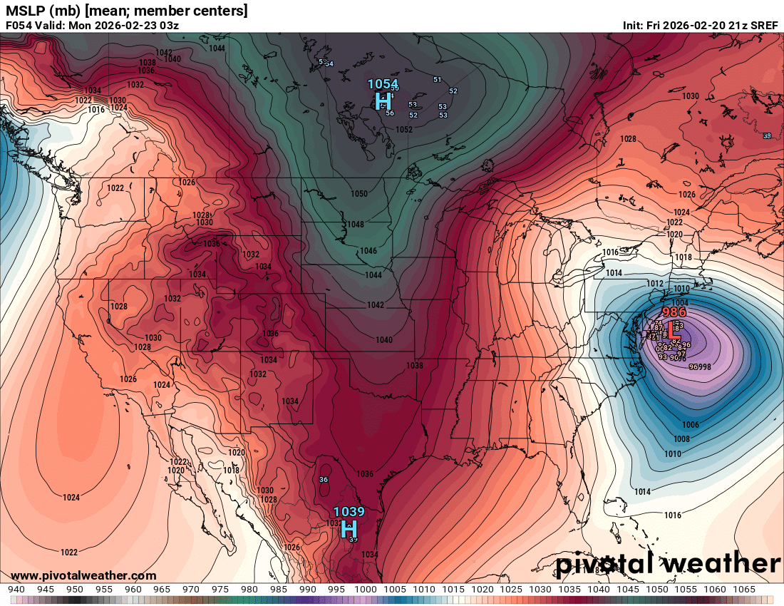
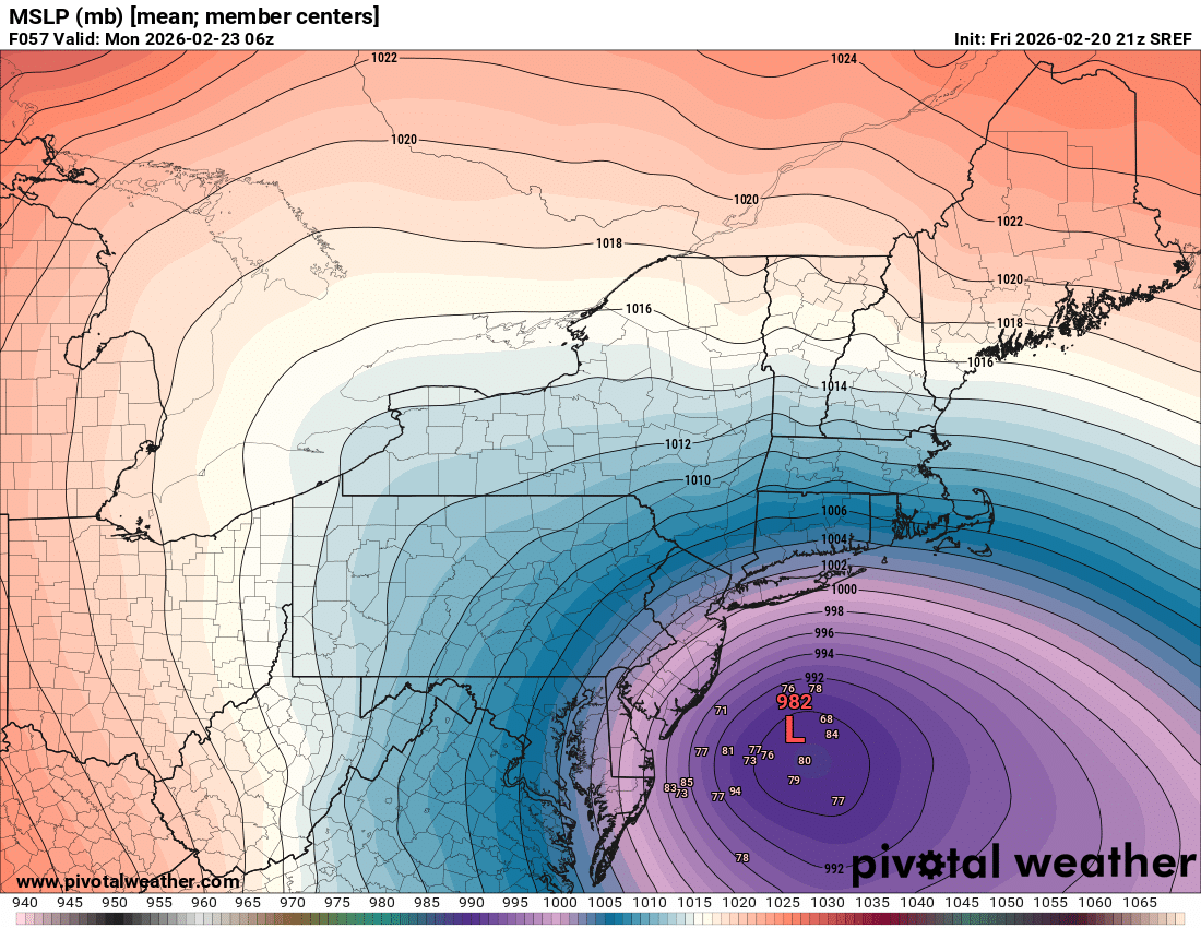
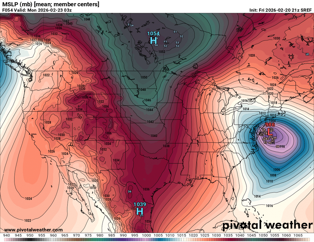
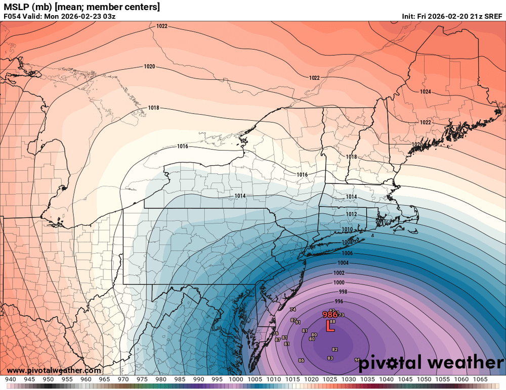
Sref also

-

February 22-23 Storm Thread/OBS
coastal front replied to Mikeymac5306's topic in Philadelphia Region
Man is this actually happening???? Holy shit what a trend the last 24 hours! -
Boxing day felt different for me bc the cave was even closer in. And the storm happening around Christmas just added to the magical feeling. Edit: also being younger helped too
-

2/22-23 "There's no way..." Storm Part 2
SnowenOutThere replied to Maestrobjwa's topic in Mid Atlantic
I’ve been out hiking and adventuring all today so what did I miss? Generally seems like guidance is shifting to a 70% GFS 30% Euro solution from last night -

-

Central PA Winter 25/26 Discussion and Obs
Mount Joy Snowman replied to MAG5035's topic in Upstate New York/Pennsylvania
Man what a score this would be for the GFS. -
For reference round timeframes for model runs for those new to this: 00z / 12Z SREF: 7:30 PM / AM NAM: 8:50 PM / AM RGEM: 10:00 PM / AM ICON: 9:50 PM / AM GFS: 10:30 PM / AM GFS AI AIGFS: 10:30 PM / AM GGEM: 10:40 PM / AM UKMET: 11:05PM / AM GEFS: 11:30 PM / AM Euro: 12:50AM / PM Euro AI AIFS: 1:00 AM / PM Shorter range models now coming into play within 84 - 60 - 48 RRFS H NAM 3k HRR RPM HRW HRDPA (Canadian)
-
Tucked
-
Excellent. Thank you for the information.
-
ICON ENS lol
-
-

2/22-23 "There's no way..." Storm Part 2
DDweatherman replied to Maestrobjwa's topic in Mid Atlantic
The mean output is going to be ridiculous with that look…