All Activity
- Past hour
-
The biggest issue is widespread drought. It has picked up steam this winter regardless of weather pattern. Reminds me of 17-18 which was so cold at times but the STJ was not there. The other thing is the northern stream is out of sync with the STJ…meaning its vortices are not connecting with STJ impulses. I see some signs of that relenting after the 25th. I am not sure how long that window lasts. Some modeling has Feb holding a SE trough w a PNA ridge. The GOA low is present on some modeling late, but generally that has been a red herring. I still remain optimistic that we see wintry conditions. There is a lot of cold air in modeling right now. I have to think we score with that on the table.
-
Get that garbage out of here man. Snowy maps only Haha
-

E PA/NJ/DE Winter 2025-26 Obs/Discussion
LVblizzard replied to LVblizzard's topic in Philadelphia Region
Mesos seem to agree on a stripe of 2-4” somewhere between Philly and the Poconos tomorrow. The question is where exactly does it set up? I’m feeling pretty good in Allentown but the Poconos could do particularly well because of their elevation. -
Did you all see the wreck in Cookeville yesterday on I 40? They had a very heavy squall move through that initially melted, and then froze back causing terrible situation. .
-

Pittsburgh/Western PA WINTER ‘25/‘26
colonel717 replied to Burghblizz's topic in Upstate New York/Pennsylvania
As beautiful as that run was the other night, that 6z run has fully erased that x10. Back to back WTOD. We may need to pull it out after that. Worst nightmare for us. -

Another Coating of Snow Saturday - "It's all we Got"
Sey-Mour Snow replied to Sey-Mour Snow's topic in New England
milder with less qpf -

2025-2026 Fall/Winter Mountain Thread
Maggie Valley Steve replied to Buckethead's topic in Southeastern States
My low was 12 this morning. My high yesterday was 23. Cataloochee has been making snow non stop since 10 PM Wednesday night. The mountain looks awesome and ready for the busy Holiday Weekend! -
One of the analogues that I continued to see back in late summer to early fall for this winter was 2013-14. (I think) lol .
-

First Legit Storm Potential of the Season Upon Us
weatherwiz replied to 40/70 Benchmark's topic in New England
Wow pleasant surprise with the overnight guidance. Given the time frame we're entering hopefully those trends are an indication of where we're headed. Definitely want to see the Euro with a bit of a bigger shift at 12z. Still need a bit of work but its doable at this range. -
-
It might not be. Euro has 2” and it’s been increasing each run. These are the sneak systems that can ramp up in the last 24 hrs. Let’s bring this one home.
-
I was just looking through ensembles and thought the same thing. Let's get plenty of rest in the mean time and hope we are tracking something significant in the latter half of the month!
-

Central PA Winter 25/26 Discussion and Obs
Itstrainingtime replied to MAG5035's topic in Upstate New York/Pennsylvania
What's the timing for tomorrow morning's snow arrival? -
One at a time! Lol
-
-
That contributed to that 2014-2015 season being one of the best that I’ve seen since we moved to E TN in 2011. That year we exceeded 20in total snowfall, but it didn’t really get going until late Jan and ramped up in Feb. and into March.
-

E PA/NJ/DE Winter 2025-26 Obs/Discussion
The Iceman replied to LVblizzard's topic in Philadelphia Region
some of the other meso's last night also hinted at this. Will be interesting to see what they say today. Could be a sneak advisory level event with the timing especially upper bucks/lehigh valley by the delaware river. -

Another Coating of Snow Saturday - "It's all we Got"
dendrite replied to Sey-Mour Snow's topic in New England
HRRR is always playing catch up -
Does that mean it is right for Sunday too? lol
-
Will need advisories soon if trend continues into 18z runs and also euro and ukmet hold or get better
-
Gotta hand it to the 2 Canadians. They've had this threat for days with only minor adjustments.
-

January 2026 regional war/obs/disco thread
Sey-Mour Snow replied to Baroclinic Zone's topic in New England
Enormous potential, but I'm not celebrating yet, it was just last year we had and epic 2 week stretch modeled with 20" + on all ensembles.. I think 3-6" verified for most over 2 weeks.. -

January 16-19th: Rolling the dice
Stormchaserchuck1 replied to SnowenOutThere's topic in Mid Atlantic
Whoa! 2-3" snow depth tomorrow between Westminster and Hagerstown on the 12z NAM -

Another Coating of Snow Saturday - "It's all we Got"
HoarfrostHubb replied to Sey-Mour Snow's topic in New England
I think it can show some trends a bit more consistently (just eyeballing)... but it does seem to overso things -
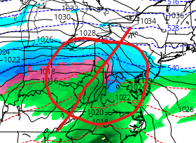
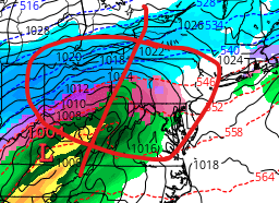
12z NAM is going all in for interior areas.


.thumb.png.4f89837092f0f2641f0c6405a7cb851c.png)
.thumb.png.4f1cac4b3dee0c6354f9bf46cb41aa5f.png)

