All Activity
- Past hour
-
 W/ that sat imagery I bet it was stronger than 125 kt. Pinhole eyes often suggest higher, but Dvorak has nothing to account for eye diameters or tight systems, esp. when the inner core is tiny. We generally underestimate the most intense TCs and small TCs from satellite estimate.
 -
More ern NY currently!
-
 Here it comes for SWCT. Just as we suspected.
 -
 This thing hangs out over water long enough NHC will give it a name.
 -
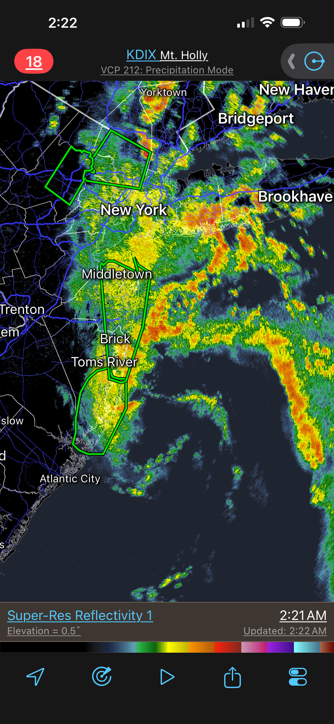
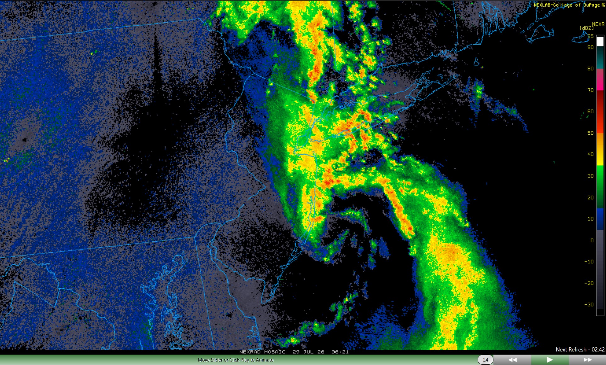
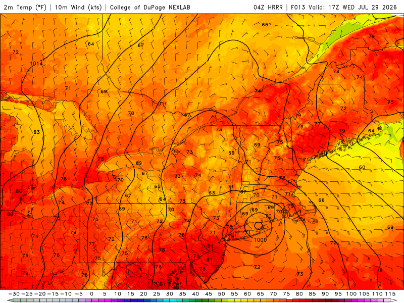
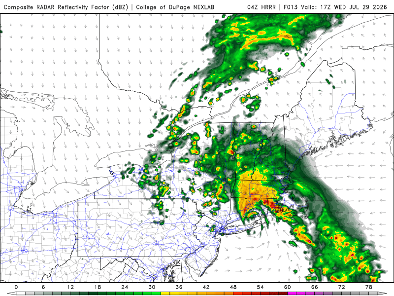
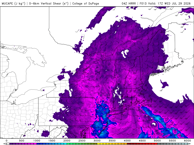
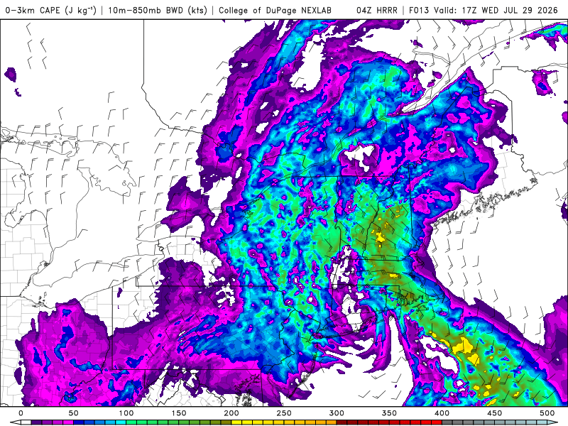
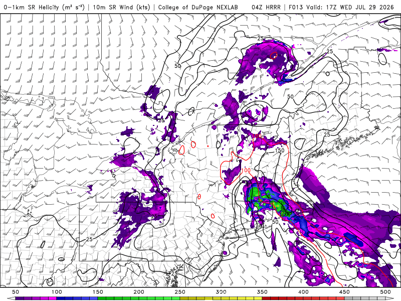
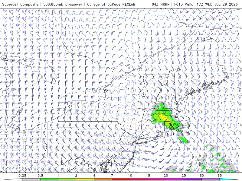
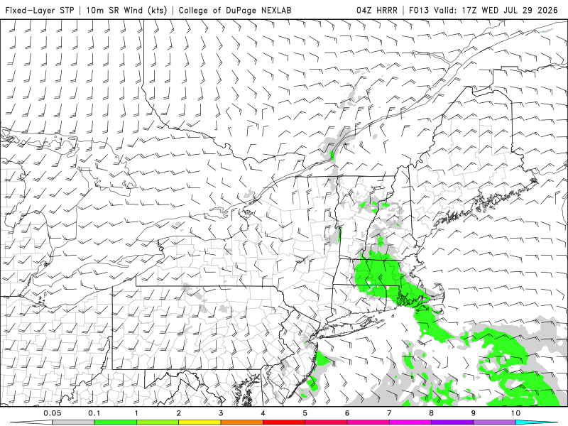
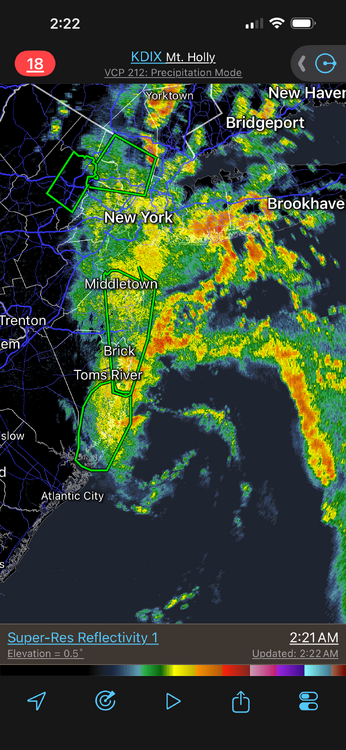
04z HRRR rides a 996 mb low into cntrl CT (makes "landfall") later this morning. This is how the BDL F4 occurred on 10/3/1979. Sfc low from S of LI came up from the S and moving right over cntrl CT. Did WxWiz even get a hint of this before going to bed? I know CoastalWx did not, and now be like, "HUH????, where did this come from?! I was focused on all the rain!" Sooo...has anyone looked at the svr wx parameters? They are sneaky impressive. From 04z HRRR: 1) CAPE values NE of the sfc (meso?) low. 500-1000. That's more than enough when low-level shear is solid (see below). 2) 0-3 km CAPE - areas of 200+ CT/RI border to srn NH - again, more than enough (75 or more is good). 3) Now this is where it gets interesting. 0-1 km SRH NE of sfc low, large area of 200 w/ a max of 447 at 17z over NW RI! That is crazy and no reason this is spurious given the set up and evolution here. 4) SCP and SIGTOR area are there. Not honkin' but that's due to low CAPE largely. Low CAPE/high shear can do some amazing things! 4) Sim radar shows discrete cells in an arcing line NE of the sfc low. NE of sfc lows (synoptic, meso, or tropical) are prime areas for spinners. You have low CAPE in the column, but its more than enough for stout convective updrafts, 0-3 km CAPE is high so there is your low-level vortex stretching, and 0-1 km SRH is excellent. SPC 06z outlook has gen tstms only for the NE. I don't know about that. And yes, the small low pressure is already there off the NJ coast (radar attached).
- Today
-
996 mb for a coastal low is quite impressive for July here. And it's tight little sucker! Going see some big rain from this esp. since CAPE are 500-1000 over srn New England for most of the event. Those are ideal values for max rainfall rates and warm rain processes.
-
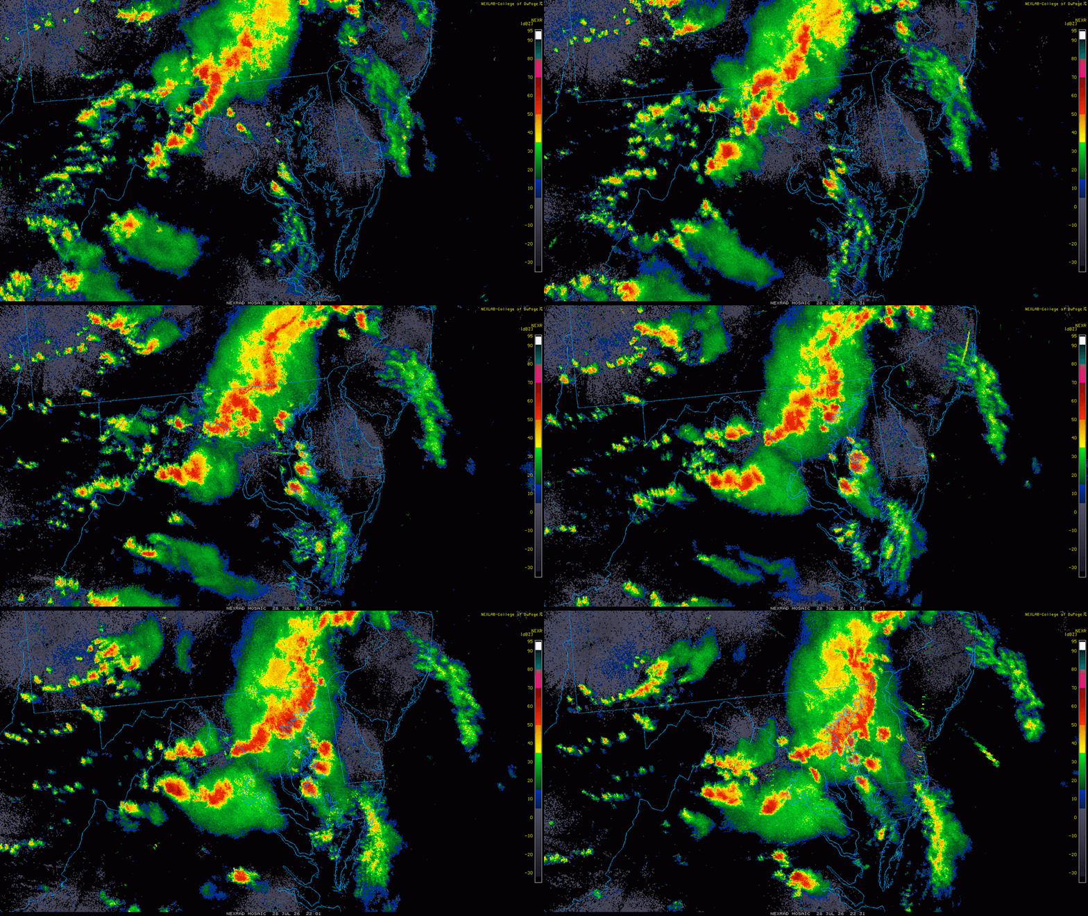
Things turned out close to what the models where showing, at least for the DC area Plenty of wind reports, some hail, and one tor so far. Odd, a lack of svr reports in the RIC area and much of cntrl VA, where the highest tor probs were initially. I had a quick 1.00" even of rain (WxU site just up the street) and it got quite windy, but no damage in my immediate area. Kind of avg for a storm.
-
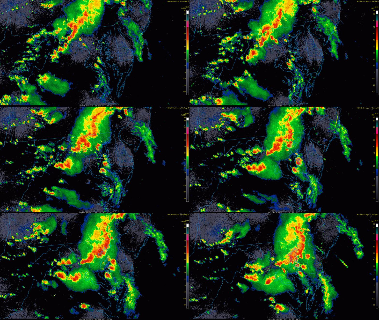
Radar loop from 2000 to 2230z here. You had a line w/ the pre-frontal trof moving SE and isolated storms moving NE ahead of it, and some were supercells, esp. those one just E of the bay. One clearly split and one produced the tor in Trappe.
-
Everyone east of the Hudson take a look at your radars - you are about to receive steady heavy rain as a long stream of moderate to heavy rain is moving up the coast and extends south all the way to the Carolinas and the developing low dropping into the trough will develop further just off the coast and draw all this moisture into it - an unusual set up for late July
-
Received 3.75" of rain Tuesday. 2.55" on Monday for 2 day total of 6.30 inches of rain. Have had 13.73" so far for July.
-
 It does on the Hrrr, just takes like 8 to 12hrs. Edit HRRR takes a 996mb low into New Haven this run and 5" for most of Faifield County.
 -
 I believe Supertyphoon Dolphin was up to 125kt/145mph today but is now down to 120kt/138mph. This is from about 12 hrs ago when the overall presentation looked the best
 -

2026 Mid-Atlantic Severe Storm General Discussion
high risk replied to Kmlwx's topic in Mid Atlantic
It was interesting how the overnight runs looked pretty good, and then the 12Z suite (and a HRRR cycle or two after that) didn't look as good, before the HRRR locked on to the solution by late morning. And I'll be curious to see how many tornadoes are actually found. There were probably way more warnings than needed, but I'm wondering if they'll find more than the current count of one (good video of a tornado on the Eastern Shore north of Cambridge). Ultimately, we probably weren't far off from a more significant tornado event, but as you suggested in your post, the low-level winds were probably just a bit too weak, although I think that the low-level profile was slightly better than what the RRFS and GFS/ECMWF were suggesting last night.- 1,673 replies
-
- 1
-

-
- severe
- thunderstorms
- (and 7 more)
-
 Is that stuff down off NJ and Delaware supposed to rotate up in here?
 -
Huge area of backbuikding over Bergen, headed this way.
-
2026 Mid-Atlantic Severe Storm General Discussion
high risk replied to Kmlwx's topic in Mid Atlantic
The guidance trends were really interesting. Things were looking encouraging for fairly significant storms in the early runs on Tuesday, and then the cycles right after the raob data became available looked fairly lousy (as noted in your post). Then, the HRRR started locking in again on the more significant solutions. -
Latest HRRR has some decent rain for LI overnight and some intensification with the developing low. So far I think there's been a 30 second shower here.
-
There’s some back building on radar.
-
 Always in warm months, never in cold months.
 -
It's going to be some very specific corridors of haves and have nots.
-
Definitely a good soaker here. Sitting at about 3 inches. Some areas got twice that, which is pretty crazy. Had solid downpours about an hour ago. Haven't had to add water to the pool once this year, and in fact I've had to drain it several times, tomorrow included.
-
 Somebody is in for a rough morning.
 -
Currently the hardest rain of the day with some thunder.
-
Absolutely nuking here, even heavier than before.