nzucker Posted December 27, 2010 Share Posted December 27, 2010 This wasn't a great "snow" storm here in terms of totals for Southern Westchester, but it was a great blizzard. Here are my top storms for Westchester County: 1) February 25, 2010 (26" wet snow, high winds) 2) January 1996 (long duration, cold, three days off school) 3) February 2006 (20" snowfall, very quiet and peaceful storm) 4) December 2010 (13" snow, 60mph winds, surprise storm) ..... Link to comment Share on other sites More sharing options...
simpsonsbuff Posted December 27, 2010 Share Posted December 27, 2010 This wasn't a great "snow" storm here in terms of totals for Southern Westchester, but it was a great blizzard. Here are my top storms for Westchester County: 1) February 25, 2010 (26" wet snow, high winds) 2) January 1996 (long duration, cold, three days off school) 3) February 2006 (20" snowfall, very quiet and peaceful storm) 4) December 2010 (13" snow, 60mph winds, surprise storm) ..... This was a "snowhole" for central westchester. Link to comment Share on other sites More sharing options...
ag3 Posted December 27, 2010 Share Posted December 27, 2010 Finished with 30.5 here. 1.5 inches short of the 1996 blizzard. But as far as impact in this specific area, this storm wins. So it's definitely #1 in my lifetime. There are cars stranded everywhere...everything is closed..it's a disaster. I'm still digging my car out and have been doing so since 8am. You just decribed 1996 too. 1996 had all that. It had the wind, the snow, the mayhem. But also had closure of schools too. 1996 also had 20"-35" everywhere. NE Queens and Nassau County got 30"+. The LIE was shut down for 7 hours for over 30 miles. And totals were measured differently back then that skewed numbers to the low. Congrats on a great storm you had!! I received around 16-18" and I will rate this storm #2 in my 30 year life. With 1996 the king still. I loved your minute by minute updates last night! Glad u got buried! If u were old enough for 1996 to remember it, you would be struggling which one was better for your area. Link to comment Share on other sites More sharing options...
Bliz299 Posted December 27, 2010 Share Posted December 27, 2010 As expressed by others it's hard to compare. Feb., 2003, had greater snow, wind, lower temps. and true blizzard conditions . Feb. of this year was more damaging because we had a mixing issue, producing much ice on trees and wires, as well as more snow & wind. 1978 & 1979 both had storms with more snow and at least as much wind. Tough to say which I enjoyed more! Historically this appears to be the greatest Dec. snowstorm in Cape May going back to 1872. My total of 16.2" easily beat 1904's 12", which was also on the 26th. Incidently my lowest pressure was 29.36" at 12:14am today. All in all: WOW! Link to comment Share on other sites More sharing options...
earthlight Posted December 27, 2010 Share Posted December 27, 2010 This radar image will go down as the single favorite radar image of my entire life. Link to comment Share on other sites More sharing options...
bluehens Posted December 27, 2010 Share Posted December 27, 2010 In Wilmington DE I'd go with 1. 1996 - I had 32" in Newark DE 2. Feb 5-6, 2010 - measured 27" in my backyard 3. Feb 9-10, 2010 - measured 21" in my backyard 4. PDII - 21" I'm no fan of wind in storms so that rules out '93 which in DE was a bust with 10" or so of front end snow followed by hours of rain and sleet. I like my storms quite so I can just watch the snow pour down and you also get better ratios with no wind. Link to comment Share on other sites More sharing options...
TwcMan Posted December 27, 2010 Share Posted December 27, 2010 1996 is number 1 for me....this is number 2....finished with 28 inches here Link to comment Share on other sites More sharing options...
nzucker Posted December 27, 2010 Share Posted December 27, 2010 This was a "snowhole" for central westchester. Yeah, we really got gipped in this one in terms of snowfall totals. Great storm but definitely would have liked to get a few more inches. Hard to call a storm that only dropped 13" one of your best ever, although it still might be 4th here for the model suspense, heavy winds, blinding snowfall rates, and taking place at the conclusion of a brutally cold December after XMAS...very fitting. No way it could stack up to 2/25/10 or January 1996, though in Westchester. This radar image will go down as the single favorite radar image of my entire life. Not mine...look at that mega-band robbing the dynamics to its east and west. This was what happened to much of the area in 12/19/09 when SE CT and C LI stole the show...similar story in Feb 06 when the heavy banding was NYC to Hartford and NJ/LI got screwed. Link to comment Share on other sites More sharing options...
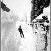
CAT5ANDREW Posted December 27, 2010 Share Posted December 27, 2010 Between 6PM and 1AM,those were the most intense conditions I have ever experienced.Between 9PM and 1AM that period beat JAN 1996,FEB 1978,FEB 1983.What I experienced last night was a once in a lifetime experience with snow and wind here.65MPH winds with snow rates of 3-4 inches per hour made the conditions the most brutal I have ever experienced.A half mile walk down Woodhaven Blvd was like crossing the Arctic Tundra.This was like a snow microburst.The Whiteout was truly 0 visibility.The wind chills were brutal.This was a TRUE Blizzard for us.I have not seen this since 1996.The plow wakes,cars buried and stranded and 6 foot drifts.This was truly a White Hurricane!! I dont know how much we truly got.I measure 21-25 inches in many areas but dont know the true accumulations,everything is an estimate.Over 20 inches is definite though.My list for SNOW RATES and WINDS combined#1 DEC 25/26 2010 the Snow derecho#2 JAN 7/8 1996#3 FEB 6/7 1978#4 JAN 22/23 2005 Link to comment Share on other sites More sharing options...
lindywx Posted December 27, 2010 Share Posted December 27, 2010 My Top 10: 1. Feb 78 2. Jan 96 3. Feb 83 4. Feb 69 5. Dec 2010 6. Feb 03 7. Jan 78 8. Dec 2009 9. Jan 2005 10. Feb 2006 Dec 2010 was 10th. in terms of snowfall for me but #1 in terms of wind and #1 in terms of tracking and #1 in terms of timing. Link to comment Share on other sites More sharing options...
earthlight Posted December 27, 2010 Share Posted December 27, 2010 Holy crap around this area...matches w/ my 30.5 ...UNION COUNTY... RAHWAY 32.0 1000 AM 12/27 PUBLIC ELIZABETH 31.8 700 AM 12/27 TRAINED SPOTTER ROSELLE 28.7 710 AM 12/27 TRAINED SPOTTER :snowman: Link to comment Share on other sites More sharing options...
jm1220 Posted December 27, 2010 Share Posted December 27, 2010 In terms of snow, I'd rank this one a shade over 12/30/00 and 12/19/09. Even without the thundersnow those had, the longer duration led to similar or higher totals. The Blizzard of 1996 and PDII are still my top two in that department. We might have come close, but didn't get the amount of snow we did from PDII. We might have gone over 2 feet from that one in Long Beach. In terms of wind, this might be my #1 snow noreaster. Overall, the March noreaster last year was windier here and the tree damage was enormous. There were a number of large branches down around town today, and one small tree I saw, but not the kind of damage I expected. Maybe the March storm knocked out all the weak trees, and the lack of leaves on trees protected them. The most we lost power for was about 15 minutes this morning. #2 might be a tie between the Blizzard of 1996 and the 2/25/10 storm. I was very young for the 1996 storm, but I distinctly remember the roaring wind along with the snow. 2/25/10 must have gotten our wind above 50 mph for a time. Last night, chances are we had over 60 mph gusts for a time. Winds are STILL gusting up to 45 mph outside. Overall, this storm ranks #2 or 3. The Blizzard of 1996 is still by far #1, and it's a tie between this one and PDII for #2. 12/30/00 and 12/19/09 are 4 and 5. Link to comment Share on other sites More sharing options...
RU848789 Posted December 27, 2010 Share Posted December 27, 2010 For me #1. 96 #2. 03 #3 06 #4. All for this location produced similar totals around 24", but for this one having 6 hours plus of whiteout conditions makes it tops for me. I literally couldn't see my neighbor's house across the street from me (maybe 200 feet away) for hours. #1 for me, also. Had more snow in 96 (28"), but this storm was more intense, with hour after hour of near zero visibility blizzard conditions with pouring snow of 2-3" per hour. I always go out regularly during storms to shovel and I've never seen conditions like last night. Amazing. Everything else is at least a notch or two behind this one and 96, which is a close 2nd for me. Link to comment Share on other sites More sharing options...
dg12x Posted December 27, 2010 Share Posted December 27, 2010 Some perspective for coastal Monmouth County (the following was put out by Neptune Township): http://www.neptunetownship.org/page.php?permalink=home (To avoid any confusion, I am not the author of this piece). BLIZZARD RECAP - DECEMBER 27TH The snow is over, but the strong northwest winds continue. Temperatures are struggling to rise out of the mid 20s, so very little melting will occur today. The "official" snowfall total for Neptune is 27 inches. Measurement was difficult due to drifting and the need to take measurements away from structures due to the snow blowing off of roofs. Many areas around your homes probably have in excess of three feet for this reason. Some other measurements of interest: In Monmouth County: Colts Neck - 25, Ocean Township - 27, Manalapan - 31, Lincroft - 26 Other areas: Elizabath 31.8 (highest I could find), Newark Liberty - 24.2, Central Park 20.6 (4th largest on record), Philadelphia - 12. Generally in Monmouth County, this storm equals the January 7, 1996 blizzard and is only surpassed by the December 26, 1947 storm when a general snowfall of 30 inches was recorded in this area. Specifically for Neptune, this is the 2nd largest snowfall in history, exceeding 1996 by one inch and trailing 1947 by three inches. The computer modeling started to show this event On December 18th and consistently showed a big event up until December 23rd when all of the modeling changed to an out to sea solution. Once the models swing so strongly in one direction, it is very rare for them to swing back in the other direction, but that is what occurred on Christmas Eve. From Christmas Eve night until the start of the snow yesterday, the modeling was very good....even showing the exact location of the the mesoscale banding that caused the extraordinary snow amounts across coastal sections. Keep in mind that plowing is being delayed throughout the area due to many stranded cars in the middle of roadways and plows simply getting stuck in the large volume of snow. Please stay off the roads for the balance of the day so that crews can work as efficiently as possible and be reminded that the second largest snowfall in history is going to cause challenges for everyone. From a forecast standpoint, I had to play a bit of catchup with the accumulation forecast due to the extreme snowfall rates that occurred between 11pm and 3am last night when about 10 inches of snow fell. For residents in the DC/Baltimore area and interior PA, the thought of the day is "What storm"? The gradient between light snow and heavy snow was very tight just west of the Delaware River followed by a second gradient between heavy snow and historic snow which ran basically north to south down the middle of New Jersey. So, no more snow in 2010 as the weather turns mild towards the New Year. This is the 4th storm in calendar year 2010 to bring in excess of 15 inches of snow to the Neptune area the 5th such storm since December 19th of last year...a simply amazing statistic given that the average snowfall for an entire winter in this area is about 25 inches. Link to comment Share on other sites More sharing options...
MJO812 Posted December 27, 2010 Share Posted December 27, 2010 I would rate this number 1. I was too young to remember the Bliz of 96. Link to comment Share on other sites More sharing options...
eyewall Posted December 27, 2010 Share Posted December 27, 2010 WHen I lived on Long Island it was '96 followed by PD II (West Islip). In 96 my brother and I actually went to robert moses st. park in the height of the storm. Unbelievable conditions there (probably 60-70 gusts and visibility was pretty much at just a few feet). What amazes me about yesterday's event from all I have seen is those kind of conditions actually ocurring in NYC and in the middle of LI etc. This storm was a monster for that and it will be remembered for true blizzard conditions and strong winds. One of the kind I have always heard talked about as a kid. In terms of overall context I would have to say the Jan 25th, 2000 event is number one for me in NC. I was in Southern Pines for it and witnessed an unforecasted 21" fall. That is at least a once in a century type of event here. Link to comment Share on other sites More sharing options...
NJwinter23 Posted December 27, 2010 Share Posted December 27, 2010 I wasn't old enough to really enjoy the 96 blizzard, so this is definitely the best storm of my life. 25" of snow with winds gusting to 35mph frequently, temps around 24-25 most of the storm. Beat my totals from all other winter events in the 2000-2010 decade. Snow totals fell short of 96 blizzard by 5" here, and December 1947 was also a 30" monster in Monmouth County. So this storm would probably be #3 all time for Monmouth County in the past 110 years!!! This was the best thing I've ever seen, my memories of 96 are good too and that was a little more snow and probably remains #1, but this was INCREDIBLE, and I'd say more intense than 96. 10-12hrs straight of true blizzard conditions with visibility 0-20 yards. I also measured between 23-27" on average, so 25" it is! Link to comment Share on other sites More sharing options...
SnoSki14 Posted December 27, 2010 Share Posted December 27, 2010 The storm was truly serendipitous considering I first saw the storm way out on the gfs right after the weekend storm bust. I don't think I've every seen a storm verify from over 10 days out. Not only did it verify but it completely surpassed all expectations. Also very rarely do we see the models go from nothing to a blizzard just over 2 days before the event, I hope we've all learned something from the models and that even 2-3 days out, nothing is a guarantee (remember March 01, January 2000). It's just a joy for something to go so right where you mostly see things trend in the wrong direction. I believe this may be one of the only KU events in such a strong Nina, which is also remarkable. This storm will definitely be the exception, not the rule in future moderate to strong Ninas, but it just goes to show, that you can't discount something because climatology says no. Now I'm curious to see the NESIS/KU rating for this storm, I'm going for either a strong 2 or a 3, which would fit in with last winter's December and February storms. And those who argue for a 4 or greater need to remember that while our area has seen some very totals, this is not a 96, 03 storm. Like last year's February storm for DCA/PHL, this one was centered more on us, not them which will decrease the overall impact. Regarding area wide impacts, this doesn't come close to 03 either because that storm was far more widespread than this one. But for us, this storm is definitely right up there with the greats, not only because of the 20"+ totals, but for the rare, verified blizzard conditions that we experienced. I don't think any other storm had the kind of wind power that this one had around this area, but I'm not that old to remember the past storms so I wouldn't know 100%. Link to comment Share on other sites More sharing options...
ARyan Posted December 27, 2010 Share Posted December 27, 2010 These types of snowstorms seem rare but they are probably common in this type of Greenland Blocking configuration that has been so prevalent since 2009. We don't have much data to work with and I don't think think these types of storms are as rare as many people think. This historical period of southern snowstorms probably isn't over yet. You should probably check out the Northeast Snowstorms book. We're in an active period but these storms are far from unprecedented. Link to comment Share on other sites More sharing options...
ARyan Posted December 27, 2010 Share Posted December 27, 2010 I had a similar story! My phone fell out of my pocket in a HUGE snow pile, and my friend found it after 15 minutes of searching. And yes, this storm is definitely my favorite of all-time. 19" here, with incredible, incredible winds. There were times where I was actually scared. Really?? When I measured last night around midnight, I measured 12"+ drifts but I figured the average was around 11" since I couldn't find a true and accurate spot to measure. I have no idea how much snow fell overnight but I have doubts that we reached 19". Anyway this storm is on my top 10 simply due to the winds. Absolutely stunning. I don't really remember 1996 since I was too young, so PD II is my all time top storm. Link to comment Share on other sites More sharing options...
baroclinic_instability Posted December 27, 2010 Share Posted December 27, 2010 Back from Christmas. Hope everyone had a merry Christmas! Looks like the storm was a fun one. Can't wait to gloss over all the data and do a write up/analysis of this storm. It certainly was amazing tracking this storm...one of the most difficult forecasts in quite a while. Looks like it ended up being quite compact, and the extreme banding is not a surprise with a system that intense and driven mainly by mesoscale forcings. Link to comment Share on other sites More sharing options...
bkviking Posted December 27, 2010 Share Posted December 27, 2010 1. The first great snowstorm that left impression on me was Feb 78, and while I was only 8, I still have images of that experience, and combined with knowledge today it verifies my memories and I would rank it number one. In youth, only Belle and Gloria left similar impressions. 2. 1996 was the next great winter blizzard after 78 (not too many memories of '83), and after such a long stretch without a true blizzard it was great, as well as fact I was older. A BIG factor was the storm started at 7AM so it was great to see the storm crank up during daylight 3. PD2 is 3, and the frigid airmass probably has as much to do with it as the snow totals. I remember JB calling this one days in advance 4. Dec 10 - although the snow totals weren't enormous, the early start and incomparable winds produced drift heights on par with higher snow total storms above. 5. Dec 09 - 25" in Miller Place here, and strong winds, BUT most of it happened overnight which makes me think this would rank higher if it was day storm Link to comment Share on other sites More sharing options...
Chris L Posted December 28, 2010 Share Posted December 28, 2010 This storm is tied for #1 for me, yes that's correct, tying my all time favorite of the Blizzard of 1996, heck it might be the all time #1 the more I think about this........ Here's why '96 never had these type of snow rates and I got around 24 inches of snow from this one in 18 hours; 1996 dumped 27.5" according to my father. But what made THIS one special was the fact that we weren't gonna get ANYTHING 54 hours out, until the H500 low was clearly a favorable setup for all of us. Now, as for as DURATION factor, the 96 blizzard remains surpreme here. (Although I did see a 48 hour snowfall, (25.3"); in Santa Fe New Mexico in December 2006; but that snow wasn't heavy, just moderate with some heavy bursts, a nice surprise, but that does not belong on the list of blizzards for this location). Here's the scary thing; had this baby was a bit longer (24 hours instead of around 18 hours or so), the NYC metro would have easily gotten close to 3 feet of snow as evidenced by John's total and Elizabeth New Jersey total of 31.8" February 2006 had simlair rates, but never the winds, the winds were rather weak in contrast. I adored PD II because it was a classic STJ Miller A with a crapload of moisture (21.5") but I had some sleet (as most of us did with that storm for a period of time, it was sleeting pretty hard at times). DEC 2000 was another great storm, and had some very heavy rates; but the winds were rather tame compared to this. And how could we forget last year? February 25th blizzard, but that did not have the bands like this one did, and even if it did, it was a longer storm as well.. The photos of this storm is...... quite unreal. Just watching the radar trends, wndows of heavy snow, going outside twice for a decent amout of time with strong winds.... And probably what made it better was I tracked it with all great weather folks as yourselves. JAN 1996 remains the king as for as duration because it had cutoff low at H500 and H700, however..... THIS was a stronger system (974, I think vs '96 979 mb).. I will always love the blizzard of 1996 because it was the first true blizzard I have seen and memories of myself being sunk in snow. Just think, put THIS storm, with the duration of 1996... what do we get? What we get is: The snow version of December 1992, which is ideally, my dream storm forevermore (Alex knows what I am talking about here, ahhh, DEC 1992 all snow; we would get 36 to 42 inches of snow, with 4 feet possible..... Link to comment Share on other sites More sharing options...
Ray8002 Posted December 28, 2010 Share Posted December 28, 2010 Back from Christmas. Hope everyone had a merry Christmas! Looks like the storm was a fun one. Can't wait to gloss over all the data and do a write up/analysis of this storm. It certainly was amazing tracking this storm...one of the most difficult forecasts in quite a while. Looks like it ended up being quite compact, and the extreme banding is not a surprise with a system that intense and driven mainly by mesoscale forcings. I have to say, you really nailed this storm bro! Great work and we really appreciate your analyses.. Link to comment Share on other sites More sharing options...
jamesny Posted December 28, 2010 Share Posted December 28, 2010 This storm and 96 are a tie for #1. I was only 12 yrs old during the Blizz of 96. I don't remember much but walking to school in higher than knee deep snow. That was something! Link to comment Share on other sites More sharing options...
Diego Posted December 28, 2010 Share Posted December 28, 2010 One of the most interesting and exiting storms in my lifetime, because (as noted by CATSANDREW), of the intensity of it between about 6PM and 1AM. The high rates of snowfall combined with high wind speeds, sustained from 25 to 35mph with gusts reaching 50mph, resulting in an incredible visual feast of heavily falling snow with the extensive blowing of it, with visibilities occasionally approaching 0. What may distinquish this one from some of the other top ones (Dec. 1960, Feb. 1978, Jan. 1996 and Jan. 2005), was the continuous nature of these conditions without interruptions during the above time period - there were no lulls, that heavy snow band remained stationary over my area during this entire period. It was also appealing because there were no mixing issues. This was a pure and cold snowfall from beginning to end. During this period, I also noticed that whenever I either opened my door or stepped outside, the air was so permeated with blowing and falling snow that I couldn't help immediately inhaling it into my nose or mouth, and needed to turn my head away from the direction of the wind in order to be able to manuever. It makes me wonder whether similar conditions were encountered during the Blizzard of 1888 in terms of intensity of the snowfall rates and the amount of blowing of the snow from the winds (though I realize that during the Blizzard of 1888, the temperatures were about 10 to 15 degrees colder with even higher wind speeds), and the blizzards that take place in the Northern Plains and the Canadian Maritimes. I also had the sense that had last nights conditions persisted for another 6 to 12 hours, things would have really become dangerous here, and NYC would have become temporarily crippled. On the other hand, I was disappointed that it didn't last at least 24 hours and cover a more extensive area like a number of other great northeasters did, i.e. Jan. 1996, or PD1. Nevertheless, this storm could potentially make my top 5, but I'll need some time to more fully digest it, before making a final conclusion. One side note and reality check, you also have to pay a price for these great events because of the disruptions they cause to your personal life, i.e. my car is entombed on a side street in my area because it is still unpaved. Link to comment Share on other sites More sharing options...
Jet-Phase Posted December 28, 2010 Share Posted December 28, 2010 in woodmere over the past 6 years #1...nothing even close. over the past 35 years, taking snow, wind, overall conditions...this probably ranks 3rd behind 1978 and 1996. The Euro was the champ here. It deviated for 2 or 3 runs but it had it lock,stock, barrel for like 8 runs in a row....GFS took over inside 72 hours. but this might go down as my fav...as I found my Blackberry, in working condition, after being at the bottom of 22" of snow ALL NIGHT I'd rank it #4 behind 1996, 1983, Feb-2010 for general Philly area (Tri-state). I'm not sure if Euro is the champ on this one. The GFS had this storm forecasted in similar strength back around 12-18-2010 (it had it for several runs). It does bring up up an interesting question. What global model had the better score with this historic storm? Link to comment Share on other sites More sharing options...
Jet-Phase Posted December 28, 2010 Share Posted December 28, 2010 1. The first great snowstorm that left impression on me was Feb 78, and while I was only 8, I still have images of that experience, and combined with knowledge today it verifies my memories and I would rank it number one. In youth, only Belle and Gloria left similar impressions. 2. 1996 was the next great winter blizzard after 78 (not too many memories of '83), and after such a long stretch without a true blizzard it was great, as well as fact I was older. A BIG factor was the storm started at 7AM so it was great to see the storm crank up during daylight 3. PD2 is 3, and the frigid airmass probably has as much to do with it as the snow totals. I remember JB calling this one days in advance 4. Dec 10 - although the snow totals weren't enormous, the early start and incomparable winds produced drift heights on par with higher snow total storms above. 5. Dec 09 - 25" in Miller Place here, and strong winds, BUT most of it happened overnight which makes me think this would rank higher if it was day storm Yep, I remember JB calling PD2 days in advance while others were model hugging. JB was one of the few to hold on to this one making the turn up the coast. Link to comment Share on other sites More sharing options...
Sock Puppet Posted December 28, 2010 Share Posted December 28, 2010 1996 was a bit better if I remember correctly. I put this a close second. 2006 wasn't close Can someone who lives in or near Queens (Flushing, Kew Garden Hills area) tell me what this storm was like in comparison to 1996 and 2006. I did not live in Queens in 96 or 06 (from TX) and can't really compare this storm to anything but from storms that occurred from 2007 and on. So for me this was definitely the best snow storm I have ever witnessed, but I want to know how this raked up against all the other big storms. Link to comment Share on other sites More sharing options...
MJW155 Posted December 28, 2010 Share Posted December 28, 2010 Reading all the replies, I just have 1 thing to say... I feel sorry for those too young to remember the Blizzard of '96. Obviously I am in Florida so I didn't experience this storm. But from what I'm hearing, older people have '96 ahead of this storm. As good as this storm was, imagine a BETTER one? That's the Blizzard of '96. Link to comment Share on other sites More sharing options...

Recommended Posts
Archived
This topic is now archived and is closed to further replies.