All Activity
- Past hour
-
Severe Weather Statement National Weather Service Mount Holly NJ Issued by National Weather Service New York NY 302 PM EDT Thu Aug 20 2026 MDC029-035-201915- /O.CON.KPHI.TO.W.0024.000000T0000Z-260820T1915Z/ Queen Anne`s MD-Kent MD- 302 PM EDT Thu Aug 20 2026 ...A TORNADO WARNING REMAINS IN EFFECT UNTIL 315 PM EDT FOR NORTH CENTRAL QUEEN ANNE`S AND CENTRAL KENT COUNTIES... At 301 PM EDT, a severe thunderstorm capable of producing a tornado was located over Chestertown, or 9 miles north of Centerville, moving east at 20 mph. HAZARD...Tornado and quarter size hail. SOURCE...Radar indicated rotation. IMPACT...Flying debris will be dangerous to those caught without shelter. Mobile homes will be damaged or destroyed. Damage to roofs, windows, and vehicles will occur. Tree damage is likely. Locations impacted include... Chestertown, Church Hill, Starkey Corner, Morgnec, Old Town, and Kingstown. PRECAUTIONARY/PREPAREDNESS ACTIONS... TAKE COVER NOW! Move to a basement or an interior room on the lowest floor of a sturdy building. Avoid windows. If you are outdoors, in a mobile home, or in a vehicle, move to the closest substantial shelter and protect yourself from flying debris. && LAT...LON 3923 7613 3929 7600 3910 7596 3911 7611 TIME...MOT...LOC 1901Z 255DEG 18KT 3918 7607 TORNADO...RADAR INDICATED MAX HAIL SIZE...1.00 IN $$ Staarmann
-

Augdewst 2026: Summer's Last Stand
vortex95 replied to Prismshine Productions's topic in New England
@JACKASS just wants the real deal! No wishcasting, whining, or waffling! -
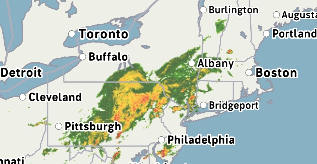
When does this thing abruptly turn south?
-
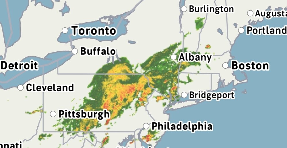
Whoever gets these bands further east is gonna love the rainfall rates. Straight up tropical downpours.
-
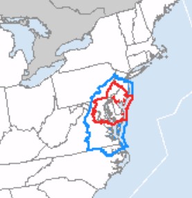
I don't think I have ever seen a TOR watch "nested" inside a larger SVR watch. Has that ever occurred before?
-

2026 Mid-Atlantic Severe Storm General Discussion
AlexD1990 replied to Kmlwx's topic in Mid Atlantic
took em long enough -
Yea I spoke too soon. Getting rocked rn. We’re just really good at humidity and storms now.
-
Yea I thought it was supposed to be further south. Actually just got under a torrential cell here with thunder.
-
Now the TOR watch comes out
-
Seems like the storms and rain are everywhere but where the actual risk region is?
-
Severe Watch just south of Immediate NYC metro from Middlesex - Somerset Counties and points south...
-
Hrrr has been insistent that the Loudoun-Frederick cluster is the entire show for areas north of DC
-
By Chestertown MD
-

Augdewst 2026: Summer's Last Stand
weatherwiz replied to Prismshine Productions's topic in New England
nice looking supercell with a TDS down in Maryland -

Augdewst 2026: Summer's Last Stand
NoCORH4L replied to Prismshine Productions's topic in New England
I think you'll have a better chance of staying dry on Saturday than SNE at least -
Yea this one is yours lol. Raining here, though.
-
Pouring here right now and under that Thunderstorm Warning.
-

2026-2027 Record-breaking El Nino
Maestrobjwa replied to Stormchaserchuck1's topic in Weather Forecasting and Discussion
Nooooo (good for some areas though) -

2026 Mid-Atlantic Severe Storm General Discussion
LeesburgWx replied to Kmlwx's topic in Mid Atlantic
Pouring precip for the past 20 minutes here -
I hope we get at least an inch. We've had almost nothing here since that severe t-storm with the hail 2 weeks ago. The ground is back to being very dry so we could use some heavy rain.
-

2026 Mid-Atlantic Severe Storm General Discussion
Eskimo Joe replied to Kmlwx's topic in Mid Atlantic
Looks pitiful on the TIAD and TBWI radars. -

2026 Mid-Atlantic Severe Storm General Discussion
midatlanticweather replied to Kmlwx's topic in Mid Atlantic
Did give the Tornado Possible in the warning. Good looking hook at times. -
2026 Mid-Atlantic Severe Storm General Discussion
AlexD1990 replied to Kmlwx's topic in Mid Atlantic
and now its warned -
That kind of SCP/SIGTOR bulls-eye is excellent for this time of year Mid-Atlantic or NEUS. And despite all the clouds and earlier showers, sfc-based CAPE is high w/ the bulls-eye just SE of the metro and a good gradient N suburbs. Current svr storm to the W ride that gradient (boundary)!
-
Heard thunder here, but looks like I’m gonna only get fringed and I’m ok with that.