All Activity
- Today
-
 Cc drop with no tornado warning just sw of flint
 -
 Video of the hail/wind here (sorry for my language lol) My poor flag pole: Good show over the lake
 -

2025 Lawns & Gardens Thread. Making Lawns Great Again
DavisStraight replied to Damage In Tolland's topic in New England
Last year my yard was inundated with squirrels, this year have only seen one. Must have been taken by predators. -
 https://x.com/Kentuckyweather/status/1923201576534978717 South illinois, indiana, and all of kentucky appears to have a rough day ahead. Broyles is on duty. i expect a pink sharped for bottom left quarter of this image
 -
 IWX is claiming on Facebook they included Hillsdale in the watch but didn't Looks like someone made an oopsie
 -
 Lansing getting hammered by the strongest part of that line right now.
 -
Gonna be quite a few spin ups farther east confirmed as well based on radar and cc drops over the past hour.
-
The humidity is yuck tonight. Went out to put the umbrella down on the deck table. As I was tying it up I could feel that it was damp. Mind you it was up all day so any moisture from the rains would have dried out. The deck surface also felt damp after being dry all day.
-
AM storms Saturday it looks like
-
lol good job iwx

-
daily record of 87 in Madison, breaking the previous one set in 1977 and 2012
-
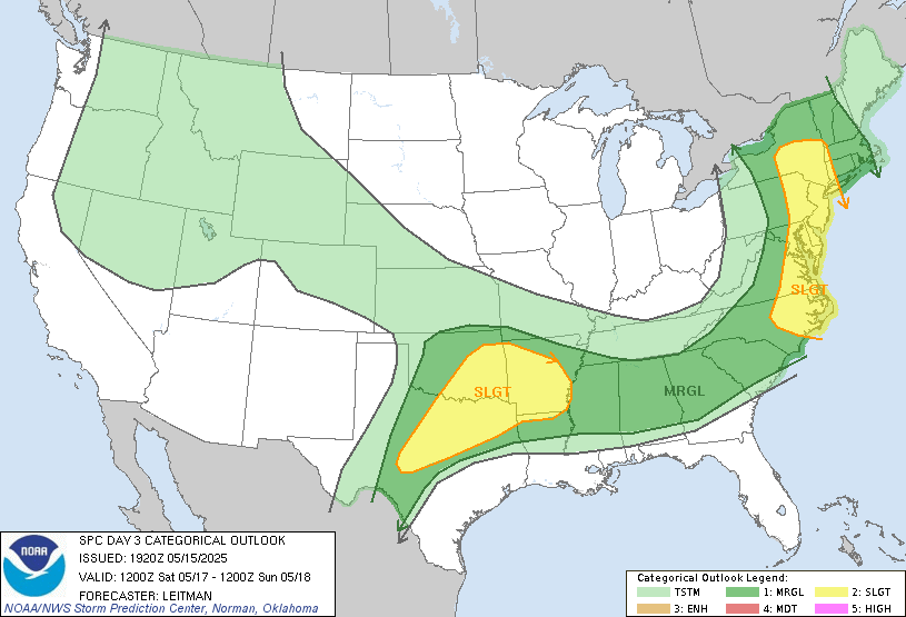
Day 3
-
 Probably going to see quite a few damage reports from Muskegon to Grand Rapids
 -
snow? lol it can barely do that during a winter month
-
12:1?
-
Some new cells are going up just south of South Bend, might be interesting if they can stay ahead of the line
-
 Yea big dud here. Excited for the miss south tomorrow.
 -
swarms of gnats in my yard this evening as the sun was setting.
-
 Total bust.
 -
 There was an entry on SPC reports for 4" hail out of Eau Claire County Wisconsin. Posted on Facebook by WQOW met https://www.facebook.com/wqownews18
 -
Tomorrow may actually be the first day that qualifies as uncomfortably warm and human. new NAM has low 80s with quite high DPs
-

-
Picture of the Potomac flooding from Scotts Run. Bunch of debris kept passing by in the water.
-
Why are we still posting snow maps lol