All Activity
- Past hour
-

November 2025 general discussions and probable topic derailings ...
ineedsnow replied to Typhoon Tip's topic in New England
We snow and sleet -
 Maybe so. That does not explain downed trees in the interior I sure hope you’re safe. OKX issued an advisory. I look at it the 10 meter ASOs gust as roughly crown height. Broken branch dead or not. causes problem. Crosswind gusts are unsafe for many aircraft. Delays etc. Folks get unhappy with delays and then act irrationally. In Some cases. Impatience caused actions when plans are unexpectedly altered.
 -
No backpedaling here P8
-
March 2019 was the last time that March was more like winter than spring month for us. Monthly Total Snowfall for NY CITY CENTRAL PARK, NY Click column heading to sort ascending, click again to sort descending. Mean 6.2 6.2 2019 10.4 10.4 2018 11.6 11.6 2017 9.7 9.7 2016 0.9 0.9 2015 18.6 18.6 2014 0.1 0.1 2013 7.3 7.3 2012 0.0 0.0 2011 1.0 1.0 2010 T T 2009 8.3 8.3 Monthly Total Snowfall for NY CITY CENTRAL PARK, NY Click column heading to sort ascending, click again to sort descending. Mean 0.1 0.1 2025 0.0 0.0 2024 T T 2023 0.1 0.1 2022 0.4 0.4 2021 T T 2020 T T
-

November 2025 general discussions and probable topic derailings ...
WinterWolf replied to Typhoon Tip's topic in New England
Well he followed your direction, now you say multiple runs lol. -

November 2025 general discussions and probable topic derailings ...
CoastalWx replied to Typhoon Tip's topic in New England
Talk to me when multiple runs show it. -
Low barometric pressure today around 29.30.
-
 34 mph highest gust here. Airports get higher wind gusts being so wide open.
 -
 Check one off the watch/warning bingo card.
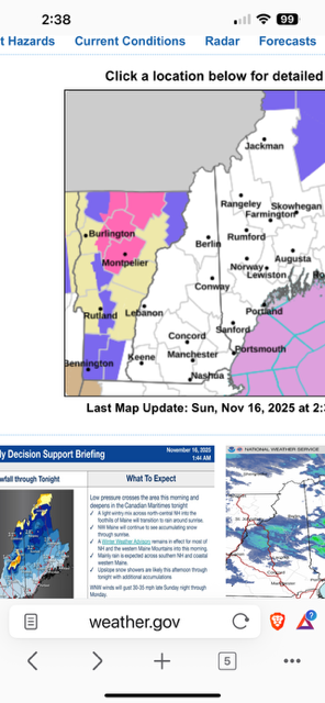
-

-
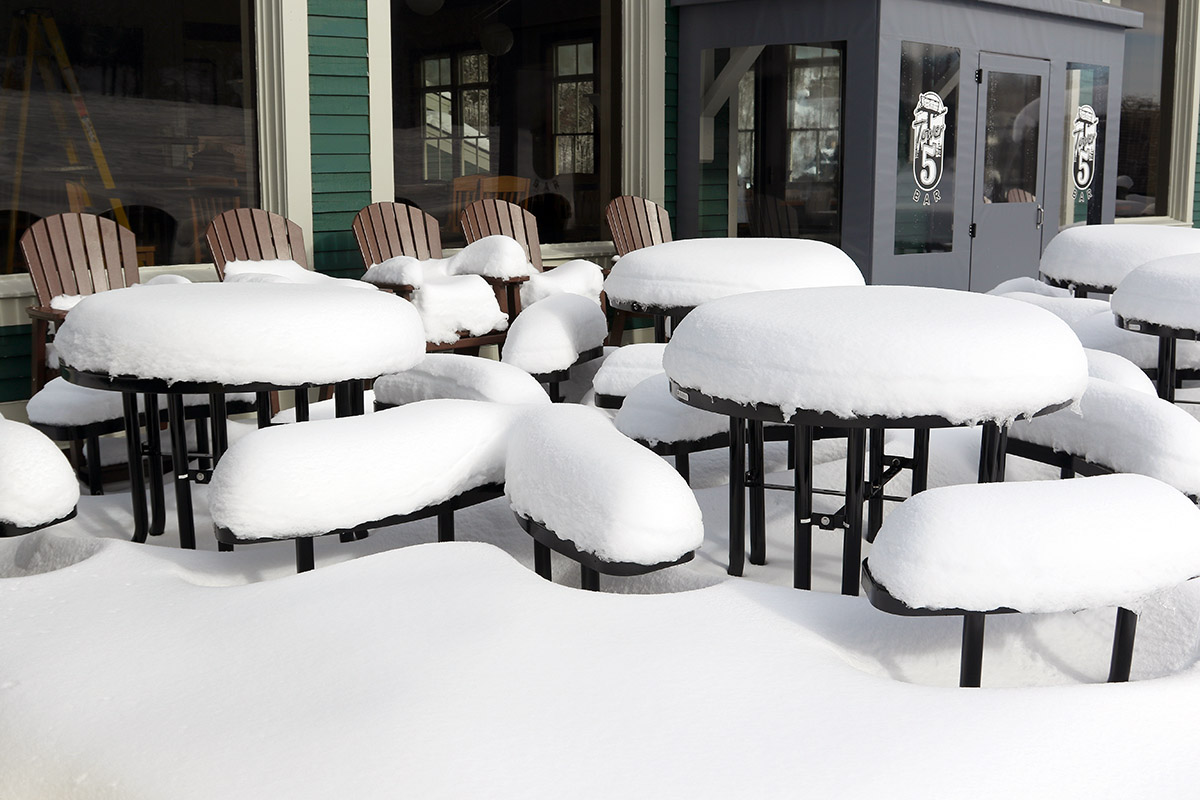
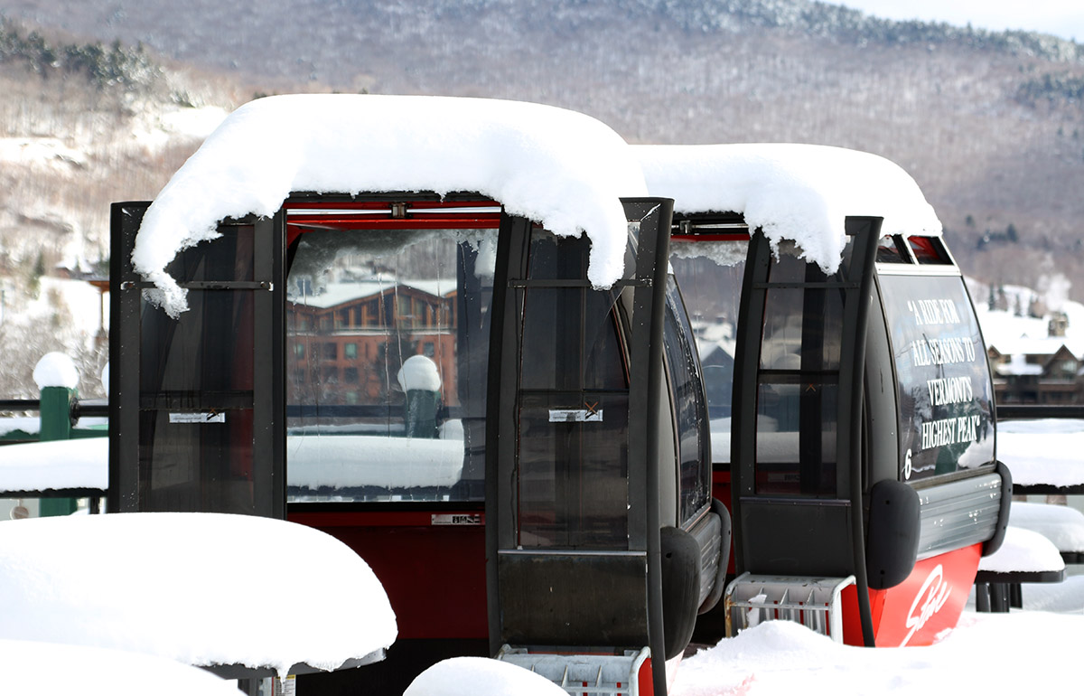
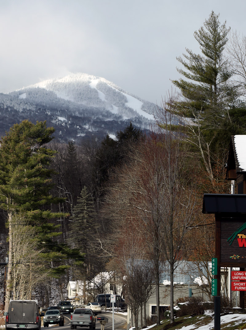
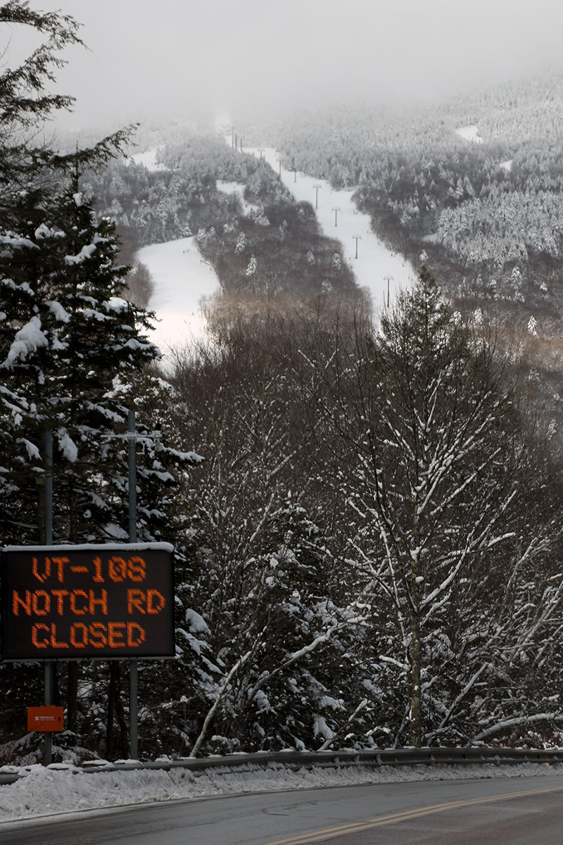
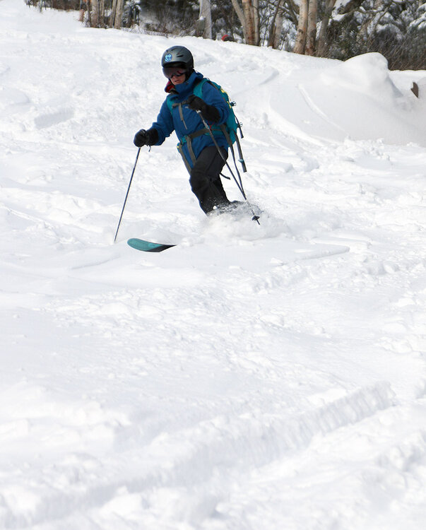
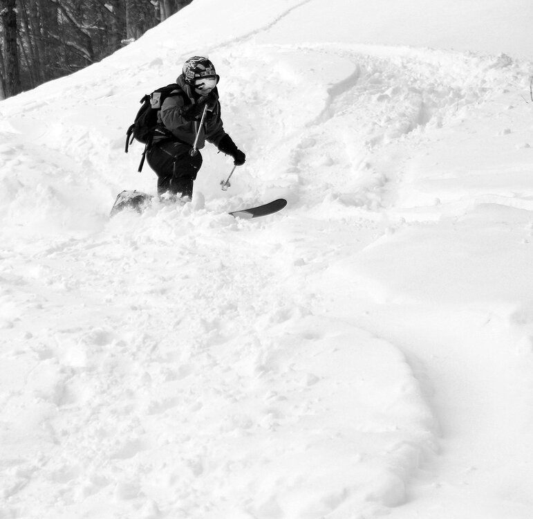
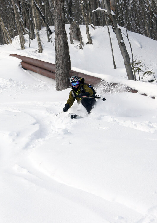
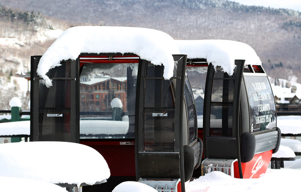
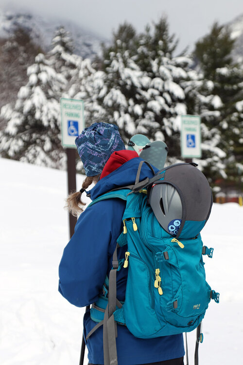
PF has done a fantastic job of keeping everyone apprised of the snow conditions at Stowe, so for yesterday’s ski tour my wife and I decided to mix it up a bit and head to mighty Mt. Mansfield. On the approach to the resort, we found spotty snow cover in the valleys building to roughly 12-15” of snow at 1,640’ at the Midway Lodge. Yesterday was a simply beautiful November day, with temperatures a bit below freezing, little to no wind, and some peeks of sun to keep it bright and create excellent views but not throw out so much sun that it substantially affected the quality of the snow. Plenty of skiers and other winter enthusiasts were around at the resort as they took the opportunity to get out and enjoy the snow, but crowds certainly weren’t crazy – I didn’t see many cars in the Mansfield lot, and the Gondola parking lots certainly weren’t full. There were plenty of established skin tracks on the Gondola terrain, and there were typically double and triple tracks available. So it was very easy to ascend side-by-side and enjoy conversations, and you could conveniently pass people or let them pass you if need be. Snow depth increased to over 20” as we ascended, and the snow was substantial enough that it provided both excellent base snow and surface powder for skiing. I’d say it was denser snow overall than what we had back from that storm on the 5th, but the powder skiing was still quite good. We found that the snow did get a touch denser below 2,000’, so you had to be on top of your turns a little more in those elevations as you finished the descent. My younger son was going to head to Bolton for a tour yesterday, but I suggested that he pop over to Mansfield instead, since Stowe isn’t open for the season yet and it’s an excellent time to get in some turns there. We were able to meet up with him and a friend at the start of their tour, just as we were finishing ours. I passed along the info what we’d encountered with respect to snow conditions, and he said they had an excellent tour with some great turns that even brought them into the trees.


-
 It was obvious hours ago a wind advisory was needed. Upton often misses wind events lately, at least out here
 -
Limbs/branches and a couple trees down in the area. I had a 51 mph gust about 15 minutes ago.
-
 URGENT - WEATHER MESSAGE National Weather Service New York NY 212 PM EST Sun Nov 16 2025 CTZ005-006-009-010-NJZ002-004-006-103>108-NYZ067>075-078>081-176>179- 170600- /O.NEW.KOKX.WI.Y.0009.251116T1912Z-251117T0600Z/ Northern Fairfield-Northern New Haven-Southern Fairfield-Southern New Haven-Western Passaic-Eastern Passaic-Hudson-Western Bergen- Eastern Bergen-Western Essex-Eastern Essex-Western Union-Eastern Union-Orange-Putnam-Rockland-Northern Westchester-Southern Westchester-New York (Manhattan)-Bronx-Richmond (Staten Island)- Kings (Brooklyn)-Northwest Suffolk-Northeast Suffolk-Southwest Suffolk-Southeast Suffolk-Northern Queens-Northern Nassau- Southern Queens-Southern Nassau- 212 PM EST Sun Nov 16 2025 ...WIND ADVISORY IN EFFECT UNTIL 1 AM EST MONDAY... * WHAT...West winds 15 to 25 mph with gusts up to 50 mph. * WHERE...Portions of southern Connecticut, northeast New Jersey, and southeast New York. * WHEN...Until 1 AM EST Monday.
 -
Looks like just about every airport NYC LI and around e PA have had 40 knots or greater. Think the impact is high ned minor. Worse than the last event and max gusts NYc may not arrive til 5pm
-
Ignore him, hes a troll thats pushing 50 and post limited here and banned elsewhere. Sad really. 40 mph gust here
-
My all-time favorite ride from Suffolk into Nassau was PD2 in 2003. Left Holbrook that Sunday evening with just cold and overcast conditions. Quickly found developing moderate snow once down to Sunrise HWY near Bayshore. Then heavy snow and blowing snow by the time we crossed the Nassau line. There was over 4” OTG by the time we got back to Long Beach with blowing and drifting snow. That had to be the slowest progression north that we ever had of heavy snow from the South Shore to the North Shore in a KU. You could watch the heavy snow on radar just south of JFK during the afternoon take until later in the evening to approach the Long Island Sound.
-
 Well, it seems by the last few comments that EPS is now showing some changes by the end of the month as well.
 -
Yep its slowing down but it will get there.
-
Gusting to 38 - 41 NW winds
-
 lol at bitching about lack of cold and snow mid November.
 -

Central PA Fall Discussions and Obs
Blizzard of 93 replied to ChescoWx's topic in Upstate New York/Pennsylvania
This wind means business today. Advisory is for real. -
We backpedal https://x.com/wxriskgrains/status/1990115198661800276?s=46&t=m4Eqkekadb-JCXTm7k-Txg
-
Some of the operational runs bring it more out east. We will have to see.
- Today
-
37 mph in Syosset & 34 mph in Muttontown so far for highest wind gust.