All Activity
- Past hour
-
 Over 1" in the park and over 1.5" in white plains still coming down good. 2" seems possible
 - Today
-
 And like I thought, boats are breaking free and sinking. This storm may not break any records or be remembered for long, but a significant amount of damage was done, considering tens of thousands of boats were still in the water.
 -
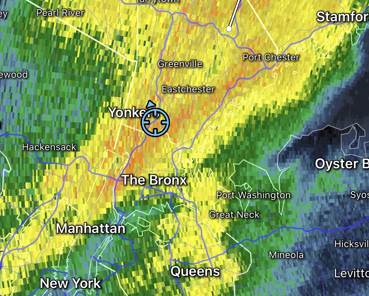
 Nice Drink, Ripping here at work(Yonkers)
-
 Winds have definitely ramped up the last hour, especially the gusts .
- 532 replies
-
- 1
-

-
- heavy rain
- damaging wind
- (and 2 more)
-
Getting a few good gusts now but the rain hasn’t been too impressive so far. Hopefully more will fill in later. I bet it’s wild at the shore tonight!
-
 I love it when it rains while sleeping. Raining pretty good here in Brooklyn.
 -
 Pouring rain here and winds picking up. 1.16" so far. JFK gusting to 44 mph at the top of the hour.
 -
Just lost power in great neck along with my entire neighborhood .
- 532 replies
-
- 1
-

-
- heavy rain
- damaging wind
- (and 2 more)
-
 Local micronet site is about to cross 1"
 -
We aren't nearly as warm as October 1919 at least. The coolest temperature that entire month in Knoxville was 54 (Knox recorded 50 yesterday morning) and it was almost 9 degrees above normal. It was a complete dud of a non-winter in Knoxville in 1919-1920.
-
 Blowing over 50 knots (60 mph) at the buoy south of fire island
 -
Now it's blowing over 40. Dam windy
-
1.1". so far
-
 1.41” with some breaks to my southeast now.
 -
 MillvilleWx changed their profile photo
 -
The 0Z UKMET is the first run with the followup MDR AEW as a TD with it going just N of due W at a rather brisk pace through the middle of the Lesser Antilles on Sunday (10/19): keep in mind that this is a top tier model that is sometimes genesis shy NEW TROPICAL CYCLONE FORECAST TO DEVELOP AFTER 150 HOURS FORECAST POSITION AT T+150 : 13.5N 57.7W LEAD CENTRAL MAXIMUM WIND VERIFYING TIME TIME POSITION PRESSURE (MB) SPEED (KNOTS) -------------- ---- -------- ------------- ------------- 1200UTC 19.10.2025 156 13.8N 59.5W 1010 32 0000UTC 20.10.2025 168 14.1N 62.8W 1009 34 —————— Also, the Icon (0Z) has it yet again.
-
I've been reading the AFD's for 25 years... even for a pedestrian storm like this one (pedestrian as in not record breaking), you would get a descriptive update every 4-6 hours in the past. Even the 7:24 PM update that @kdxken pointed out earlier, if you select the "highlight changed discussion feature" the only part that changed was the aviation forecast. That means that's mostly the same forecast from 2:30, and before that, the other significant update was 3:30 am. That's essentially only 2 major updates in 24 hours. I guess my overall point is that the lack of updates is noticeable, and disappointing, for whatever the reason is that's causing the reduction.....
-
Seeing our first burst of moderate rain in Greenfield. .20" so far. Hartford to Springfield definitely getting the good banding tonight.
-
 This is definitely a good soaking from the city east. Winds are there, but not extreme.
 -
Been raining pretty good for the last hour, quickly moved past an inch.
-
Might want to check this out!!! https://www.mammothmountain.com/on-the-mountain/storm-tracker Some places high up in the Mammoth Ski area may get two, maybe close to three feet of wet snow tomorrow night! This particular webstream is gonna be LIT tomorrow night as torrential snow smashes into the Main Lodge!!!! Main Lodge https://www.mammothmountain.com/on-the-mountain/mammoth-webcam/main-lodge Woolly Cam's another good one! https://www.mammothmountain.com/on-the-mountain/mammoth-webcam/woolly-cam Trust me I should KNOW, after three seasons!!!! This ain't just only The Beginning of the season. IT'S EARLY!!!!!!!!!! We just getting started!!!! Let's Get It Started.
-
He loves to troll
-
0.18” as of 11:30 pm for the day since midnight. 54/52
-
Wait.. as re you at the CT Shore?
-
Absolutely hammering out there. Trees whipping back and forth. Constant roar and pounding rain. Great storm.
-

Central PA Fall Discussions and Obs
Itstrainingtime replied to ChescoWx's topic in Upstate New York/Pennsylvania
Yeah, I have no idea who Kraft will look for. I feel like it might end up being someone not on everyone's radar right now. Just a hunch.


.thumb.png.4150b06c63a21f61052e47a612bf1818.png)


