All Activity
- Past hour
-
E MA up to its normal antics . N ATL FTL
-

Central PA Spring 2026 Discussion/Obs Thread
Mount Joy Snowman replied to Voyager's topic in Upstate New York/Pennsylvania
Low of 40 with some heavy dew, not to be confused as .01-.02" of rain. Talking to all you Cocorahs observers out there haha. -
Just make it warmer
-
Let’s just hope this means we can keep the heat off while the AC isn’t being used.
-
Ugh, we’re doing a weekend trip to Charlottesville, lovely.
-
Nice couple days shaping up-was down to 36 here this am with frost on the roof
-
GFS says if you thought this past weekend was blah, we’re going to crank up next weekend on the shitty weather scale.
-
Crazy stuff
-
Already 52.. off to the torches .
-

Central PA Spring 2026 Discussion/Obs Thread
Superstorm replied to Voyager's topic in Upstate New York/Pennsylvania
37.6 F in Lancaster for the low. . -
Central PA Spring 2026 Discussion/Obs Thread
Superstorm replied to Voyager's topic in Upstate New York/Pennsylvania
Sweltering! . -
35.4° this morn Should make a run at 70°.
-

Central PA Spring 2026 Discussion/Obs Thread
canderson replied to Voyager's topic in Upstate New York/Pennsylvania
Low of 78 it looks like in Austin. About to head back to home. Wedding yesterday was outdoors - since yesterday it 92 and a 78 dew point they brought out massive misting fans. It helped somewhat. lol -

Central PA Spring 2026 Discussion/Obs Thread
mahantango#1 replied to Voyager's topic in Upstate New York/Pennsylvania
- Today
-
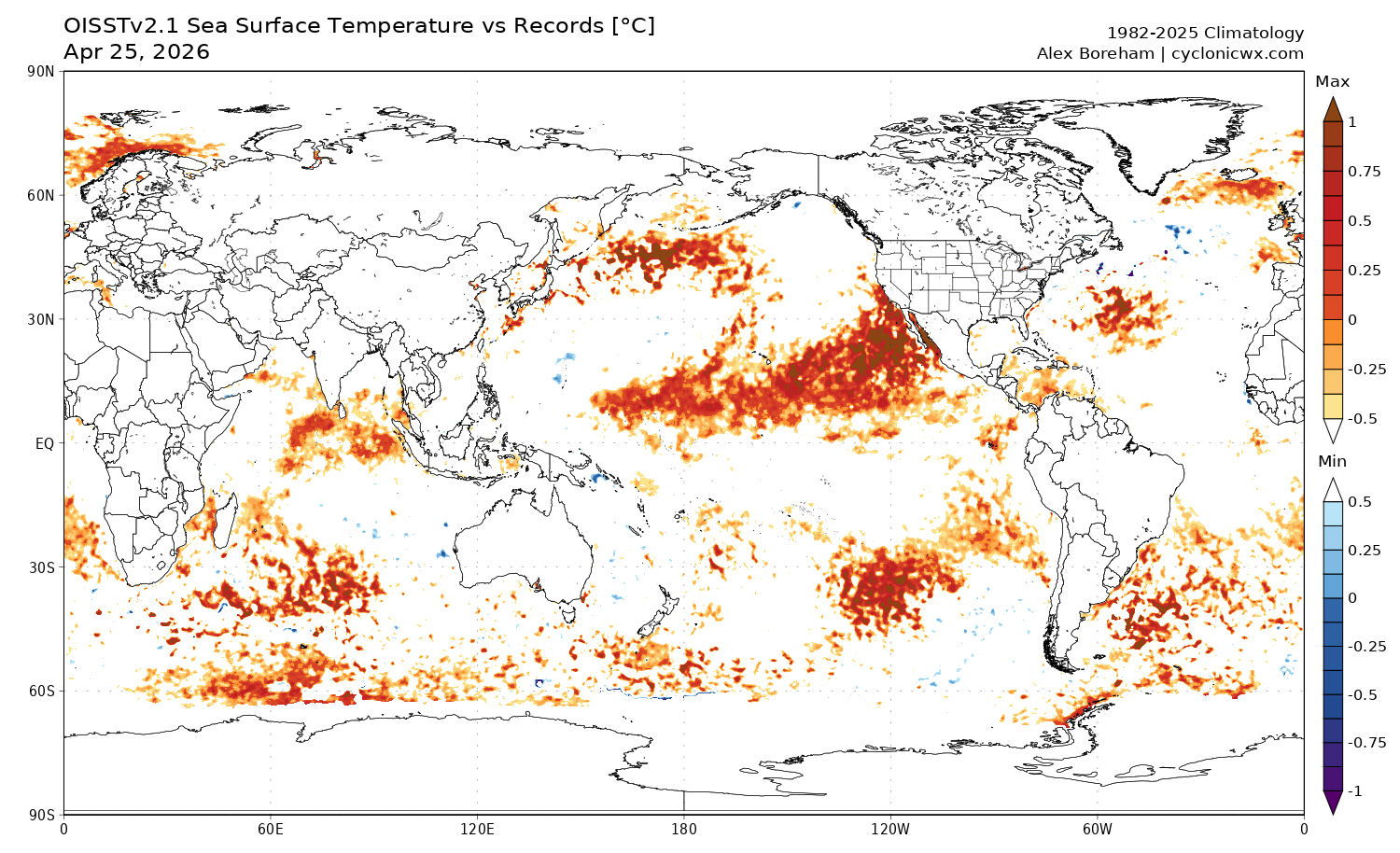
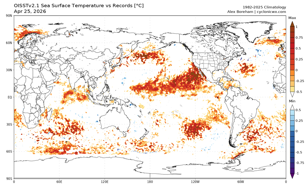
This chart shows where daily satellite SST is at record levels. Biggest feature is the large area of record warmth in the PMM area extending west of North America. An important area with nino conditions developing. There are also less extensive record temperatures in the southern hemisphere Pacific south of the enso region. https://cyclonicwx.com/sst/
-

2026-2027 El Nino
bluewave replied to Stormchaserchuck1's topic in Weather Forecasting and Discussion
We can see why the recently initialized models like the CFS are going higher. This is the first time since 1997 with an OHC reading reaching over 2.0° in April. Remember, 1982 didn’t reach this level of heat until October. Plus even 2015-2016 only peaked at 1.91 and not until October. My guess is that the ECMWF release on May 5th will increase its forecast over the April 5th levels once this record kelvin wave and OHC is initialized. So it appears we are on track for our first two El Nino events with a peak over +2.0 only separated by 3 years. We may not know what the ceiling is on this one until we get into late May or June. But it looks higher than 2023-2024 due to how strong this is becoming early on. https://www.cpc.ncep.noaa.gov/products/analysis_monitoring/ocean/index/heat_content_index.txt -

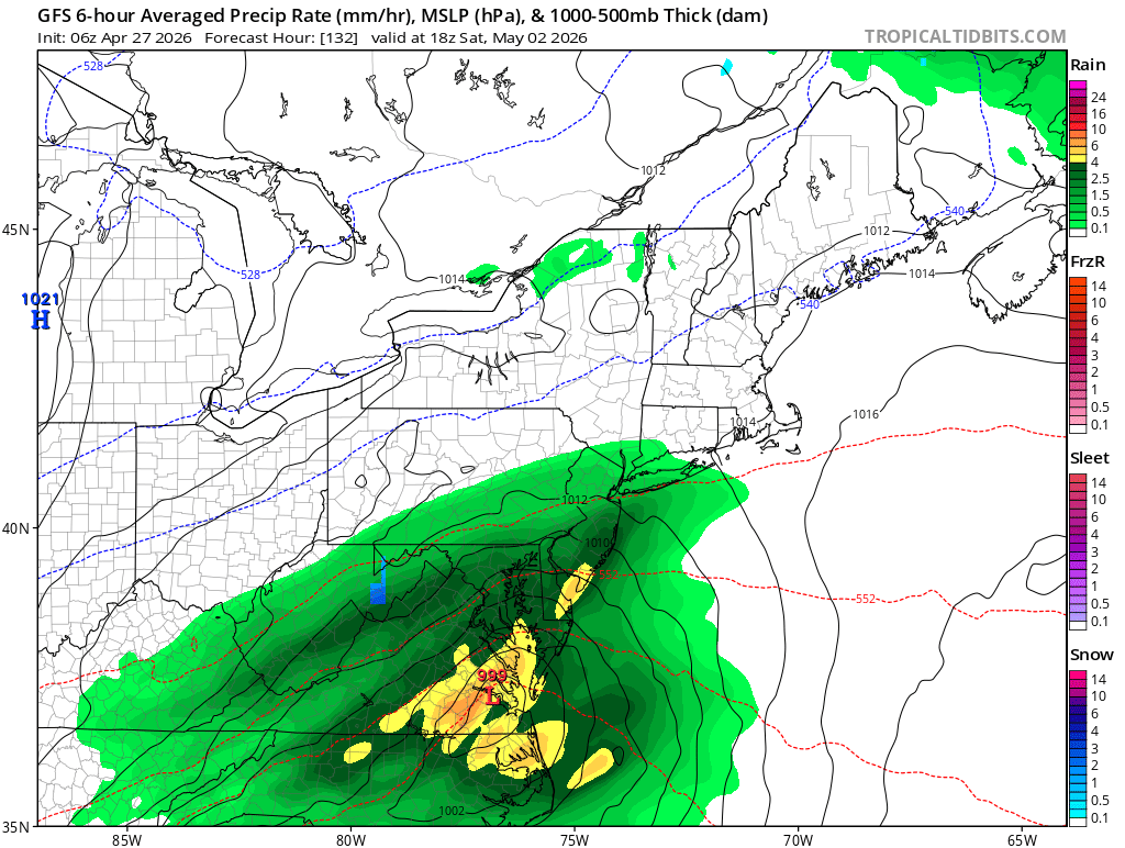
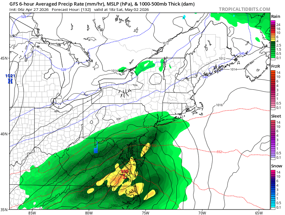
Potential Sever Weather Outbreak 4/27/2026
King James replied to pen_artist's topic in Lakes/Ohio Valley
Soooo just a rainy day? Lolz -
Central PA Spring 2026 Discussion/Obs Thread
mahantango#1 replied to Voyager's topic in Upstate New York/Pennsylvania
34 here as well this morning. -

2026-2027 El Nino
snowman19 replied to Stormchaserchuck1's topic in Weather Forecasting and Discussion
^”The RONI.. newer “relative” index - which takes our warmed climate into account - is like +2.7 which would be close to a record (if averaged over 3 months). The current record is +2.5°C in 1982-83.” -

Central PA Spring 2026 Discussion/Obs Thread
pawatch replied to Voyager's topic in Upstate New York/Pennsylvania
Sheesh 34 degrees this morning. I’m ready to get out of this pattern. -
2026-2027 El Nino
snowman19 replied to Stormchaserchuck1's topic in Weather Forecasting and Discussion
-
Vortex PT in RI today? https://www.facebook.com/reel/1413402380828852
-

Potential Sever Weather Outbreak 4/27/2026
TheNiño replied to pen_artist's topic in Lakes/Ohio Valley
00z HRRR came in hot for eastern Missouri and central Illinois. Looking like a more limited risk for LOT but things down south are looking quite spicy Edit: No moderate risk on the new day 1. Is my weenie certificate mailed to me or do I need to pick it up in person? -
Hopefully we can get a decent rainfall tomorrow morning with the crapvection, as the afternoon stuff looks like a non-event for this area. Been a nice and rainy past month or so, but sort of a drier stretch coming up for the next few weeks. Still have ground to make up for that abysmal Aug-Feb stretch of dry weather.
-
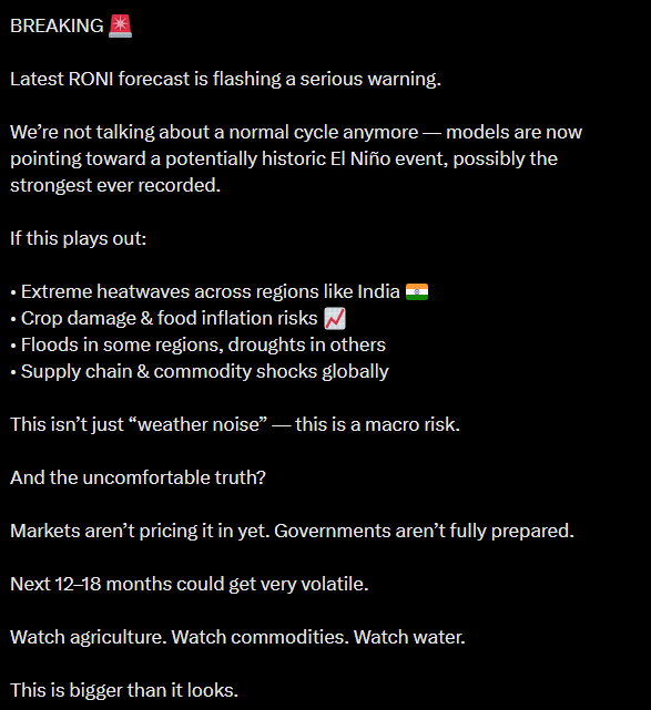
Not the chart (which you already reposted with a Tweet 2 posts before this one btw), but the entire content of the tweet leading up to it Every line containing the hallmarks of AI, completely synthetic fluff packaged into a tweet format. I sincerely hope you don't follow this guy and just found them by searching up keywords like "Super El Nino", but I also wouldn't put it past you.